Continental Divide
A continental divide is defined as a natural boundary that separates a continent’s precipitation systems (rivers, snowfall, rainfall) that flow into different oceans or other major water bodies. In other words, the continental divide acts as a wide drainage barrier that prevents rivers on one side from flowing into the oceans on the other side.

Continental divides are found on all continents of the planet and in some cases, they are found to extend across multiple continents. It is generally observed that continents bounded by more than two water bodies possess more than one continental divide. Two major continental divides of the Americas are discussed below.
Continental Divide Of The Americas

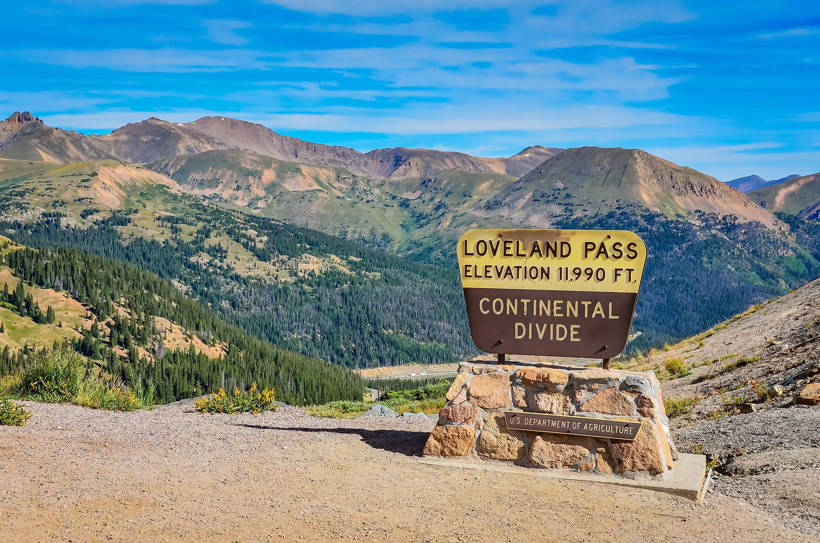
The Continental Divide of the Americas, also known as the Great Divide or the Western Continental Divide, is a large mountainous divide that passes through most of the continents of North America and South America, extending from the Bering Strait to the Strait of Magellan. It serves as a hydrological divide and separates the waters that flow into the Pacific Ocean from the waters that drain into the Arctic and the Atlantic Oceans and the Gulf of Mexico.
It starts from the Cape of Prince Wales in the western part of Alaska and then runs through the crests of the Rocky Mountains in northwestern Canada and the continental United States (states of New Mexico, Colorado, Wyoming, Idaho, and Montana). From there, the divide continues through the Sierra Madre Occidental Mountains of Mexico, through Central America, and into the continent of South America.
In South America, the Continental Divide runs along the peaks of the Andes Mountains and then continuing into the western part of Colombia, central Ecuador, and the western and southwestern part of Peru. From there it runs through the eastern part of Chile, into the southern edge of Patagonia, and the Tierra del Fuego archipelago. The Great Divide comprises a series of mountain ranges including the Cassiar Mountains, Omineca Mountains, and the Bitterroot Range, among others. Located in the US State of Colorado is Grays Peak, which rises to an elevation of 4,352 m and is the highest point of the Continental Divide in North America. The Continental Divide reaches its lowest natural point at about 47 m at the Isthmus of Rivas in Nicaragua.
The Western Continental Divide stretches across many national parks like the Waterton Lakes National Park, Glacier National Park, Bob Marshall Wilderness, and Yellowstone National Park.
Eastern Continental Divide
Often referred to as the Appalachian Divide, the Eastern Continental Divide located in the eastern part of North America runs along the high peaks of the Appalachian Mountains. This natural hydrological divide separates the watershed draining east into the Atlantic Ocean from the watershed draining west into the Gulf of Mexico. The Eastern Continental Divide stretches from the southern portion of Lake Ontario to the Florida Peninsula and comprises the Appalachian Mountains, the southern part of the Piedmont Plateau, and the lowland ridges of the Atlantic coastal plain. Located in the US State of North Carolina is Mount Mitchell, which rises to an elevation of 2,037 m and is the highest point in the Eastern Continental Divide.


