Greenland Sea
The Arctic Ocean is the smallest, shallowest, and coldest of the five world oceans. Although the Arctic Ocean is small, it has some of the world’s biggest marginal seas, including the Barents Sea, Greenland Sea, and the East Siberian Sea. The Greenland Sea is the ocean’s second-largest sea and the 22nd largest in the world, covering an estimated 1.205 million km2. However, some sources consider the Greenland Sea to be part of the Atlantic Ocean.
Where Is The Greenland Sea?

The Greenland Sea is located to the east of Greenland and west of the Svalbard archipelago. It borders the Arctic Ocean on the south, with the Fram Strait separating it from the ocean. The Barents Sea is to the east of the Greenland Sea, while the Norwegian Sea is to the south. Some sources consider the Greenland Sea as part of the Nordic Seas, alongside the Iceland Sea and the Norwegian Sea.
The sea’s northern extent is marked by a line joining Svalbard’s northernmost point to Greenland’s northernmost point, marking the border with the Norwegian Sea. The island of Spitzbergen forms the eastern limit, while the western limit is on Greenland’s Northeast and East Coast. The southwest limit is a line joining Cape Nansen to Straumnes, and the southwest limit is between West Spitzbergen’s extreme southern point and Jay Mayen Island’s northern point.
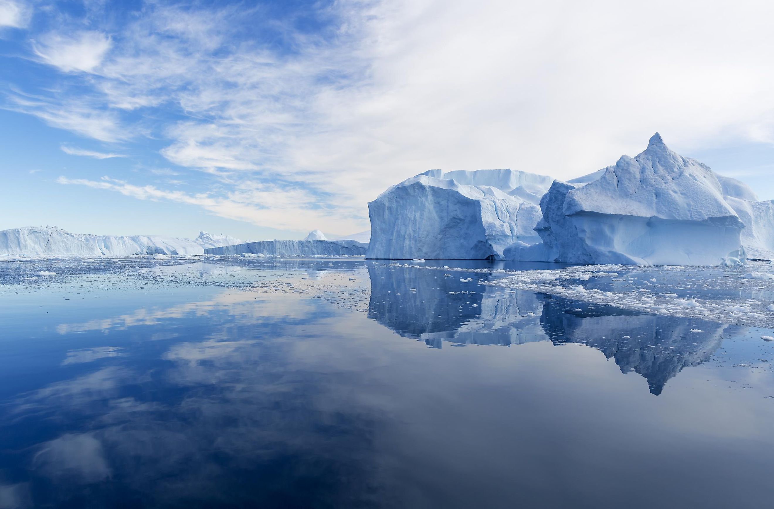
Geography

The Greenland Sea is the Arctic Ocean’s second-largest sea after the Barents Sea. It has an average depth of 1,444 m, with a maximum volume of 1.75 million km3. Its drainage basin covers three countries: Iceland, Norway, and Greenland (autonomous territory within the Kingdom of Denmark).
An arctic climate characterizes the Greenland Sea, with air temperature as low as -50 °C in the winter. The Odden area, an ice formation that appeared in the winter, once extended from the East Greenland Ice edge towards the east. The sea’s major islands include the Svalbard Archipelago, Jan Mayen, Ella, Norske, Godred Hansen, Gamma, and Lynn. Only Svalbard Island is inhabited permanently, while Jan Mayen is inhabited temporarily by military staff.
Marine Life

There are numerous vascular plant species on the Greenland Sea's shores, especially on the Greenland mainland. The common species are low-lying shrubs like crowberries and dwarf willows. Some colorful flowers and heaths contrast the icebergs surrounding the sea.
The Greenland Sea has numerous organisms that support the ocean food chain. Common fish species include redfish, cod, herring, plaice, and halibut. Marine mammals include seals, whales, and walruses, while land mammals are caribou, musk ox, Arctic wolf, polar bear, Arctic fox, and Arctic hare.
Brief History
The first scientific study of the Greenland Sea was undertaken in 1876-78. Since then, several countries, including Norway, Russia, and Iceland have carried out scientific expeditions in the area. The Greenland Sea was an important hunting ground for whales in the last 300 years, until 1911. However, the whaling industry became less profitable in the years following because of the depleted whale population. Currently, whales in the sea are protected, but the species are regenerating at a slower rate than was expected. In 2017, Fiann Paul led a team of rowers for the first man-powered crossing of the sea.
According to the US Geological Survey, the Arctic Ocean has approximately 13% of the world’s oil yet to be discovered and 30% of gas pockets, and the Greenland Sea might be a source of natural gas. Thus, the Parliament of Greenland has given permits to various potential hydrocarbon extractions. In 2013, three joint companies, Eni, Chevron, and Statoil were granted hydrocarbon extraction rights to explore four large hydrocarbon areas in the Greenland Sea.


