Strait Of Magellan
A strait is defined as a narrow, navigable water passage that is situated between two landmasses and acts as a connection between two larger bodies of water. The Strait of Magellan is such a navigable waterway located in the southern part of Chile and connecting the Pacific and the Atlantic Oceans. The strait has been named in honor of the famous Portuguese explorer Ferdinand Magellan, who discovered the strait in 1520.
Where Is The Strait Of Magellan?

The Strait of Magellan separates the southern edges of the continental South American mainland in the north from the Tierra del Fuego archipelago in the south. The Smyth Channel links the Strait with other waterways in the northwest. In the strait’s eastern part there is a wide bay situated on the border of Argentina and Chile. The western part of the strait is its entrance to the Pacific Ocean.
From the Atlantic Ocean, the Strait of Magellan extends westwards between the Cabo del Espíritu Santo and the Cape of Vírgenes and then moves southwestwards and turns to Froward Cape in the northwest, at the southern edge of the Brunswick Peninsula. It eventually connects with the Pacific Ocean after passing through Cape Pillar on Desolación Island, Chile's eighth-largest island.
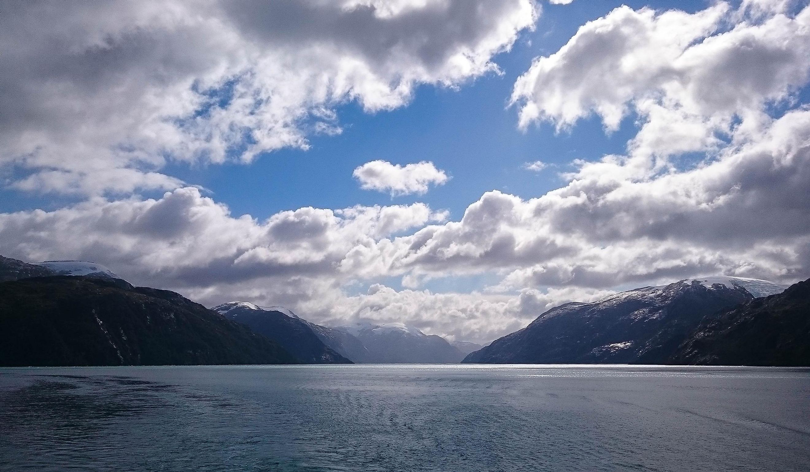
Geography

Referred to as Estrecho de Magallanes in Spanish, this curly strait has a length of about 570 km. It is about 2 km wide at its narrowest point at Carlos III Island. The strait’s major part is located within the territorial waters of Chile, except its extreme easternmost portion which forms a part of Argentina.
The Strait of Magellan is often compared to Alaska’s Inside Passage and the strait’s numerous fjords and channels are renowned for their natural beauty. The Strait of Magellan is known to face unpredictable weather with sudden changes in wind and sea conditions. The strait experiences a unique geographical phenomenon called Williwaws where sudden gusts of strong cold winds descend on the strait from the mountainous coasts.
There are several islands in the Strait including the Capitán Aracena, Clarence, Santa Inés, Desolación, and other smaller islands in the south along with the Riesco, Manuel Rodriguez, and some islands of the Queen Adelaide Archipelago as well as the Brunswick Peninsula and the Muñoz Gamero Peninsula in the north.
Brief History

The area around the strait was inhabited by Indigenous tribes for several years. The Kawésqar tribes lived on the northern coast of the strait while the Tehuelche tribes lived on the strait’s eastern coast. The eastern part of Tierra del Fuego was occupied by the Selk’nam tribes, while its southern part was occupied by the Yaghans. All these tribal groups were mainly nomad hunter-gatherers and also depended on the strait for their sustenance.
The Portuguese explorer Ferdinand Magellan was the first European who successfully navigated the waters of the strait during his famous circumnavigation voyage in 1520. The strait was named by Magellan in Spanish as Estrecho de Todos Ios Santos (“Strait of All Saints”), as his fleet of ships first entered the strait waters on November 1, celebrated as All Saints Day in honor of the Christian Saints. After seven years of the strait’s discovery by the Europeans, it was finally renamed Estrecho de Magallanes (Strait of Magellan), to honor the strait’s discoverer. The British survey vessel HMS Adventure carried out a detailed exploration of the strait from 1826 to 1830. The commercial movement of steamships was first started in the strait by the Pacific Steam Navigation Company in 1840.
Before the construction of the Panama Canal, the Strait of Magellan was used as a safe passageway for traveling between the Atlantic and Pacific oceans. Some famous lighthouses are also found along the strait which serves as a major tourist attraction. Punta Arenas is a major Chilean port located on the Strait of Magellan.
Wildlife

Many Chilean National Parks and Marine Protected Areas are located along the Strait of Magellan. Positioned in the center of the strait is the Los Pingüinos Natural Monument, which serves as a home for more than 60,000 breeding Magellanic penguins (Spheniscus magellanicus). Other notable seabirds like seagulls and imperial shag and various aquatic animals like the South American fur seals (Arctocephalus australis), southern right whales (Eubalaena australis) and humpback whales (Megaptera novaeangliae) are also found here.


