Largest Islands In The Nation Of Samoa

Samoa’s two largest islands, Savai’i and Upolu, together comprise 99.2% of the nation's total land area. Upolu is the most populous and Savai’i is the biggest island in the country. The other lands are less than 1 square kilometer. The smaller islands constitute of small villages, some are uninhabited, and others have wildlife sanctuaries. Many of Samoa’s islands have reef-bordered beaches and rugged terrain of rainforest interior with gorges and spectacular waterfalls. Apia is the country largest and capital city.
Savai’i
Savaii Island is the biggest island in Samoa with an area of 1,694 square kilometers. It is also the second most populous island in the island nation of Samoa, housing 43,142 people according to the 2006 Census. In contrast to Upolu, the island is less developed. Selelologa is the only township found the island main entry point. There is a tar closed road serving and connecting most villages and settlements. The island is also the biggest shield volcano in South Pacific, dotted with approximately 100 volcanic craters that provide habitats to most flora and fauna. The flying fox, geckos, and seabirds dominate the area. The island also houses 11 species endemic to Samoa, such as the Samoan White-eye which is only found in the heights of Mount Silisili and Samoan Moorhen near Aopo. There are also ferns, flowering plants, and tree species. There are a few signs of modern life in the island but the traditional form of life including matai chief titles, kinship, and history. The social life is dictated by their culture where etiquette, politeness, and greetings are a norm. Plantation farming and fishing are the primary economic activities of the people. Cultivated crops include fruits and vegetables, cacao beans, taro, coconuts, and native plants such as pandanus, which is used for weaving beautiful mats.
Upolu
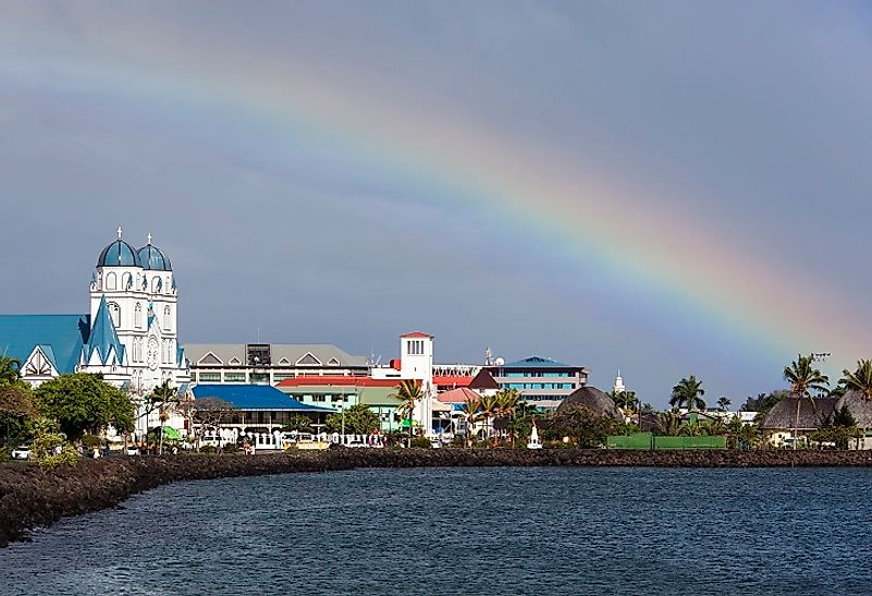
Upolu Island in Samoa was formed by a massive basaltic shield volcano rising from the seafloor in the Western Pacific Ocean. With an area of 1,125 square kilometers, the island has a population of approximately 135,000 people, making it the most populous island in the independent state Island of Samoa. The capital, Apia, found in Upolu houses Faleolo International Airport. In 1841, Upolu Island provided the site needed by the US Exploring Expedition. The flora of the island constitute is a small species of spider, the endangered flying fox, and several species of tropical birds. In 2009 a tsunami hit the island destroying approximately 20 villages. The disaster in Lepa was intense that only the church and the welcome sign to the community were left standing. The island densely forested interior, fertile coastal soils and the tropical wet climate provides a perfect environment for agriculture. Plants grown include coconuts, taro, cacao beans, and tropical beans. The people also practice livestock farming. The port of Apia is the commercial and political center of the country. In addition to farming the small island also manufactures beer, cigarettes, coconut creams and oil, cacao, and taro.
Manono
Manono Island, located in the Apolima Strait, is the third largest at 3 square kilometers in land area, and lies between Savai’i and Upolu, the main islands of Samoa. Manono is only a 20-minute boat ride away from Upolu. The island has a total population of around 889 people as per the 2006 Census. There are no roads or cars on the island. The country banned the use of horses or keeping dogs in Manono for environmental reasons. In the 19th Century, the island was a Methodist Church stronghold during the Methodists' early missions endeavors in the country.
Apolima
Apolima is the smallest inhabited island in the country. The island has a dormant volcanic crater with an elevation of around 165 meters. The island has Savai’i to the west and Upolu to the East. With less than 1 square kilometers, the island has a population of 75 people as the 2006 census. Also, the island is only accessible by a boat from the northern side thanks to the wide opening found there. Apolima Tai, the only village in Apolima is located at the bottom of the extinct volcano rim in the north of the island and has a beautiful fusion of bushes and gardens. There are no cars or roads on the tiny island. The people here retain a very traditional lifestyle, and visitors are few. On the cliffs seabirds nest, and the coral reefs are inhabited by whales, dolphins, shellfish, and other fish species.
Conservation and Development in Samoa
Most of the other islands of Samoa are uninhabited. The government supports and protects the conservation areas and sanctuaries on the Island of Savai’i where most of the local endemic species are. Conservative regions include the Tafua Rainforest Preserve, Falealupo Rainforest Preserve, and Aopo Cloud Forest Reserve. Also, conservation projects are only developed when the villages approve and cooperate, as has been the case with the United Nations Development Program. The independent island has no ongoing territorial disputes.
Largest Islands In The Independent State Of Samoa
| Rank | Largest Islands In The Independent State Of Samoa | Land Area |
|---|---|---|
| 1 | Savai'i | 1,694 square kilometers |
| 2 | Upolu | 1,125 square kilometers |
| 3 | Manono | 3 square kilometers |
| 4 | Apolima | ~1 square kilometer |
| 5 | Nu'ulopa | ~1 square kilometer |
| 6 | Nu'utele | 1.08 square kilometers |
| 7 | Nu'ulua | 0.25 square kilometers |
| 8 | Namua | 0.20 square kilometers |
| 9 | Fanuatapu | 0.15 square kilometers |
| 10 | Nu'usafe'e | <0.1 square kilomters |


