Gulf of Maine
The term gulf generally refers to large, distinctly indented saline water bodies that are encircled by the coastline. The Gulf of Maine, also referred to as Golfe du Maine in French, is an expansive gulf of the Atlantic Ocean surrounded on its northern and western sides by the North American mainland. The gulf has been named after the former Province of Maine, which included various English colonies established along North America’s northeastern coast in the 17th century. Bounded by the northeastern United States and the Canadian Maritime Provinces, the Gulf of Maine houses one of the richest marine ecosystems in the world.
Geography Of The Gulf Of Maine
This semi-enclosed water body includes the entire coastlines of the Northeastern US States of Maine, New Hampshire, and Massachusetts, as well as the western and southern coastlines of the Canadian provinces of Nova Scotia and New Brunswick. The gulf is bounded in the southwest by Cape Cod at Massachusetts’s eastern tip and in the northeast by Cape Sable Island at Nova Scotia’s southern tip. Often called a “sea within a sea,” the Gulf of Maine also includes the Bay of Fundy, Penobscot Bay, Massachusetts Bay, and Passamaquoddy Bay. Some of the prominent islands in the Gulf of Maine include Grand Manan, Mount Desert Island, Isle au Haut, and the Fox Islands (Vinalhaven and North Haven).

Occupying a roughly rectangular-shaped depression having a surface area of about 36,000 sq. mi, the gulf is partly enclosed on its northern and western sides by the North American mainland while it remains connected with the Atlantic Ocean in the southeast. The Gulf of Maine watershed covers an area of 69,000 sq. mi and includes all of Maine, and approximately 41% of Massachusetts, 70% of New Hampshire, 56% of New Brunswick, and 36% of Nova Scotia. A small southern portion (less than 1%) of the Canadian province of Quebec also forms a part of the gulf’s watershed. Out of these six jurisdictions, only Quebec does not have a shoreline along the Gulf of Maine. The overall watershed of the gulf can be further subdivided into 25 major watersheds and 11 minor coastal drainage areas. Some of the notable rivers that drain into the Gulf of Maine include the Annapolis, Salmon, Saint John, St. Croix, Kennebec, Piscataqua, Charles, Shubenacadie, Petitcodiac, Magaguadavic, Penobscot, Saco, and Merrimack. Of these, the 418 miles long Saint John River and the 175-mile-long Penobscot River have the greatest discharges.
Geology Of The Gulf Of Maine
The Gulf of Maine’s present-day morphology includes several deep basins and shallow banks that are believed to have been formed as a result of a complex series of marine depositions, river-based depositions, and subsequent erosions, all of which, in due course, were altered by glacial erosion and eventual deposition. The three principal deep basins of the Gulf of Maine that are isolated from each other and drop below the 650ft isobath include the Jordan Basin in the northeast, the Georges Basin in the south, and Wilkinson Basin in the west. Placed immediately north of Georges Bank, the Georges Basin is the deepest of the three basins and reaches a depth of more than 1200 ft. Overall, these basins make up approximately 30% of the Gulf of Maine’s floor area.
In addition to the deep basins, there are also many deep channels within the Gulf of Maine. The most notable of these channels include the Northeast and Great South Channels. The Northeast Channel serves as a major channel linking the Gulf of Maine with the rest of the Northwest Atlantic. Placed between the Georges Bank and the Nantucket Shoals, the comparatively shallower Great South Channel links the Gulf with the rest of the Atlantic. The banks of the Gulf of Maine include Georges Bank, Jeffrey’s Bank, and the Stillwater Bank. On its southern end, the Georges Bank shelters the Gulf of Maine from the warmer Gulf Stream. The colder Labrador Current strongly influences the waters of the Gulf of Maine, making it quite colder and more nutrient-rich than other areas to the south.
Climate Of The Gulf Of Maine
Considered a cold-water ecosystem, the Gulf of Maine is comparatively much colder than other New England water bodies. During summer, the surface waters of the gulf have a temperature of 63°F, while during winters, the surface water temperature hovers around 50°F. However, in recent times, the Gulf of Maine has experienced faster warming than any other ocean ecosystem. Global climate projections have revealed that the Gulf of Maine region will continue to warm much above the average rate. This continuous warming of the Gulf of Maine has raised concerns regarding how the marine ecosystems and communities situated around the Gulf will change as global warming progresses, leading to a rise in ocean temperatures.
History Of The Gulf Of Maine

Approximately 12000 years ago, settlers started arriving in the Gulf of Maine region. However, the Gulf region experienced extensive coastal settlement and development during the last 500 years. The Gulf’s closeness to Europe made it an ideal destination for early European colonization. The European settlers were initially drawn to the shores of the Gulf in search of fortune, and given the available resources, it is believed that the Gulf served these early settlers quite well. Settlements started developing close to the natural salt and freshwater marshes, and a vast network of dikes was constructed in the upper reaches of the Bay of Fundy. The cod fisheries flourished in this gulf ecosystem and, along with salt and hay, formed the initial steps for maritime trade, bringing centuries of prosperity to the entire region.
In due course, shipbuilding in the Gulf grew in support of salt cod trade with Europe, Africa, the Caribbean, and North America. In addition to cod, other products like granite, ice, lime, salt, molasses, glass, spices, etc., fuelled shipbuilding activities in New England, which in turn promoted industrialization and economic growth for the entire region. In the late 1790s, spurred by the Industrial Revolution in Europe, entrepreneurs in the Gulf region began developing their own industrial base. Shoe-making, clothing, cotton textile, and paper manufacturing eventually started driving the region’s economy. During the 1960s and 1970s, a dispute arose between Canada and the United States regarding the rights over fishing and other resources in the Gulf of Maine. In 1984, the International Court of Justice delineated a maritime boundary through the Gulf. Currently, both nations maintain harmonious restraint against the exploration of offshore oil and gas, especially in the Georges Bank region.
Ecology Of The Gulf Of Maine

The cold waters, currents, extreme tidal mixing, and complex seafloor topography together make the Gulf of Maine one of the North Atlantic’s most biologically productive marine ecosystems supporting a diverse assemblage of species. The myriad habitats of the gulf, such as the rocky intertidal habitats, sandy habitats, muddy habitats, salt marshes, seagrass beds, kelp beds, shellfish beds, etc., serve as crucial habitats for numerous flora and fauna and forms the base of the gulf’s rich food web. As per the latest reports, about 3,317 floral and faunal species are found in the Gulf of Maine. More than 652 species of marine fish have been recorded living in or migrating through the Gulf of Maine. Spring and fall phytoplankton blooms occur on a yearly basis in the Gulf.
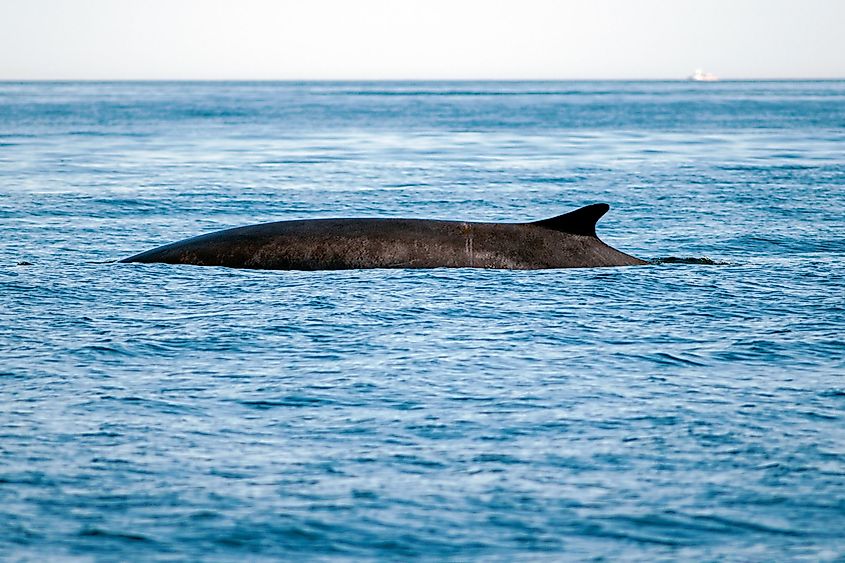
Invertebrates make up 60% of the known marine floral and faunal species within the gulf. Some common invertebrates observed here include the American cupped oyster, Atlantic razor clam, European flat oyster, American lobster, Atlantic rock crab, American sea scallop, Northern pink shrimp, and many more. Cetaceans like North Atlantic right whales, fin whales, minke whales, humpback whales, white-sided dolphins, etc., are also found here. In addition, more than 184 species of marine birds have been documented in the Gulf of Maine.
Attractions Around The Gulf Of Maine
Glaciation by Laurentide Ice Sheet removed the sedimentary soil away from the Gulf coastline, resulting in the creation of a rocky shoreline that lacks sandy beaches. The only notable coastal developments along the Gulf of Maine have been observed along metropolitan areas of Boston, Portland, Saint John, and Portsmouth.

The capital and biggest city of Massachusetts, Boston, located along the Massachusetts Bay, also serves as the cultural and financial center of the New England region. Boston is also a fantastic travel hub and provides quick access to various other prominent cities and vacation destinations. Located along the Piscataqua River in the southeastern portion of New Hampshire, Portsmouth is a well-known summer tourist destination. Situated on a peninsula in the Gulf of Maine’s Casco Bay, the port city of Portland is Maine’s most populous city. The city’s economy relies mostly on tourism, the service sector, and the marine industry, which supports fishing and commercial shipping activities. The second-largest city in Canada’s New Brunswick province and placed along the Bay of Fundy, Saint John is the country’s oldest incorporated city. The city’s economy mainly relies on fishing, shipping, and shipbuilding activities, making the Port of Saint John the third-largest port in Canada in terms of tonnage.
It is to be noted that anthropogenic climate change has been leading to drastic changes in the Gulf of Maine. Due to the rapid rising of water temperatures, the Gulf has become too hot for cod and kelp forests. Studies have revealed that some areas have witnessed about a 36.2% decrease in kelp forests. Moreover, the kelp beds have also been replaced by invasive turf referred to as macroalgae. In addition, overfishing has led to the rapid collapse of fish stocks in the gulf. Therefore, it is very important to note all the abrupt changes occurring in the Gulf of Maine and take appropriate measures to protect this pristine water body.


