Maps of Zimbabwe
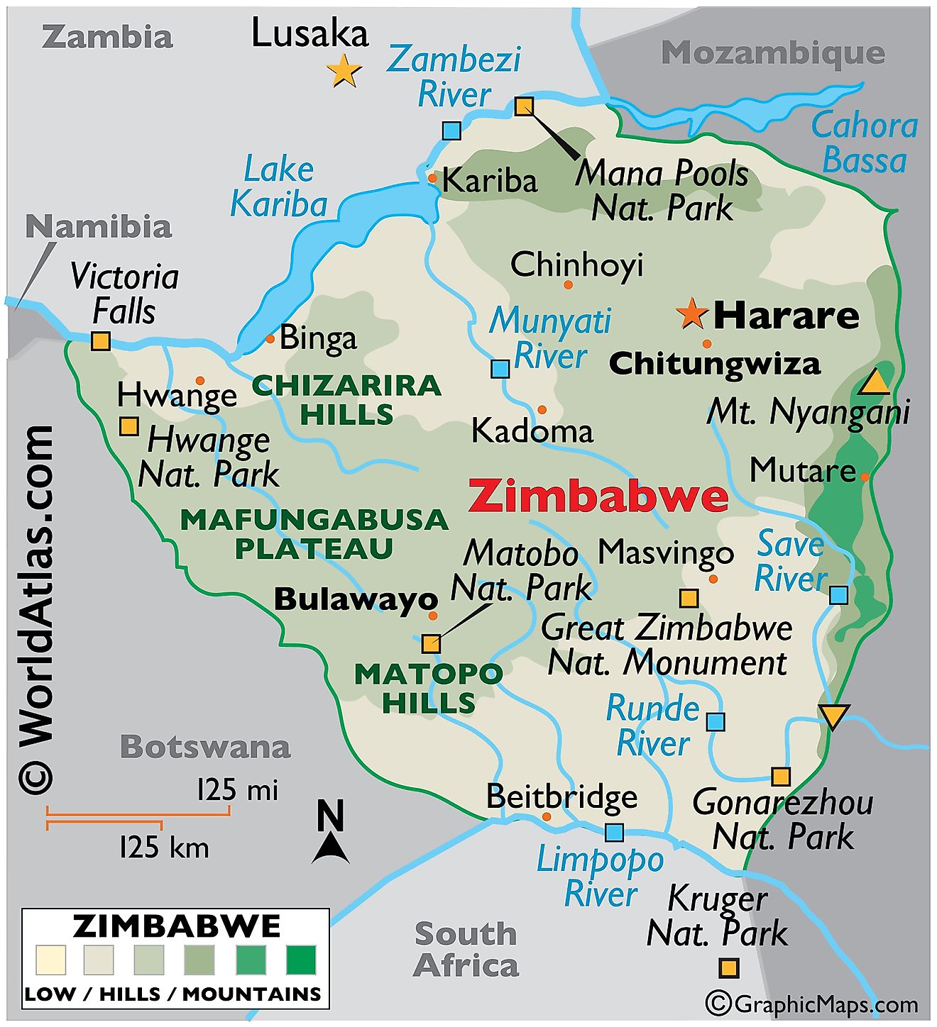
Zimbabwe, a landlocked country in southern Africa, shares its borders with four countries: Mozambique to the northeast and east, South Africa to the south, Botswana to the southwest and west, and Zambia to the northwest. In total, the country covers an area of approximately 390,760 km2 (150,873 mi2).
Mashonaland Plateau: One of the dominant geographical features, the Mashonaland Plateau, runs from the southwest to the northeast of the country. This plateau region consists mainly of granite hills, interspersed with wooded valleys. Harare, Zimbabwe’s capital and largest city, sits on this plateau. The area has a combination of red clay soils and deeper sandy soils suitable for agricultural activities, primarily tobacco and maize farming.
Highveld: Central Zimbabwe contains the Highveld, which is a range of hills sitting at an altitude ranging from 1,200 meters to 1,500 meters. It is the highest plateau area in Zimbabwe and includes some of the country's most fertile lands. Owing to the altitude, this region often experiences cooler temperatures than the surrounding areas.
Eastern Highlands: Along the border with Mozambique lie the Eastern Highlands. These mountainous regions include the Nyanga, Bvumba, and Chimanimani ranges. The highest peak, Mount Nyangani, rises to an elevation of 2,592 meters (8,504 feet) and is part of the Nyanga range. This region, with its cooler and wetter climate, supports different ecosystems compared to other parts of Zimbabwe and is important for tea and coffee cultivation.
Lowveld: The southeastern part of Zimbabwe descends into the Lowveld. This area sits at an altitude of below 900 meters and has a hotter and drier climate. The Sabi and Runde rivers flow through this region. It is also home to the Gonarezhou National Park, a crucial conservation area that forms part of the larger Great Limpopo Transfrontier Park when combined with areas in neighboring countries.
Matabeleland: To the west, Matabeleland extends as a relatively dry region. It includes parts of the Kalahari Desert, with sandy soils and sparse vegetation. This region consists of the Matabeleland North and Matabeleland South provinces. Bulawayo, Zimbabwe's second-largest city, is in this region. Cattle ranching is a common economic activity here due to the unsuitability of the land for crop cultivation.
Bodies of Water and Rivers: The largest inland body of water, Lake Kariba, sits on the Zambia-Zimbabwe border. This man-made reservoir results from the damming of the Zambezi River and serves as a major source of hydroelectric power and a focal point for tourism.
The major rivers of Zimbabwe include the Zambezi, Limpopo, Sabi, and Runde. The Zambezi River, the fourth-longest river in Africa, forms the country's northern boundary. The Limpopo River forms part of its southern boundary, separating Zimbabwe from South Africa.
Provinces of Zimbabwe Map
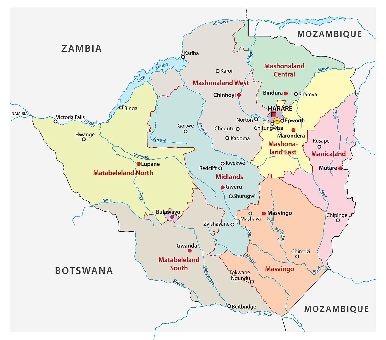
The political map of Zimbabwe shows its 8 provinces with their capitals and 2 cities with provincial status. The 8 provinces are Manicaland, Mashonaland Central, Mashonaland East, Mashonaland West, Masvingo, Matabeleland North, Matabeleland South, and Midlands. The two cities with provincial status include Bulawayo and Harare. The latter serves as the capital city of Zimbabwe. The provinces of the country are divided into districts which are further subdivided into wards.
With an area of 75,025 sq. km, Matabeleland North is the largest province of Zimbabwe by area. Hosting around 16.26% of the country’s total population, Harare is the most populous province in the country.
Where is Zimbabwe?
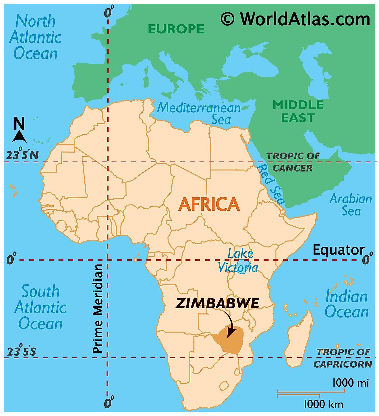
Zimbabwe is a southern African landlocked country. It is located in the Southern and Eastern Hemisphere regions of the world. Zimbabwe is bordered by four countries. Zambia and South Africa border Zimbabwe to the north and south respectively. Botswana borders it to the west and southwest while it is bounded by Mozambique to the east and northeast. Zimbabwe’s northwestern corner is only around 150 m from Namibia.
Zimbabwe Bordering Countries: Namibia, Mozambique, Zambia, Botswana, South Africa.
Regional Maps: Map of Africa
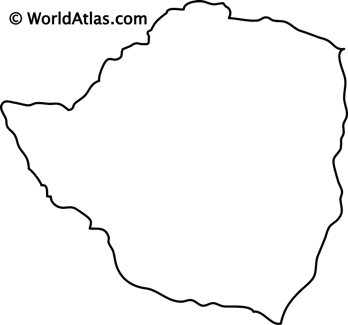
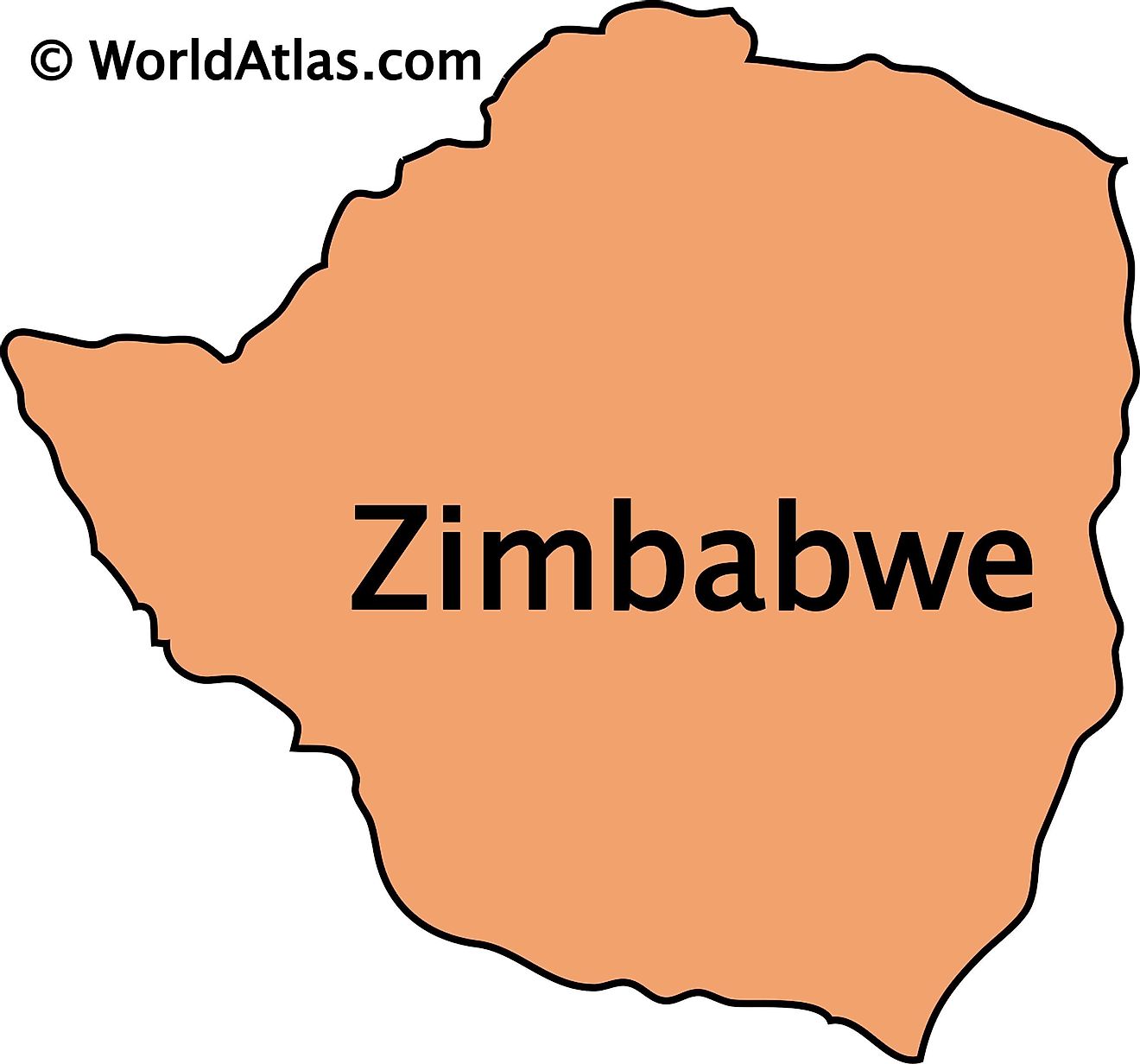
Outline Map of Zimbabwe
Key Facts
| Legal Name | Republic of Zimbabwe |
|---|---|
| Flag |
|
| Capital City | Harare |
| 17 49 S, 31 02 E | |
| Total Area | 390,757.00 km2 |
| Land Area | 386,847.00 km2 |
| Water Area | 3,910.00 km2 |
| Population | 14,645,468 |
| Major Cities |
|
| Currency | Zimbabwean dollars (ZWD) |
| GDP | $21.44 Billion |
| GDP Per Capita | $1,463.99 |
This page was last updated on August 9, 2023
