Maps of Wales
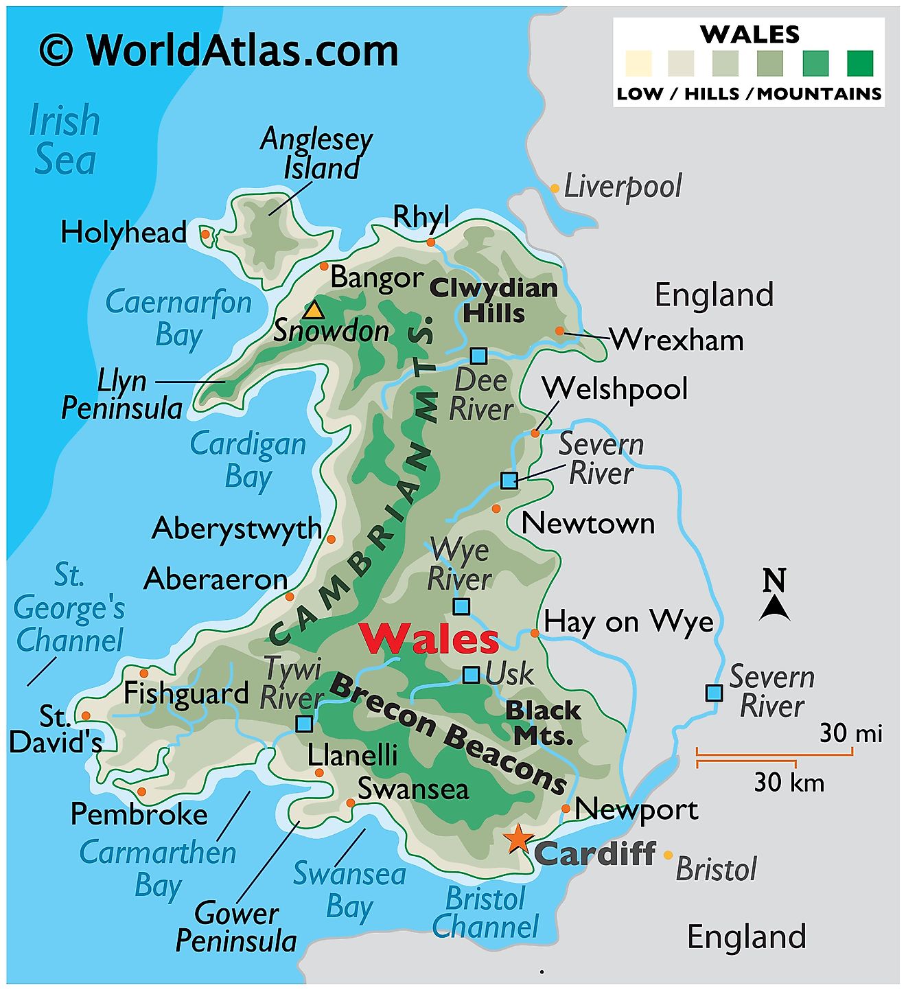
Wales, a country located in the southwest of The United Kingdom, shares its eastern border with England and its northern and western borders with the Irish Sea. Covering a total area of approximately 8,023 square miles, Wales boasts a diverse and rich geographical landscape that attracts visitors from around the world.
The geography of Wales can be divided into three main regions: the coastal plains, the uplands, and the mountains. The coastal plains stretch along the entire coastline of the country, encompassing sandy beaches, rugged cliffs, and fertile lowlands. These plains are particularly prominent in the southern and western areas, with the Gower Peninsula and the Pembrokeshire coast being some of the most scenic and well-known locations.
The uplands, which are found mainly in the central and eastern parts of Wales, consist of plateaus and rolling hills. These regions offer a mix of agricultural land, moorland, and forests. The Brecon Beacons, a range of hills in the southeastern part of the country, are a notable example of the upland landscape. This terrain is famous for its extensive cave systems and waterfalls.
Wales' most famous geographical feature, however, is its mountainous terrain. The country is home to several mountain ranges, the most prominent being Snowdonia in the northwest. This region encompasses the highest peak in Wales, Mount Snowdon, which stands at 3,560 feet above sea level. The Cambrian Mountains, located in central Wales, also contribute to the nation's striking topography.
Wales' geography is further defined by its many bodies of water and rivers. The coastline of Wales is characterized by several large estuaries, such as the Severn Estuary, which forms part of the border between Wales and England, and the Dee Estuary in the north. These estuaries create habitats for diverse flora and fauna, including migratory birds and marine life.
Numerous rivers flow through the country, providing essential resources and contributing to the overall beauty of the landscape. The River Severn, which forms part of the border between Wales and England, is the country's longest river, while the River Wye, River Teme, and River Usk are other major rivers in Wales. These rivers play a vital role in supporting agriculture, industry, and the local ecosystems.
Map
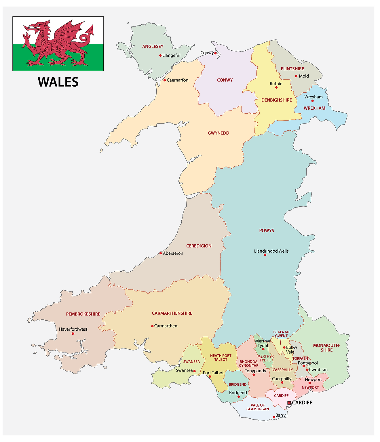
Wales is administratively divided into 22 principal areas (unitary authorities). Of these principal areas, there are 9 counties, 10 county boroughs, and 3 cities. In alphabetical order, the principal areas are Blaenau Gwent, Bridgend, Caerphilly, Cardiff, Carmarthenshire, Ceredigion, Conwy, Denbighshire, Flintshire, Gwynedd, Isle of Anglesey, Merthyr Tydfil, Monmouthshire, Neath Port Talbot, Newport, Pembrokeshire, Powys, Rhondda Cynon Taf, Swansea, Torfaen, Vale of Glamorgan, and Wrexham. The principal areas are further subdivided into a total of 878 communities.
Covering an area of 20,779 sq. km, Wales is a country located in the southwestern region of the United Kingdom. Located on the southern coast of Wales is Cardiff – the capital and the largest city of Wales. It also serves as a major commercial and financial center of the country. Cardiff is the 11th largest city in the United Kingdom.
Where is Wales?
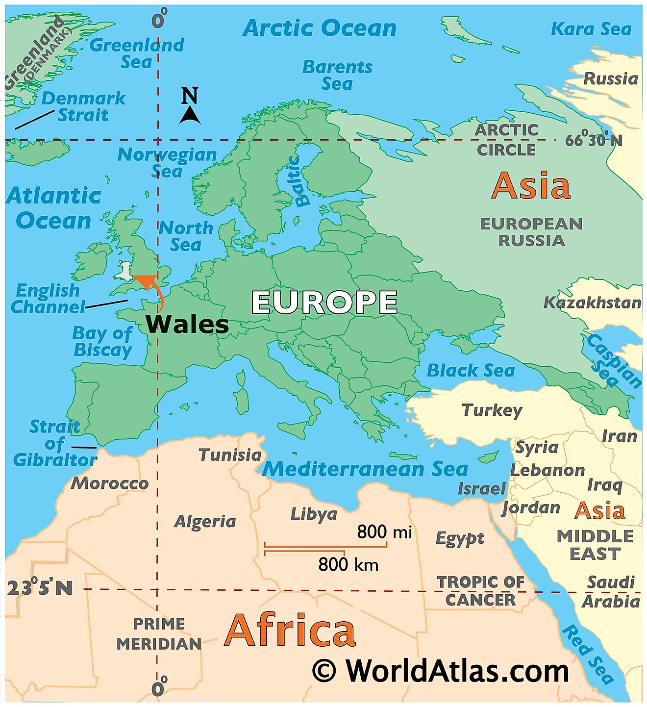
Wales is a country, that is located in the southwestern region of the United Kingdom and forms the westward extension of Great Britain Island. It is geographically positioned in the Northern and Western hemispheres of the Earth. Wales is bordered by England in the east; the Irish Sea in the north and west; the Celtic Sea and the St. George’s Channel in the southwest; and the Bristol Channel in the south.
Regional Maps: Map of Europe
Outline Map of Wales
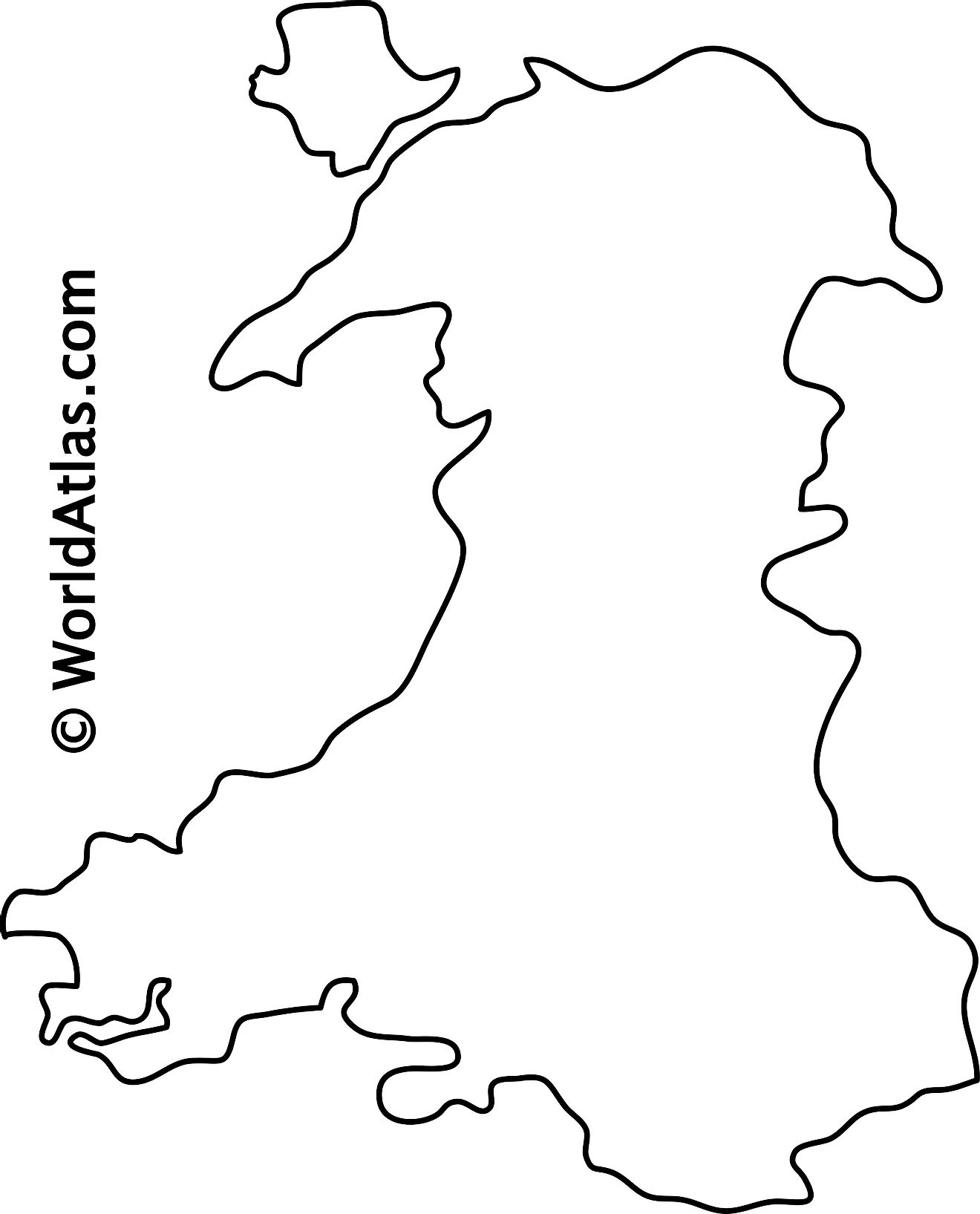
The above blank map represents the country of Wales, located in the southwestern region of the United Kingdom. The above map can be downloaded, printed, and used for geography education purposes like map-pointing and coloring activities.
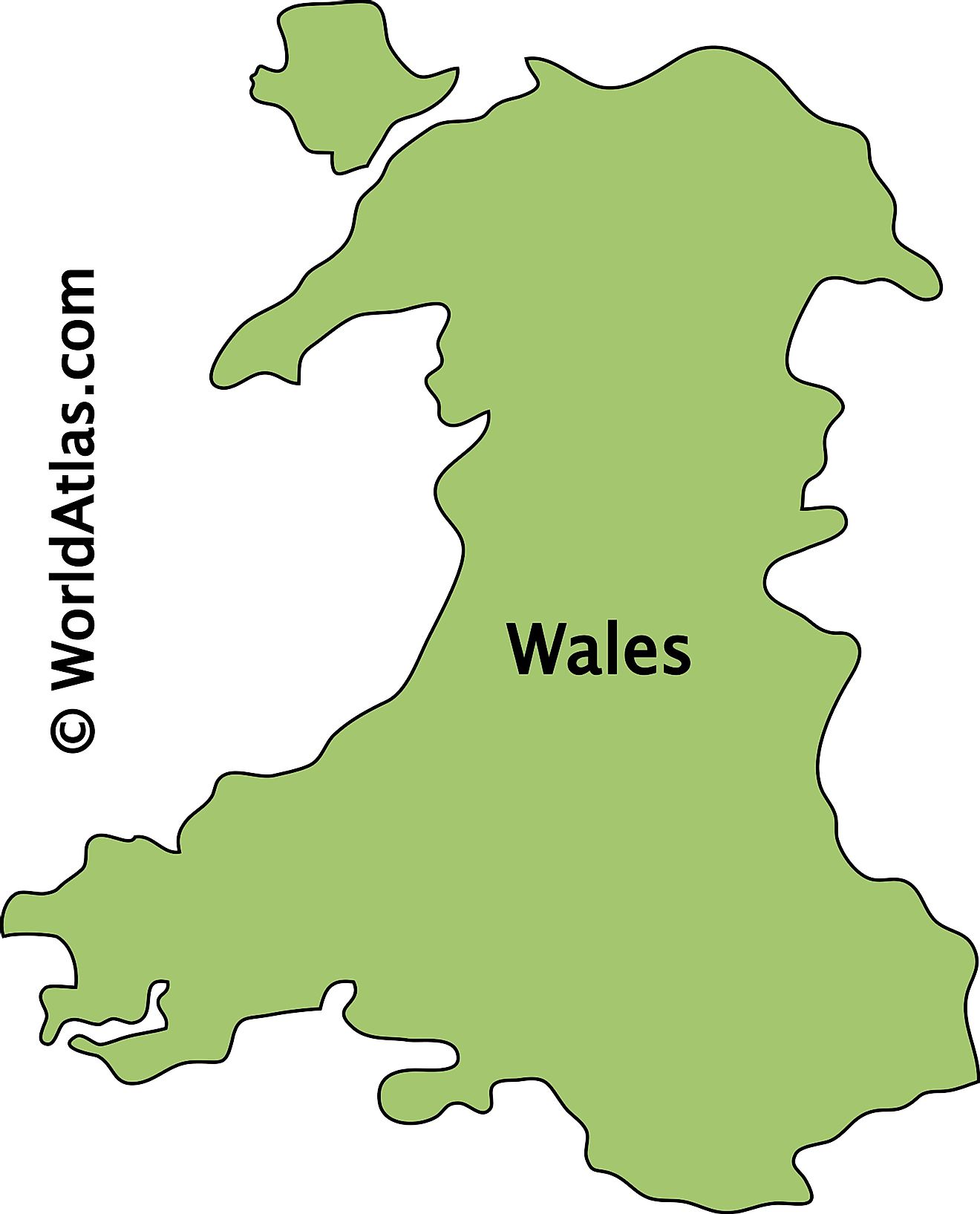
The above outline map represents the country of Wales, located in the southwestern region of the United Kingdom.
Key Facts
| Legal Name | Part of Wales |
|---|---|
| ISO 3166 Code | UK-UKW |
| Capital City | Cardiff |
This page was last updated on April 18, 2023


