The Great Lakes
The Great Lakes of North America (Great Lakes) are a series of five interconnected deep freshwater lakes that are located in the east-central part of North America. The five lakes, Lake Superior, Lake Michigan, Lake Huron, Lake Ontario, and Lake Erie, span across Canada and the United States and form the largest body of fresh water on the planet.
Collectively, the Great Lakes occupy an area of 244,106 km2 and hold about 22,671 km3 of water. The lakes serve as a natural boundary between Canada and United States and touch the Canadian Province of Ontario as well as the US States of Michigan, New York, Pennsylvania, Wisconsin, Ohio, Illinois, Indiana, and Minnesota. Out of the five Great Lakes, only Lake Michigan is located entirely within the United States. The Great Lakes have also been nicknamed “inland seas,” owing to their massive expanse, volume, rolling waves, depths, and strong currents.
Contents:
- Geography
- Lake Superior
- Lake Huron
- Lake Michigan
- Lake Erie
- Lake Ontario
- Islands And Peninsulas
- Wildlife
- Brief History
Geography

It is generally believed that the Great Lakes started to form about 14,000 years ago, at the end of the Wisconsin Glaciation. As the huge ice sheets melted, they left behind a chain of large depressions that eventually became filled with water. This led to the formation of the basic shape of the Great Lakes and about 10,000 years ago, the Great Lakes began to assume their present form. Lakes Huron, Michigan and Superior were likely the last to reach their present form, about 3,000 years ago.
The Great Lakes together form the western part of the St. Lawrence hydrographic system. Several rivers, tributaries, and manmade canals connect the lakes and provide a major transportation route that links the inland areas with the Atlantic Ocean. It is estimated that more than 85 million people reside in the Great Lakes Megalopolis region, including some human settlements along the St. Lawrence River which connects the lakes to the Atlantic.
According to the Köppen climate classification, the Great Lakes experience a humid continental climate. The Great Lakes greatly moderate the climate of the surrounding areas and lead to comparatively cool summers and warm winters. The lakes also face severe storms during the early winter season. A large area of the surface water of the lake also freezes during the winters.
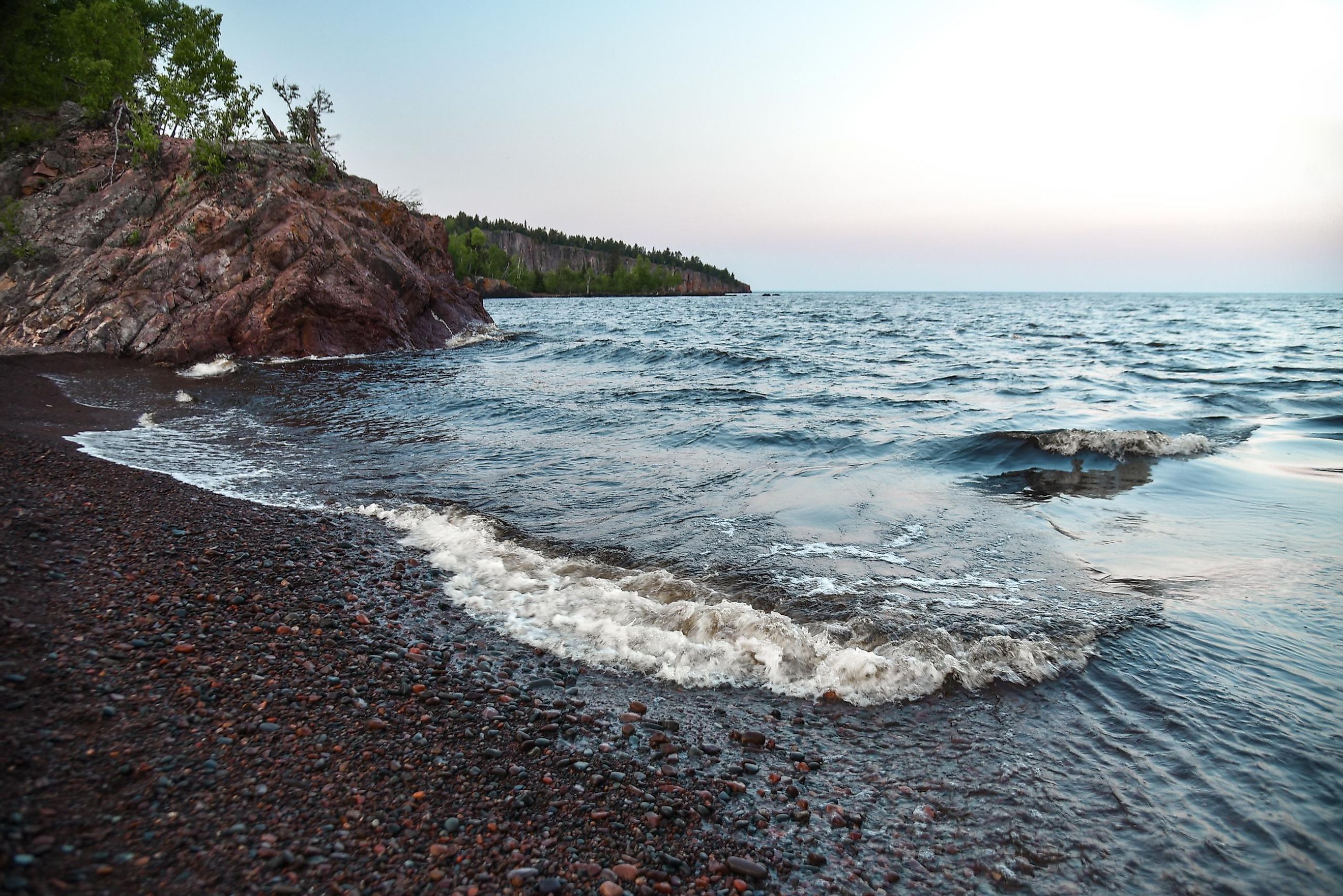
Lake Superior

Covering an area of about 82,000 km2, Lake Superior is the largest of the Great Lakes as well as the world’s largest freshwater lake by surface area. The Lake is located at the northwestern end of the Great Lakes chain and extends into the Canadian province of Ontario as well as the US States of Minnesota, Wisconsin, and Michigan’s Upper Peninsula. Lake Superior empties into Lake Huron via the St. Marys River. The lake has a length of about 560 km and a width of 260 km. It has an average depth of 147 m and a maximum depth of 406 m. Several islands like Isle Royale, Apostle Islands, and Slate Islands are located within Lake Superior. The biggest human settlements on its shores are Thunder Bay and Sault Ste. Marie in Ontario, Duluth in Minnesota, and Marquette and Sault Ste. Marie in Michigan.
Lake Huron

Covering an area of about 59,588 km2, Lake Huron is the second-largest of the Great Lakes. It occupies the eastern part of Lake Michigan-Huron and is shared by the Canadian Province of Ontario and the US State of Michigan. The lake has a length of about 332 km and a width of 295 km. It has an average depth of 59 m and a maximum depth of 229 m. Manitoulin Island is the largest island located in Lake Huron and the largest freshwater island in the world. Along the shores of Lake Huron are the towns of Sarnia in Ontario and Bay City and Alpena in Michigan.
Lake Michigan

Covering an area of about 58,030 km2, Lake Michigan is the third-largest of the Great Lakes by area and the second-largest by volume. Lake Michigan is situated entirely within the United States and occupies the western portion of Lake Michigan-Huron. The lake has a length of about 494 km and a width of 190 km. It has an average depth of 85 m and a maximum depth of 281 m. Lake Michigan and Lake Huron are connected by the Straits of Mackinac. Chicago and Highland Park, Illinois, and Benton Harbor, Michigan are some of the towns located along its shores.
Lake Erie

Covering an area of about 25,667 km2, Lake Erie is the fourth-largest of the Great Lakes and the smallest lake by volume. It is the southernmost of the Great Lakes and extends into the Canadian province of Ontario and the US States of Pennsylvania, Michigan, Ohio, and New York. The lake has a length of 388 km and a width of 92 km. It has an average depth of 19 m and a maximum depth of about 64 m. Lake Erie and Lake Ontario are connected by the Niagara River and the Niagara Falls. Its human settlements are Buffalo, New York; Erie, Pennsylvania; Toledo and Cleveland, Ohio; and Monroe, Michigan.
Lake Ontario

Covering an area of 19,000 km2, Lake Ontario is the smallest of the Great Lakes. The lake is shared by the Canadian Province of Ontario and the US State of New York. The lake has a maximum length of 311 km and a width of 85 km. It has an average depth of 86 m and a maximum depth of 244 m. The St. Lawrence River connects Lake Ontario with the Gulf of St. Lawrence and the Atlantic Ocean. Canada's largest city, Toronto, is located along its shores, along with Kingston and Hamilton, Ontario, and Rochester, New York.
Islands And Peninsulas
The Great Lakes contain approximately 35,000 islands. With an area of about 2,766 km2, Manitoulin Island is the largest freshwater island in the world and is located in Lake Huron. The Manitoulin Island itself contains numerous freshwater lakes among which Lake Manitou is the largest lake in the world that is located on a freshwater island. With an area of 535.4 km2, Isle Royale is the world’s fourth-largest lake island and also the second-largest island in the Great Lakes. Isle Royale is situated in the northwestern part of Lake Superior.
There are many peninsulas in the Great Lakes including the Ontario Peninsula, Door Peninsula, and the Upper and Lower Peninsulas of Michigan.
Wildlife

Over 3,500 species of flora and fauna are found in the Great Lakes basin. Diatoms, blue-green algae, microscopic crustaceans, copepods, cladocerans have been recorded in the waters of the Great Lakes. Other invertebrate species like snails, worms, mayflies, caddisflies, clams, opossum shrimp, deepwater sculpins, zebra mussels, and spiny water fleas are also found in the lakes' waters. Some of the significant fish that are found here include whitefish, smelt, lake herring, lake trout, salmon, catfish, bass, white perch, and walleye, among others. Ring-billed gulls, herring gulls, and terns are some of the common avian species observed in the Great Lakes. The lake islands also serve as critical habitats for various shorebirds and ducks.
Brief History
Several Indigenous peoples inhabited the Great Lakes beginning after the end of the Last Glacial Period, around 10,000 BCE. The Great Lakes played a great role in the exploration and development of the North American continent. In 1535, Jacques Cartier reached the St. Lawrence River while on his search for a new sea route to the Orient. He was followed by Samuel de Champlain, who reached Lake Huron in 1615 and eventually became the first European to visit all the Great Lakes. The lakes were also explored by various other explorers who established initial settlements along the lake region, trading with the Indigenous peoples. The Great Lakes served as a battle site for the French and Indian War (the North American portion of the broader Seven Years' War), the American Revolution, and the War of 1812.


