Maps of Arizona
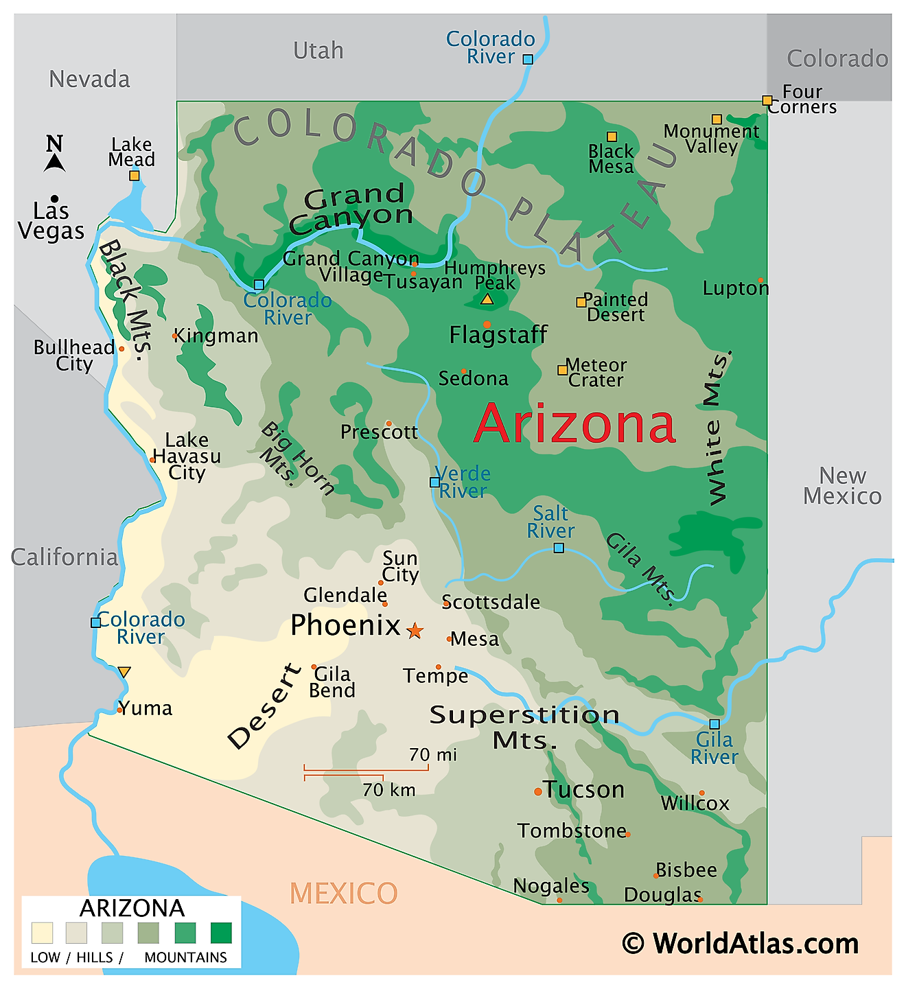
Arizona is a state in the southwestern United States. It shares its borders with Utah to the north, New Mexico to the east, the Mexican states of Sonora and Baja California to the south, and California and Nevada to the west. At its extreme northeastern corner it also touches Colorado at Four Corners, the only place in the country where four states meet at a single point. The state covers an area of approximately 113,998 square miles (295,253 square kilometers), making it the sixth largest state.

Arizona is landlocked, but water explains almost everything about it. The Colorado River forms the entire western boundary with California and part of the Nevada border, and over roughly six million years it carved the deepest and most famous canyon on the continent. Elevation does the rest: the land falls from over 12,600 feet in the north to just 70 feet in the southwest corner, and that 12,500-foot drop takes the state from alpine tundra through ponderosa pine forest and grassland down into true desert.
Where Is Arizona?

Arizona measures about 400 miles north to south and 310 miles east to west. Its northern and eastern boundaries are survey lines, its southern boundary is an international border running 389 miles along Sonora and Baja California, and its western boundary follows the Colorado River.
Although the state is best known for desert, its mean elevation of about 4,100 feet is among the highest in the country. With roughly 7.6 million residents, Arizona is the 14th most populous state, and it is divided into just 15 counties, fewer than almost any other state of comparable size.
The Colorado Plateau
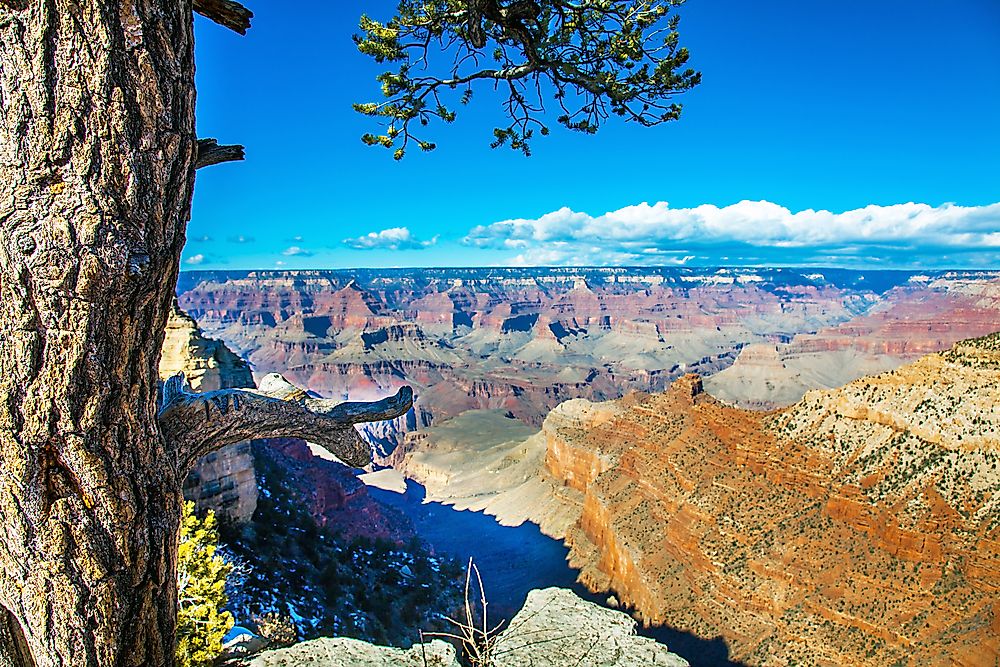
The Colorado Plateau covers the northern third of Arizona, a high tableland of flat-lying sedimentary rock standing mostly between 5,000 and 8,000 feet. The rock here was never folded, only lifted, so the layers remain nearly horizontal and streams have cut straight down through them into canyons, mesas, and buttes.
The Grand Canyon is the outstanding example. It runs 277 miles, reaches 18 miles across at its widest, and drops more than a mile from rim to river. Its walls expose nearly two billion years of rock, one of the most complete geological sequences visible anywhere on earth.
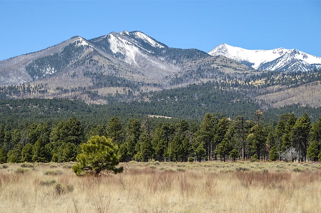
Humphreys Peak, the highest point in Arizona at 12,633 feet (3,851 meters), rises from this plateau within the Kachina Peaks Wilderness north of Flagstaff. It is the tallest of the San Francisco Peaks, which are the eroded remains of a stratovolcano that once stood considerably higher before its summit collapsed. The surrounding San Francisco Volcanic Field contains more than 600 vents, and its youngest, Sunset Crater, erupted less than a thousand years ago. The peak's upper slopes hold the only alpine tundra in Arizona.

Elsewhere on the plateau, the Painted Desert spreads across banded badlands of mudstone and clay stained by iron and manganese, and Petrified Forest National Park preserves one of the world's largest concentrations of fossilised Triassic wood. Monument Valley, on the Navajo Nation along the Utah line, holds sandstone buttes rising up to a thousand feet above the valley floor, remnants left behind as the surrounding rock eroded away.
The Transition Zone

Between the plateau and the deserts lies the Transition Zone, a rugged diagonal belt of mountains, deep canyons, and basins crossing the state from northwest to southeast.
Its northern edge is defined by the Mogollon Rim, and this is worth stating precisely because it is often described incorrectly. The Mogollon Rim is an escarpment, not a mountain range. It is the cliff line marking the southwestern edge of the Colorado Plateau itself, running roughly 200 miles from northern Yavapai County east toward the New Mexico border and dropping as much as 2,000 feet. Its pale Coconino Sandstone cliffs form the visual boundary between the high country and everything south of it.

The Rim carries the largest continuous ponderosa pine forest in the world, stretching into New Mexico. Below it, the Transition Zone proper holds the Verde and Tonto basins, the mineral belt that produced Arizona's copper mining industry, and rivers including the Verde and the upper Salt that supply water to the cities in the valleys below.

The White Mountains in the east are volcanic in origin, built on the Rim's southern margin. Mount Baldy reaches 11,409 feet and is sacred to the White Mountain Apache, and the surrounding high country holds meadows, spruce-fir forest, and the headwaters of several rivers.
The Basin and Range

Southern and western Arizona belong to the Basin and Range province, where the crust was stretched and pulled apart beginning about 20 million years ago. Blocks of rock dropped along faults to form basins while others tilted upward into narrow north-south ranges, and sediment eroding off the ranges has since filled the valleys to depths of thousands of feet. The result is the province's characteristic rhythm of broad flat basins separated by abrupt, isolated mountains.
Most of this region lies within the Sonoran Desert, the only place on earth where the saguaro cactus grows naturally. Unlike most deserts, the Sonoran receives rain in two seasons, winter frontal storms and summer monsoon thunderstorms, which is why it supports far more plant life than its rainfall alone would suggest.

In the southeast, the ranges rise high enough to carry forest, and these are the Madrean Sky Islands: isolated mountains such as the Chiricahuas, Santa Catalinas, and Huachucas, surrounded by desert and grassland. Each functions as an ecological island, and because they sit where the Rocky Mountains, the Sierra Madre, and two deserts overlap, they are among the most biologically diverse areas in North America.
Arizona's lowest point lies at the far southwestern corner, along the Colorado River just west of San Luis in Yuma County, at 70 feet (21 meters). Note that this is where the river crosses into Mexico, not into California.
Deserts
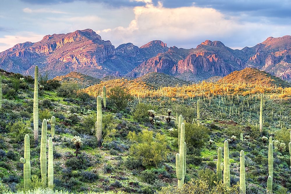
Arizona contains parts of four North American deserts, more than any other state. The Sonoran covers the south and centre and is the hottest and most vegetated. The Mojave occupies the northwest around the lower Colorado and is drier still, marked by Joshua trees. The Chihuahuan reaches into the far southeast, a higher grassland desert of agave and yucca. The cold Great Basin desert extends onto the northern plateau, where sagebrush replaces cactus and winters bring snow.

That range is unusual. Few places on earth hold four distinct desert systems, and the reason is Arizona's enormous span of elevation and its position at the meeting point of several climate regimes.
Rivers
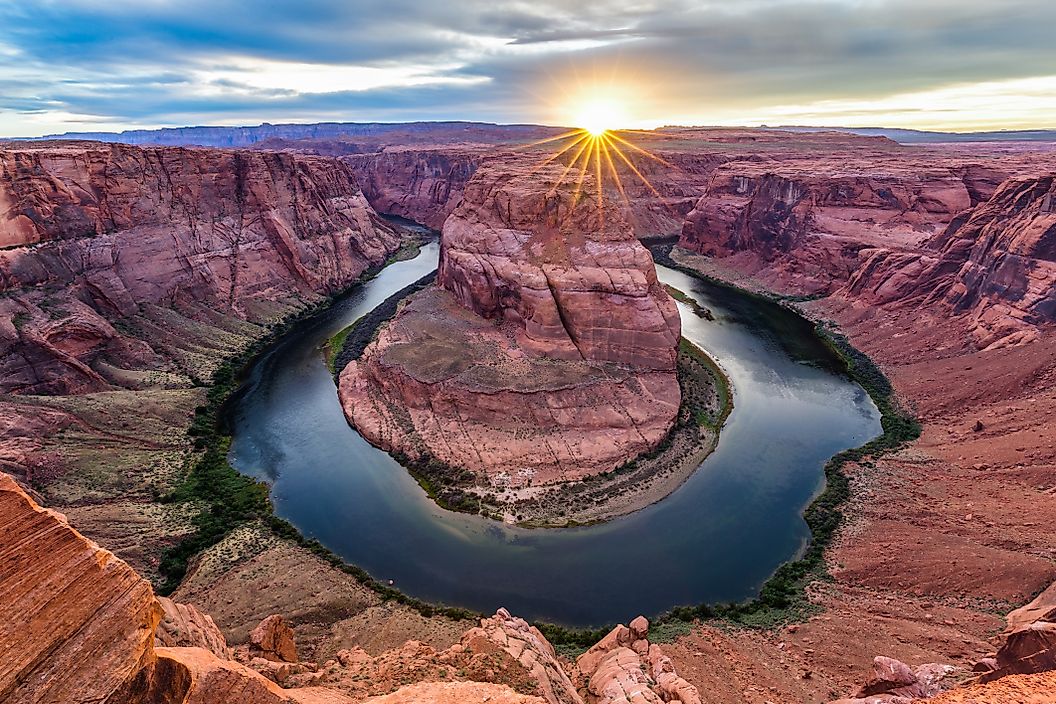
The Colorado River is the dominant watercourse, entering from Utah, cutting the Grand Canyon, then turning south to form the western boundary before crossing into Mexico. Its flow is almost entirely allocated among seven states and Mexico, and in most years it no longer reaches the sea.
The Gila River is the principal river of southern Arizona, rising in New Mexico and running west across the state to meet the Colorado at Yuma. Its tributaries include the Salt, the Verde, the San Pedro, and the Santa Cruz, and together they drain most of the state's southern half.
Many Arizona watercourses are ephemeral, flowing only after storms. Dams and groundwater pumping have left long reaches of the Gila, Salt, and Santa Cruz dry for most of the year, and the San Pedro is now one of the last major undammed rivers in the Southwest.
Lakes and Reservoirs

Arizona has almost no natural lakes. Every large body of water in the state is a reservoir, built to store a river supply that arrives unevenly through the year.
Lake Mead, impounded behind the Hoover Dam on the Colorado, is the largest reservoir in the United States by capacity. Lake Powell, behind Glen Canyon Dam near Page, is second, and Lake Havasu behind Parker Dam supplies both the Central Arizona Project and water bound for California. All have fallen well below capacity during the prolonged drought of recent decades.

On the Salt River, a chain of four reservoirs rises behind Theodore Roosevelt, Horse Mesa, Mormon Flat, and Stewart Mountain dams, creating Roosevelt, Apache, Canyon, and Saguaro lakes. Roosevelt Lake is the largest body of water lying entirely within Arizona, and the Roosevelt Dam, completed in 1911, made large-scale settlement of the Salt River Valley possible.
Climate

Arizona has no single climate. Elevation governs everything, and conditions shift from arid desert in the southwest through semi-arid steppe in the middle elevations to humid continental and even subalpine on the highest peaks.
Rainfall ranges from under 4 inches a year at Yuma, among the driest places in the country, to more than 30 inches on the Mogollon Rim and the White Mountains. Flagstaff, at 7,000 feet, averages about 100 inches of snow a season while Phoenix, 140 miles south, almost never sees any.
The defining feature of the year is the North American monsoon. From roughly July through September, a seasonal shift in wind draws moisture north from the Gulf of California and the Gulf of Mexico, producing violent afternoon thunderstorms, flash floods, and dust storms known as haboobs. Roughly half of annual rainfall in southern Arizona arrives in these few weeks.
Arizona Geography at a Glance
| Feature | Detail |
|---|---|
| Total area | Approx. 113,998 sq mi (295,253 sq km), 6th largest state |
| Dimensions | Approx. 400 mi north to south; 310 mi east to west |
| Highest point | Humphreys Peak, 12,633 ft (3,851 m), San Francisco Peaks |
| Lowest point | Colorado River near San Luis at the Mexican border, 70 ft (21 m) |
| Mean elevation | Approx. 4,100 ft |
| Bordering states | Utah, New Mexico, California, Nevada, and Colorado at Four Corners |
| International border | 389 mi with Sonora and Baja California, Mexico |
| Major regions | Three: Colorado Plateau, Transition Zone, Basin and Range |
| Key escarpment | Mogollon Rim, approx. 200 mi, marking the plateau's southern edge |
| Deserts | Four: Sonoran, Mojave, Chihuahuan, Great Basin |
| Largest lake in state | Roosevelt Lake (reservoir) |
| Counties | 15 |
Counties Map
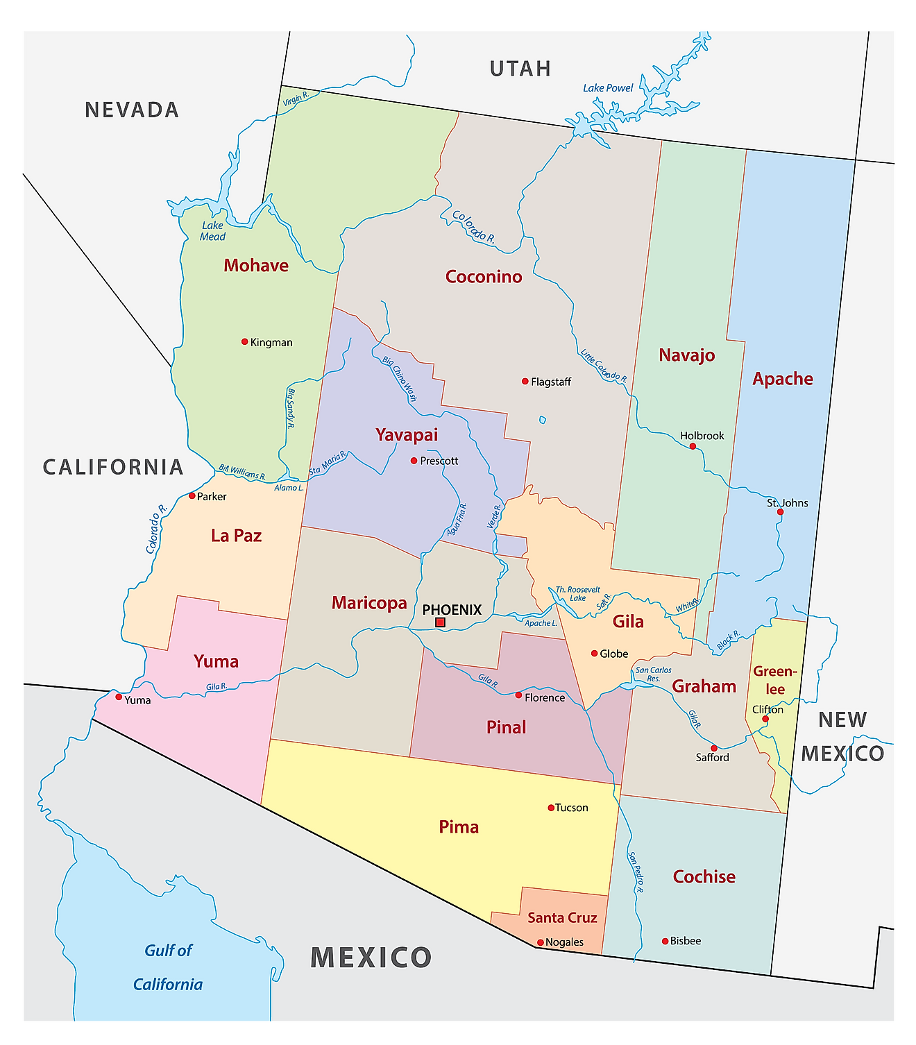
The State of Arizona is divided into 15 counties. In alphabetical order, these counties are: Apache, Cochise, Coconino, Gila, Graham, Greenlee, La Paz, Maricopa, Mohave, Navajo, Pima, Pinal, Santa Cruz, Yavapai, and Yuma.
With an area of 295,253 sq. km, Arizona is the 6th largest and the 14th most populous state in the USA. Located in the south-central part of the state, along the Salt River, is Phoenix – the capital and most populous city in Arizona. With roughly 1.65 million residents it is the fifth-most populous city in the United States and the largest state capital in the country, the only one with over a million people. It serves as the financial, cultural, transportation, and communication hub of the state. Its economy is built around real estate, trade, health care, and insurance services, alongside a rapidly expanding semiconductor industry. Phoenix sits in Maricopa County, which holds about 62 percent of Arizona's population and is the fourth most populous county in the United States.
Where is Arizona?
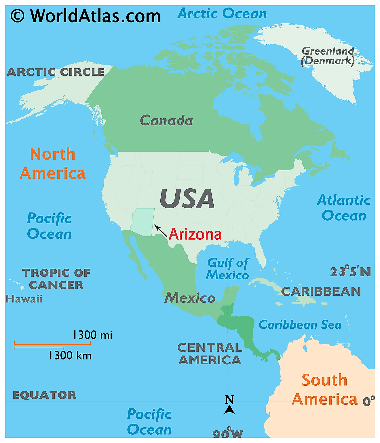
The State of Arizona is located in the southwestern region of the United States. This landlocked state is bordered by California in the west; by Nevada in the northwest; by Utah in the north; by New Mexico in the east; by the Mexican state of Sonora in the south; and by Baja California in the southwest. Arizona shares the Four Corners region, in its extreme northeastern corner, with the states of Colorado, Utah, and New Mexico.
Regional Maps: Map of North America
Outline Map of Arizona
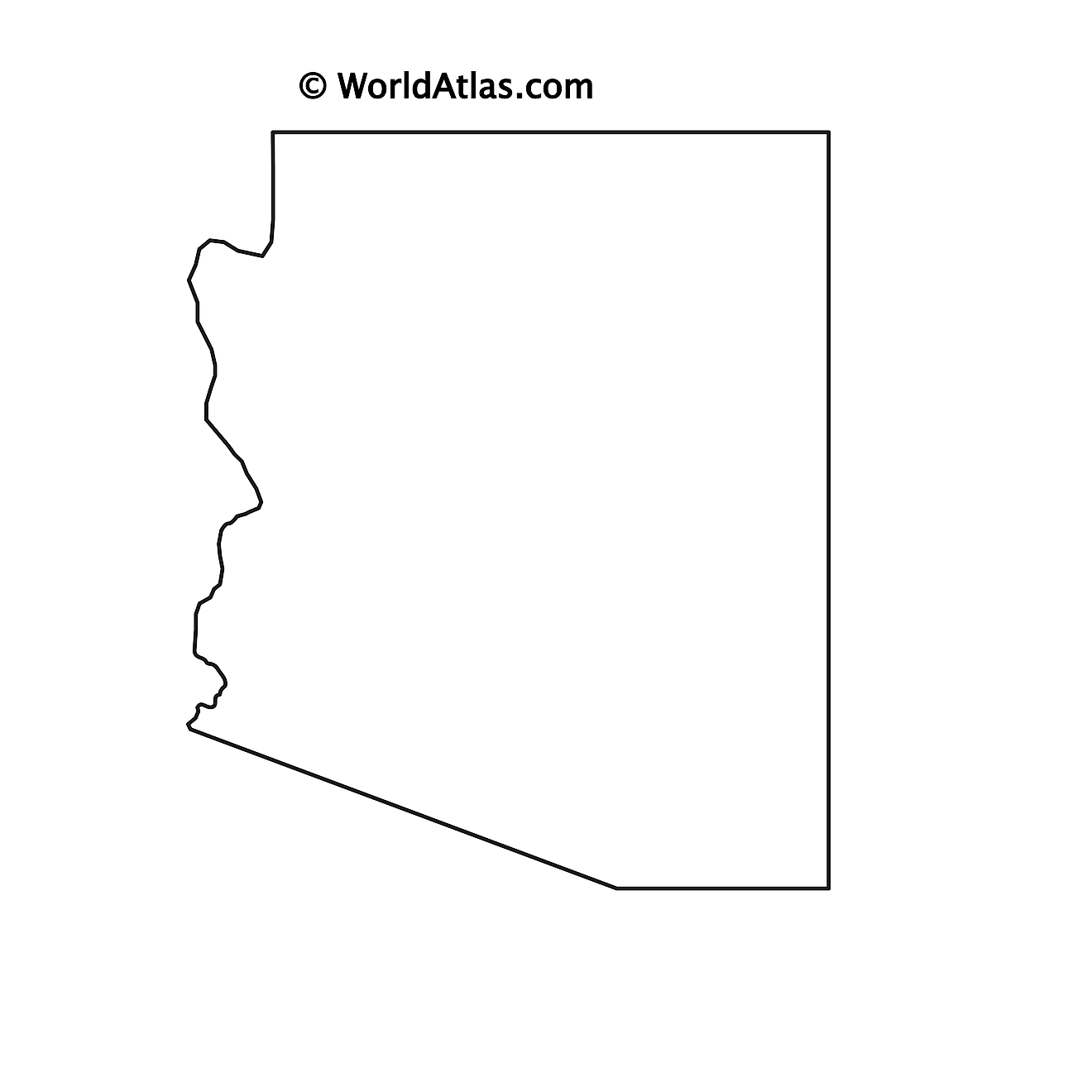
The above blank map represents the State of Arizona, located in the southwestern region of the United States. The above map can be downloaded, printed and used for geography education purposes like map-pointing and coloring activities.
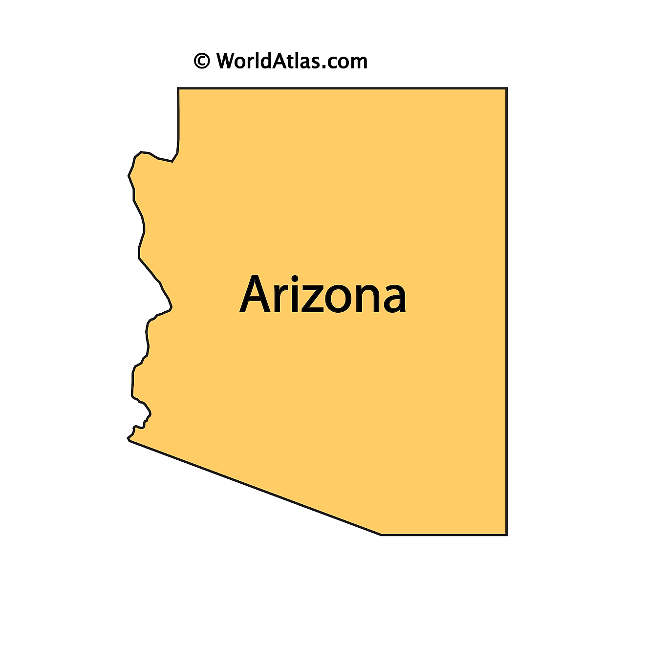
The above outline map represents the State of Arizona, located in the southwestern region of the United States.
Key Facts
| Legal Name | State of Arizona |
|---|---|
| ISO 3166 Code | US-AZ |
| Capital City | Phoenix |
| Major Cities |
|
This page was last updated on October 5, 2026


