Maps of Pennsylvania
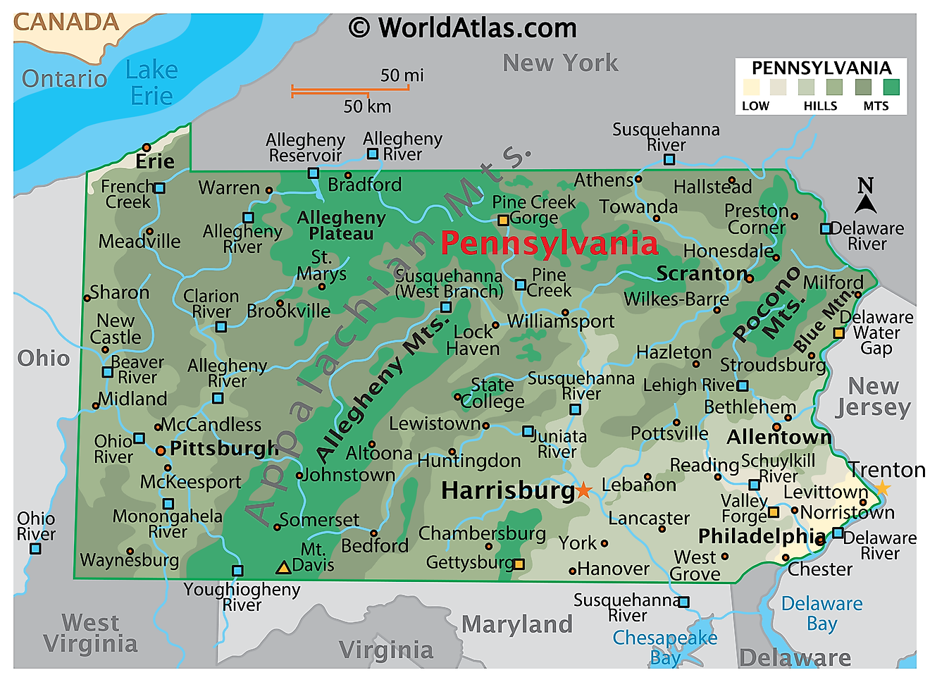
Pennsylvania is a state in the Mid-Atlantic and Northeastern regions of the United States. Officially styled a commonwealth rather than a state, it covers approximately 46,054 square miles and ranks as the 33rd largest state in the country. With just over 13 million residents, it is the fifth most populous.

Pennsylvania is one of the most thoroughly mountainous states east of the Mississippi, but its mountains are not jagged peaks. They are long, parallel ridges and broad, deeply eroded plateaus, shaped over hundreds of millions of years by continental collisions and then carved by rivers and, in the north, by ice. Forests cover roughly 58% of the state, and the only true lowlands lie in two small areas at opposite corners: a sliver of Atlantic Coastal Plain in the southeast and the Lake Erie plain in the northwest.
Where Is Pennsylvania?

Pennsylvania borders six states. New York lies to the north, New Jersey to the east across the Delaware River, Delaware, Maryland, and West Virginia to the south, and Ohio to the west. West Virginia also wraps around part of the southwestern corner. In the northwest, a short shoreline on Lake Erie gives Pennsylvania a water boundary with Ontario, Canada, and access to the Great Lakes shipping system.
The state's southern boundary with Maryland is the Mason-Dixon Line, surveyed in the 1760s to settle a colonial border dispute. Philadelphia, in the southeastern corner, is the largest city; Pittsburgh anchors the west, and Harrisburg, on the Susquehanna, is the capital.
Pennsylvania's Physiographic Regions

Geologists divide Pennsylvania into six physiographic provinces, each with a distinct rock structure and landform signature:
- Atlantic Coastal Plain — a narrow strip along the Delaware River around Philadelphia, and the state's only sea-level ground.
- Piedmont — rolling lowlands and limestone valleys across the southeast, including the farmland of Lancaster, Chester, and York counties.
- New England Province — a small area of ancient crystalline rock northwest of Philadelphia, known locally as the Reading Prong or South Mountain.
- Ridge and Valley — the corrugated belt of long parallel ridges and farm valleys running diagonally across the center of the state.
- Appalachian Plateaus — by far the largest province, covering roughly half of Pennsylvania across the north and west. The Allegheny Plateau and the Pocono Plateau are subdivisions of it.
- Central Lowlands — the flat Lake Erie plain in the extreme northwest.
One point often confused: the Allegheny Plateau is not a separate region from the Appalachian Plateau. It is the Pennsylvania portion of it.
The Ridge and Valley Appalachians

The Appalachian Mountains cut diagonally across Pennsylvania from the northeast to the south-central border. The Ridge and Valley province is their most visually striking expression: a washboard of narrow sandstone ridges rising 1,000 to 1,500 feet above intervening limestone and shale valleys, all running roughly parallel for mile after mile. The pattern is the eroded remnant of folded rock layers, buckled when Africa collided with North America some 300 million years ago.
Blue Mountain, also called the Kittatinny Ridge, is the southeastern front of this province — an almost unbroken ridge running about 150 miles from the Delaware Water Gap southwest toward Maryland. It sits south of the Pocono Plateau, not east of it, and forms the visual wall that travelers cross when leaving the Piedmont farmland for the mountains. Its unbroken updrafts make it one of the premier raptor migration corridors in eastern North America.

The Pocono Mountains in the northeast are not a folded range at all, despite the name. They are the glaciated southeastern escarpment of the Appalachian Plateau, a wooded upland of waterfalls, bogs, and kettle lakes left behind by the ice sheet.
The Delaware Water Gap

Where the Delaware River crosses the Pennsylvania–New Jersey line, it slices straight through Blue Mountain in a gorge roughly 1,200 feet deep, with Mount Minsi on the Pennsylvania side and Mount Tammany on the New Jersey side. This is a classic water gap: the river is older than the ridge and cut downward as the rock rose around it, rather than detouring around the obstacle.
The Delaware Water Gap National Recreation Area protects about 40 miles of river corridor on both sides. The Delaware itself is the longest undammed river east of the Mississippi, and its tidal reach at Philadelphia is Pennsylvania's lowest point, at sea level.
The Appalachian Plateau and Mount Davis

West and north of the Ridge and Valley, the rock layers were lifted without being folded, producing a high tableland that streams have since dissected into steep hills and narrow hollows. The result looks mountainous from the ground but is, structurally, a plateau cut apart by water.
Pine Creek Gorge, widely called the Pennsylvania Grand Canyon, is the most dramatic example. Running about 47 miles through Tioga State Forest, it reaches depths near 1,450 feet. It formed at the close of the last Ice Age, when glacial meltwater reversed Pine Creek's flow and sent it cutting a new channel southward.
Mount Davis, in Somerset County in the state's southwestern corner, is the highest point in Pennsylvania at 3,213 feet. It is not a peak in any conventional sense but the high shoulder of Negro Mountain, a broad plateau ridge in the Allegheny Mountains section. The Poconos, Allegheny Front, and Laurel Highlands are other well-known parts of this province.
Rivers

Pennsylvania straddles a continental-scale drainage divide. Water in the east flows to the Atlantic by way of the Delaware and the Chesapeake; water in the west flows to the Gulf of Mexico by way of the Ohio and Mississippi; and a narrow strip in the northwest drains to the Great Lakes and the St. Lawrence.
The Susquehanna River is the dominant river of the state's heartland. Rising at Otsego Lake in New York, it runs about 444 miles to Chesapeake Bay, making it the longest river on the American East Coast and the longest river in the contiguous United States without commercial navigation along its length. It supplies roughly half of the bay's freshwater.

In the west, the Allegheny River flows south from the plateau country and meets the Monongahela, arriving from West Virginia, at Point State Park in downtown Pittsburgh. Their confluence forms the Ohio River, which then runs northwest for roughly 40 miles through Allegheny and Beaver counties before crossing into Ohio near East Liverpool. Contrary to a common misconception, the Ohio does not form any part of Pennsylvania's boundary; the state's western borders are surveyed straight lines. The Ohio only becomes a state boundary downstream, between Ohio and West Virginia.
Other significant rivers include the Schuylkill, which joins the Delaware at Philadelphia, along with the Lehigh, Juniata, Youghiogheny, and Clarion.
Lake Erie and the Northwest

Pennsylvania's Lake Erie frontage runs about 51 miles — the shortest Great Lakes shoreline of any of the eight states that touch the lakes, but disproportionately important. Presque Isle, a curving sand spit reaching roughly seven miles into the lake, shelters Presque Isle Bay and gives Erie the only natural harbor on the Pennsylvania lakeshore.
The narrow plain between the lake and the plateau escarpment is flat, fertile, and unusually mild for its latitude. The lake delays autumn frost by several weeks, which is why this strip supports Pennsylvania's Concord grape and wine industry.
Lakes and Reservoirs

Pennsylvania has close to 4,000 lakes, ponds, and reservoirs, though together they cover less than 2% of the state. Most natural lakes are in the glaciated northeast and northwest; the south, never reached by the ice, has almost none.
Raystown Lake in Huntingdon County is the largest body of water entirely within Pennsylvania, stretching about 28 miles behind a flood-control dam on the Juniata River. Lake Wallenpaupack in the Poconos, created in 1926 for hydroelectric power, covers roughly 5,700 acres and is among the state's best-known recreational lakes. Conneaut Lake in Crawford County is the largest natural lake, and the Allegheny Reservoir straddles the New York border above Kinzua Dam.
Forests and Farmland

The state's name means "Penn's woods," and the label still fits. Roughly 16.6 million acres — about 58% of Pennsylvania — is forested, overwhelmingly second- and third-growth hardwood dominated by oaks, maples, black cherry, and hemlock. That figure represents a dramatic recovery: by 1907, after a century of logging, forest cover had fallen to around 32%. About 70% of the forest today is privately owned.
Farmland accounts for roughly another quarter of the state, concentrated in the limestone soils of the southeast. Lancaster County, on the Piedmont, is among the most productive non-irrigated farming counties in the United States. Beneath much of the western and northern plateau lies the Marcellus Shale, a gas-bearing formation that has made Pennsylvania one of the country's leading natural gas producers, while the northeastern mountains hold nearly all of the United States' anthracite coal.
Climate

Most of Pennsylvania has a humid continental climate, with cold winters, warm to hot summers, and precipitation spread fairly evenly through the year. The southeastern corner is milder and edges toward a humid subtropical pattern.
Statewide precipitation averages about 41 inches a year. It falls below 35 inches in parts of the northern tier and the lower Susquehanna Valley, and exceeds 45 inches in the northwestern counties and parts of the southeast. Elevation matters more than latitude here: the plateau and ridge country is consistently cooler and wetter than the valleys below.
Snowfall varies sharply. Northern areas average around 54 inches a season, while Erie, exposed to lake-effect snow streaming off Lake Erie, routinely records close to 100 inches — among the snowiest cities of its size in the country. Philadelphia, by contrast, typically sees around 20 inches.
Pennsylvania Geography at a Glance
| Feature | Detail |
|---|---|
| Total area | Approx. 46,054 sq mi (33rd largest state) |
| Land / water | 44,743 sq mi land; 1,312 sq mi water |
| Highest point | Mount Davis, 3,213 ft (Somerset County) |
| Lowest point | Delaware River, sea level |
| Bordering states | New York, New Jersey, Delaware, Maryland, West Virginia, Ohio |
| Great Lakes shoreline | Approx. 51 mi on Lake Erie |
| Longest river | Susquehanna, approx. 444 mi (longest on the US East Coast) |
| Forest cover | Approx. 16.6 million acres, about 58% of the state |
| Physiographic provinces | Six, dominated by the Appalachian Plateaus |
| Capital / largest city | Harrisburg / Philadelphia |
Counties Map

The Commonwealth of Pennsylvania is divided into 67 counties. In alphabetical order, these counties are: Adams, Allegheny, Armstrong, Beaver, Bedford, Berks, Blair, Bradford, Bucks, Butler, Cambria, Cameron, Carbon, Centre, Chester, Clarion, Clearfield, Clinton, Columbia, Crawford, Cumberland, Dauphin, Delaware, Elk, Erie, Fayette, Forest, Franklin, Fulton, Greene, Huntingdon, Indiana, Jefferson, Juniata, Lackawanna, Lancaster, Lawrence, Lebanon, Lehigh, Luzerne, Lycoming, McKean, Mercer, Mifflin, Monroe, Montgomery, Montour, Northampton, Northumberland, Perry, Philadelphia, Pike, Potter, Schuylkill, Snyder, Somerset, Sullivan, Susquehanna, Tioga, Union, Venango, Warren, Washington, Wayne, Westmoreland, Wyoming, and York.
With an area of 119,280 sq. km, Pennsylvania is the 33rd largest and the 5th most populous state in the USA. Located on the eastern bank of the Susquehanna River near the foothills of the Appalachian Mountains is Harrisburg – the capital and the 9th largest city in Pennsylvania. As the seat of state government, Harrisburg's economy is dominated by public-sector employment, with healthcare, transportation and logistics, and light manufacturing as the other main contributors. Situated in the southeastern part of the state, at the confluence of the Schuylkill and Delaware Rivers, is Philadelphia – the most populous city in Pennsylvania. It serves as the chief cultural and economic hub of the Delaware Valley, and is the principal industrial, transportation, and educational center of the state. The city is also a major tourist destination and home to many firsts in the US.
Where is Pennsylvania?
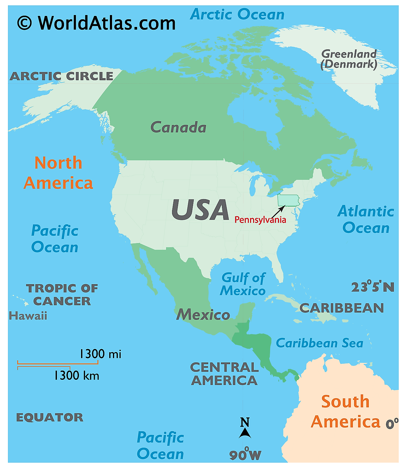
The State of Pennsylvania is located in the Middle Atlantic region of the United States. Pennsylvania is bordered by the state of New York in the north; by Delaware in the southeast; by Maryland in the south; by West Virginia in the southwest; by Ohio in the west and by New Jersey and Delaware River in the east. It is also bordered by Lake Erie and the Canadian province of Ontario in the northwest.
Regional Maps: Map of North America
Outline Map of Pennsylvania
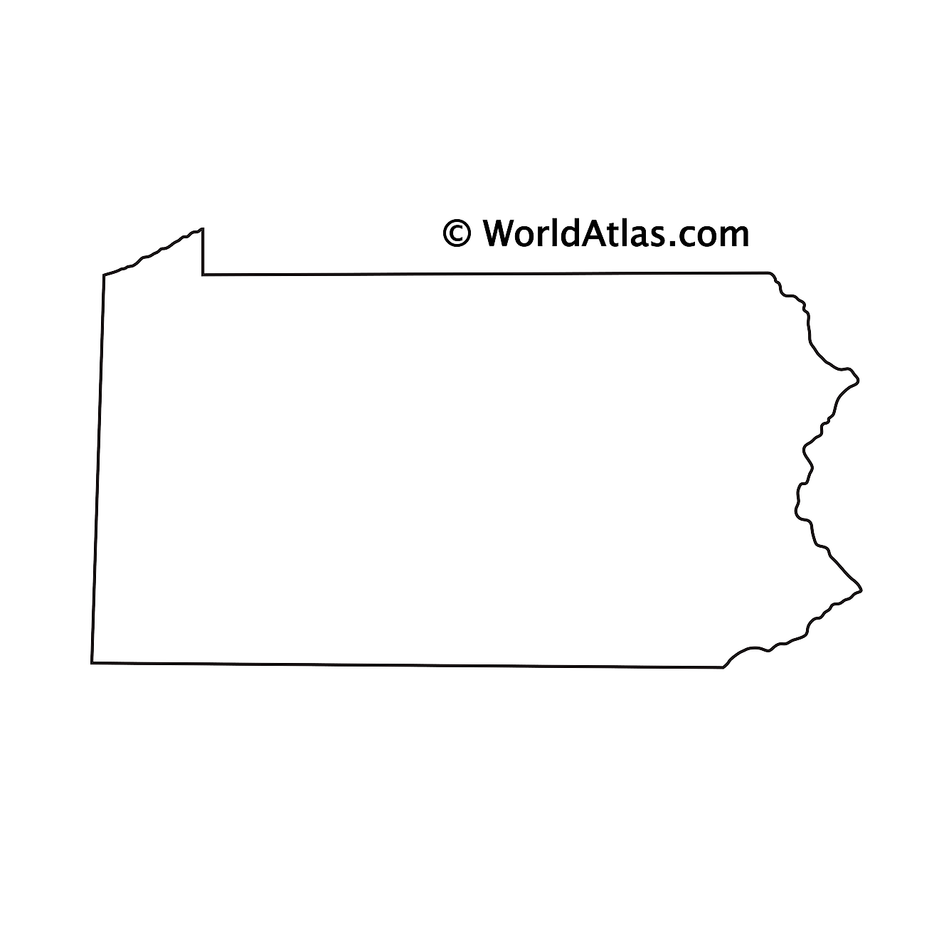
The above blank map represents the State of Pennsylvania, located in the Middle Atlantic region of the United States. The above map can be downloaded, printed and used for geography education purposes like map-pointing and coloring activities.
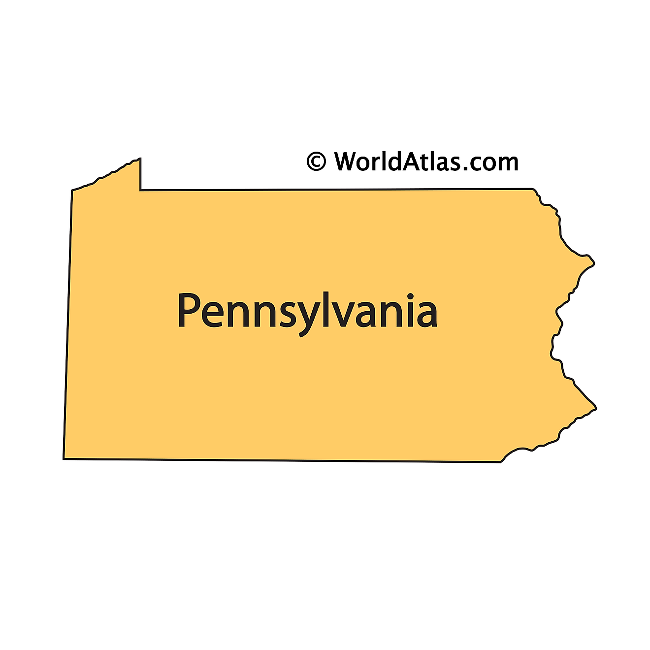
The above outline map represents the State of Pennsylvania, located in the Middle Atlantic region of the United States.
Key Facts
| Legal Name | State of Pennsylvania |
|---|---|
| ISO 3166 Code | US-PA |
| Capital City | Harrisburg |
| Major Cities |
|
This page was last updated on September 15, 2026


