Maps of Minnesota
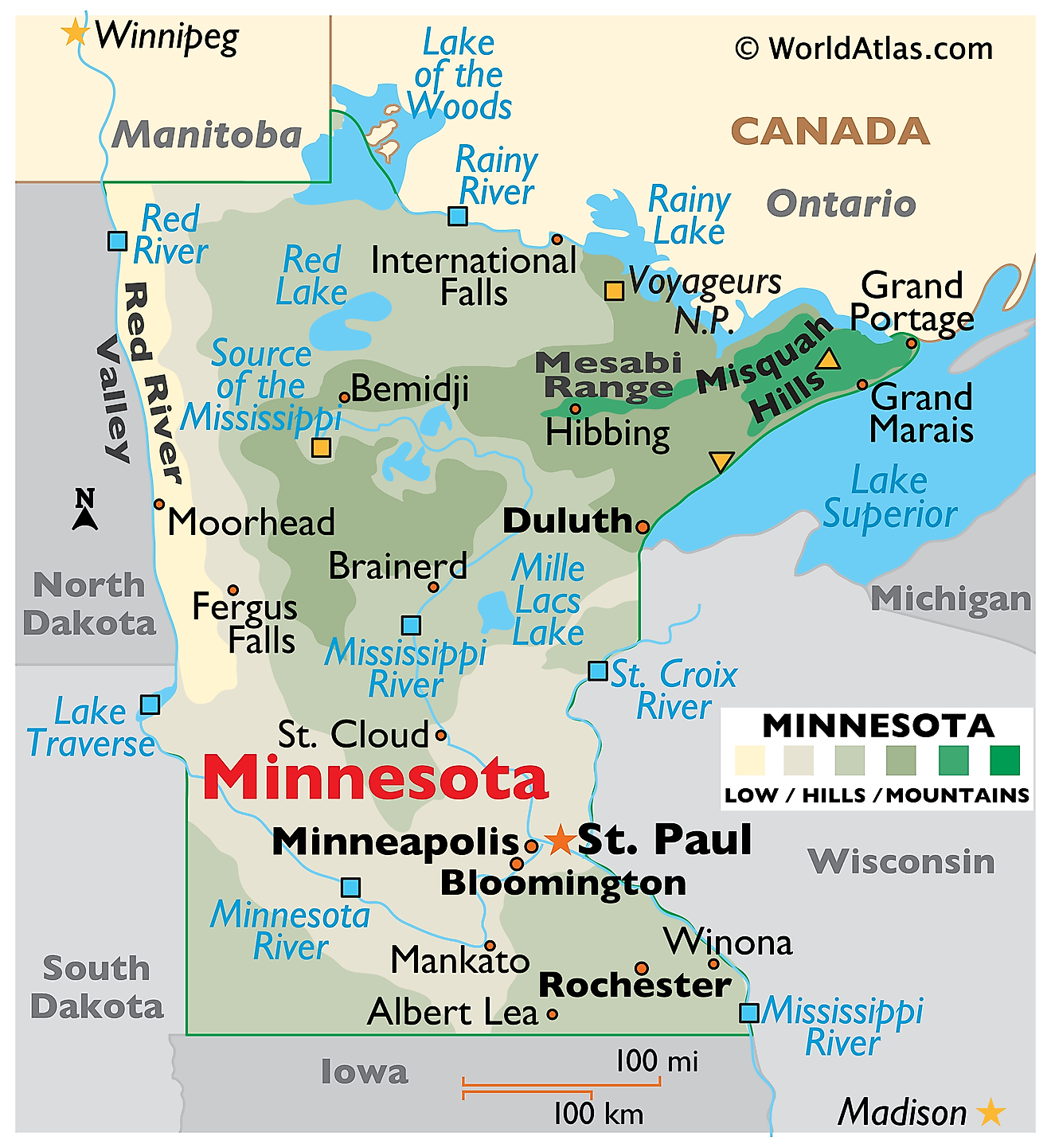
Minnesota is a state in the upper Midwest of the United States. It borders Canada to the north, Lake Superior and Wisconsin to the northeast, Iowa to the south, and South Dakota and North Dakota to the west. The state spans an area of 86,936 square miles (225,163 square kilometers), making it the 12th largest state and the largest outside the West and Alaska.

Minnesota was shaped almost entirely by ice and by the water the ice left behind. Glaciers advanced and retreated across the state repeatedly, scraping the northeast down to ancient bedrock, burying the south and west under hundreds of feet of debris, and flooding the northwest beneath a lake larger than all the modern Great Lakes combined. When the ice finally went, it left roughly 11,842 lakes of ten acres or more. Minnesota also occupies one of the most unusual hydrological positions on the continent, sending water to three different oceans.
Where Is Minnesota?

Minnesota measures about 400 miles north to south and 250 miles east to west. Its northern boundary with Canada follows a chain of lakes and rivers used for centuries as a fur trade route, and at the Northwest Angle the border juts upward into Lake of the Woods, creating the northernmost point in the contiguous United States. The angle is an accident of 18th century mapmaking, cut off from the rest of Minnesota by water and reachable overland only through Manitoba.
Minnesota also has one of the smallest vertical ranges of any large state. Eagle Mountain, the high point at 2,301 feet, stands only about 12 miles from Lake Superior at 601 feet, which is the state's lowest ground. With roughly 5.8 million residents, Minnesota is the 22nd most populous state, and it is divided into 87 counties.
The Lake Agassiz Plain

Northwestern Minnesota is the flattest landscape in the state, and the reason is that it was the floor of a lake. Around 13,000 years ago, meltwater trapped between the retreating ice sheet and the high ground to the south pooled into Glacial Lake Agassiz, which at its greatest extent covered more area than all five Great Lakes together.
Its bed became the Red River Valley, a plain of deep, dark, almost stone free clay soils that now supports sugar beets, wheat, and soybeans. The valley is so level that the Red River drops only about a foot per mile, which is why spring flooding here spreads for miles rather than running off. Lake of the Woods, in the far north, along with Upper and Lower Red Lakes, are surviving remnants of Agassiz. Red Lake is the largest lake lying entirely within Minnesota.
The Lake Superior Highland

The northeastern corner, known as the Arrowhead, is the oldest and most rugged part of Minnesota. Here the glaciers stripped away the soil rather than depositing it, exposing the Canadian Shield: Precambrian granite, gabbro, and basalt formed more than a billion years ago. Thin soils, bare rock ridges, and thousands of small lakes in scoured basins are the result.
Along Lake Superior the land rises abruptly from the water in a series of cliffs and ridges, giving the state about 189 miles of Great Lakes shoreline. The Sawtooth Mountains form part of this shore near Lutsen and Tofte, their serrated profile visible from the water.

Minnesota's highest point, however, is not in the Sawtooths. Eagle Mountain, at 2,301 feet (701 meters), lies inland in the Misquah Hills of northern Cook County, within the Boundary Waters Canoe Area Wilderness and Superior National Forest. The confusion is understandable, because a second, much lower peak called Eagle Mountain sits in the Sawtooths at the Lutsen ski area. The Misquah Hills summit ranks 37th among the 50 state high points, and it was only confirmed as the state's highest in 1961, when an aerial survey displaced a Misquah Hills peak that had held the title since the 1890s.
The Arrowhead also holds the Iron Range. The Mesabi, Vermilion, and Cuyuna ranges yielded the iron ore that built much of American industry, and the Mesabi remains the largest producing iron formation in the country.
The Central and Eastern Till Plains

Across the middle of the state, glaciers left a thick blanket of till: an unsorted mix of clay, sand, gravel, and boulders dropped as the ice melted. The surface is gently rolling, broken by moraine ridges and dotted with kettle lakes that formed where buried ice blocks thawed out. This is the heart of Minnesota's lake country, and Mille Lacs, covering about 132,000 acres, is among the largest of these basins.
The Eastern Till Plain runs along the Wisconsin border and carries slightly more relief. The St. Croix River, a tributary of the Mississippi, cuts through it in a steep gorge known as the Dalles, where basalt walls rise a hundred feet above the water. The St. Croix forms a natural boundary with Wisconsin, and its confluence with the Mississippi was a principal reason the Twin Cities grew where they did.
The Southwestern Plains

Southwestern Minnesota is open prairie country on older glacial deposits, worked by streams for far longer than the younger surfaces to the north and east. It belongs to the Central Lowland rather than the Great Plains proper, although it sits at the transition between them.
Its dominant feature is the Coteau des Prairies, a flatiron shaped plateau of glacial drift rising several hundred feet above the surrounding country and running southeast from South Dakota into Minnesota. Its Minnesota crest is called Buffalo Ridge, and the steady wind across it has made the area one of the state's main wind power corridors.
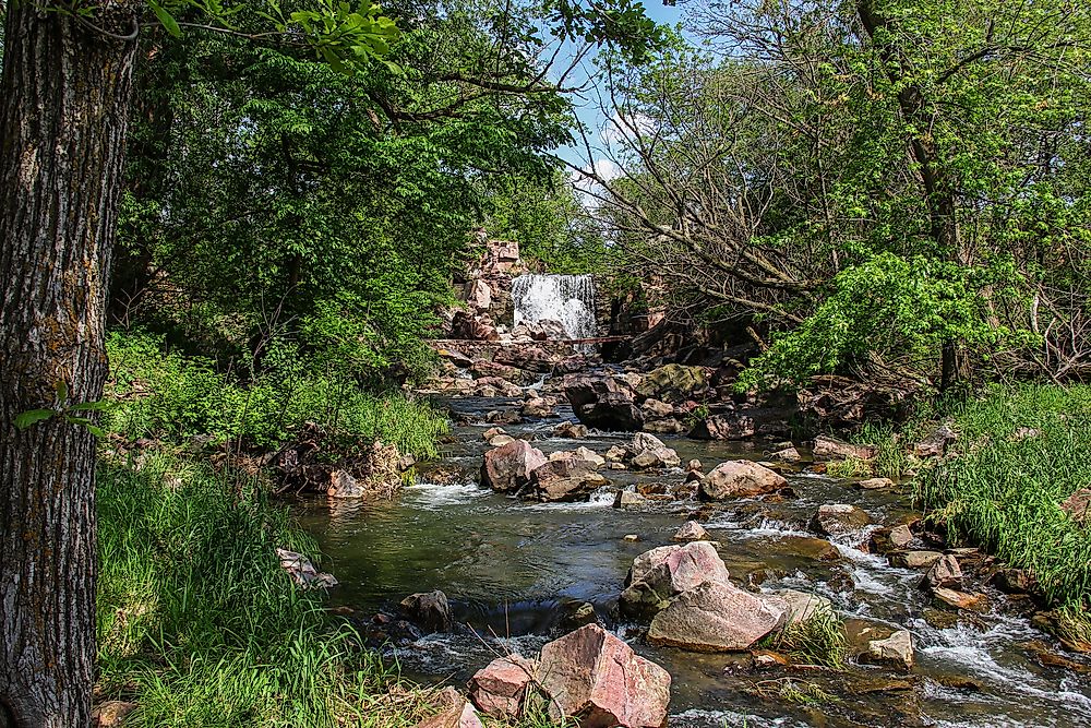
At Pipestone, a band of soft red catlinite lies beneath the harder Sioux quartzite. Indigenous peoples have quarried it for ceremonial pipes for at least three thousand years, and the site is protected as Pipestone National Monument.
One correction worth making: the Red River is not part of this region. It forms Minnesota's boundary with North Dakota in the northwest, flowing north toward Canada. The southwestern border with South Dakota is a surveyed line.
The Southeastern Upland

The southeastern corner is Minnesota's share of the Driftless Area, a region that the most recent glaciers bypassed. With no drift to smooth it over, water has been carving into limestone and sandstone bedrock continuously, producing deep valleys, tall bluffs along the Mississippi, and hillsides quite unlike anything else in the state.
Soluble limestone gives the area karst features: caves, sinkholes, and cold springs that feed the trout streams of the Root River and the Whitewater. The Upper Iowa River drains the southernmost edge. Mystery Cave, the longest in Minnesota, runs more than 13 miles beneath this landscape.
Rivers and the Triple Divide

Minnesota is one of very few places in North America where water drains to three different oceans. A triple divide crosses the northern part of the state. North of it, the Red and Rainy rivers flow to Hudson Bay and the Arctic. East of it, Lake Superior drains through the Great Lakes and the St. Lawrence to the Atlantic. South of it, the Mississippi runs to the Gulf of Mexico.
The Mississippi begins at Lake Itasca in the northwest at an elevation of 1,475 feet, leaving the lake as a stream narrow enough to step across. It then loops north and east before turning south, a course that reflects the shifting margins of the retreating ice sheet rather than any modern logic.

The Minnesota River occupies a valley far too large for it. That trench was cut by Glacial River Warren, the enormous outlet that drained Lake Agassiz southward, and the modern river simply inherited the channel. Other major waterways include the Red, the Rainy, the St. Croix, the St. Louis, and the Crow Wing.
Lakes

The nickname "Land of 10,000 Lakes" undercounts. Minnesota has 11,842 lakes of at least ten acres, and far more if smaller ponds are included. Nearly all are glacial, formed either in scoured bedrock basins in the northeast or in kettle holes and moraine hollows across the centre of the state.
Lake Superior is by far the largest body of water touching Minnesota, and the largest freshwater lake in the world by surface area. Of the wholly inland lakes, Red Lake is the biggest at about 288,000 acres, followed by Mille Lacs, Leech, Winnibigoshish, and Vermilion. Lake of the Woods spans the border with Ontario and Manitoba and contains more than 14,000 islands.

The Boundary Waters Canoe Area Wilderness protects about 1.1 million acres of this lake country along the Canadian border, with over a thousand lakes linked by portage trails. Adjoining it, Voyageurs National Park is one of the few national parks best travelled by boat, since roughly a third of it is water.
Climate

Minnesota has a humid continental climate with some of the widest temperature swings in the country. Sitting far from any moderating ocean, it is exposed to Arctic air in winter and Gulf moisture in summer. Recorded temperatures span from 60 degrees below zero to 114 above, a range of 174 degrees Fahrenheit.
Precipitation falls off sharply from southeast to northwest, from about 35 inches a year in the southeast corner to under 20 inches in the northwest. Snowfall runs the other way, exceeding 70 inches along the North Shore, where cold air crossing Lake Superior picks up moisture and drops it on the highlands inland.
The state lies in the northern reach of the corridor where severe thunderstorms and tornadoes are common, averaging around 45 tornadoes a year. Spring flooding along the Red River, where the flat valley and a northward flowing channel combine badly with a thaw that moves from south to north, is the other persistent hazard.
Minnesota Geography at a Glance
| Feature | Detail |
|---|---|
| Total area | 86,936 sq mi (225,163 sq km), 12th largest state |
| Dimensions | Approx. 400 mi north to south; 250 mi east to west |
| Highest point | Eagle Mountain, 2,301 ft (701 m), Misquah Hills, Cook County |
| Lowest point | Lake Superior, 601 ft |
| Bordering states | Wisconsin, Iowa, South Dakota, North Dakota |
| International border | Ontario and Manitoba, Canada |
| Great Lakes shoreline | Approx. 189 mi on Lake Superior |
| Northernmost point | Northwest Angle, the northernmost point in the contiguous US |
| Lakes | 11,842 of at least 10 acres |
| Largest inland lake | Red Lake, approx. 288,000 acres |
| Drainage | Three oceans: Hudson Bay, the Atlantic via the Great Lakes, and the Gulf of Mexico |
| Counties | 87 |
Counties Map
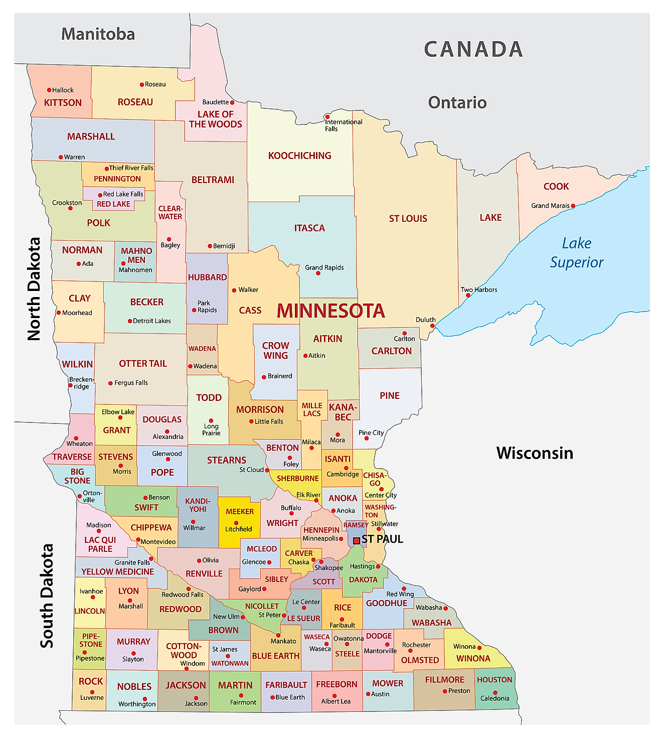
The State of Minnesota is divided into 87 counties. In alphabetical order, these counties are: Aitkin, Anoka, Becker, Beltrami, Benton, Big Stone, Blue Earth, Brown, Carlton, Carver, Cass, Chippewa, Chisago, Clay, Clearwater, Cook, Cottonwood, Crow Wing, Dakota, Dodge, Douglas, Faribault, Fillmore, Freeborn, Goodhue, Grant, Hennepin, Houston, Hubbard, Isanti, Itasca, Jackson, Kanabec, Kandiyohi, Kittson, Koochiching, Lac Qui Parle, Lake, Lake of the Woods, Le Sueur, Lincoln, Lyon, Mahnomen, Marshall, Martin, McLeod, Meeker, Mille Lacs, Morrison, Mower, Murray, Nicollet, Nobles, Norman, Olmsted, Otter Tail, Pennington, Pine, Pipestone, Polk, Pope, Ramsey, Red Lake, Redwood, Renville, Rice, Rock, Roseau, Saint Louis, Scott, Sherburne, Sibley, Stearns, Steele, Stevens, Swift, Todd, Traverse, Wabasha, Wadena, Waseca, Washington, Watonwan, Wilkin, Winona, Wright, and Yellow Medicine.
With an area of 225,163 sq. km, Minnesota is the 12th largest and the 22nd most populous state in the USA. Located in the southeastern part of the state, on the Mississippi River just downstream of its confluence with the Minnesota River, is Saint Paul, the capital city of Minnesota. The city grew up at the head of navigation on the Upper Mississippi, the furthest point steamboats could reach, and it remains a major business center in the Upper Midwest. It hosts the Xcel Energy Center, a multi-purpose arena and home of the Minnesota Wild, and has the second-highest number of higher-education institutions per capita of any city in the United States, behind only Boston. Situated on both banks of the Mississippi River is Minneapolis, the most populous city in Minnesota and the commercial and cultural center of the Upper Midwest. Together, Saint Paul and Minneapolis form the Twin Cities Metropolitan Area, which functions as the chief administrative, business, industrial, education, cultural, and transportation center of the state.
Where is Minnesota?
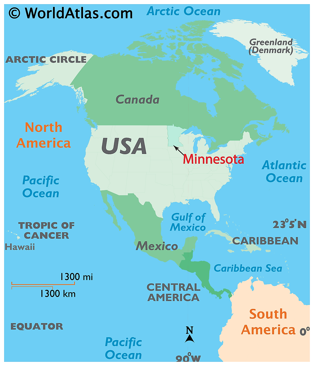
The State of Minnesota is located in the North-Central (Midwest) region of the United States. Minnesota is bordered by the states of North Dakota and South Dakota in the west; by Iowa in the south and by Wisconsin and Lake Superior in the east. It is also bordered by the Canadian provinces of Manitoba and Ontario in the north.
Regional Maps: Map of North America
Outline Map of Minnesota
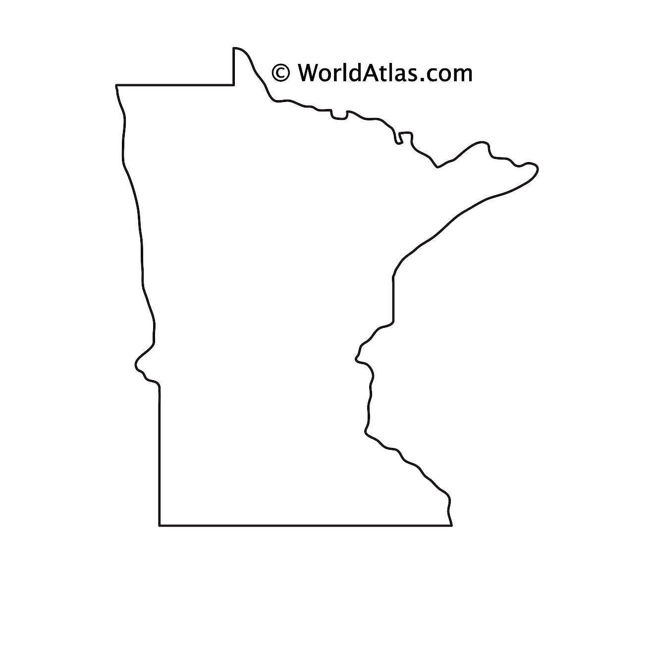
The above blank map represents the State of Minnesota, located in the North-Central (Midwest) region of the United States. The above map can be downloaded, printed and used for geography education purposes like map-pointing and coloring activities.
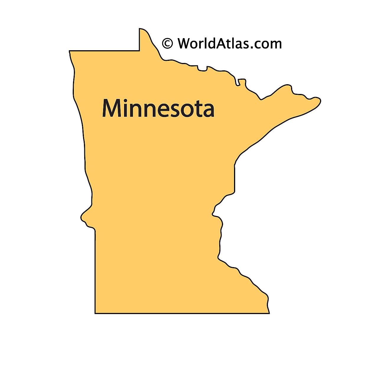
The above outline map represents the State of Minnesota, located in the North-Central (Midwest) region of the United States. Minnesota is nicknamed as the "Land of 10,000 Lakes" as there are about 11,842 large-sized lakes that are scattered all over the state.
Key Facts
| Legal Name | State of Minnesota |
|---|---|
| ISO 3166 Code | US-MN |
| Capital City | Saint Paul |
| Largest City |
Minneapolis-St. Paul (2,989,669) |
This page was last updated on September 20, 2026


