Maps of Utah
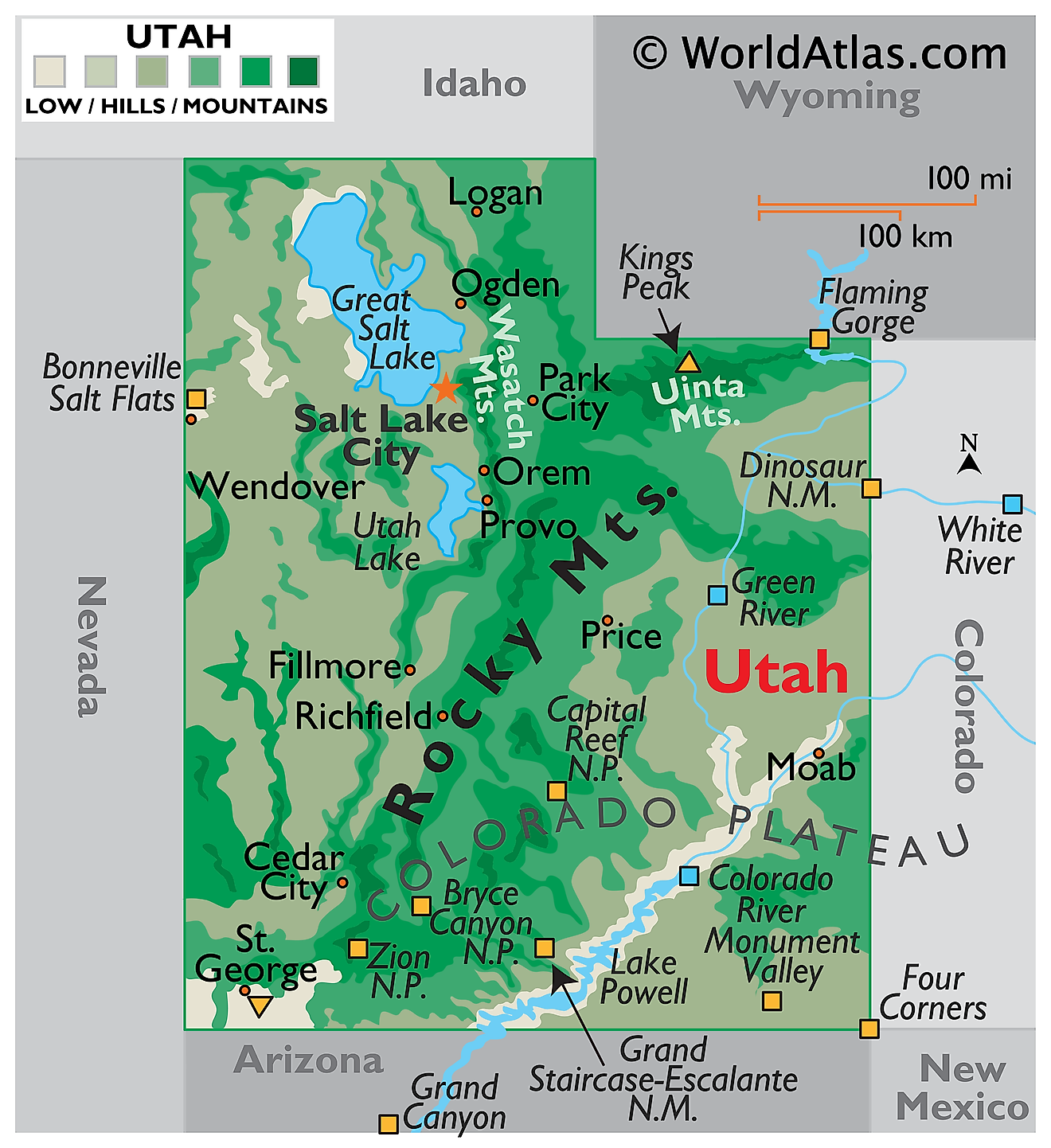
Utah is a landlocked state in the western United States. It shares borders with Idaho to the north and Wyoming to the northeast, Colorado to the east, Arizona to the south, and Nevada to the west. At Four Corners its southeastern tip touches New Mexico at a single point, the only place in the country where four states meet. The state covers a total area of approximately 84,899 square miles (219,887 square kilometers), making it the 13th largest state.

Utah is one of only three states, with Colorado and Wyoming, whose boundaries are drawn entirely as straight lines of latitude and longitude. Nothing inside those lines is straight. Three major provinces of the North American continent meet here and behave nothing like one another: stretched and broken crust in the west, folded and faulted mountains in the northeast, and a vast tilted slab of sedimentary rock in the southeast. Utah's mean elevation of about 6,100 feet is the third highest of any state, and it is the second driest after Nevada.
Where Is Utah?

Utah measures roughly 350 miles north to south and 270 miles east to west. Elevations run from 13,528 feet at Kings Peak in the Uinta Mountains down to 2,180 feet at Beaver Dam Wash in the southwestern corner, near the Arizona line.
With roughly 3.5 million residents, Utah is the 30th most populous state and among the least densely settled. It is divided into 29 counties. Around 80% of the population lives along the Wasatch Front, a narrow strip of valley floor at the western foot of the Wasatch Range, which makes Utah one of the most urbanised states in the country despite its empty reputation.
The Basin and Range

Sunrise over the Bonneville Salt Flats.
Western Utah belongs to the Basin and Range, a province of parallel north-south mountain ranges separated by broad flat desert valleys. A clarification is needed here, because the cause is often misstated. These ranges are not remnants of volcanic activity. They were produced by crustal extension: beginning roughly 17 million years ago the crust was pulled apart, and blocks of rock dropped and tilted along normal faults, leaving some standing as ranges while others sank to form basins that have since filled with eroded sediment.
Most of this region lies within the Great Basin, an area of internal drainage where no water reaches the sea. Rivers simply end in salt flats or shallow lakes and evaporate. Vegetation is sparse, dominated by sagebrush and shadscale.
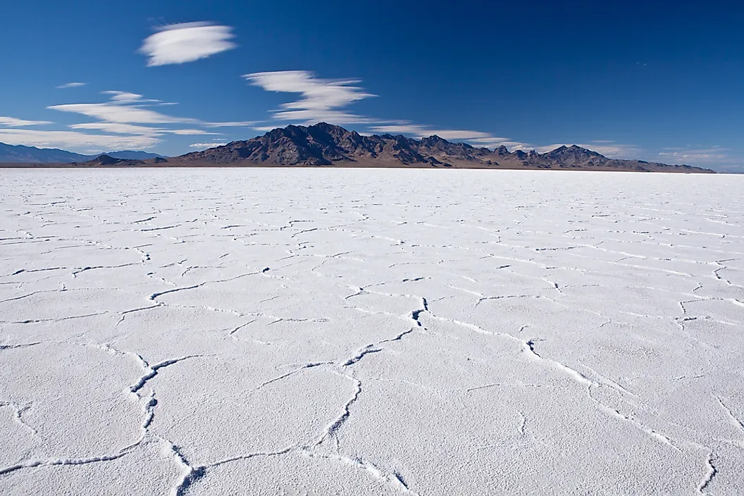
During the last Ice Age this basin held Lake Bonneville, a freshwater body covering about 20,000 square miles and reaching depths over 1,000 feet. Around 14,500 years ago it breached a divide in southern Idaho and drained catastrophically. Its old shorelines are still visible as terraces cut into the mountainsides above Salt Lake City, and the Great Salt Lake, Utah Lake, and the Bonneville Salt Flats are all what remains of it.
The Middle Rocky Mountains

Northeastern Utah holds the Middle Rocky Mountains, the state's highest and wettest country. The Uinta Mountains run about 150 miles from east to west, making them the largest range in the contiguous United States with that orientation, since nearly every other western range trends north to south.
The Uintas are a broad anticline, an upward fold cored by Uinta Mountain Group quartzite more than a billion years old. Above 11,000 feet the range is less a set of peaks than a rolling tundra plateau holding more than a thousand lakes scooped out by glaciers. Kings Peak, the highest point in Utah at 13,528 feet (4,123 meters), rises from this plateau. Some sources give 13,534 feet, reflecting an older survey.

The Wasatch Range runs north to south down the centre of northern Utah, rising abruptly from the valley floor along the Wasatch Fault, a 240-mile active fault that marks the boundary between the Basin and Range and the mountains. That fault is why the range presents such a wall above Salt Lake City, Ogden, and Provo, and why the region carries significant earthquake risk. The range's snowfall, unusually dry because storms cross the desert before reaching it, supports the state's ski industry.
The Transition Zone

Between the Basin and Range and the Colorado Plateau lies a complex belt where the two provinces overlap. Here the flat-lying plateau rock has been broken by faulting and cut by canyons, producing high tablelands, isolated mountain ranges, and dramatic cliff lines.
The High Plateaus of central and southern Utah form the core of this zone, rising above 10,000 feet in places. The Grand Staircase, a sequence of cliffs stepping down from Bryce Canyon toward the Grand Canyon, exposes roughly 200 million years of rock in a single descending series. Capitol Reef National Park protects the Waterpocket Fold, a 100-mile warp in the crust where the rock layers on one side stand nearly 7,000 feet higher than those on the other.
The Colorado Plateau

Eastern and southern Utah sit on the Colorado Plateau, a thick slab of nearly horizontal sedimentary rock that was lifted thousands of feet without being significantly folded. Because the layers stayed flat, rivers cut straight down through them rather than around, producing the canyons, mesas, buttes, arches, and natural bridges the region is known for.
The San Rafael Swell is a notable anticline, a bulge in the crust about 75 miles long where erosion has stripped the top off a dome, exposing tilted rock layers in concentric rings. The Uinta Basin and Tavaputs Plateau occupy the northern part of the province.

Arches National Park contains over 2,000 documented natural stone arches, the greatest concentration anywhere on earth. They form where a buried salt layer has deformed the overlying sandstone into parallel fins, which weathering then hollows out. Canyonlands sits where the Green and Colorado rivers converge, dividing the park into three districts separated by the gorges themselves.

Utah has five national parks, the third most of any state after California and Alaska. Alongside Arches, Canyonlands, and Capitol Reef are Zion, where the Virgin River has cut a gorge half a mile deep through Navajo Sandstone, and Bryce Canyon, which is not a canyon at all but a series of natural amphitheatres eroded into the edge of the Paunsaugunt Plateau, filled with limestone spires called hoodoos carved by repeated freezing and thawing.
Lakes
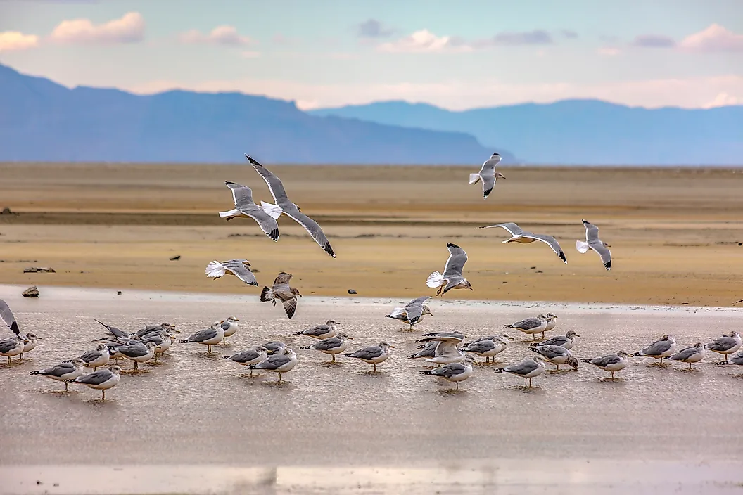
The Great Salt Lake, in the northern Basin and Range, is the largest saltwater lake in the Western Hemisphere. It has no outlet, so minerals carried in by rivers simply accumulate, leaving the water several times saltier than the ocean and in places approaching saturation. Because the lake is shallow, often averaging only around 15 feet, small changes in inflow cause enormous changes in its area, and it has shrunk substantially in recent decades.
Utah Lake, immediately south, is the largest freshwater lake in the state and drains north into the Great Salt Lake through the Jordan River. Bear Lake straddles the Idaho border and is sometimes called the Caribbean of the Rockies for its turquoise colour, which comes from suspended limestone particles in the water.
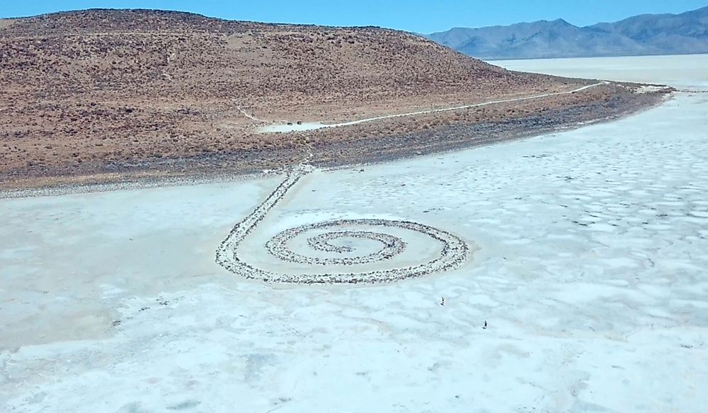
In the south, Lake Powell is a reservoir on the Colorado behind Glen Canyon Dam, shared with Arizona, and Flaming Gorge Reservoir on the Green is shared with Wyoming.
Rivers

Cataract Canyon reflection in Colorado River.
Utah's drainage is split in two. The western third lies in the Great Basin and drains nowhere, with the Bear, Weber, Provo, Jordan, and Sevier rivers all ending in lakes or sinks. Everything east and south drains to the Colorado River and eventually the Gulf of California.
The Colorado enters from the northeast and runs southwest across the plateau, cutting Cataract Canyon and feeding Lake Powell. The Green River, its longest tributary, flows south from Wyoming through Flaming Gorge and the Uinta Basin before joining the Colorado in Canyonlands. The San Juan, Dirty Devil, Escalante, and Virgin complete the system.
The Bear River is worth noting as a curiosity: it travels roughly 500 miles through three states and finishes within about 90 miles of where it started, making it the longest river in the Western Hemisphere that does not reach the sea.
Climate

Utah is the second driest state in the country, with most areas receiving under 12 inches of precipitation a year and parts of the Great Basin under 5 inches. The mountains are the exception, where the Wasatch and Uintas can exceed 50 inches, mostly as snow, and that snowpack supplies nearly all the water the rest of the state uses.
Climate varies enormously with elevation and latitude. The northern valleys are humid continental with cold snowy winters, the Great Basin is cold desert, and the southwestern corner around St. George is hot desert, warm enough that summer temperatures regularly exceed 100 degrees Fahrenheit while Logan, 300 miles north, is still thawing.
Southern Utah receives a monsoon influence in late summer, when thunderstorms produce flash floods in slot canyons that can arrive from storms miles away under a clear sky. Drought is the long-term concern, and the shrinking of the Great Salt Lake has become one of the state's most pressing environmental issues.
Utah Geography at a Glance
| Feature | Detail |
|---|---|
| Total area | 84,899 sq mi (219,887 sq km), 13th largest state |
| Dimensions | Approx. 350 mi north to south; 270 mi east to west |
| Highest point | Kings Peak, 13,528 ft (4,123 m), Uinta Mountains |
| Lowest point | Beaver Dam Wash, 2,180 ft, at the Arizona border |
| Mean elevation | Approx. 6,100 ft, third highest of any state |
| Bordering states | Idaho, Wyoming, Colorado, Arizona, Nevada, and New Mexico at Four Corners |
| Major regions | Basin and Range, Middle Rocky Mountains, Transition Zone, Colorado Plateau |
| National parks | Five: Arches, Bryce Canyon, Canyonlands, Capitol Reef, Zion |
| Largest lake | Great Salt Lake, largest saltwater lake in the Western Hemisphere |
| Borders | One of only three states bounded entirely by straight lines |
| Counties | 29 |
Counties Map
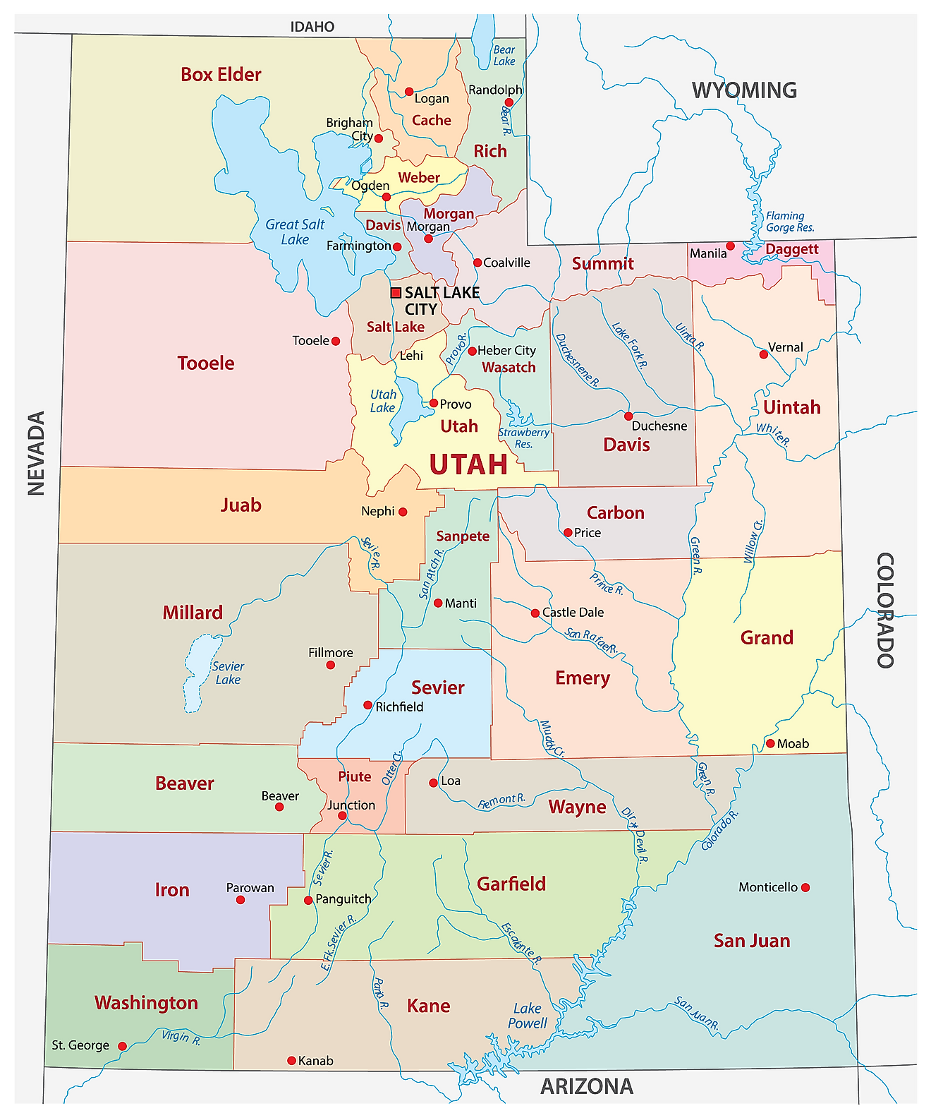
Utah is divided into 29 counties. In alphabetical order, the counties are: Beaver, Box Elder, Cache, Carbon, Daggett, Davis, Duchesne, Emery, Garfield, Grand, Iron, Juab, Kane, Millard, Morgan, Piute, Rich, Salt Lake, San Juan, Sanpete, Sevier, Summit, Tooele, Uintah, Utah, Wasatch, Washington, Wayne, and Weber.
With an area of 219,887 sq. km, Utah is the 13th largest and the 30th most populous state in the USA. Located in the northern part of the state is Salt Lake City – the capital and most populous city in Utah. The capital city hosts the world headquarters of the LDS Church and serves as the national hub of industrial banking, with most of the country's industrial banks chartered in Salt Lake County. The city is also a major tourist destination, built on skiing, outdoor recreation, and religious tourism. It hosted the 2002 Winter Olympics and has been selected to host the Games again in 2034.
Where is Utah?
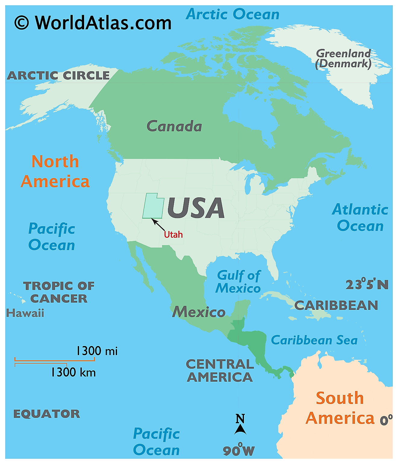
The State of Utah is located in the west-central region (or Mountain States area) of the United States. The landlocked state of Utah is bordered by the states of Nevada in the west; by Idaho in the north; by Wyoming in the northeast; by Colorado in the east; by Arizona in the south and by New Mexico (at a single point, in the Four Corners) in the southeast.
Regional Maps: Map of North America
Outline Map of Utah
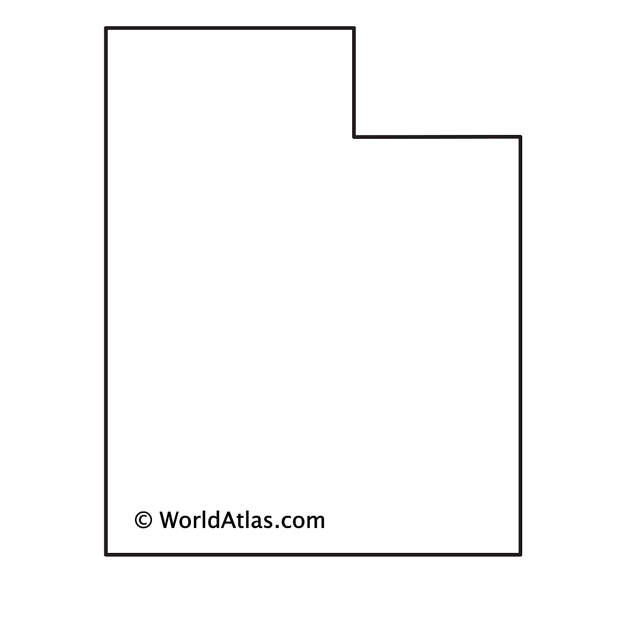
The above blank map represents the State of Utah, located in the west-central region (or Mountain States area) of the United States. The above map can be downloaded, printed and used for geography education purposes like map-pointing and coloring activities.
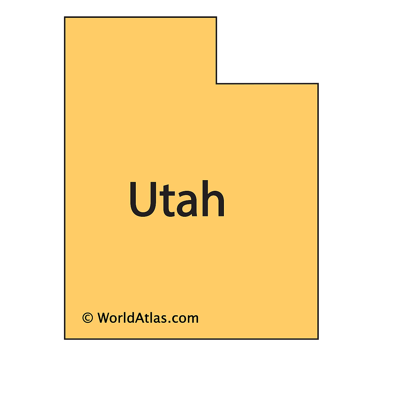
The above outline map represents the State of Utah, located in the west-central region (or Mountain States area) of the United States.
Key Facts
| Legal Name | State of Utah |
|---|---|
| ISO 3166 Code | US-UT |
| Capital City | Salt Lake City |
| Major Cities |
|
This page was last updated on November 10, 2026


