1. Home
  2. Countries
  3. Canada
  4. Prince Edward Island

Prince Edward Island

Map of Prince Edward Island new brunswick nova scotia quebec prince edward island prince edward island map graphic maps
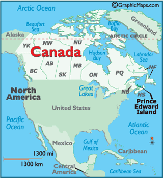
Locator Map of Prince Edward Island worldatlas.com arctic ocean pacific ocean gulf of mexico caribbean sea caribbean central america united states north america great lakes greenland arctic circle mexico Alaska beaufort sea canada yukon british columbia alberta saskatchewan manitoba ontario quebec new brunswick nova scotia prince edward island newfoundland and labrador nunavut northwest territories hudson bay prince edward island atlantic ocean

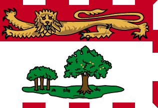
Prince Edward Island Flag

DESCRIPTION

The flag is in essence a banner depicting the official coat of arms granted in 1905. It displays an island and a great British oak tree centered, with its symbolic descendants to the immediate left. All are protected by the gold British Lion.

All Province and Territory Flags here!

Map of Prince Edward Island here!

Buy this flag, or any Canadian flag here

Provinces & Territories Of Canada

This page was last updated on July 10, 2020

Latest by WorldAtlas