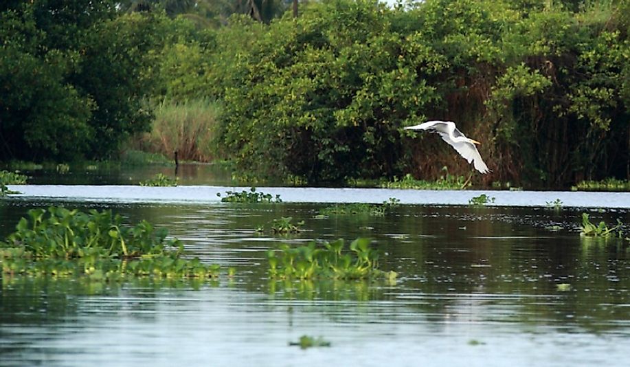
Ecological Regions Of Guatemala

Guatemala is a Central American country with an area of 42,042 square miles. Within this area are a diverse range of habitats. These include lowlands, coastlines, valleys, mountains, and deserts. The climate also varies depending on the region within the country and can range from hot and tropical to cool and dry. The country is filled with lakes, rivers, swamps, and lagoons. Within its borders are a large number of ecological regions. This article takes a look at some of these ecological regions and their flora and fauna.
Ecological Regions of Guatemala
Belizean Coast Mangroves
One of the ecological regions in Guatemala within the Mangroves biome is the Belizean Coast Mangroves. These mangroves are stretch between Belize and Guatemala, where they make up the Amatique Bay. The climate in this ecoregion is tropical with rainy season between May and February. This mangrove forest consists of red, white, and black mangrove trees which are important to the shoreline because their roots help prevent erosion. This region is also home to a diverse range of animal species, from manatees in the bay to birds on the coast. Some of these birds include Yucatan parrots, brown jays, brown pelicans, and ospreys. Alligators, pacas, black howler monkeys, ocelot, and coatimundi can all be found here as well. The Belizean coast mangroves are considered vulnerable.
Central American Atlantic Moist Forests
The Central American Atlantic Moist Forests form another interesting ecoregion found in Guatemala. This ecoregion belongs to the Tropical and Subtropical Moist Broadleaf Forest biome. The Atlantic moist forest is comprised of 34,600 square miles that stretch throughout Nicaragua, Costa Rica, and Panama. In Guatemala, it is located on the lowland Atlantic slopes and contains a typical tropical rainforest with trees reaching 164 feet in height. This creates several habitats including a canopy, a sub-canopy, and an under-story filled with dwarf plants. These forests are filled with various animal species, including monkeys, jaguars, and peccaries. The Central American Atlantic moist forest is classified as vulnerable.
Central American Dry Forest
The Central American Dry Forest ecoregion belongs to the Tropical and Subtropical Dry Broadleaf Forest biome. This ecoregion can be found along the Pacific coast and generally only up to 2,624 feet in elevation. Itis classified as dry because it experiences between 5 and 8 months of little to no precipitation. The highest treetop canopy reaches around 100 feet and is comprised of mainly deciduous trees. Evergreen trees grow at lower heights. Underneath both types of trees, thorny trees, woody lianas, and epiphytes can be found. Its unique habitat has resulted in a high level of endemism, with at least 50 endemic plants, such as the Myrospermum. Additionally, a high number of endemic birds make their home here. These birds include the white-bellied chachalaca, giant wren, and blue-tailed hummingbird. Spider monkeys, tapirs, and various wild cats live here as well.
Environmental Threats and Conservation Efforts
The Belizean coastal mangroves are threatened by coastal development, deforestation, sewage disposal, and industrial pollution. The development and deforestation has resulted in erosion and large amounts of sediment washing into the bay which affects marine life there as well. The previously mentioned forests are also threatened by deforestation as a result of agricultural development. Due to the fact that many of the communities living near these ecoregions lack economic opportunities, agriculture is their only means of survival. The dry forest in particular is in need of rehabilitation in order to connect the fragmented sections that remain.
Conservation measures in all of these ecoregions require efforts from the federal government, local government, and community level initiatives alike. These efforts must take into consideration economic resources and involve the international community as well as nonprofit organizations in order to be successful. If a conservation plan is not established and followed soon, the country risks losing these vulnerable regions as well as their unique biodiversity.
Ecological Regions Of Guatemala
| Ecological Regions Of Guatemala | Biome |
| Belizean Coast mangroves | Mangroves |
| Central American Atlantic moist forests | Tropical and Subtropical Moist Broadleaf Forests |
| Central American dry forests | Tropical and Subtropical Dry Broadleaf Forests |
| Central American montane forests | Tropical and Subtropical Moist Broadleaf Forests |
| Central American pine-oak forests | Tropical and Subtropical Coniferous Forests |
| Chiapas Depression dry forests | Tropical and Subtropical Dry Broadleaf Forests |
| Chiapas montane forests | Tropical and Subtropical Moist Broadleaf Forests |
| Chiapas-Fonseca | Tropical and Subtropical Coastal Rivers |
| Chiapas-Nicaragua Pacific Coastal Waters | Tropical East Pacific Marine |
| Grijalva-Usumacinta | Tropical and Subtropical Coastal Rivers |
| Motagua Valley thornscrub | Deserts and Xeric Shrublands |
| Northern Dry Pacific Coast mangrove | Mangroves |
| Northern Honduras mangroves | Mangroves |
| Petén-Veracruz moist forests | Tropical and Subtropical Moist Broadleaf Forests |
| Quintana Roo-Motagua | Tropical and Subtropical Coastal Rivers |
| Sierra Madre de Chiapas moist forest | Tropical and Subtropical Moist Broadleaf Forests |
| Tehuantepec-El Manchon mangroves | Mangroves |
| Upper Usumacinta | Tropical and Subtropical Upland Rivers |
| Western Caribbean Sea | Tropical Northwestern Atlantic Marine |
| Yucatán moist forests | Tropical and Subtropical Moist Broadleaf Forests |


