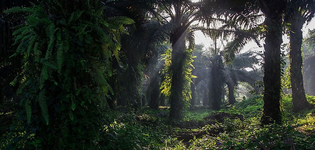
The Ecological Regions Of Honduras

Honduras, officially known as the Republic of Honduras is a country in Central America. It is bordered by Guatemala to the west, El Salvador to the southwest, and Nicaragua to the southeast. It covers a total area of approximately 43,278 square miles and has a population of approximately 8.2 million. Honduras was invaded by the Spanish in the 16th century who introduced Roman Catholicism and the Spanish language. The former became the predominant religion and the latter the main language of the country. The country is rich with resources such as minerals, coffee, tropical fruit, sugar cane, and textile industries. The country has several ecological regions in which different species of fauna and flora thrive. Some of the ecoregions are discussed below.
Ecological Regions Of Honduras
Central American Montane Forests
The Central American Montane Forests are composed of the tropical and subtropical moist broadleaf forests located in the high mountainous regions of Central America. The forests extend from Southern Mexico, through Guatemala, El Salvador and Honduras to the northern part of Nicaragua. They grow an altitude of between 5,900 to 13,100 feet and cover a total area of approximately 5,100 square miles. The precipitation level of this ecoregion is high, but the climate is temperate. These high altitudes support the growth of the thriving oak, maple, and conifer trees. Different species of birds such as the resplendent quetzal are found in the ecoregion. The Central American Montane Forests of Honduras has been listed as a vulnerable ecoregion due to severe deforestation
Central American Pine-oak Forests
The Central American pine-oak forests are found in the mountainous region of Central America. The forests cover a total area of 43,000 square miles. They extend from Chiapas in Mexico through Guatemala, El Salvador, and Honduras to central Nicaragua. They are located in higher altitudes of around 2,000 to 5,900 feet and are surrounded by the tropical moist forest and the tropical dry forests at the lower altitude. The forest is composed of several species of flora; these include the oaks, pines, fir, and the cypress. It consists of the tropical and subtropical coniferous forests; the region has been listed as an endangered ecoregion.
Northern Honduras Mangroves
The northern Honduras mangroves is an ecosystem consisting of indigenous mangroves. It covers an estimated area of 400 square miles. It is a dense ecosystem that houses several species of insects, birds, and snakes. The ecoregion is under threat due to human activities majorly deforestation. Climate change is also affecting the ecoregion as plants and animals migrate to suitable climatic conditions.
Central American Dry Forests
The Central American dry forests is an ecoregion located in Central America. It extends from the southern Chiapas in Mexico, through Guatemala, El Salvador, Honduras, and Nicaragua, to the northern part of Costa Rica. It covers an estimated area of 26,300 square miles. It consists of the tropical and subtropical dry broadleaf forests. The climate of the ecoregion is composed of long dry seasons. The plants and animals in this ecoregion are adapted to the harsh hot climate. Much of the ecoregion is used by herders to graze their livestock.
Environmental Threats
Deforestation is the greatest challenge facing these ecoregions. Uncontrolled logging and clearing of land for agricultural purpose is slowly but surely taking its toll on the environment. Climate change is affecting the natural environment and casusing the migration of animals.
Ecological Regions Of Honduras
| Ecological Regions of Honduras | Biome |
| Central American Atlantic moist forests | Tropical and Subtropical Moist Broadleaf Forests |
| Central American dry forests | Tropical and Subtropical Dry Broadleaf Forests |
| Central American montane forests | Tropical and Subtropical Moist Broadleaf Forests |
| Central American pine-oak forests | Tropical andSubtropical Coniferous Forests |
| Chiapas-Fonseca River System | Tropical and Subtropical Coastal Rivers |
| Chiapas-Nicaragua | Tropical East Pacific Marine |
| Estero Real-Tempisque River System | Tropical and Subtropical Coastal Rivers |
| Gulf of Fonseca mangroves | Mangroves |
| Miskito pine forests | Tropical andSubtropical Coniferous Forests |
| Mosquitia River System | Tropical and Subtropical Coastal Rivers |
| Mosquitia-Nicaraguan Caribbean Coast mangroves | Mangroves |
| Northern Honduras mangroves | Mangroves |
| Quintana Roo-Motagua River System | Tropical and Subtropical Coastal Rivers |
| Southwestern Caribbean | Tropical Northwestern Atlantic Marine |
| Western Caribbean and Mesoamerican Barrier Reef | Tropical Northwestern Atlantic Marine |


