Isthmus of Panama: Bridge Between The Pacific And Caribbean Worlds

5. Description
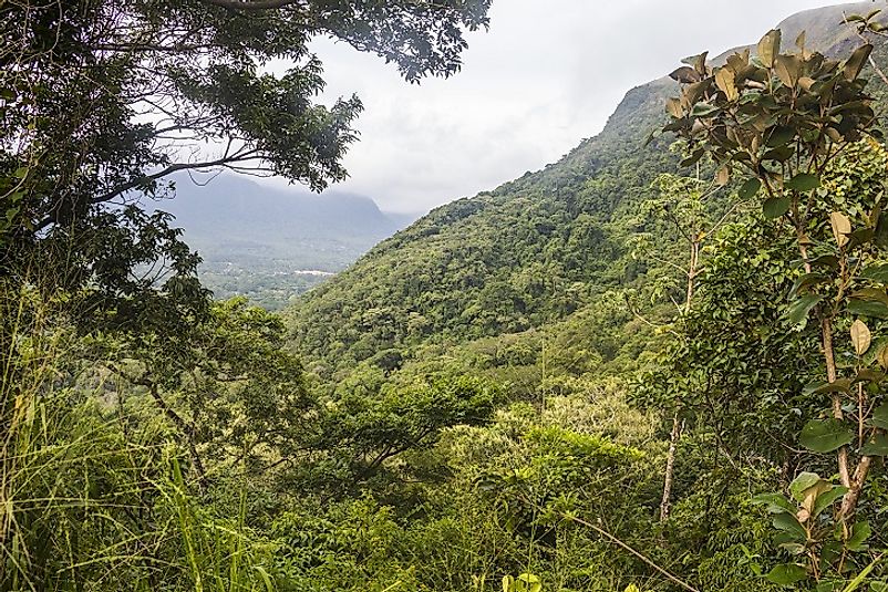
Twenty million years ago, ocean waters separated the continents of North and South America where waters from the Atlantic and Pacific intermingled. Beneath the ocean, the Pacific Plate and the Caribbean Plate were in constant collision. The resulting heat and pressure formed underwater volcanoes, some of which grew tall enough to break the surface water and form islands. The movement of the tectonic plates was also pushing up the sea floor and over several million years, massive quantities of sediment were peeled away from both continental coasts and coalesced between the islands. By around 3 million years ago, the gaps were completely filled and a narrow strip of land joined North and South America. The Atlantic and Pacific oceans were separated by the isthmus on which now sits the Republic of Panama. The isthmus is the narrowest part of the Americas and terrain is dominated by mountains, tropical rainforests, coastal plains and hundreds of rivers. A bend in the isthmus is the only place in the world from where one can see the sun rise in the Pacific and set in the Pacific.
4. Historical Role
The isthmus was first inhabited by the prehistoric hunter-gatherers who were migrating from North America. One of the first Europeans to see the Pacific Ocean was Vasco Nunez de Balboa who heard about the ‘south sea’ from the natives. The town of Panama was founded in 1519 and it soon developed into an important port of trade and administrative center. Though Panama was frequently raided by English privateers, the area remained under Spanish control until its independence in the early 19th Century. In 1698, Scotland tried to establish a settlement on the isthmus through the disastrous Darien scheme. The English bailed out Scotland, which eventually merged with the former. The California Gold Rush of the 1850s brought a tremendous influx of fortune-seekers from both the Pacific and Atlantic coasts. The Transisthmian Railway was constructed and soon afterwards botched attempts were made to construct the Panama Canal. In 1904, Colombia’s “Department of Isthmus” formally became the Republic of Panama upon U.S. intervention. The U.S. finished the construction of the Panama Canal in 1914.
3. Modern Significance
Today, tourism and numerous industries are booming in the Isthmus of Panama. Important products and services hailing from the region include pharmaceuticals (especially antibiotics), petrochemicals, bananas, alcohol, agricultural machinery, shoes, clothing, and gold. In recent decades, Panama has seen a redistribution of land across classes to mitigate longstanding socioeconomic imbalances, and a U.S.-led intervention to combat drug trafficking and human rights abuses. To facilitate regional and international trade, the U.S. Dollar is an official currency of the nation, alongside the Panamanian Balboa. At one-and-a-half million residents, Panama City is the largest and capital city of the country of Panama.
2. Habitat and Biodiversity
The formation of the Isthmus of Panama played a huge role in transforming the biodiversity of the Americas. The isthmus formed a bridge on which animals and plants migrated between North and South America for millions of years. Animals like the North American opossum, porcupine and armadillo can all trace back their ancestry to animals that migrated north. Likewise, ancestors of South American cats, dogs, horses, bears, raccoons, and llamas all made the journey south through the isthmus.
1. Environmental Threats and Territorial Disputes
Industrial activity is severely undermining the ecological of the isthmus with soil erosion and deforestation the major concerns for Panama. The isthmus loses 2,000 tons of soil every year while its annual rate of deforestation was 1.6% of late. Air pollution is another major concern; carbon dioxide emissions were measured at 6.3 metric tons in 2000. Sewage, pesticides and the oil industry further elevate pollution in levels. Panama’s environment situation threatens a high number of flora and fauna. Panama and Costa Rica has a border dispute, which goes back more than a century. In 1900, French President Emile Loubet defined the boundary between Colombia and Costa Rica, when Panama was still a part of Colombia. After being separated from Colombia in 1902, Panama succeeded the boundary dispute, which still lingers despite the Loubet award and the 1914 arbitration by U.S. Supreme Court Judge Douglas White.


