Which Countries Border Belarus?

Belarus is located in the eastern region of Europe, where it covers a total area of 80,153 square miles. This country is home to at least 3,000 waterways and 4,000 lakes, which together make up around 1,093 square miles of territory. In other words, approximately 1.4% of the total area of Belarus is covered in water. Additionally, an estimated 40% of its area is covered in forest land. This country is primarily characterized by flat land, although the relatively low-lying Belarusian Mountain range cuts diagonally across the entire area. Its highest point is Mount Dzyarzhynskaya, which stands at only 1,135 feet above sea level. Belarus has a population size of over 9.5 million. Of these individuals, 83.7% identify as being of Belarusian ethnicity and just under 25% of the population lives in the capital city Minsk.
Geographically, this country is considered landlocked, which means it has no direct access to the open sea. The closest open sea to Belarus is the Baltic Sea, which can only be reached by traveling through Latvia and Lithuania. Belarus has 2,263 miles of land borders, which are shared with Russia, the Ukraine, Lithuania, Poland, and Latvia. This article takes a closer look at each of the international borders of Belarus.
Russia
The border between Belarus and Russia stretches for 815.24 miles, making it the longest shared border in Belarus. This boundary line lies to the northeastern and eastern region of Belarus and is the same that was established during the Soviet era. It begins where the eastern border of Latvia runs into the Belarus border. From here, it moves in an eastward direction before turning toward the south. Today, these two countries share a peaceful relationship that is reflected in their border policies. Until 2016, the government of Russia did not require any specific documentation from anyone traveling from Belarus. After October of 2016, however, the Russian government implemented a new policy that allows border crossing checks of any non-Belarusian citizen. The northernmost point of the Belarus-Russia border is straddled by the Sebezhsky National Park, which covers an area of just over 193 square miles.
Ukraine
The border between Belarus and the Ukraine measures at 690.34 miles in length and lies along the southern region of Belarus. It begins where the border between Belarus and Poland ends. From this point, it moves to the east, first going slightly north before turning toward the south. Before reaching Russia, this border moves in a northward direction once again. This border follows the general direction of the Pripyat River, although the two do not overlap and the river primarily runs through Belarus. Along this border, the landscape is made up of large tracts of flat land, including the East European Plain. Before this border ends at the Russian border, the flat landscape changes to a rolling plateau-like landscape known as the Central Russian Upland.
Lithuania
The border between Belarus and Lithuania has a length that measures 397.67 miles and lies along the lower northwestern region of Belarus. This border was officially defined in 1995, although it largely follows the line that was established during the Soviet era. The westernmost point of this border begins at the boundary with Poland and from here, it moves in a northeastern direction until reaching its endpoint at the border with Latvia. Its location is often cited as the boundary of the Commonwealth of Independent States; nations located to the west are members of this Commonwealth. Prior to 2007, crossing the border between these two countries was relatively easy. With the implementation of the Schengen area, however, the border checkpoints have become more difficult to cross without the proper documentation.
Nearly half of this international line runs through or along a body of water, like the Neman and Dysma Rivers and Lake Druksiai. This lake, which covers 17.29 square miles, was important to a now-closed, nuclear power plant between 1983 and 2004. The plant utilized water from the lake to cool its reactors.
Poland
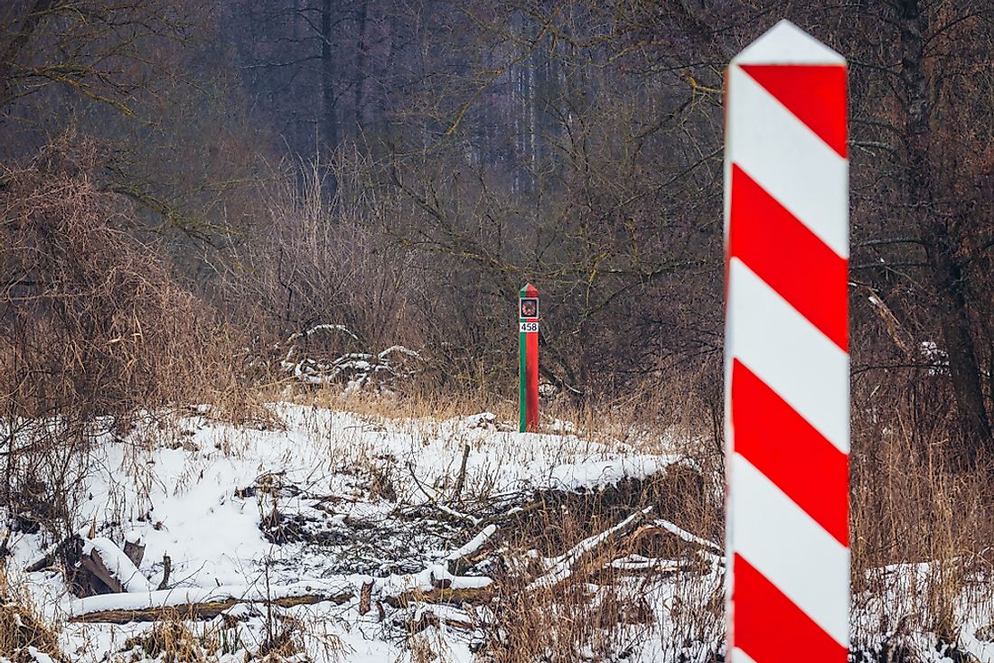
The border between Belarus and Poland stretches for a total of 259.73 miles and lies along the western edge of Belarus. At its most northern point, this boundary meets the border with Lithuania and then runs in a southward direction until it ends at the border with the Ukraine. The European Union sits to the west of this line. The territory between these two countries went through significant changes after the start of the Soviet era, when Poland lost some of its area to present-day Belarus. In 1945 and again in 1946, some of this disputed territory was reassign to Poland. Since that time, the border between these two countries has remained unchanged. Belarus and Poland share 13 border points, 6 of which are on roadways and 4 of which are by train. Because these two countries share large areas of undeveloped forests, the governments decided in 2015 that hikers and cyclists would not be required to have a visa in order to cross the border.
Latvia
The border between Belarus and Latvia has a total length of 100.04 miles, making it the shortest shared border in Belarus. It is located along the northwestern region of Belarus, beginning at the border with Lithuania and moving in a northwestern direction until it ends at the border with Russia. Approximately 10.3 miles of this border runs along the course of the Daugava River. Additionally, this international line cuts through Lake Rychy, which covers a surface area of 4.9 square miles. These two countries share seven border crossing checkpoints at the following locations: Lipovka, Urbany, Bigosovo, Gavrilino, Pljusy, Grigorovscina, and Druja. In 2017, the government of Latvia announced plans to build a barrier over 74 miles of the shared border. This barrier will consist of a 6.5-foot high fence topped with barbed wire. This border barrier does not run over difficult terrain nor through bodies of water. The reason for this project is likely to prevent undocumented immigrants from entering the European Union through Belarus.


