Jamaica Bay
Jamaica Bay is an estuary on Long Island's southern point, in the U.S. state of New York. The bay connects with the Lower New York Bay to the west via Rockaway Inlet and is the westernmost of Long Island's coastal lagoons.
Geography Of Jamaica Bay

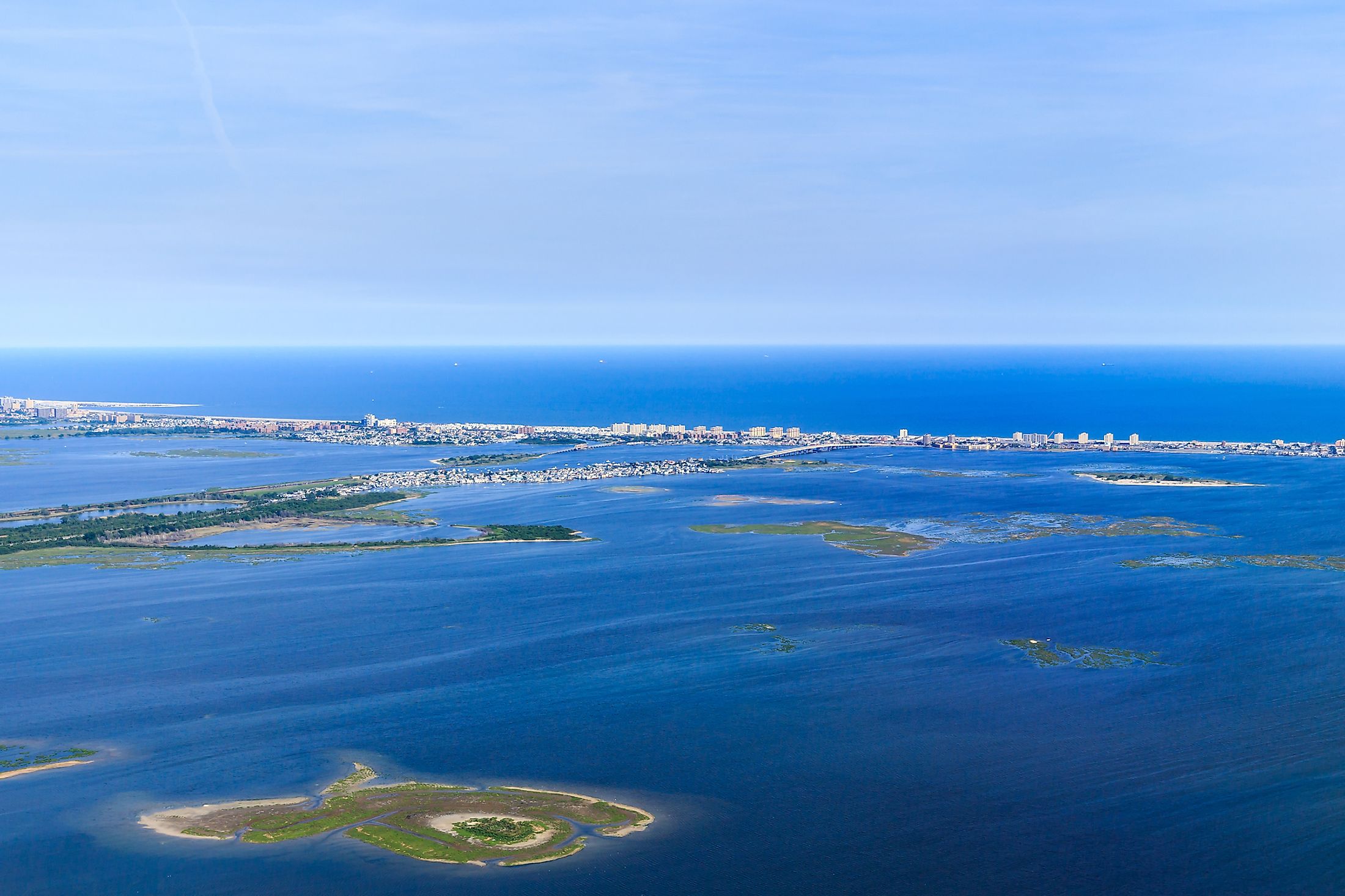
Jamaica Bay is a 25,000-acre eutrophic (nutrient-rich) salty to brackish estuary (100 km2). Rockaway Inlet connects the bay to Lower New York Bay and the Atlantic Ocean. Jamaica Bay is located in the southern section of New York City. The uplands around the bay, as well as part of the Rockaway barrier beach, are heavily developed. Dredging, filling, and development have all impacted the bay. The initial 65 square kilometers of wetlands have been filled in to the tune of 49 square kilometers. The bay's center is characterized by subtidal open water and huge low-lying islands with salt marsh, intertidal flats, and uplands that are vital for colonial breeding waterbirds. Food resources abound in intertidal zones, including a wide range of benthic crustaceans and macroalgae dominated by sea lettuce.
Historic Seaport Proposal

In the early twentieth century, a concept to develop Jamaica Bay as a seaport surfaced. Plans were canceled due to a lack of business traffic to support the building. By 1905, the manufacturing industry in New York was valued at $1.5 billion. The project began in 1911 but was halted during World War I. The docklands were supposed to be linked to the Long Island Rail Road. Dredging the Paerdegat Basin was an important aspect of the strategy since it would provide ships heading to Canarsie with better access. The New York City Board of Estimate authorized a proposal in 1931 to construct railroads on both sides of the Paerdegat Basin. The Board accepted Robert Moses' idea for a system of parks and parkways along Jamaica Bay's northern and western coasts in 1949.
Environmental Conditions
Jamaica Bay's salt marshes provide ideal habitat for migrating birds and other species. Since 1972, the majority of the rivers and marshes have been protected. As of Spring 2003, marshland was vanishing at a pace of around 40 acres (160,000 m2) per year. The causes of this loss are unknown. However, one theory is that it is caused by increasing sea levels.
Ownership And Protection
The Jamaica Bay Unit of the Gateway National Recreation Area includes the majority of Jamaica Bay and sections of the uplands and barrier beach. The federal government of the United States and the city of New York possess the vast bulk of the land and water inside this complex. Small pockets of private residential or business ownership persist in the upland buffer around the bay and on the Rockaway Peninsula. The federal Coastal Barrier Resources Act has classified and mapped Jamaica Bay as an otherwise protected beach unit, preventing incompatible government financial aid or flood insurance inside the area. Within the Jamaica Bay and Breezy Point habitat complex, the New York State Natural Heritage Program has designated two Priority Sites for Biodiversity. The New York City Department of Environmental Protection prepared a detailed watershed management plan for the bay in 1993.
Ecology

Jamaica Bay and surrounding Breezy Point host seasonal or year-round populations of approximately 330 special focus and listed species, including 48 fish and 120 bird species. This geographic region concentrates marine and estuarine species traveling between the North Atlantic's New York Bight and the Hudson and Raritan River estuaries.
Jamaica Bay Wildlife Refuge
Over 12,600 acres of water, salt marshes, freshwater and brackish water ponds, upland farms and woodlands, open bay, and islands make up the Jamaica Bay Wildlife Refuge. It is one of the biggest bird habitats in the northeastern United States, and it is an excellent location for seeing seasonal bird migration and resident species. Robert Moses, Commissioner of the New York City Department of Parks and Recreation, established the Wildlife Refuge in the 1950s. When the National Park Service created Gateway in 1972, this property became a component of it.


