Port Angeles, Washington
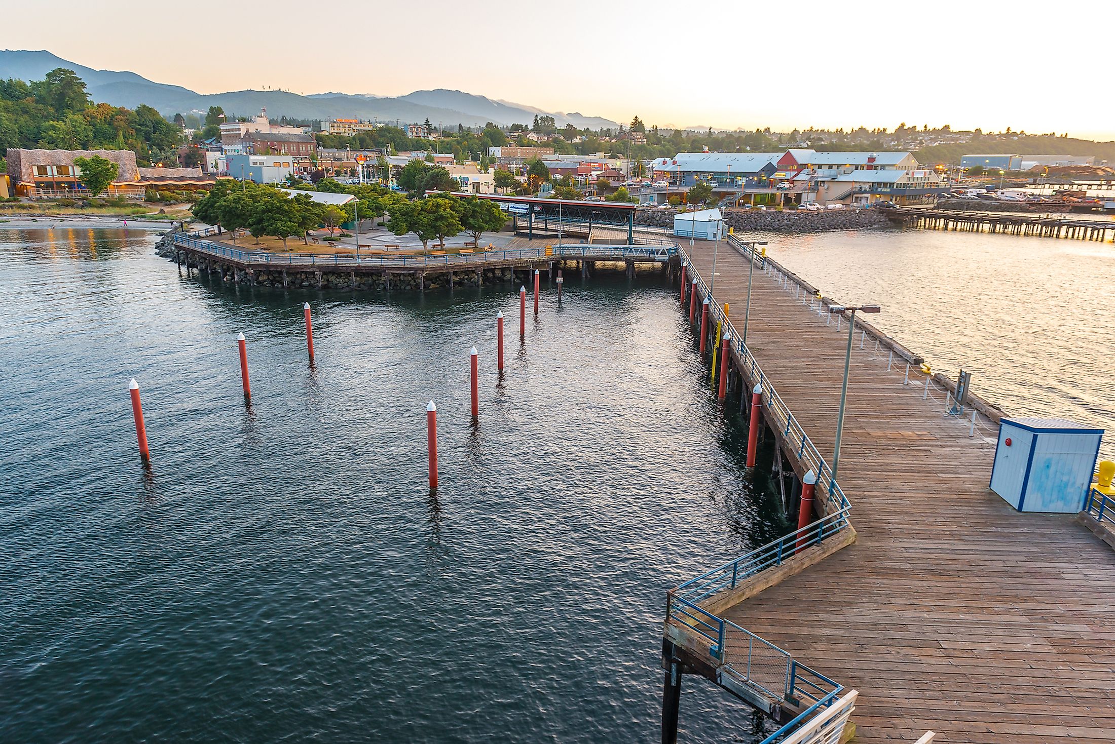
Port Angeles, the tourism hub of the Olympic Peninsula, is where travelers from near and far come to spend a magnificent holiday. Located in the rain shadow of the Olympic Mountains, it serves as the gateway to the Olympic National Park, one of the biggest and most visited parks in the United States network of national parks. Port Angeles is a well-liked vacation spot for the over 3.5 million tourists who travel to the North Olympic Peninsula each year because of its temperate temperature, rural way of life, variety of outdoor recreation, and strong business environment.
Location Of Port Angeles

Port Angeles serves as the city and county seat of Clallam County in Washington. In the center of Port Angeles is the Olympic Discovery Trail, a 130-mile lowland route that connects the Puget Sound to the Pacific Coast. The Olympic Mountain Range forms its southern border, and the Strait of Juan de Fuca forms its northern boundary. It is connected to Victoria, British Columbia, Canada, which is located 18 miles (29 km) to the north via ferry. Port Townsend, Washington, is only 47 miles (76 km) away from Port Angeles, while Sequim, Washington, is only 17 miles (27.36 km) east of Port Angeles. Fifty-nine miles (95 km) from Port Angeles, on the Hood Canal side, is the town of Brinnon.
Geography Of Port Angeles
Port Angeles has a coastline that stretches for around 26 kilometers. With depths of more than 90 feet near the eastern end, Port Angeles Harbor is regarded as the largest naturally occurring deep water harbor on the west coast of the United States. The city has a total area of 14.52 square miles (37.61 km2), of which 10.70 square miles (27.71 km2) is land and 3.82 square miles (9.89 km2) is water, according to the United States Census Bureau.
Climate Of Port Angeles
The Köppen Climate Classification categorizes the climate in Port Angeles as Mediterranean. Due to the Pacific Ocean's strong climate regulation, its latitude experiences cold summers and warm winters. The winters are lengthy, bitterly cold, wet, and largely cloudy, while the summers are brief, pleasant, dry, and partly cloudy. The average annual temperature ranges between 35°F and 71°F, with lows of 26°F and highs of 83°F being rare. August is the hottest month of the year, and the warm season lasts for 2.9 months, with an average daily high temperature exceeding 66°F. With an average daily maximum temperature below 50°F and December being the coldest month, the chilly season lasts for 3.8 months. On average, Port Angeles receives 36 inches of rain and 3 inches of snow each year.
Brief History Of Port Angeles

The region's plentiful natural resources supported the early settlers, who were Native Americans from tribes like the Klallam ("Strong People") and Makah. The area's harbor was given the name Puerto de Nuestra Senora de Los Angeles by Spanish explorer Francisco de Eliza in 1791, which means "Port of Our Lady of the Angels." A year later, it was abbreviated to Porto de Los Angeles. Due to the similarities between Ediz Hook and the Dungeness Spit, it was later referred to as "False Dungeness." Later, it was called "Cherbourg" because a person who had visited France hoped it would become the "Cherbourg of America." Finally, on June 6, 1862, the city was given the name Port Angeles. After the United States and Canada's border was established in 1846, Port Angeles' actual settlement started in the 1850s. The Port of Port Angeles was established in 1922. Shipping and both commercial and recreational fishing have traditionally been attracted to the natural deep-water harbor. Over the coming decades, the town continued to expand.
Demographics Of Port Angeles
Out of 631 communities in Washington, Port Angeles has 20,144 residents, making it the 72nd most populous city in the state. Since the most recent census, which indicated a population of 19,960 in 2020, Port Angeles' population has decreased and is now growing at a rate of 0.46% annually. White (Non-Hispanic) (81.5%), Two+ (Non-Hispanic) (4.31%), White (Hispanic) (4.28%), Other (Hispanic) (2.32%), and American Indian & Alaska Native (Non-Hispanic) (2.2%) make up Port Angeles, Washington's top 5 ethnic groupings. Port Angeles has a poverty rate of 14.57% and a $60,672 average household income. In prior years, the average rent was $980 per month, and the average home's worth was $231,900. In Port Angeles, the median age is 38.9 years, with 36.9 years for men and 41.1 years for women.
Economy
The Port of Port Angeles' fundamental purpose as a pioneer in economic development is to improve the quality of life in the communities on the north Olympic Peninsula. The Port does this via careful and innovative management of people, resources, and facilities to advance the long-term prosperity of Clallam County's residents and business community. The Port is excellently situated to reach a wide range of domestic and international markets because of its advantageous location on the Strait of Juan de Fuca. The Port Angeles City and Clallam County administrations, along with Peninsula College and Olympic Medical Center, are the top three employers.
Top Attractions In Port Angeles
Hurricane Ridge

With a 17-mile journey from the city, Hurricane Ridge gives one of the most breathtaking views of Olympic National Park. Hurricane Ridge Road is a south side of town road that begins just after the Olympic National Park Visitors Center. The well-known Heart O' the Hills Campground, one of Olympic National Park's top camping spots, is located close to the road. In the winter, Hurricane Ridge continues to draw tourists. Warmly attired guests take part in snowshoeing, sledding, and downhill activities at the snowy summit's Hurricane Ridge Ski and Snowboard Area.
Marymere Falls

Marymere Falls, which is a well-known tourist destination for both locals and visitors, is situated within the Olympic National Park in the state of Washington. You'll have to travel a mile-long dirt path to get there, but the journey itself is half the enjoyment because you'll be surrounded by stunning, tall cedar, fir, and hemlock trees. The 90-foot-high waterfall is a magnificent site to see and is a well-liked option due to both its beauty and ease of access.
Ediz Hook
A three-mile-long, crescent-shaped sand spit called Ediz Hook extends off the Port Angeles coastline. This unusual landform, often known as "the Spit" or "the Hook," provides quick excursions outside the city. The breathtaking view of Port Angeles set against the Olympic Mountains is what initially stands out on The Spit. Kayaking and canoeing are permitted since the hook shields the shoreline from strong waves. You can go motorized vehicle riding, scuba diving, paddle boating, and other activities.
Arthur D. Feiro Marine Life Center
Though the concept for the Arthur D. Feiro Marine Life Center began to take shape in the early 1970s, it was not until 1982 that it was first made public. Arthur Feiro, a creative mentor, and educator who wanted to spread his passion for marine studies, species, and ecosystems, came up with the idea for the teaching laboratory and public aquarium. All different types of marine life, from sea stars and scallops to anemones and enormous Pacific octopuses, will be seen up close. The microscope station, where you can observe whale bones and shells, is one of their most well-liked attractions.
Lake Crescent

Another jewel in Olympic National Park's crown is Lake Crescent, which is located 20 miles to the west of Port Angeles. The natural beauty of this glacially sculpted lake, which is very deep and clean, is abounding. Picnicking is a well-liked activity in areas with swimming beaches, notably East Beach and Bovee's Meadow. This location is a favorite with hikers as well since the trails offer beautiful vistas, particularly those of the magnificent Marymere Falls.
The best natural attractions may be found in Port Angeles, including breathtaking waterfalls, unspoiled beaches, and scenic hiking routes. Make this town the location of your upcoming trip, and for the finest experience, stop by a few of these sites mentioned above.
