Tumalo Falls, Oregon
Tumalo Falls is the largest and most stunning waterfall on Tumalo Creek in Bend, Oregon. There are hiking paths and a day-use area beside this magnificent waterfall. Just a short distance from the trailhead, this day-use area provides unforgettable views of Tumalo Falls. Picnic places and access to hiking and mountain bike paths are available. One of the nicest things to do in Bend is to visit this soaring masterpiece.
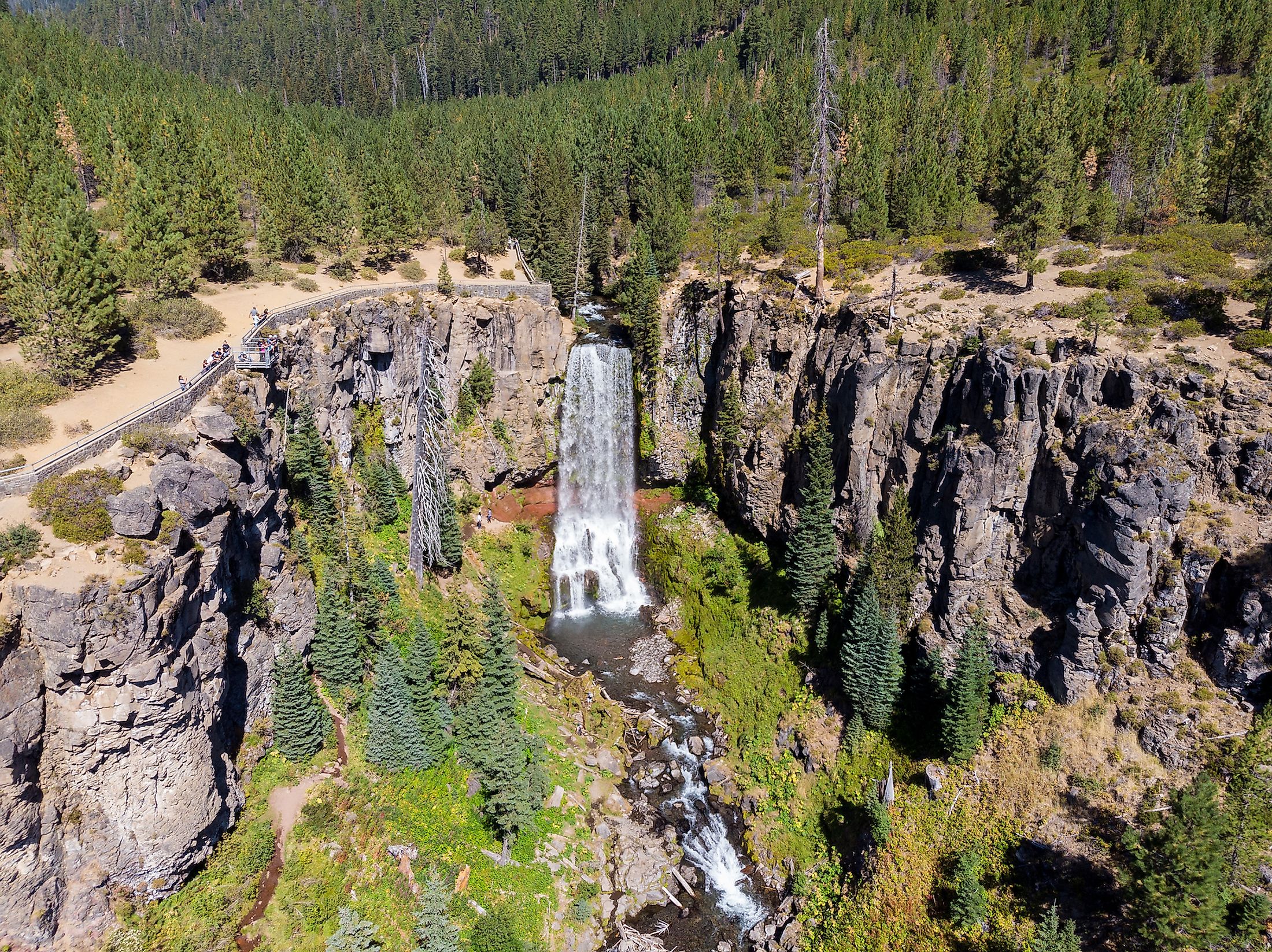
Geography Of The Tumalo Falls

In the Cascade Range, west of Bend in the U.S. state of Oregon, Tumalo Falls is a 97-foot (30 m) waterfall that flows into Tumalo Creek. Upstream of Bridge Creek Falls, a tributary of Tumalo Creek, there are additional waterfalls. These waterfalls are all located inside the Deschutes National Forest.
About 14 miles (23 km) along forest roads from Bend, the Tumalo Falls Day Use Area is managed by the United States Forest Service. The day-use facility provides picnic areas, restrooms, and waterfall views in addition to providing access to hiking and mountain bike routes. About 0.25 miles (0.40 km) upstream from the picnic spot, the Tumalo Falls Trail leads to an observation terrace above Tumalo Falls. The route goes on after the falls. Upstream, it travels another 1.25 miles (2.01 km) to Middle Tumalo Falls, a second waterfall with a two-tiered cascade that rises 65 feet (20 m).
Tumalo Falls Hike

There is a solid reason why Tumalo Falls is one of Central Oregon's most well-known tourist attractions. The Deschutes National Forest's Tumalo Creek sits at the foot of Broken Top, and this trip provides a leisurely 8.2-mile loop up to Happy Valley or a 4-mile out-and-back to one of the highest waterfalls where the bridge spans Middle Fork Tumalo Creek. Take the North Fork Trail for a mile up to Double Falls if you simply want something quick and beautiful. This walk is well-liked not just in the summer, but it is also a lovely place to visit in the winter. Cross-country skiers and snowshoers can go two miles to the Tumalo Falls viewpoint by closing the access road to the main parking area with a gate once the snow starts to fall. However, the remainder of the path is not advised in the winter because it is not designated for usage on snowy surfaces.
Brief History
The Molala Indians' historic homeland includes the region around Tumalo Creek, which empties into the Deschutes River. The region's first irrigation project was organized in the 1890s after the arrival of the first Euro-American immigrants in the 1880s. Agriculture required extensive irrigation. The water table lies hundreds of feet below the earth in many areas of the dry landscape. The early 20th-century history of the Tumalo Irrigation District serves as a cautionary tale regarding the risks associated with water development projects financed by private stock investment firms. The state of Oregon assumed management of the project in 1912 since the private investment firms were unable to maintain it. One of several significant events that signaled a change in Oregon's political culture under the administration of the progressivist Governor Oswald West was the state's ownership and operation of the Tumalo project.

During winter, icicles grow on the stony snow-coated banks of Tumalo Creek. In autumn, golden aspens border the brook. Spring welcomes rich greenery. Hence, regardless of the season, you will have a blast when visiting Tumalo Falls.


