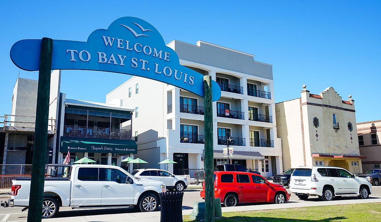
Manitoulin Island
The largest freshwater island in the world is more than just a record-setting mass. Ontario's Manitoulin Island is full of culture, community bonds, history, and wilderness - all of which draw a healthy surge of summer tourists. Last month, while cruising this mysterious rock, I ran into some car trouble. But as is often the case when traveling, the apparent mishap turned into a blessing-in-disguise, for I was able to sink into the small-town Manitoulin scene for three extra days before resuming my tour of the island's highlights. Allow me to expound on what makes this Canadian gem so valuable to the local Anishinaabe, the seasonal visitors, and the plants and animals that occupy its wonderfully-irregular form.
Geography

At 2,765 square-kilometers, Manitoulin Island is not only the largest freshwater island in the world, but the largest island situated within any lake. It, along with other islands of Manitoulin Island District, helps define the waters of Lake Huron (i.e. one of the Great Lakes), to the southwest, Georgian Bay, to the southeast, and the North Channel, which sits, well…to the north!
Manitoulin Island also hovers at the somewhat subjective transitional latitude between northern and southern Ontario. Some sources consider it to be positioned at the northernmost edge of southern Ontario, while others nudge it definitively into the northeastern region. Note: even though this is still technically the bottom quarter of the province, the vast majority of Ontario's residents (as is the case across the rest of the country) live near the U.S. border. As such, the northern/southern distinction is based on population/infrastructure, rather than objective geography.
Thanks to the creative topography of the Niagara Escarpment, the aforementioned surrounding bodies of water are complemented by a wealth of additional blue forms. Four main rivers criss-cross Manitoulin Island (i.e. Kagawong, Manitou, Blue Jay Creek, Mindemoya), 108 lakes splotch its interior, and countless bays/coves punctuate the perimeter.
Within the Manitoulin District, of which Manitoulin Island is the dominant entity, there are two incorporated towns (i.e. Gore Bay and Northeastern Manitoulin and the Islands), and a host of smaller, yet personable communities. There are also five First Nation reserves (i.e. Sheguiandah, Aundeck Omni Kaning, M'Chigeeng, Zhiibaahaasing and Sheshegwaning), in addition to the Wiikwemkoong Unceded Territory (more on this distinction in a moment).
Getting To/From the Island

Manitoulin Island can be accessed from the north via Highway 6, which stems southbound from the Trans-Canada Highway (i.e. Highway 17), at a crossroads immediately north of Espanola, Ontario. Motorists may reach this junction via Sudbury (~70 kilometers to the east), or Sault Ste. Marie, Ontario (240 kilometers to the west). Sault Ste. Marie, Michigan is just a couple clicks removed from its Canadian sister city. In fact, Manitoulin Island floats at a similar latitude to where The Great Lake State's Upper and Lower Peninsulas meet.
If driving in from the northshore of Lake Huron, then the first point of contact with Manitoulin Island will be the community of Little Current, which can be accessed via the iconic Little Current Swing Bridge.
For those coming from the Greater Toronto Area, or elsewhere in southern Ontario, there are two main options for reaching Manitoulin Island. The Trans-Canada Highway (i.e. Highway 400) can be taken northbound towards Sudbury, paralleling the eastern shore of Georgian Bay in the process. Alternatively, the Owen Sound Transportation Company operates a two-hour seasonal ferry from Tobermory, Ontario, to the island's southernmost community of South Baymouth. The MS Chi-Cheemaun (which is an Ojibwe term meaning "Big Canoe") runs from the first Friday in May until the Sunday after (Canadian) Thanksgiving (i.e. October).
Finally, anyone looking to expedite their travels can lean on the island's two small airports. Both the Gore Bay-Manitoulin Airport and Manitoulin East Municipal Airport are classified as "airports of entry" by Nav Canada. This means that either can be utilized by those wishing to hop a domestic charter, or fly in from abroad.
History

Archeological evidence from Sheguiandah (a National Historic Site of Canada located just outside of the First Nation reserve by the same name) demonstrates human activity on the island going back 9,500 years. This makes it one of the oldest prehistoric civilization sites in North America. These earliest of Indigenous settlers mined high-quality quartz rock from which they crafted spears and arrowheads.
Though Manitoulin Island was only sporadically occupied until the 19th century, prior to European colonization it was controlled by the Odawa, Ojibwe, and Potawatomi (who fled to Canada in the wake of the United States' 1830 "Indian Removal Act") nations - collectively known as the Three Fires Confederacy. Given this living heritage, and the fact that 40.5% of Manitoulin Island's 12,600 permanent residents are Indigenous people, the area is also referred to as Mnidoo Mnising, or Odawa Mnis, meaning "The Heart and Spirit of the Great Lakes," and "The Island of the Great Spirit," respectively, in the Eastern Ojibwe and Odawa languages. Sometimes the general translation is shortened to "Spirit Island." Even the current English name, Manitoulin Island, is based on the "mysterious being" known as Manitou (or Mnidoo), which, according to the Canadian Encyclopedia, "represents the unknown power of life and the universe."
The first contact between European (i.e. French) explorers and the island's Indigenous population occurred in 1610. This was followed up by the arrival of a small group of Jesuit missionaries in 1648 - though they had little success in converting the natives. Come 1836, the goal of assimilation was abandoned and instead, the Manitoulin Island Treaty, aka the Bond Head Treaty (named after Sir Francis Bond Head, Lieutenant Governor of Upper Canada), or Treaty 45 was signed. This was meant to encourage the First Nations of Upper Canada to settle on the island, thereby opening up more of the mainland to foreigners. That same year, the island's first European settlement was established: Manitowaning.
As the decades wore on, the migration intended by the Manitoulin Island Treaty proved only mildly successful. But as more Europeans flocked to the area, the island's agricultural prospects became more enticing. So in 1862, another draft of the Manitoulin Island Treaty, aka the McDougall Treaty (after William McDougall, Superintendent General of Indian Affairs), or Treaty 94, was drawn. This time, five of the six local Anishinaabe nations signed it, resulting in the formation of five reservations. The Wiikwemkoong (also spelt Wikwemikong) refused the new concessions and were successfully able to hold onto what is still one of the largest unceded territories (by area) in North America (i.e. 426.14 square-kilometers of the eastern peninsula). The Wiikwemkoong posted a 2021 population of 2,728, making them one of the key demographics on Manitoulin Island to this day. To learn more about their culture, check out the annual Cultural Festival (late July/early August) - one of the longest running powwows in northeastern North America
Communities
The communities throughout Manitoulin Island might best be described as "low-key." Many of them feature little more than a post-office, grocery store, coffee shop, and maybe a little tavern or ice cream parlor. Most doors will be shuttered early in the week and for much of the off-season. And don't expect to find much in the way of nightlife either. With that said, each and every place has its own combination of serene nature and charming community. Let's meet a few of the characters, starting with the bookends of the island.
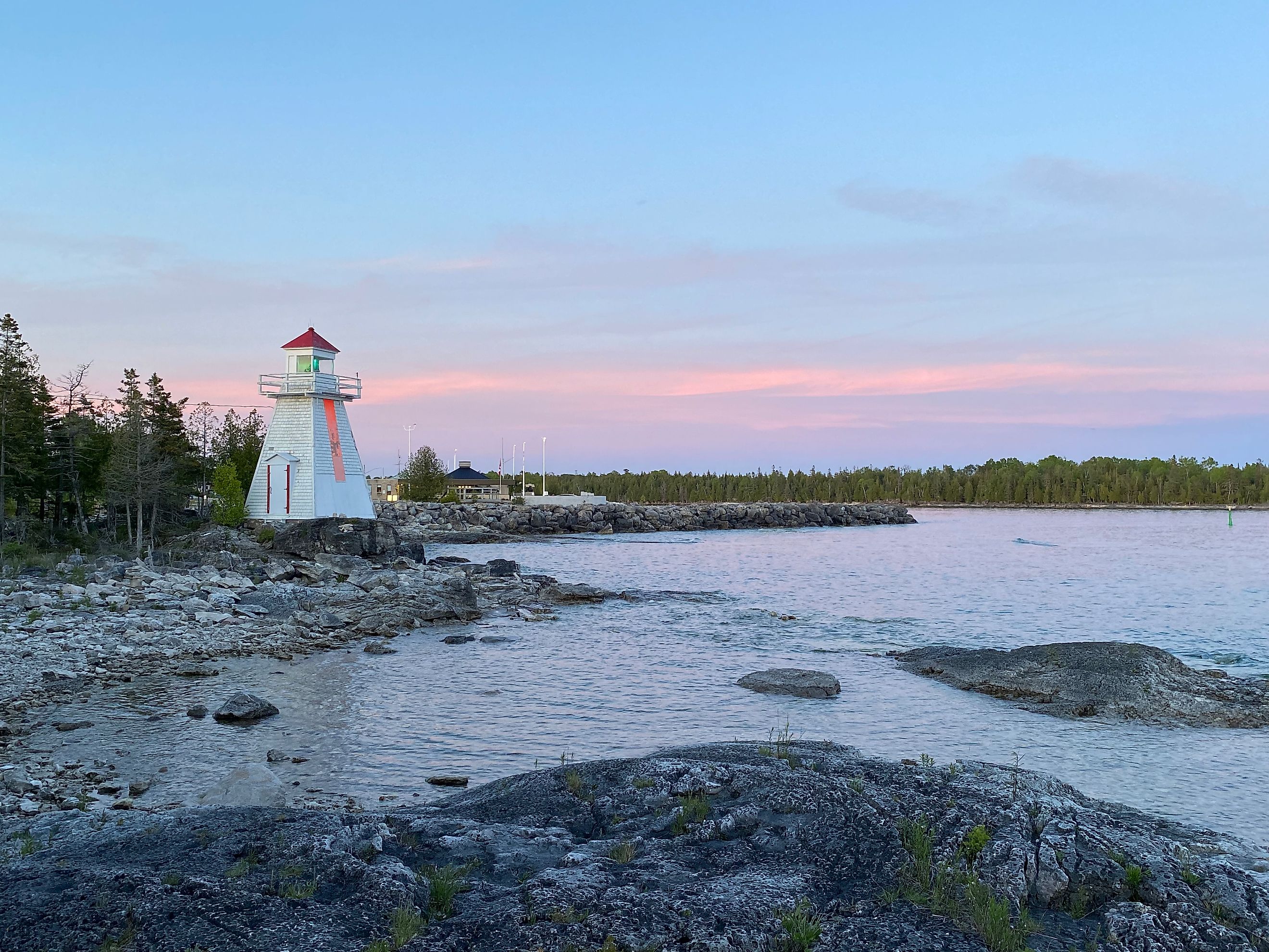
South Baymouth

Those reaching Manitoulin Island via Tobermory will land in South Baymouth - a ferry port within the Tehkummah Township. Many of the passenger vehicles simply blow through after being released from the Chi-Cheemaun, but I recommend lingering for a bit. The short boardwalk is worth a stroll at any time of day, as it affords views of the marina and little peninsula lighthouse, and the Little Schoolhouse and Museum is a wholesome and affordable time capsule. The latter was built in 1891 (though since reconstructed) and gives a snapshot of what life was like for the children of early pioneer families.
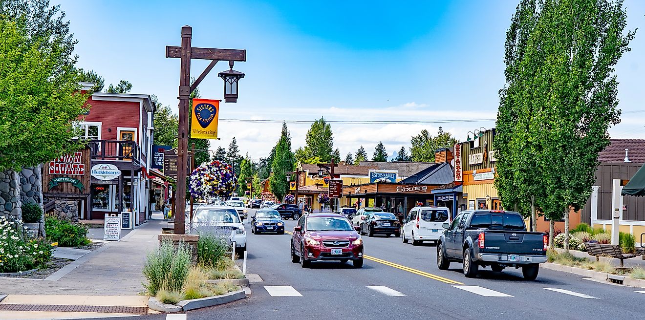
Little Current

For anyone venturing in from the north, or continuing north after their island tour, Little Current will either be an excellent introduction to Manitoulin, or a worthy send off. Located within the municipality of Northeastern Manitoulin and the Islands (i.e. the largest settlement), Little Current has all the little kicks and quirks one could hope to find in a tastefully-touristic town. Walkable, shop-lined waterfront? Check. Cute cafe and craft brewery? Double check. Outdoor murals, municipal parks, and quaint accommodations? You bet. Little Current has it all, but nothing in excess. As a digital nomad, and selective-extrovert, this ended up being my favorite spot on the island.
Manitowaning

Manitowaning strikes a nice balance between the first two highlighted communities. Situated on the east-central part of the island, it was not only the first European settlement, but the Ojibwe considered this to be the home base of the Gitchi Manitou. In fact, the town's name translates as "Den of the Great Spirit." Given the hilltop view of the namesake bay and the pleasant vibes emanating from the Loco Beanz, Assiginack Museum, and Burns Wharf/public beach, I can see why disparate cultures have been, and continue to be drawn here.
Gore Bay

The only other incorporated town on Manitoulin Island (this time in the northwest sector) also enjoys an approachable main street (i.e. Meredith Street) and welcoming waterfront. Boot up to the East Bluff Lookout, grab a bite on either side of the marina, or try one of the local craft concoctions at Split Rail Brewing Co.
Mindemoya

A drained battery/faulty starter (some might call it fate), brought my girlfriend and I to the centralized community of Mindemoya. Given that our car troubles started on a Saturday, we had to wait until midday the following Monday to get fixed up by Meneray Automotive Repair (who also towed us from Providence Bay). Because almost every business was closed Sunday to Tuesday, we weren't able to investigate the commercial side of town (humble as it may be), but instead experienced the kindness and relaxed nature of small-town Manitoulin. For three days we camped out in Meneray's parking lot, walked some of the nearby nature trails, paddled the adjacent lake, and got to know our amiable mechanics. The big moments were when a food truck rolled into town, and when the peloton from the Manitoulin Passage Ride (which is actually super cool, and surely a must-do for avid cyclists) passed by.
Natural Attractions

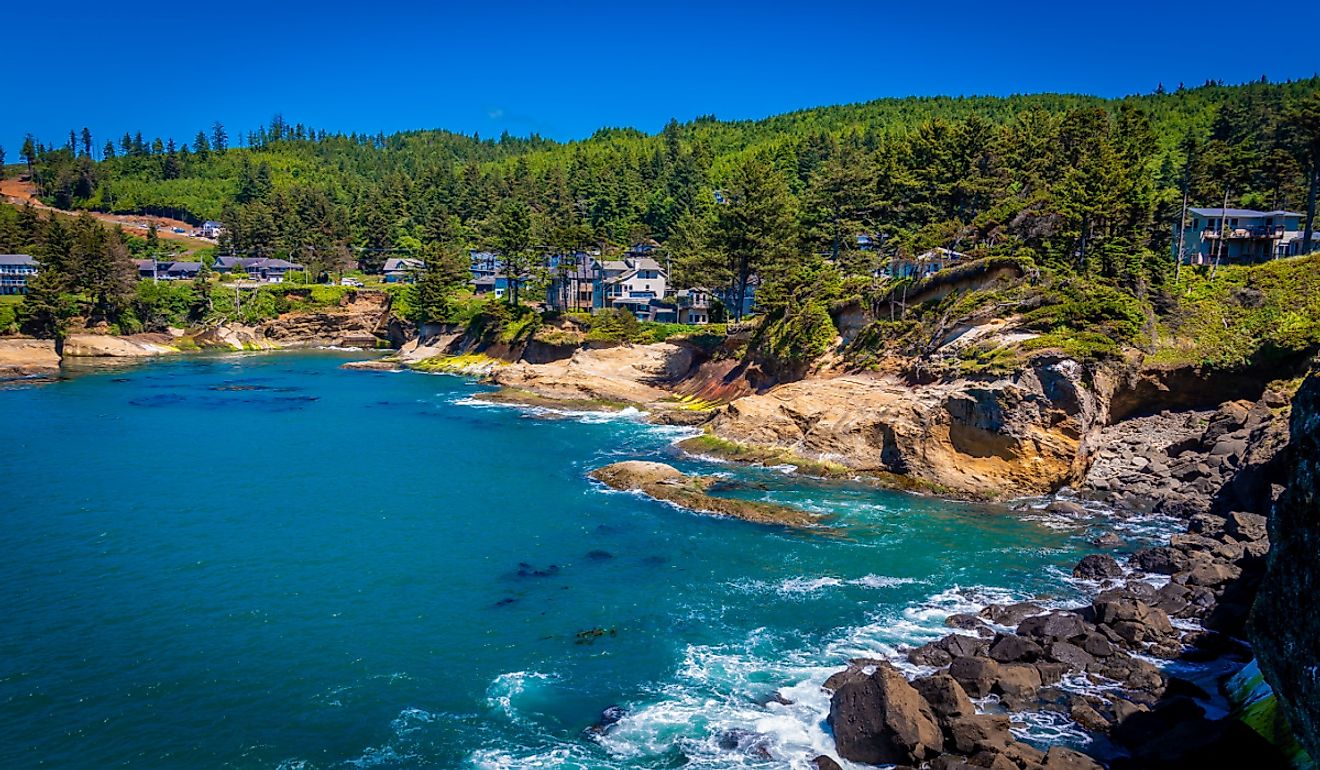
Manitoulin Island is endlessly beautiful to drive, bike, hike, or boat around. Rich green forests and high-quality alvar habitats blanket the craggy Niagara Escarpment, which is not only surrounded by the crystal clear waters of Lake Huron (and its subsidiaries), but dotted with inland lakes and brushed with peripheral sandy beaches. While summer is certainly the peak season, plenty of winter fun can be had thanks to the cross-country ski trails, natural skating rinks, and backcountry snowmobile routes.
Given its wild and sparsely-populated physique, Manitoulin is home to such iconic North American mammals as the black bear, gray wolf, moose, bobcat, beaver, otter, and deer, as well as a slew of migratory birds, amphibians, and reptiles.
The island's natural attractions are wide reaching, and would require multiple trips to fully check off, but here are a few standouts to mix into your next tour.
Bridal Veil Falls

In between Gore Bay and Little Current, in a little place called Kagawong, motorists will find a turnout for Bridal Veil Falls. This wide waterfall and accompanying watering hole is great for a swim, a picnic, or simply stretching the legs and snapping a few pictures. There is also a gentle wooded trail (i.e. Kagawong River Trail) that leads down towards Mudge Bay and the Old Mill Heritage Center. Those with a sweet tooth can indulge at either end of the hike by hitting up Manitoulin Chocolate Works or Boo-Bah-Lou Candy Corner (or both!).
Cup and Saucer Trail
Just 15 minutes east of Bridal Veil Falls, another outdoor recreation gem awaits. Cup and Saucer Nature Preserve sports the first major hiking trail to be blazed on Manitoulin Island. This five-kilometer out-and-back path through deciduous forest takes hikers high onto the Niagara Escarpment, treating them to expansive views of the island's green surface, as well as West Bay and Lake Manitou. Cup and Saucer Trail is still widely considered to be the island's best, but since its inception many communities have been inspired to build their own networks - so have an eye for the subtly-signed trails waiting to be discovered across all corners.
Providence Bay

Manitoulin Island's longest beach sits on one of its southcentral bays. Providence Bay is a perfect place to pass a sunny afternoon. Along with the generous stretch of soft sand, there is a playground for kiddos, a lengthy boardwalk for scenic strolls, and the accompanying waters are shallow and (relatively) warm, and therefore suitable for most swimmers. The community's amenities will also help keep visitors well-caffeinated and satiated. Grab a cone at Huron Island Time, a cup of joe at Providence Peace Cafe, or some freshly-caught grub at Lake Huron Fish & Chips.
Manitoulin Eco Park
While the daylight illuminates Manitoulin's refreshing wilderness, the untarnished night sky reveals a cosmic splendor. The Royal Astronomical Society of Canada's first designated commercial Dark Sky Preserve (i.e. Manitoulin Eco Park) sits just 14 kilometers north of South Baymouth - meaning that if you take the late ferry up from Tobermory, this may very well be your first item on the itinerary. Accommodations are available throughout this 268-acre park in the form of classic campsites, tipis, "forest bunkies," and cabins.
Parting Thoughts
Hiding in plain sight between southern Ontario's bustling metropolitans and Michigan's dual peninsulas, Manitoulin Island transports visitors to a simpler time. Its stunning natural landscape is only occasionally interrupted by laid-back communities, each with a unique feel and backstory. So if you find yourself in the Great Lakes Region this summer (or any subsequent season), head for this intriguing, historical, and record-setting haven.