10 Largest US Lakes
Approximately 269,717 square miles—about 7% of the total area of the United States—consist of water, including rivers, lakes, inlets, and territorial waters along the coast. The US is home to over 102,500 lakes. Alaska has the largest number of lakes, although many of them remain unnamed. In contrast, Minnesota holds the distinction of having the most named lakes in the country.
The Great Lakes group, which make up the five largest lakes in the country, spans a total of 94,250 square miles, which is nearly the same size as the United Kingdom. Lake Superior is the country’s largest lake, followed by Lake Huron, Lake Michigan, Lake Erie, and Lake Ontario. The remaining five largest lakes are Lake of the Woods, Iliamna Lake, Great Salt Lake, Lake Oahe, and Lake Okeechobee. While nine out of ten of the United States’ largest lakes are freshwater, one, the Great Salt Lake in Utah, is saltwater.
10 Largest Lakes in the United States by Surface Area
| Rank | Name | Location | Area |
|---|---|---|---|
| 1 | Lake Superior | Michigan, Minnesota, Wisconsin, Ontario | 31,700 sq mi |
| 2 | Lake Huron | Michigan, Ontario | 23,000 sq mi |
| 3 | Lake Michigan | Illinois, Indiana, Michigan, Wisconsin | 22,300 sq mi |
| 4 | Lake Erie | Michigan, New York, Ohio, Ontario, Pennsylvania | 9,910 sq mi |
| 5 | Lake Ontario | New York, Ontario | 7,340 sq mi |
| 6 | Lake of the Woods | Manitoba, Minnesota, Ontario | 1,679 sq mi |
| 7 | Iliamna Lake | Alaska | 1,014 sq mi |
| 8 | Great Salt Lake | Utah | 950 sq mi |
| 9 | Lake Oahe | North Dakota, South Dakota | 685 sq mi |
| 10 | Lake Okeechobee | Florida | 662 sq mi |
1. Lake Superior - 31,700 Square Miles
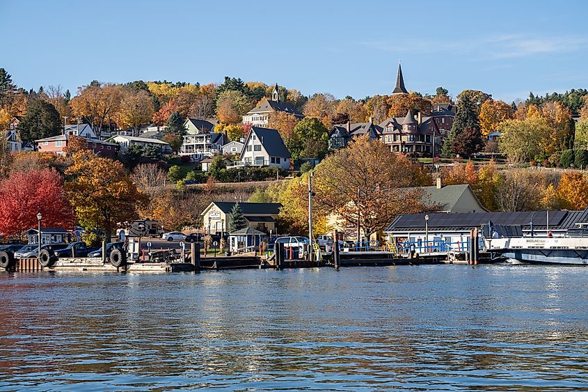
Lake Superior, spanning 31,700 square miles, is the largest lake in the United States and the largest freshwater lake in the world. It borders Michigan, Minnesota, Wisconsin, and Ontario and is part of the Great Lakes Group. Stretching approximately 350 miles wide and 160 miles long, its shoreline stretches about 2,800 miles. Comparing the surface area to countries, Lake Superior is roughly the same size as Austria and two times larger than Denmark.
Lake Superior holds roughly 2,900 cubic miles of water, which represents 10% of the world’s freshwater. With a maximum depth of 1,332 feet and an average depth of about 500 feet, Lake Superior is the deepest and coldest of the Great Lakes Group. Over 200 rivers feed into Lake Superior, with the lake draining into Lake Huron through the St. Mary’s River.
2. Lake Huron - 23,000 Square Miles
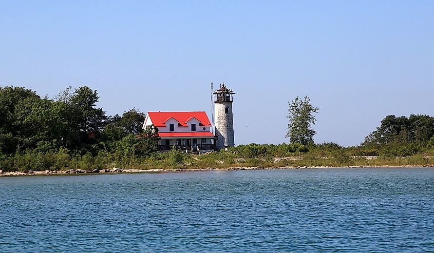
Covering 23,000 square miles, Lake Huron is the second-largest lake in the United States. It borders both Michigan and the Canadian province of Ontario and is also a member of the Great Lakes group. It spans 206 miles across and 183 miles from north to south, with an average depth of 195 feet and a maximum depth of 750 feet. Comparatively, Lake Huron is approximately twice the size of Belgium and over four times larger than Connecticut. Holding 844.8 cubic miles of water, it is the fastest-flowing of the Great Lakes, largely thanks to its extensive drainage basin in Ontario and Michigan. In addition to receiving water from Lake Superior, Lake Huron also receives water from Lake Michigan via the Straits of Mackinac.
3. Lake Michigan - 22,300 Square Miles
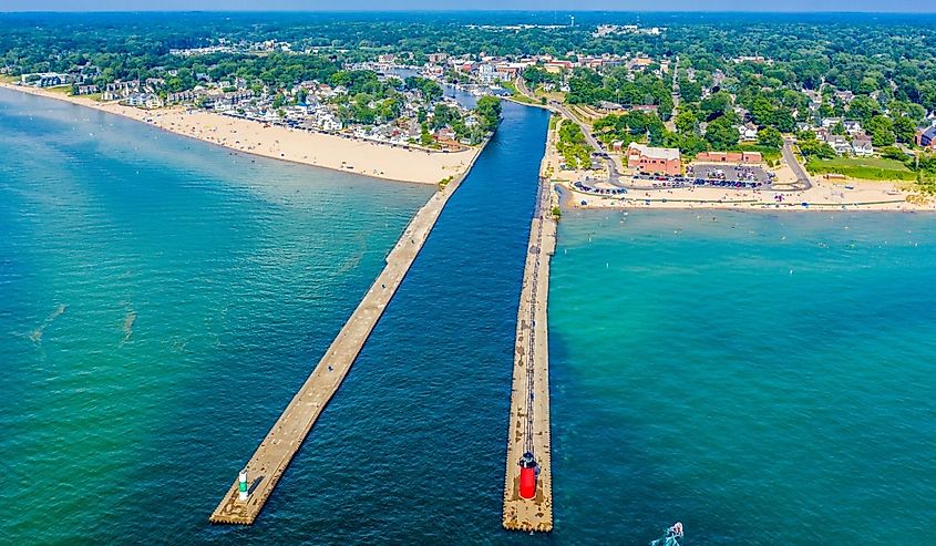
Lake Michigan, bordering Illinois, Indiana, Minnesota, and Wisconsin, is the country’s third largest lake at 22,300 square miles. It is also the only Great Lake completely in the United States. Measuring 307 miles long and 118 miles wide, it is roughly 11 times larger than Delaware. The average depth is approximately 279 feet, although it reaches 925 feet at its deepest point. With a volume of 1,180 cubic miles of water, Lake Michigan holds more water than Lake Huron, despite its smaller surface area. Several rivers flow into Lake Michigan, some of the most prominent including the Straits of Mackinac, Fox River, and Grand River.
4. Lake Erie - 9,910 square miles

At 9,910 square miles, Lake Erie is the fourth largest lake in the United States, bordering Michigan, New York, Ohio, Ontario, and Pennsylvania. It stretches 241 miles across and 57 miles long, with an average depth of about 62 feet and a maximum depth of 210 feet. With regards to its surface area, it is roughly half the size of Costa Rica and just slightly smaller than Massachusetts. Of all the Great Lakes, Lake Erie is the smallest in volume, containing 119 cubic miles of water. The Detroit River is Lake Erie’s main source of inflow, with the majority of the water draining through the Niagra River and Welland Canal.
5. Lake Ontario - 7,340 Square Miles
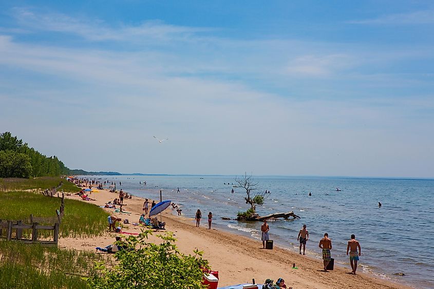
Covering a surface of 7,340 square miles, Lake Ontario is the fifth-largest lake in the United States and the smallest of the Great Lakes Group. Even though it is the smallest of the Great Lakes, Lake Ontario is seven times larger than Luxembourg. It borders only New York and Ontario and has slightly smaller dimensions than Lake Eerie, measuring 193 miles by 53 miles. With an average depth of 283 feet, Lake Ontario holds over three times the water volume of Lake Erie. The Niagara River is Lake Ontario's main inflow source, while it primarily drains into the St. Lawrence River.
6. Lake of the Woods - 1,679 Square Miles
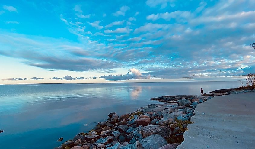
Lake of the Woods, spanning 1,679 square miles, is the sixth largest lake in the United States, sharing a border with Minnesota and the Canadian provinces of Manitoba and Ontario. It is approximately 70 miles long and 60 miles wide, containing more than 14,500 islands. To put its size into perspective, Lake of the Woods is just slightly smaller than the Caribbean island of Trinidad and Tobago. The Rainy River, to the southeast, is the lake’s main source of inflow, with the water draining northwestward into the Winnepeg River, ultimately ending up in Winnepeg Lake.
7. Iliamna Lake - 1,014 Square Miles
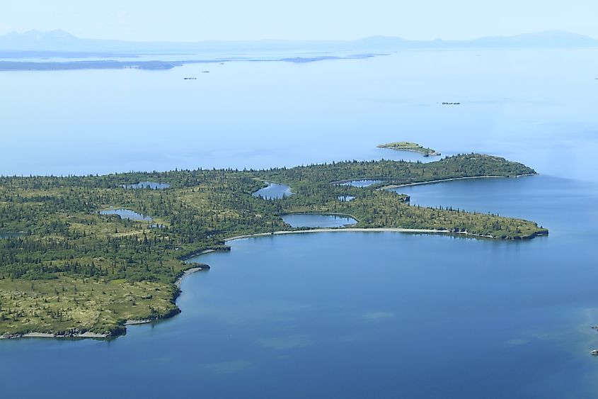
Iliamna Lake, located in southwest Alaska west of the Cook Inlet, spans 1,014 square miles, making it the seventh-largest lake in the country and the largest in the state. It is approximately 77 miles long and 22 miles wide, with a surface area comparable to that of Rhode Island. Although the average depth of the lake is 144 feet, it reaches 988 feet at its deepest point, holding a total volume of about 27.7 cubic miles. The Newhalen River, Iliamna River, Pile River, and Copper River primarily feed into Iliamna Lake, with the water draining southwest into the Kvichak River, ultimately ending up in Bristol Bay and then the Bering Sea.
8. Great Salt Lake - 950 Square Miles

The Great Salt Lake, at 950 square miles, is the eighth-largest lake in the country and the largest saltwater lake in the Western Hemisphere. Located in Northern Utah, the Bear River, Jordan River, and Weber River primarily feed the lake. It measures 75 miles long and 28 miles wide, with an average depth of 16 feet and a maximum depth of 33 feet. The lake holds a volume of approximately 4.5 cubic miles. The Great Salt Lake is a remnant of the massive prehistoric Lake Bonneville that once covered the region.
9. Lake Oahe - 685 Square Miles

At 685 square miles, Lake Oahe, a reservoir located behind the Oahe Dam, is the country’s ninth-largest lake. It begins slightly north of Pierre, South Dakota, and extends north near Bismarck, North Dakota. In length it is roughly 231 miles long and has a shoreline stretching 2,250 miles. With a maximum depth of 205 feet, Lake Oahe has a volume of 7 cubic miles. As a reservoir along the Missouri River, Lake Oahe receives its main inflows from the Cheyenne, Moreau, and Grand Rivers, with the Missouri River serving as its primary outflow.
10. Lake Okeechobee - 662 Square Miles
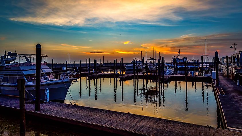
Lake Okeechobee, located in south central Florida, covers 662 square miles, making it the tenth-largest lake in the United States. It spans 36 miles in length and 29 miles in width, expansive enough that it is not possible to see the opposite shoreline. For its surface area, Lake Okeechobee is extremely shallow, with an average depth of eight feet and 10 inches, reaching just 12 feet at its deepest point. Kissimmee River, to the north of Lake Okeechobee, is the main source of inflow, while the Everglades, Caloosahatchee River, and the St. Lucie River are the primary outflows.
Final Thoughts
Although these lakes are massive, many comparable to the size of small countries, they continue to face environmental threats today. Factors such as climate change, plastic pollution, oil spills, and invasive species pose ongoing threats to their ecosystems and the communities that depend on them. Protective measures, such as the Great Lakes Compact and the Clean Water Act, have played a crucial role in preserving these vital resources and will continue to be essential for safeguarding their future.
Largest Lakes in the United States by Surface Area
| Rank | Name | Location | Area |
|---|---|---|---|
| 1 | Lake Superior | Michigan, Minnesota, Wisconsin, Ontario | 31,700 sq mi |
| 2 | Lake Huron | Michigan, Ontario | 23,000 sq mi |
| 3 | Lake Michigan | Illinois, Indiana, Michigan, Wisconsin | 22,300 sq mi |
| 4 | Lake Erie | Michigan, New York, Ohio, Ontario, Pennsylvania | 9,910 sq mi |
| 5 | Lake Ontario | New York, Ontario | 7,340 sq mi |
| 6 | Lake of the Woods | Manitoba, Minnesota, Ontario | 1,679 sq mi |
| 7 | Iliamna Lake | Alaska | 1,014 sq mi |
| 8 | Great Salt Lake | Utah | 950 sq mi |
| 9 | Lake Oahe | North Dakota, South Dakota | 685 sq mi |
| 10 | Lake Okeechobee | Florida | 662 sq mi |
| 11 | Lake Pontchartrain | Louisiana | 631 sq mi |
| 12 | Lake Sakakawea | North Dakota | 520 sq mi |
| 13 | Lake Champlain | New York, Vermont, Quebec | 490 sq mi |
| 14 | Becharof Lake | Alaska | 453 sq mi |
| 15 | Lake St. Clair | Michigan, Ontario | 440 sq mi |
| 16 | Red Lake | Minnesota | 427 sq mi |
| 17 | Selawik Lake | Alaska | 404 sq mi |
| 18 | Fort Peck Lake | Montana | 393 sq mi |
| 19 | Salton Sea | California | 347 sq mi |
| 20 | Rainy Lake | Minnesota, Ontario | 345 sq mi |
