Lake Cahuilla
Lake Cahuilla is an ancient lake that existed up to 1580 located between northern Mexico and California (United States). The prehistoric lake covered the Imperial and Coachella Valleys and spanned 5,700 square kilometers. The lake was named after the Cahuilla people. This lake formed during the Pleistocene period, with its level rising to 52 meters above sea level. During the Holocene period, the lake received most of its water from the Colorado River and emptied into the Gulf of California via the Rio Hardy. It dried and refilled several times in the last two centuries and eventually disappeared around 1580. Today, the Salton Sea covers part of the lake’s lower basin.
Geography Of Lake Cahuilla

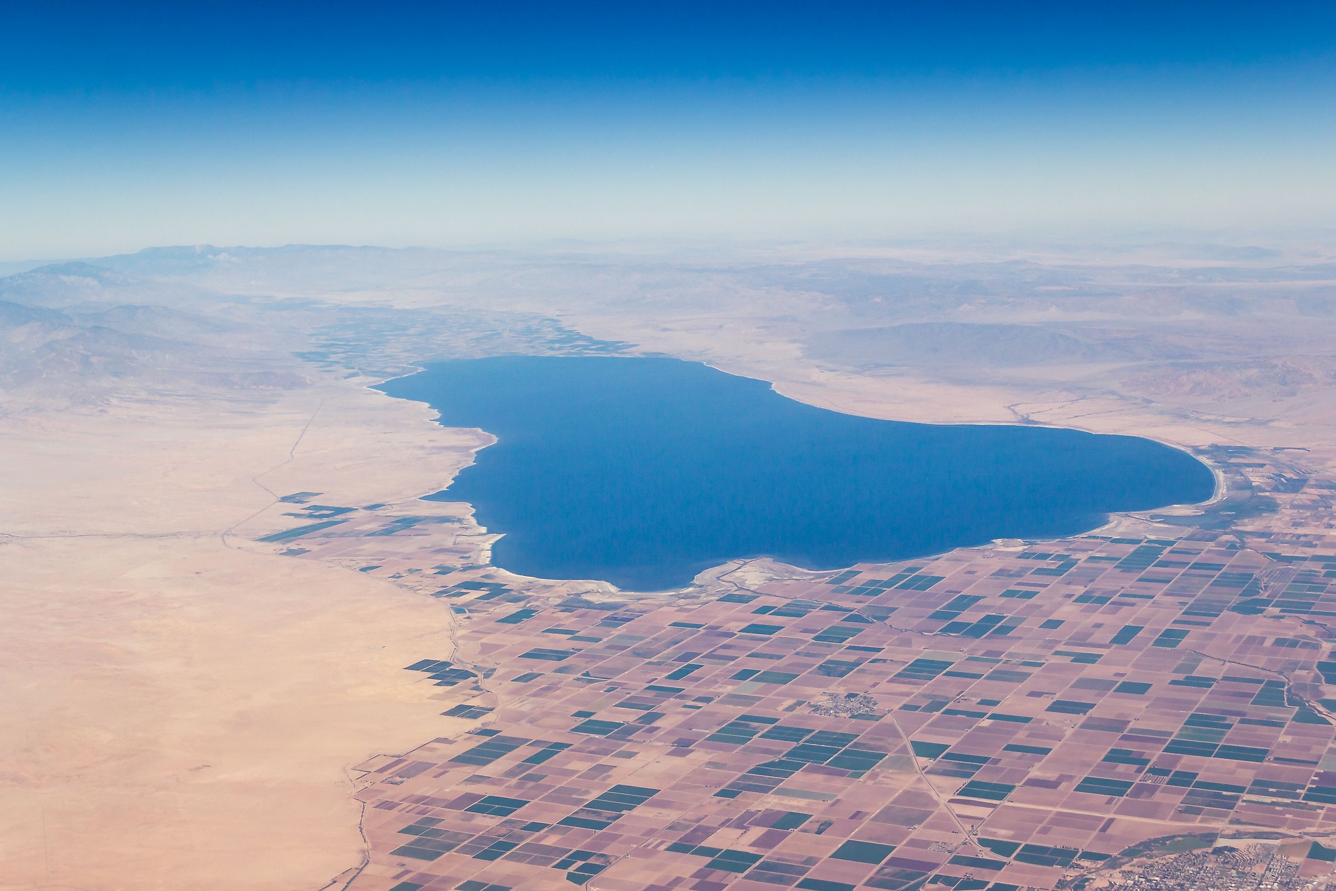
Lake Cahuilla was located in the Colorado Desert and covered Coachella Valley’s southern end, the Imperial Valley, and Mexico’s Cerro Prietto. Several mountains surrounded Cahuilla, including Santa Rosa Mountains on the north and Vallecito and Fish Creek Mountains on the south. The lake’s southern shoreline was located south of the Mexico-US border. The Obsidian Butte and Bat Caves Butte were major islands when the lake’s water level was higher, although the former was submerged during highstands. Some of the towns occupying areas previously covered by the lake include Mecca, Thermal, Indo, Imperial, Brawley, Calipatria, Niland, and El Centro.
Lake Cahuilla was 160 kilometers long and 65 kilometers wide at the widest point. It covered a surface area of approximately 5,700 square kilometers, making it one of the largest lakes in Holocene North America. Currently, the entire lake area, except 300 square kilometers, is located below sea level. Cahuilla was approximately 91 meters deep to a water height of 12 meters above sea level. At its maximum level, the lake contained 480 cubic kilometers of water.
The lake’s shoreline is located at an elevation of 7.6-18.3 meters, with the beach deposits and wave cuts responsible for the variation. The shoreline’s nature also varies, with wavecut cliffs on the east reaching 7.6 meters and one on the north rising 5.6 kilometers. The shoreline is visible near the Santa Rosa Mountains, particularly at Travertine Point, where the travertine contrasts the dark rock varnish.
Hydrology
The Colorado River was the principal water source for Lake Cahuilla and accounted for about 62% of the lake’s water. The lake also received water from underground sources and inflow from small streams. Cahuilla needed about half of the Colorado River’s discharge to sustain it at a height of 12 meters above sea level. The river deposited approximately 4,800 kg of sediments per second into Lake Cahuilla. Besides Colorado, other streams that fed the lake included Carrizo Creek, San Felipe Creek, Whitewater River, Mammoth Wash, Salt Creek, and Arroyo Salado.
Lake Cahuilla contained freshwater during highstands, with the salinity increasing when the level dropped. Other sources indicate that the lake contained brackish water and that the salinity level was lowest where the Colorado River drained into the lake. Since only half of the Colorado River’s water could fill the lake, the remaining water overflowed into Rio Hardy and drained into the Gulf of California.
History Of Lake Cahuilla
Lake Cahuilla formed in an area where the San Andreas Fault and the Gulf of California tectonic zone meet. It was formed about 40,000 years ago and existed from the late Pleistocene period to the Holocene. However, the lake’s water level varied from 30-52 meters above sea level during the Pleistocene period to 12 meters during Holocene. The lake occurred in five separate stages and included six highstands. However, there are several theories regarding when the highstands occurred.

Lake Cahuilla grew and shrank at least 12 times in the last 2-3 centuries. The Cahuilla and Kemi tribes may have occupied the lake’s dry bed and migrated to the mountains when it was flooded. It is unclear whether the lake existed when the Spaniards reached the region, although some sources report that the Colorado River drained into Lake Cahuilla and the Gulf of California during the Coronado Expedition in 1540. The lake disappeared after 1580, with small lakes forming in the basin when the Colorado River flooded in 1891, 1867, 1862, 1852, 1849, 1840, and 1828.


