Where is Keweenaw County, Michigan?
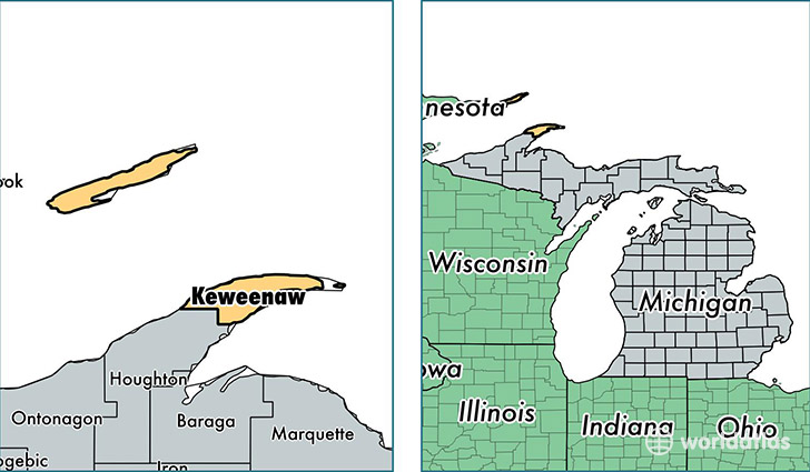
Keweenaw County is a county equivalent area found in Michigan, USA. The county government of Keweenaw is found in the county seat of Eagle River.
With a total 15,452.56 sq. km of land and water area, Keweenaw County, Michigan is the 66th largest county equivalent area in the United States. Home to 2,217 people, Keweenaw County has a total 2469 households earning 39038 on average per year.
Keweenaw County, Michigan offers the following attraction to visitors: Isle Royale NP
Keweenaw County, Michigan - Quick Facts
| FIPS Code | 26083 |
| Area Codes | 906 |
| Time Zone | EST |
| Major Cities | Mohawk (population: 1,151), Ahmeek (population: 355), Allouez (population: 344), Copper Harbor (population: 123) |
| Land Area | 856 sq miles |
| Water Area | 540 sq miles |
| Household Income | $39,038 |
| Housing Units | 2,469 |
| Median Home Value | $101,700 |
| High School Grads | 93% of population |
| Holders of Bachelors Degrees | 24% of population |
| Retail Spending | $1,465 per capita |
| Food & Accomodation Sales | $4,385 per capita |
This page was last updated on June 30, 2016.