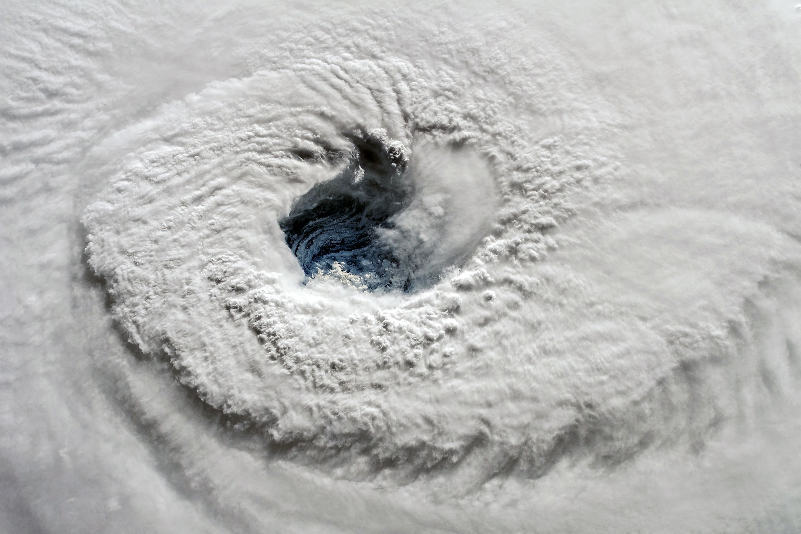
What Is the Eye of a Hurricane?
A violent, swirling thunderstorm. A roiled sea. Death and destruction. That is what a hurricane looks like. The truth is, a hurricane is a bit more complex. Scientists have mapped out a hurricane into three semi-distinct parts. These include the eye, the eyewall, and the spiral bands. Some hurricanes have a fourth part: the moat.
The eye of a hurricane is a circular area of relative calm, typically found at the center of a severe tropical storm. Although the size of a hurricane's eye can range anywhere between 5 and 120 miles, in most cases, the eye spans between 20 and 40 miles. The following is what to know about the eye of the hurricane, including how it forms, some of its main characteristics, and why it is deceptively calm.
How The Eye Forms
Hurricanes are tropical cyclones over the Atlantic or eastern Pacific Oceans. They form over warm ocean waters, typically found near the equator. Because of the heat, warm, moist air above the water's surface will start to rise, leaving behind a low-pressure space with less air. Because of the pressure difference, high-pressure air in the surrounding regions rushes to the low-pressure space. Expectedly, this new air will soon heat as well and, hence, will begin to rise.
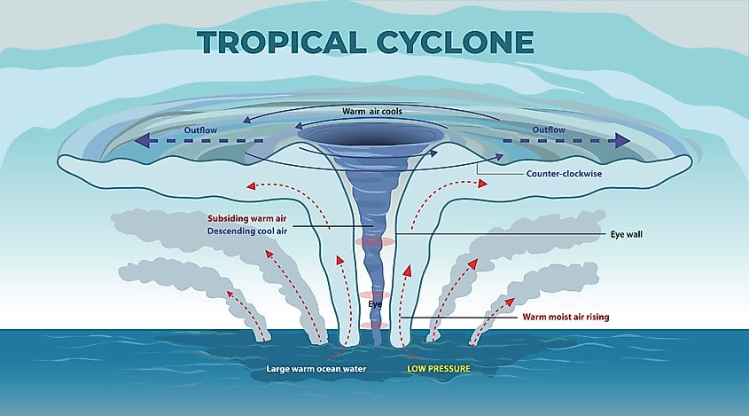
As warm air continues to rise with new air filling the void, a swirling motion starts to take shape. Meanwhile, the mist in the air begins to form clouds. The swirling motion soon transitions into a storm, with storms north of the equator spinning counterclockwise — as those south spin clockwise. This is because of the way the Earth rotates on its axis. As the storm gathers pace and speed, an eye forms in the center, a distinct space of relative calm. Because of this long process, only a mature hurricane has a noticeable eye.
Characteristics Of The Eye
The eye of a hurricane has distinct features and characteristics you may not find anywhere else in the storm. First, the winds in the hurricane’s eye are typically calm and much lighter compared with those in other parts of the hurricane. The winds of the hurricane’s eyewall are particularly known to be much more turbulent.

Secondly, the hurricane's eye often features clear skies. If not clear, the eye will be a bit cloudy. Either way, the eye often features a measure of visibility not associated with other parts of a hurricane.
Also, as we have mentioned, the eye is a low-pressure space. Not just that: the eye is where the atmospheric pressure is at its lowest in a hurricane. Of course, this low-pressure space is necessary because it facilitates the swirling motion of the hurricane.
Lastly, while an eye can span up to 120 miles, they are often between 20 and 40 miles. Think of the distance from New York’s Central Park to Long Beach. Something else: while the eye is relatively calm, this is never a sign that the storm is over.
The Eye Wall
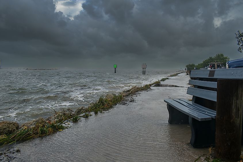
The eyewall is the most destructive part of a hurricane. It is also where it rains most heavily and exhibits the strongest winds. As air rushes into the low-pressure core of a hurricane, it is quickly heated by the warmth of the sea and rises in a surging updraft, causing vertical winds. Indeed, the eyewall exhibits the greatest vertical wind speeds in a hurricane. This can be 5 to 10 meters per second — or 11 to 22 miles per hour. Although these speeds are nothing compared to those of horizontal winds, vertical winds are crucial in a hurricane since they help form the convective clouds in the eyewall, from which much of the rainfall associated with hurricanes emanates.
When updrafts reach the upper boundary of the troposphere, which is the lowest, most-changing layer of Earth's atmosphere, it will start to flow outwards. However, the Coriolis force soon counteracts this outward flow, and an anticyclonic circulation ensues. Because of this, horizontal circulation in the upper parts of a hurricane is opposite to that close to the surface and in the eye.
Eyewalls are not similar in appearance. Moreover, the size and shape of a hurricane’s eyewall may change during the hurricane’s lifetime. In a typical hurricane, a single eyewall encircles the eye. However, a hurricane can have two or three eyewalls at the same time. Multiple hurricane eyewalls are called concentric eyewalls.
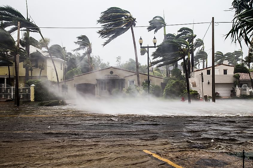
Eyewalls of mature hurricanes sometimes contract over time. During this time, a hurricane’s wind speed will slow down significantly. A new eyewall will then begin to form outside of the contracting eyewall, typically from one of the innermost spiral bands. After a new eyewall forms, the previous one may decay, a period characterized by decreasing wind speeds. With time, the new outer eyewall may also begin to contract, and the hurricane’s strength will increase. This cycle may repeat multiple times and is called an eyewall replacement cycle. Unfortunately, eyewall replacement cycles can be devastating, especially when they occur just before landfall. You may want to think of eyewall replacement as a hurricane shedding its skin.
After the eye passes over an area, one may think the storm is over. Far from it. The eyewall can soon follow, bringing back extreme weather conditions.
Why The Eye Is Deceptively Calm
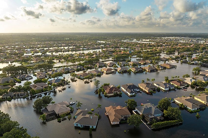
Eyewitnesses have reported seeing beautiful, blue skies when a hurricane's eye envelops an area. There is warmth. There's sunshine. It almost looks like springtime. However, to those who know more about hurricanes, this is the proverbial calm before the storm. Unfortunately, this sudden stillness can be deceptive and can cause untold harm. One may not see them, but swirling just outside the eye are the turbulent winds that make up the eyewall. One may revel in the peaceful state of the eye, not knowing that immediately outside this oasis, winds are roaring at more than 140 miles per hour and blowing in many different directions. Therefore, unless authorities give the green light, it is advisable not to leave a safe room at any point during the life of a hurricane.
While how the eye forms is not completely understood, scientists agree on the general idea. Air is warmed up in the center, rises, and flows out over the storm clouds. Curiously, some air doesn't flow out over the edge but descends directly back to the center. On land, the air that descends overpowers the air that rises, eliminating the possibility of rain. What ensues, therefore, is this deceptive calm.
Common Misconceptions About the Eye Of A Hurricane
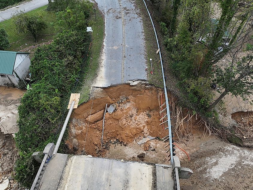
There are certain misconceptions about the eye of a hurricane. The following are a few stand-outs.
- Misconception-1: The eye is always safe.
- Reality: While the eye is calm, it is surrounded by extremely dangerous conditions, and the storm will resume once the eye passes.
- Misconception-2: The eye is small or hard to detect.
- Reality: The eye can be clearly visible on satellite imagery and is often quite large, spanning several miles in diameter. Although typically between 20 and 40 miles in diameter, the eye can span up to 120 miles.
Some Real-World Examples Concerning The Eye Of A Hurricane
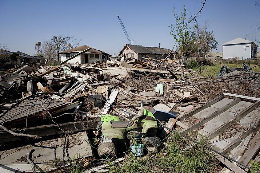
Hurricane Katrina occurred in 2005 and caused more than 1,800 deaths, making it one of the worst disasters in U.S. history. It started as a tropical depression over the coasts of the Bahamas but quickly gained strength with wind speeds of between 39 and 73 mph. As it neared Florida's coast, Katrina's wind speeds surpassed 73 mph, making it a Category 1 hurricane. As it swirled west across the warm waters of the Gulf of Mexico, Katrina picked up speed, with peak levels of about 175 mph, a mark of a Category 5 hurricane.
Katrina had a distinct eye with a central pressure of 920mb at landfall, the third-lowest on record for a United States landfalling hurricane. Its eye was fairly large, extending 37 miles in diameter. Typically, the larger the eye, the larger the storm — and true to expectations — Katrina was huge and caused the costliest havoc in U.S. history.
Although destructive, a hurricane is not uniformly so. The eye of a hurricane is a large, calm space that can appear completely safe and free of danger. However, bordering the eye is the eyewall, by far the most destructive part of a hurricane. Therefore, it is advisable not to venture out during a hurricane, even if everything appears to be back to normal. To be on the safe side, wait for the authorities to give the green light.


