Maps of Gabon
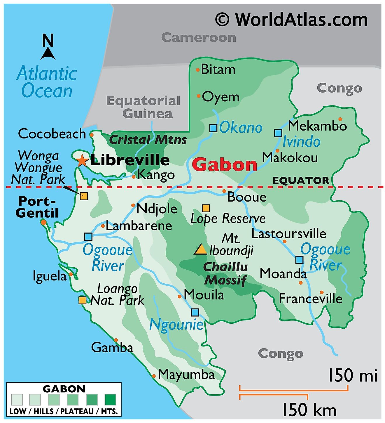
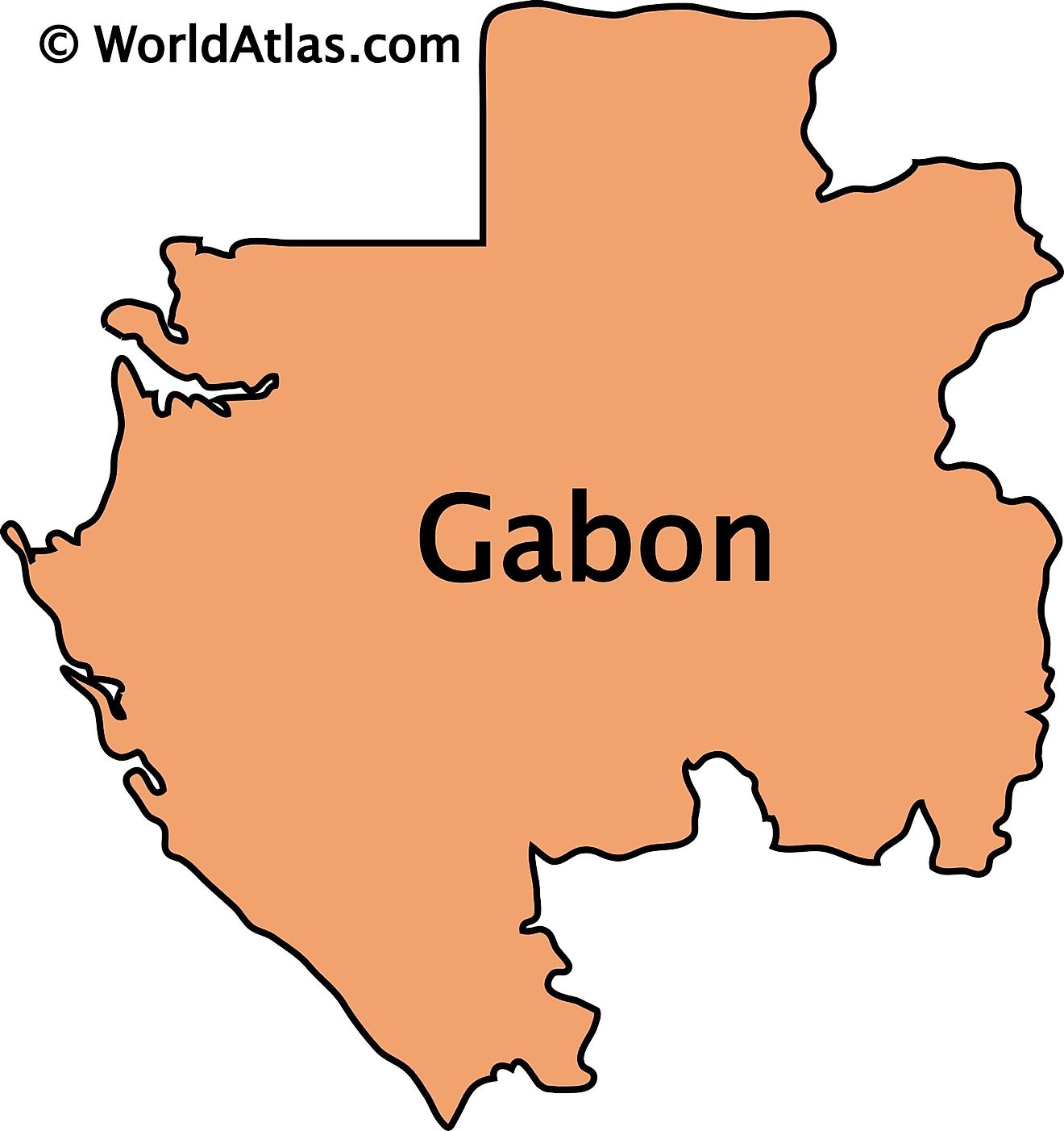
Gabon, located on the west coast of Central Africa, shares its borders with Equatorial Guinea to the northwest, Cameroon to the north, the Republic of Congo to the east and south, and the Atlantic Ocean to the west. The country encompasses an area of approximately 267,667 km2 (103,347 mi2).
The Gabonese landscape has several geographical regions and several rivers:The Coastal Plain, stretching up to 20 kilometers (12 miles) inland from the Atlantic Ocean in the west, features a mosaic of lagoons, sandy beaches, and mangrove swamps. This region transitions into the Crystal Mountains, a series of rolling hills northwest of the Ogooué River, where the elevation gradually increases as one moves inland.
Central Gabon is dominated by the vast Ogooué Basin, characterized by its dense equatorial forests and the Ogooué River, Gabon's most significant and longest river, which bisects the country.
The Chaillu Massif in the east is home to the country's highest point, Mont Iboundji, which reaches an elevation of 1,575 meters (5,167 feet). This region features a series of plateaus interspersed with small valleys and is characterized by its rugged terrain and dense forest cover.
The Woleu-Ntem Plateau lies in the northeastern corner of Gabon. This highland area, extending into Cameroon and Equatorial Guinea, is characterized by its undulating terrain and savanna grasslands, contrasting with the dense forests prevalent in other parts of the country.
Major bodies of water: Aside from the Ogooué River, Gabon also features several other notable rivers including the Nyanga, Ntem, and Ivindo. There are several concentrated bodies of water like Lake Oguemoué and Lake Onangue, as well as lagoons like Fernan Vaz Lagoon, Nkomi Lagoon, and Muni Estuary.
Gabon Provinces Map
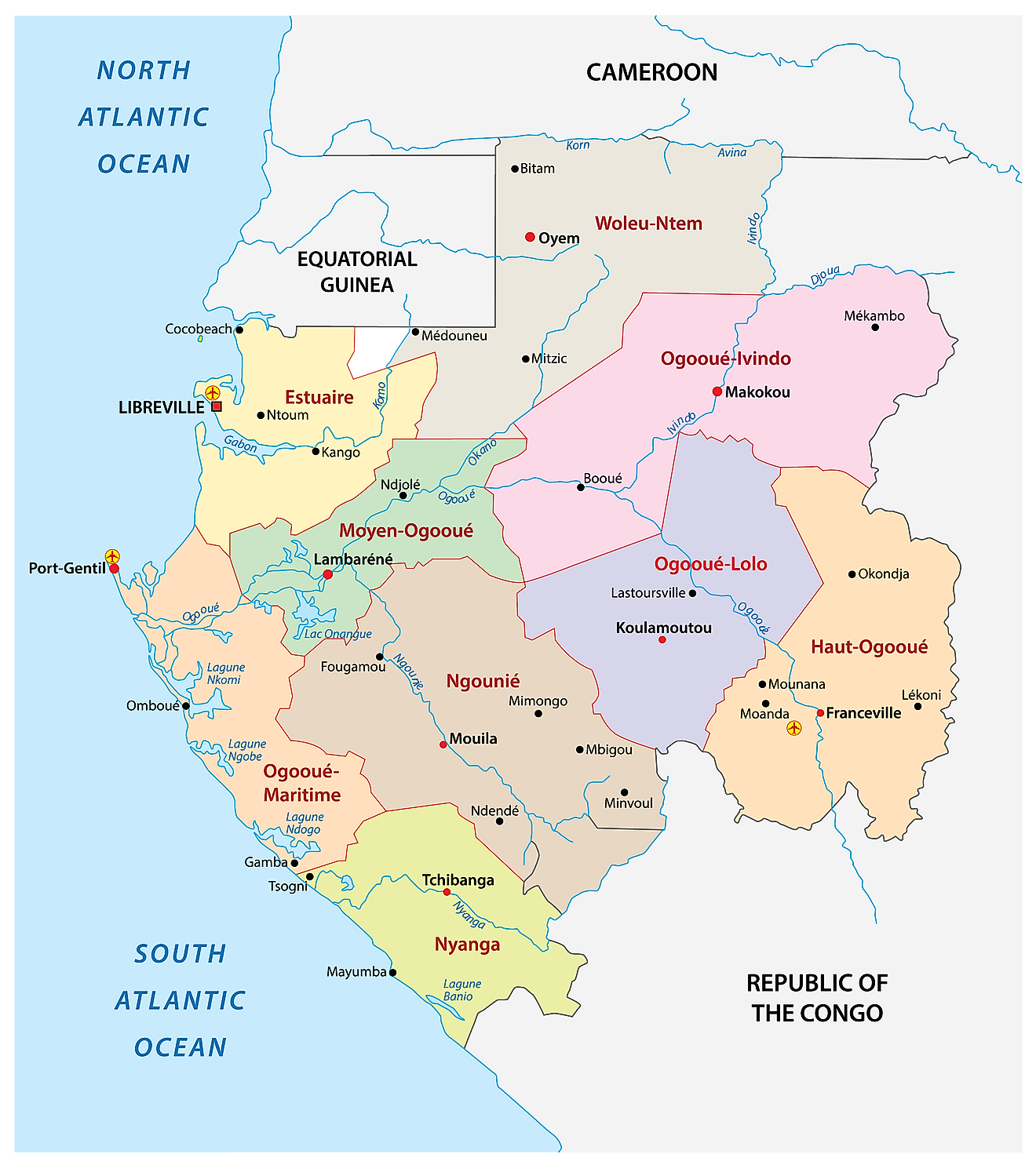
Gabon has nine provinces which are further subdivided into 50 departments. In alphabetical order, the provinces are as follows: Estuaire, Haut-Ogooue, Moyen-Ogooue, Ngounie, Nyanga, Ogooue-Ivindo, Ogooue-Lolo, Ogooue-Maritime, and Woleu-Ntem. These provinces are further subdivided into 50 departments. With an area of 46,075 sq. km, Ogooue-Ivindo is the largest province by area and Estuaire is the most populous one. The latter hosts the national capital of Libreville.
Where is Gabon?
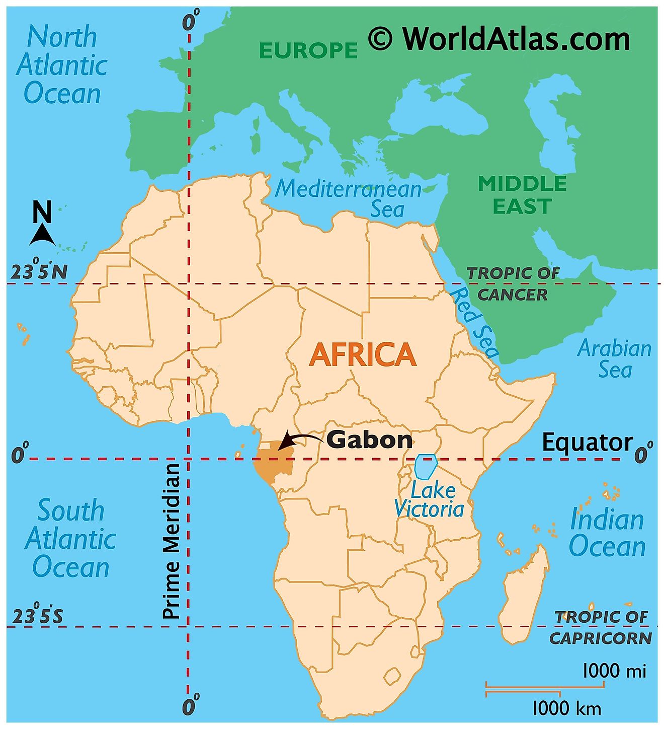
Gabon is a country in Central Africa. It is located in the Eastern Hemisphere. As the Equator passes through Gabon, it stretches into both the Northern and Southern Hemispheres. Gabon is bordered by three countries. The Republic of the Congo borders it to the east and south. Cameroon lies to the north and Equatorial Guinea to the northwest. Gabon has a coastline on the Gulf of Guinea to the west.
Gabon Bordering Countries: The Congo, Equatorial Guinea, Cameroon.
Regional Maps: Map of Africa
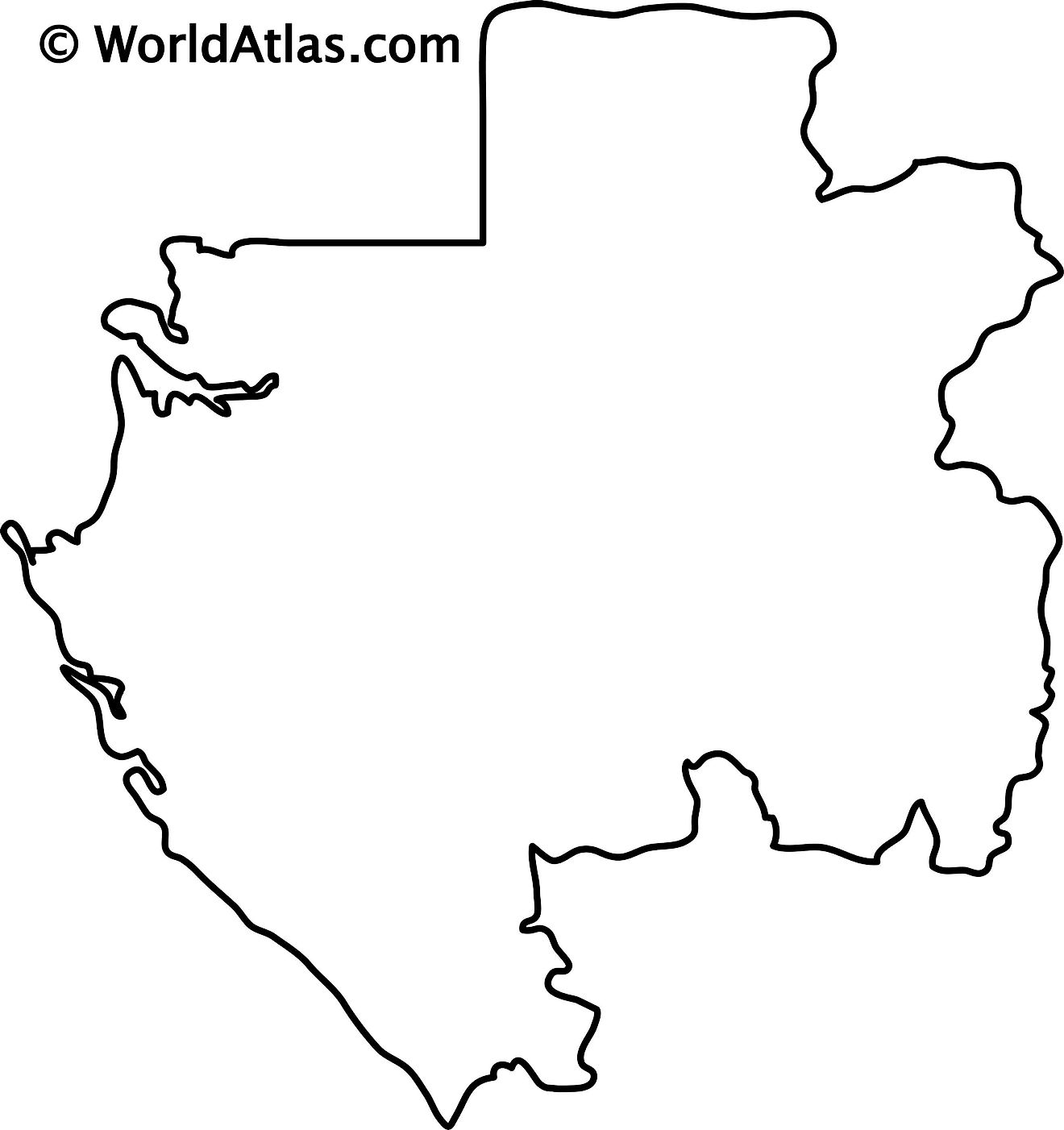
Outline Map of Gabon
Key Facts
| Legal Name | Gabonese Republic |
|---|---|
| Flag |
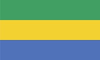
|
| Capital City | Libreville |
| 0 23 N, 9 27 E | |
| Total Area | 267,667.00 km2 |
| Land Area | 257,667.00 km2 |
| Water Area | 10,000.00 km2 |
| Population | 2,172,579 |
| Largest City |
Libreville (869,773) |
| Currency | Cooperation Financiere en Afrique Centrale francs (XAF) |
| GDP | $16.66 Billion |
| GDP Per Capita | $7,667.37 |
This page was last updated on November 13, 2023
