Maps of Sudan
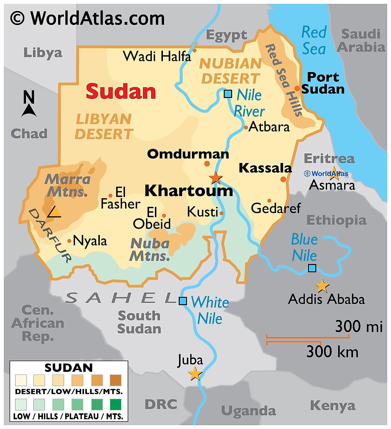
Sudan is the third largest nation in all of Africa occupying an area of 1,886,068 sq. km. Sudan shares a border with its seven neighbors: South Sudan, Ethiopia, Eritrea, Egypt, Libya, Chad, and the Central African Republic. Sudan also has a significant coastline along the Red Sea. This narrow strip of water gives vital access to the Indian Ocean as well as the Mediterranean Sea through the Suez Canal. Much of Sudan consists of deserts and arid grasslands with little in the way of vegetation. Massive plains and plateaus cover most of the nation.
The central plain of the country can be divided into three regions depending on topography. The northern part of this plain is a primarily rocky desert area called the Nubian Desert (as shown on the map). The central-southern part is a clay plain while the western part features a desert area covered by sand dunes.
The Nile River Valley is perhaps the most important geographic feature in the nation. The Nile River has long been the beating heart of this part of the world. Much of the land fit for farming and permanent settlements can be found along the shores of the Nile including the capital city of Khartoum. The Nile River and its tributaries flow from south to north and drain most of the country. The River enters Sudan as the White Nile and then joins the Blue Nile (from the Ethiopian Plateau) at Khartoum to form the Nile River.
The Marrah Mountains rise out of the Darfur Plateau in the west. This area of Sudan hosts the tallest peak in the country, the Deriba crater which is 3,042 m tall. This part of Sudan is particularly inhospitable and has a very low number of people living there. To the north of the Marrah mountain range is the Libyan Desert, the largest in Sudan.
The Red Sea Hills sits along the eastern edge of the county. This region is made up of rugged hills cut by fast-moving streams. A narrow coastal plain lies to the east of this hilly region along the Red Sea. Sudan is mainly composed of vast plains and plateaus that are drained by the Nile River and its tributaries. This river system runs from south to north across the entire length of the east-central part of the country.
States of Sudan Map
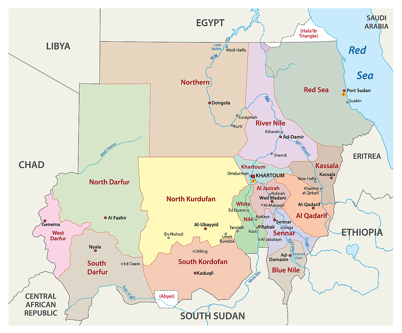
As observed on the map above, the Republic of Sudan has 18 states or 18 wilayat. In alphabetical order, these are Blue Nile, Central Darfur, East Darfur, Gedaref, Gezira, Kassala, Khartoum, North Darfur, North Kordofan, Northern, Red Sea, River Nile, Sennar, South Darfur, South Kordofan, West Darfur, West Kordofan, and White Nile.
Before July 9, 2011, Sudan was composed of 25 states. 10 of these states were ceded to the newly formed country of South Sudan resulting in Sudan having only 15 states. In 2012, two new states were created within the territory of Sudan and a third one was created in 2013. Thus, the total number of states in the country is now 18.
The country also has an area with a special administrative status called the Abyei Area. It is located on the border between Sudan and South Sudan. Khartoum is the capital city of the country.
Where is Sudan?
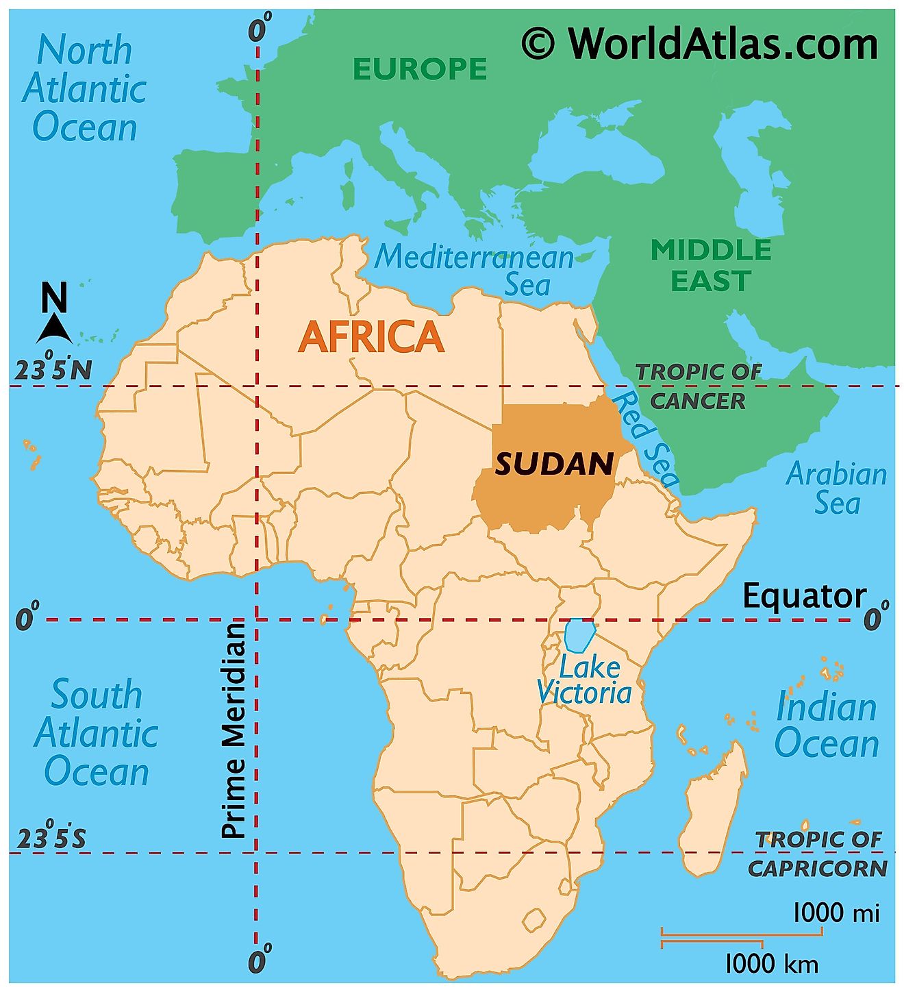
Sudan is a Northeast African country. It is located in the Northern and Eastern Hemispheres of the Earth. Sudan is bordered by seven countries. Egypt bounds it to the north. It has borders with Libya and Chad to the northwest and west respectively. To the south and southeast are South Sudan and Ethiopia respectively while Eritrea borders Sudan to the east. The northeastern boundary is formed by the Red Sea.
Sudan Bordering Countries: The Central African Republic, Egypt, Ethiopia, South Sudan, Eritrea, Libya, Chad, Mongolia.
Regional Maps: Map of Africa
Outline Map of Sudan
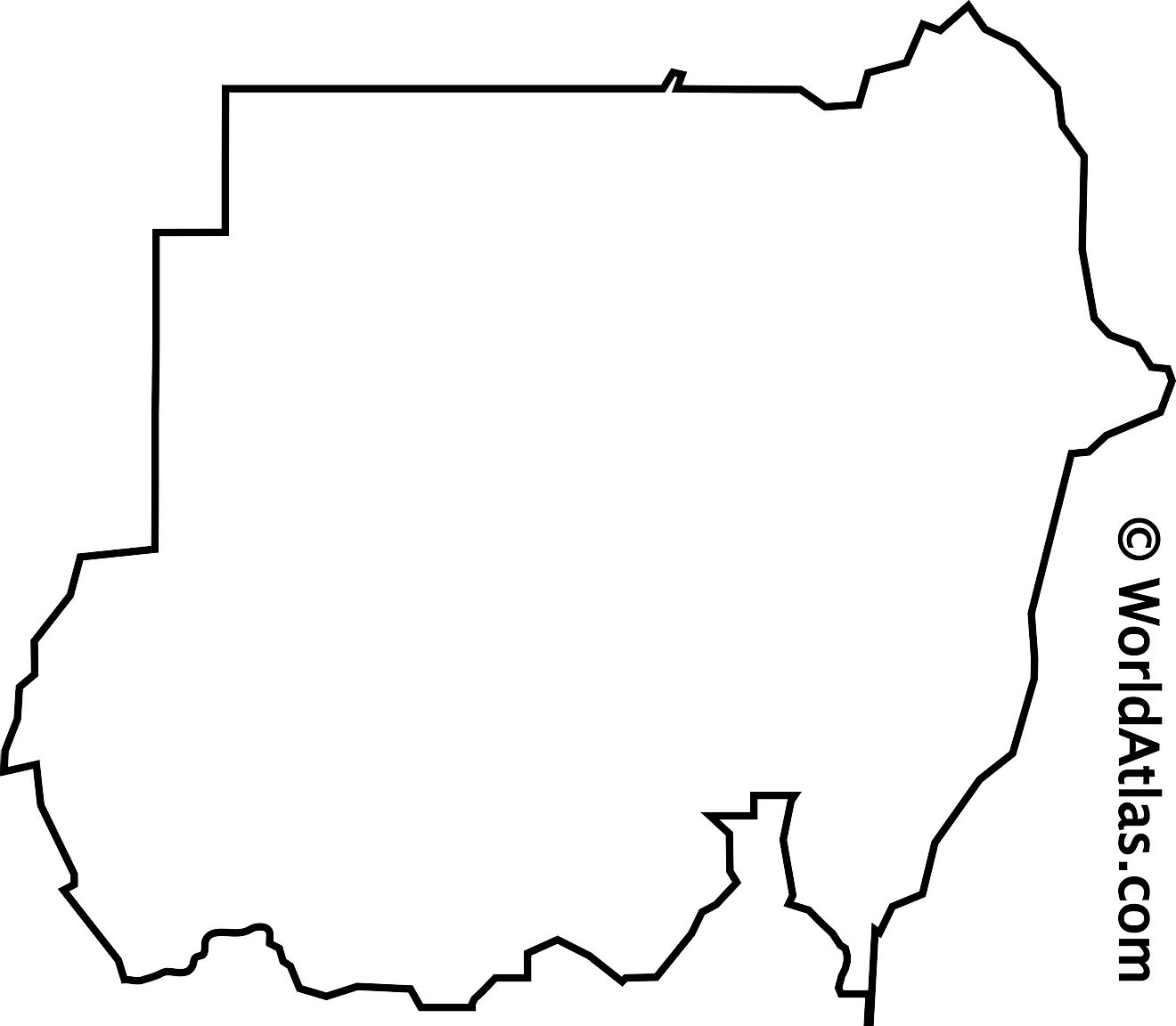
The blank outline map respresents mainland Sudan. The country has several islands on the Red Sea. The above map can be downloaded for free, and used for educational purposes like map-pointing activities.
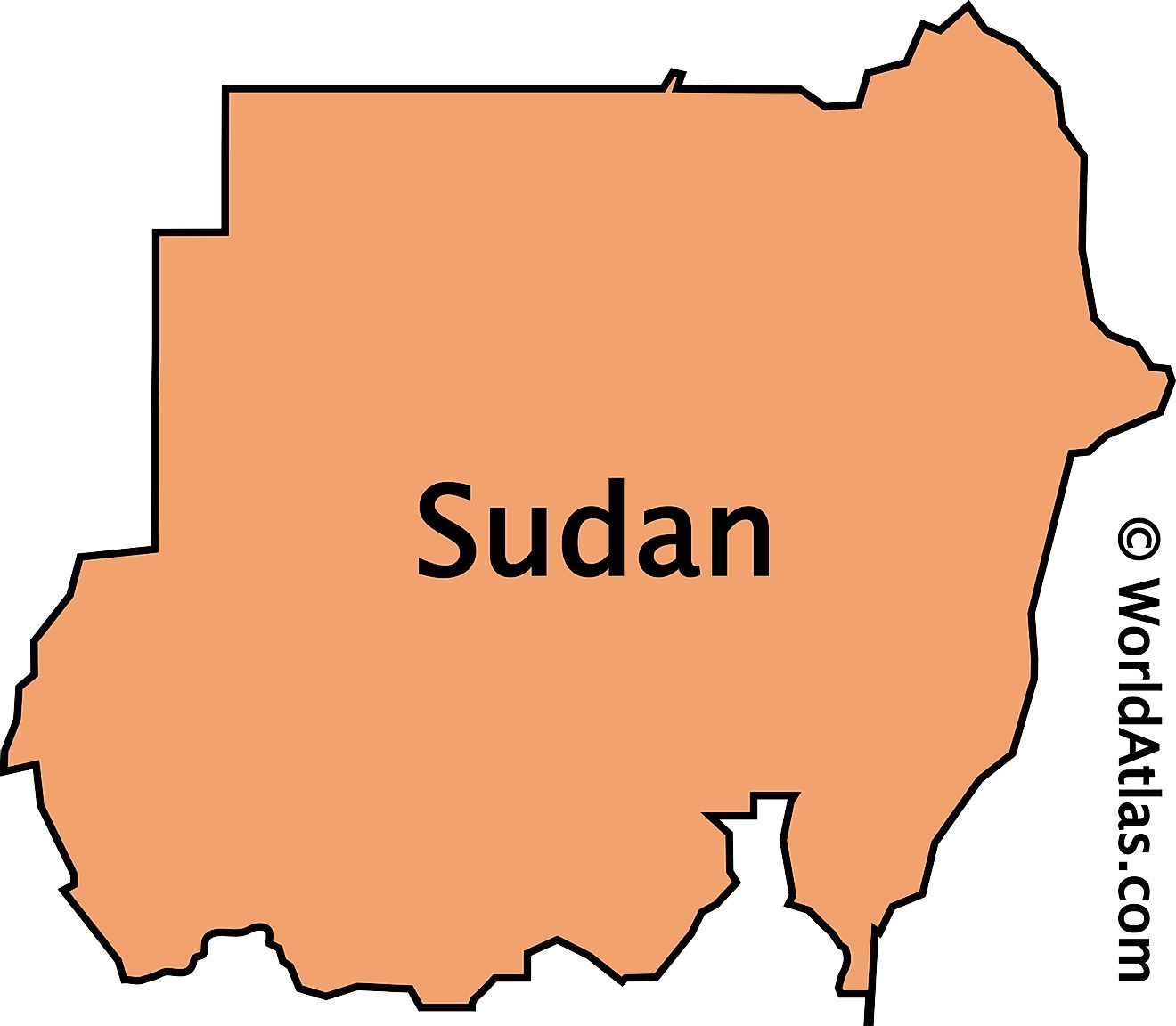
The outline map represents the mainland territory of the Northeast African country of Sudan. This relatively large country has several islands on the Red Sea.
Key Facts
| Legal Name | Republic of the Sudan |
|---|---|
| Flag |
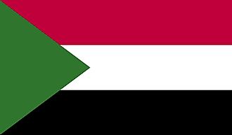
|
| Capital City | Khartoum |
| 15 36 N, 32 32 E | |
| Total Area | 1,861,484.00 km2 |
| Land Area | 1,731,671.00 km2 |
| Water Area | 129,813.00 km2 |
| Population | 42,813,238 |
| Major Cities |
|
| Currency | Sudanese pounds (SDG) |
| GDP | $18.90 Billion |
| GDP Per Capita | $441.51 |
This page was last updated on December 17, 2023
