Maps of Maryland

Maryland, a state in the eastern United States, shares borders with Pennsylvania to the north, Delaware to the east, West Virginia to the southwest, and Virginia to the south and west. It also has a significant coastline along the Atlantic Ocean. It also encloses the District of Columbia on three sides. The state's total area encompasses 12,407 mi2 (32,133 km2).
From western Maryland to eastern Maryland, these are the five primary geographical regions that make up the state:
Appalachian Plateaus Province: This region, particularly the Allegheny Mountain Section, marks the westernmost part of Maryland. Characterized by rugged terrain and forested mountains, it includes the state's highest point, Backbone Mountain, reaching an elevation of 3,360 feet (1,024 meters). This area is noted for its deep valleys and uneven topography, a result of extensive geological activity over millions of years.
Ridge and Valley Province: Encompassing the Folded Appalachian Mountains section and the Great Valley Section, this region is marked by a series of parallel ridges and valleys. These features are the result of erosion and the folding of the earth's crust. The landscape here is a mix of narrow, steeply sloped ridges and broad, fertile valleys, offering a stark contrast to the adjacent plateau.
Blue Ridge Province: This area is defined by the Blue Ridge Mountains, a part of the Appalachian Mountains range. The region is characterized by its notable elevation and distinct blue color, especially visible from a distance. The Blue Ridge Province serves as a natural barrier and a significant watershed in the state.
Piedmont Plateau Province: This province is divided into the Lowland Section and the Upland Section. The Lowland Section, closer to the Atlantic Coastal Plain, features rolling hills and is crucial for the state's agriculture due to its fertile soil. The Upland Section, in contrast, is hillier and includes the state's major cities such as Baltimore. This area transitions from the mountainous regions to the west and the flatter coastal areas to the east.
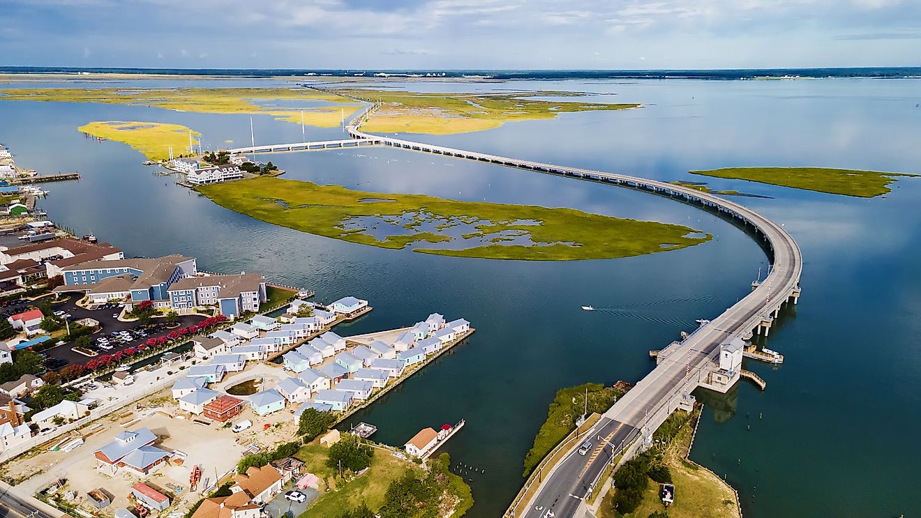
Coastal Plain Province: Separated from the inland regions by the "Fall Line" escarpment, this province includes the Western Shore Uplands, the Western Shore Lowlands, and the Delmarva Peninsula. The Chesapeake Bay, a significant feature, bisects this province. The Coastal Plain is characterized by flat, sandy terrain and includes the state's lowest point at sea level along the Atlantic coast. The Chesapeake Bay heavily impacts the terrain of this region by creating a landscape of marshes, wetlands, and small islands.
Major Bodies of Water: Maryland hosts several major rivers, including the Potomac, which defines much of its boundary with Virginia and West Virginia. Other significant rivers include the Patapsco, Patuxent, and the Susquehanna, which originates in New York and flows into the Chesapeake Bay. While the state does not have large natural lakes, it does have several important reservoirs like Deep Creek Lake, the largest inland body of water in Maryland.
Counties Map
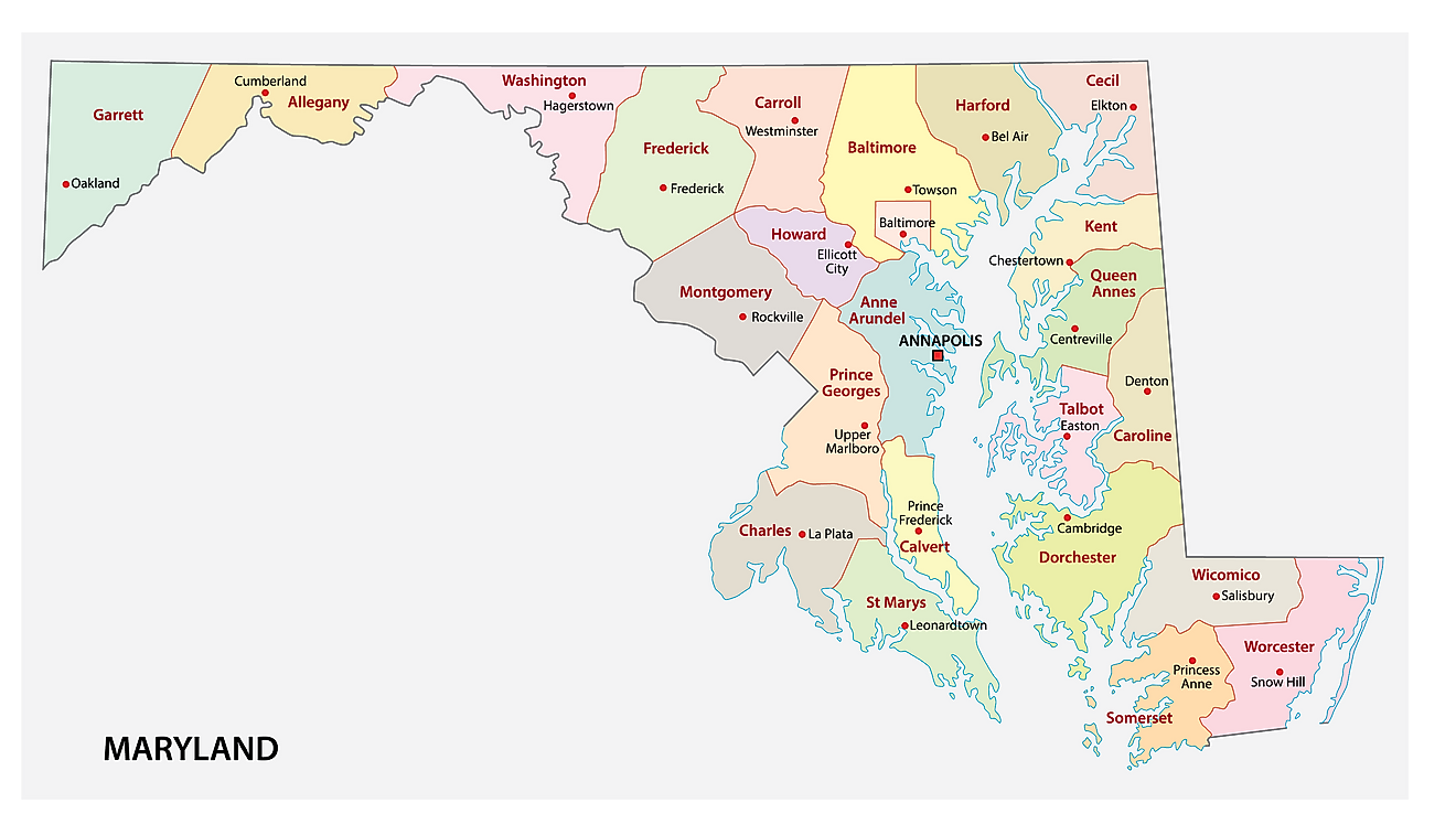
The State of Maryland is divided into 24 counties. In alphabetical order, these counties are: Allegany, Anne Arundel, Baltimore, Baltimore City, Calvert, Caroline, Carroll, Cecil, Charles, Dorchester, Frederick, Garrett, Harford, Howard, Kent, Montgomery, Prince Georges, Queen Annes, Saint Marys, Somerset, Talbot, Washington, Wicomico, and Worcester.
With an area of 32,133.2 sq. km, the State of Maryland is among the smallest states in the US in terms of both area and population density. Located in Anne Arundel County, along the Severn River, at the mouth of the Chesapeake Bay is Annapolis – the capital city of Maryland. Situated in the north-central part of the state is Baltimore – the largest and the most populous city of Maryland. Baltimore also serves as a major seaport and the economic center of the state.
Where is Maryland?
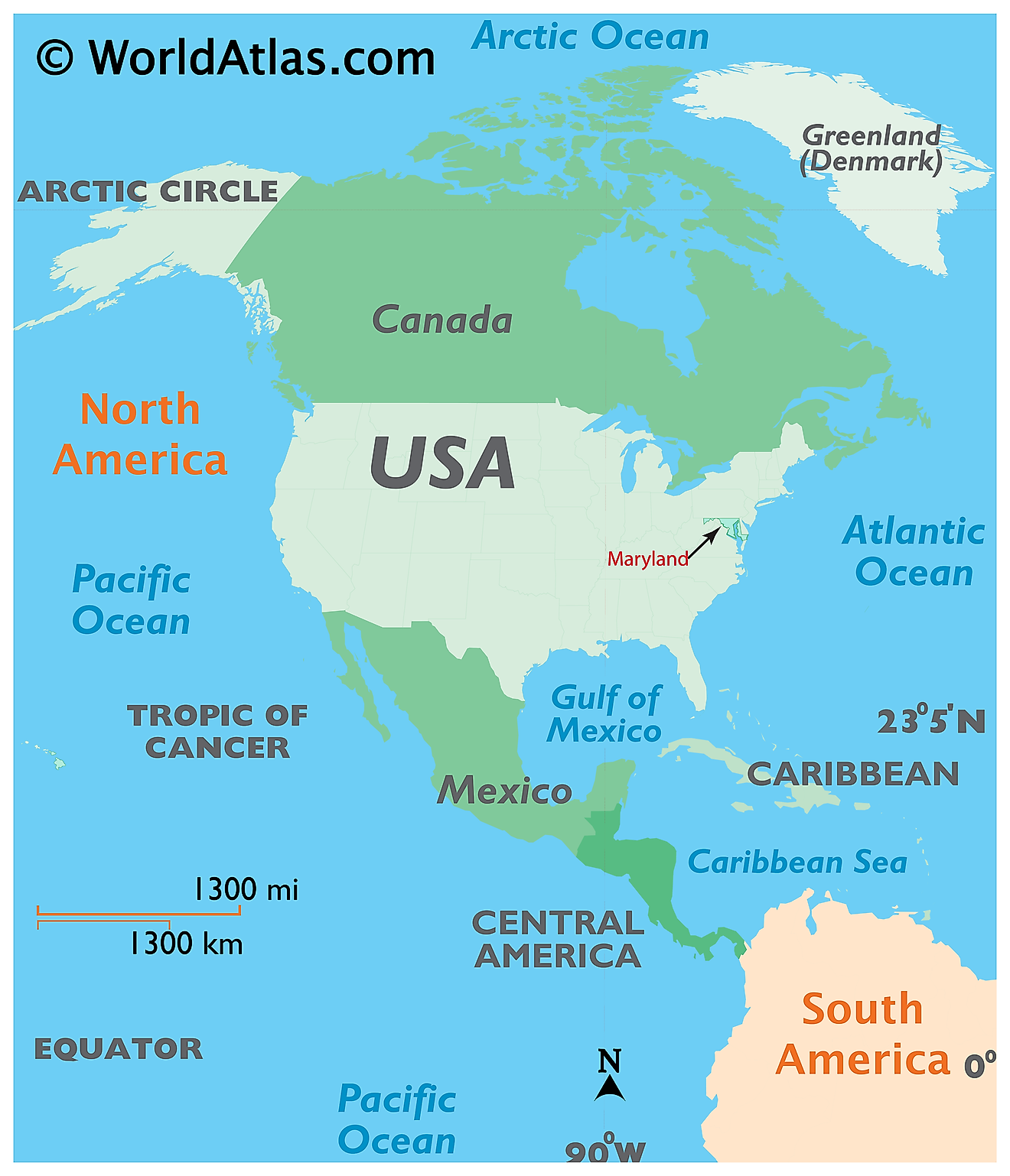
The State of Maryland is located in the Mid-Atlantic region of the United States. Maryland is bordered by Pennsylvania in the north, by Virginia, West Virginia, and Washington D.C. in the west and south, and by Delaware and the Atlantic Ocean in the east.
Regional Maps: Map of North America
Outline Map of Maryland
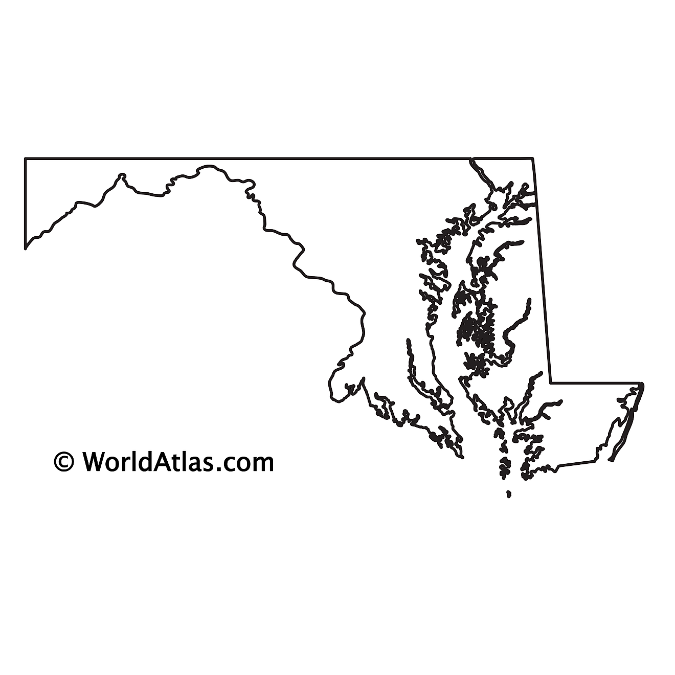
The above blank map represents the State of Maryland, located in the Mid-Atlantic region of the United States. The above map can be downloaded, printed and used for geography education purposes like map-pointing and coloring activities.
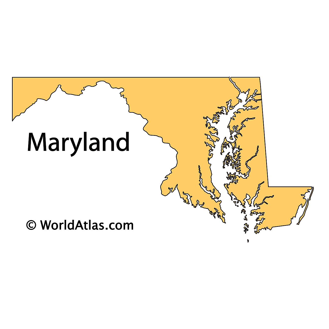
The above outline map represents the State of Maryland, located in the Mid-Atlantic region of the United States.
Key Facts
| Legal Name | State of Maryland |
|---|---|
| ISO 3166 Code | US-MD |
| Capital City | Annapolis |
| Largest City |
Baltimore (2,354,936) |
This page was last updated on January 18, 2024
