Aral Sea
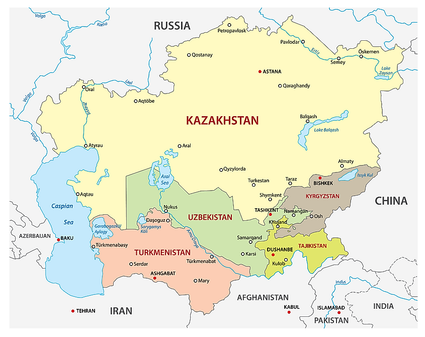
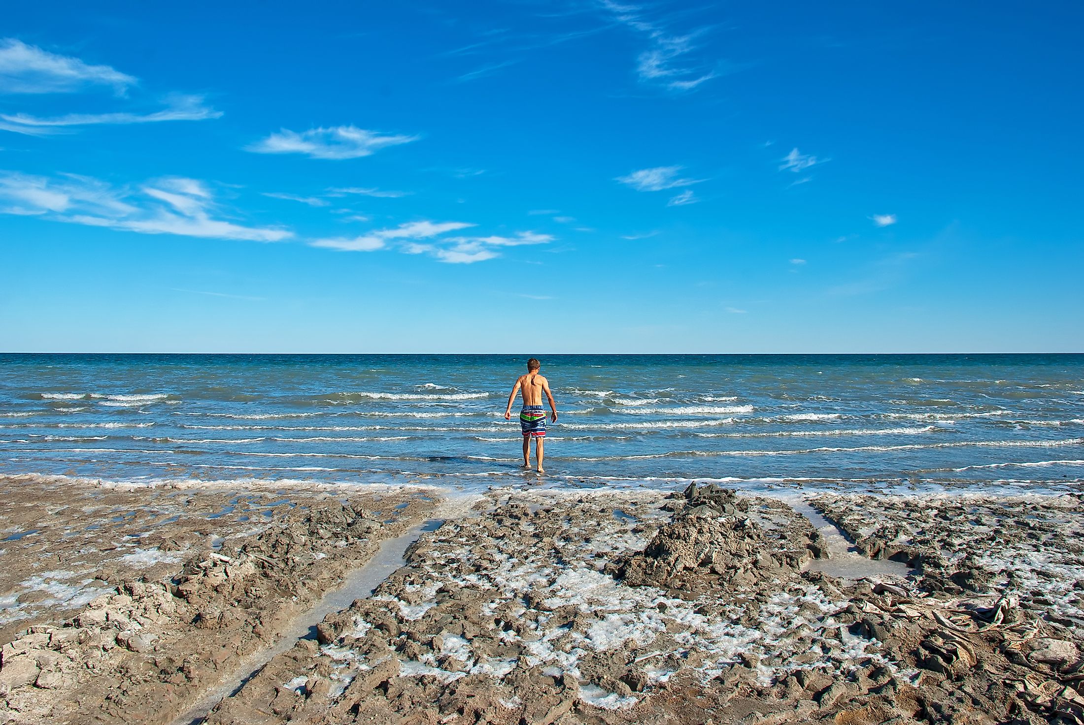
Up to the late 20th century, the shallow Aral Sea was the world’s fourth-largest saline lake, spanning 63,000 square kilometers. However, the lake started shrinking in the 1960s, when the Soviet government decided to divert two of its main inlet rivers, the Syr Darya and the Amu Darya, to irrigate the surrounding desert region. The lake’s remnants sit between Kazakhstan and Uzbekistan. The lake’s salinity level has risen from less than 10 grams/liter to over 100 g/l in the remnant lake. The once-prosperous region is now heavily polluted, with serious public health concerns. However, there are ongoing efforts to save the Aral Sea from completely drying off.
Contents:
- Location
- Geology And Formation
- Climate And Hydrology
- Brief History
- The Diminishing Sea
- Impact
- Restoration Strategies
Location
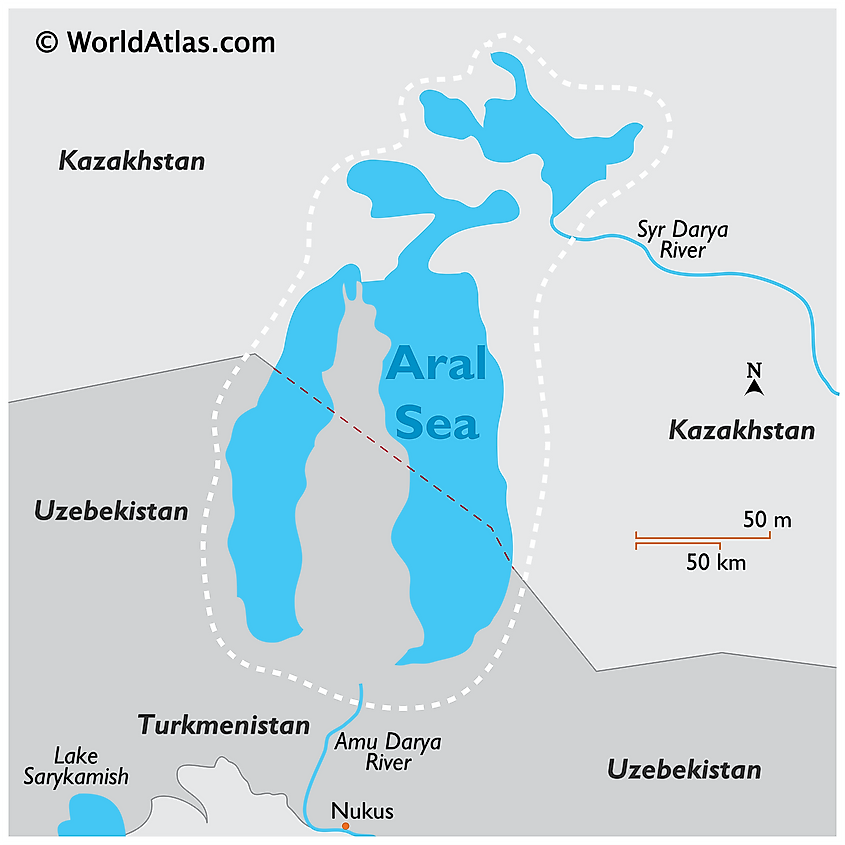
The Aral Sea, also known as Orol Dengizi (Uzbek) or Aral Tengizi (Kazakh) is a saline lake in Central Asia straddling the boundary between Uzbekistan and Kazakhstan to the south and north. The lake once covered 68,000 square kilometers between the Kyzylorda and Aktobe regions in Kazakhstan and the Karakalpakstan region of Uzbekistan. The Caspian Sea on the west is the lake’s nearest large water body. Its catchment area is approximately 1.5 million square miles and drains Uzbekistan and portions of Kazakhstan, Tajikistan, Afghanistan, Turkmenistan, Iran, and Kyrgyzstan.
Geology And Formation
The depression, later filled with water and became the Aral Sea, formed in the late Neogene Period, about 2.6 million years ago. During this period, the Amu Darya River, one of Aral’s main inlets, drained into the Caspian Sea. But some geographers, like Nick Middleton, believe the rivers started flowing into Aral in the current geological epoch (Holocene epoch). However, Syr Darya may have started flowing into the lake much earlier. The region may have dried up from around mid-Pleistocene Epoch and flooded again in the early Holocene Epoch. The Amu Darya temporarily diverted to the Aral Sea and combined with the Syr Darya to become the lake's main water source until the 1960s. The two rivers accounted for 75% of the water into the lake, while 25% was rainwater.
Climate And Hydrology
The Aral Sea is located within the harsh climate region of Central Asia. The area experiences a desert-continental climate, characterized by hot summers, cold winters, and varying diurnal air temperature. The Aral region receives sparse rainfall, with an average annual precipitation of 100 mm. Showers are frequent in autumn and spring. Northwesterly winds are common in winter and autumn, while southwesterly and westerly winds prevail in summer and spring.
Until the 1960s, the Ural Sea’s main source of water was rivers Syr Darya and the Amu Darya, accounting for close to four-fifth of its water supply. Rainfall accounted for the rest of the waters. However, when the Soviet government diverted the rivers to irrigate the farms in Ferghana Valley, the water balance was greatly affected due to the high evaporation rate. Evaporation reduced the water level in the lake by the same amount brought in by the rivers. Therefore, the diversion of the rivers caused the sea to shrink slowly over the years. Over the years, the water level has decreased by more than 20 feet. The size of the lake has also declined to less than 10% of the original area.
Brief History
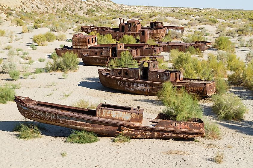
Desert nomads inhabited most of the areas around the lake. However, not much is known about them since they left few written records. Later, the Kwarazm of the Tang Dynasty occupied the Oxus delta in the south and established the Chinese western frontier in the region. Russian expedition, led by Alexey Butakov, conducted the first Aral Sea for exploration in 1848. Three years later, they established the first fishing industry in the area. However, the Russian navy established the first post on the Aral region at Raimsk in 1847, which later became Fort Aralsk. Since the Aral Sea does not connect to any other water body, the Russians dissembled their vessels and transported them overland then reassembled them at Aralsk. One of the vessels was used by Butakov to survey the lake region in 1848. It took the Russians two years to explore the entire area
The Diminishing Sea
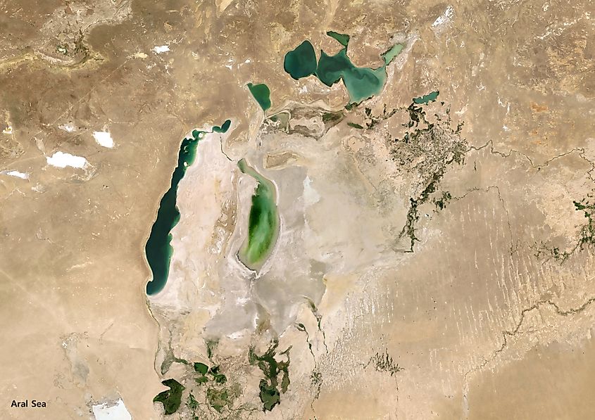
Before the 1960s, the Aral Sea had a maximum depth of 69 meters (western shores) and a surface area of 68,000 square kilometers. It has a maximum length of 435 kilometers from north to south and was 290 kilometers wide from west to east. However, the average depth was less than 16 meters. The northern shore had numerous bays and the eastern shore had a huge river delta (Syr Darya) bordered by shallow waters. Amu Darya delta is on the southern shores.
In the early 1960s, the Soviet government came up with a plan to make cotton one of its chief exports. As part of the plan, waters from the Syr Darya and the Amu Darya were diverted from flowing into the Aral Sea to irrigate the desert region. The Soviets converted large tracts of unused land in Uzbekistan, Kazakhstan, and Turkmenistan into farmland and depended on water from the two rivers and their tributaries. Although many canals were constructed in the 1960s, most of them were poorly constructed, allowing excess leakage and evaporation and wasting 30%-75% of the water.
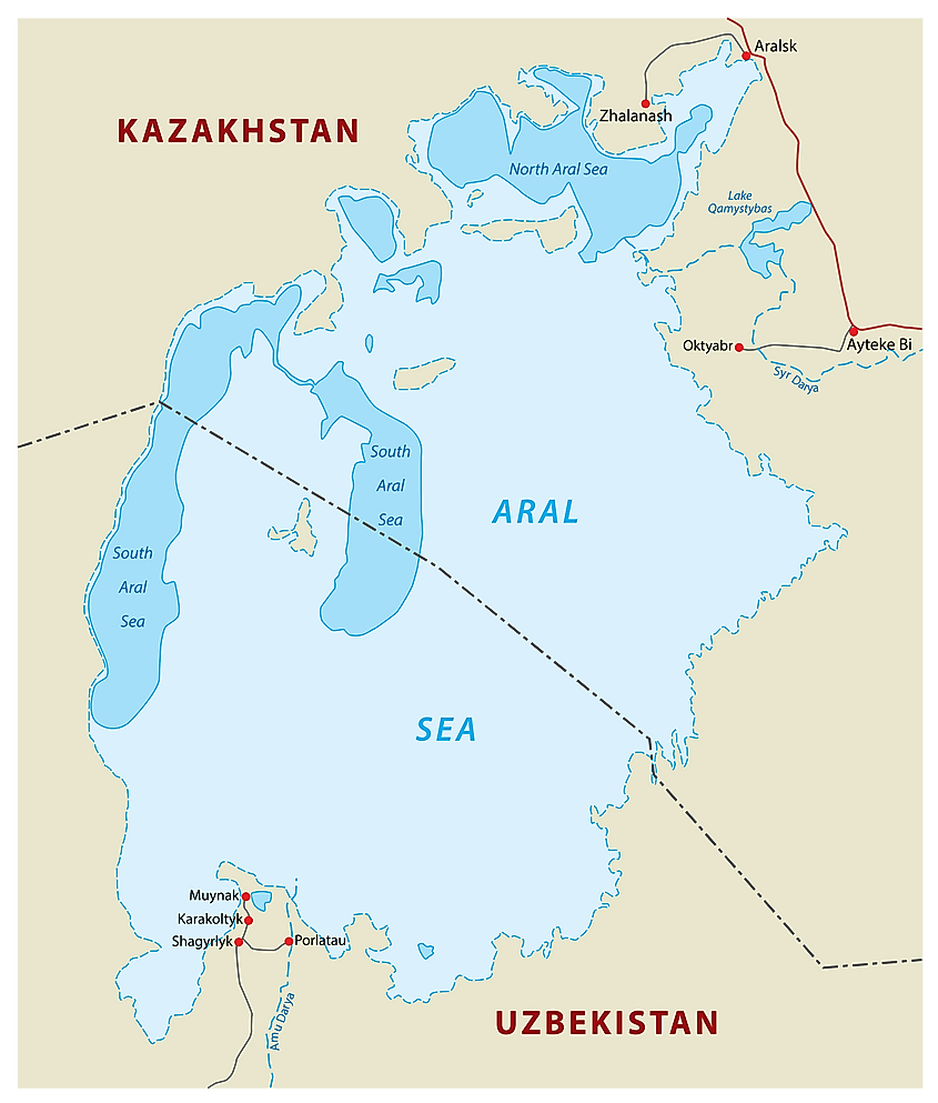
By 1960, the Soviet government had diverted close to 60 cubic kilometers of water from going to the Aral Sea. Between 1961 and 1970, the lake’s water level decreased by about 20 centimeters annually. By the end of the 1980s, the water level reduced by at least 80 cm every year. By 1989, the lake had receded and formed two separate portions; the Lesser Sea (North Aral Sea) and Greater Sea (South Aral Sea). Between 1960 and 1998, the lake’s surface area shrank by over 60%, and volume reduced by over 80%. By 2004, only 25% of the Aral Sea's water surface was left. The salinity level had also increased nearly ten times, from 10 g/l in the 1960s to 100 g/l in the 200s.
Impact
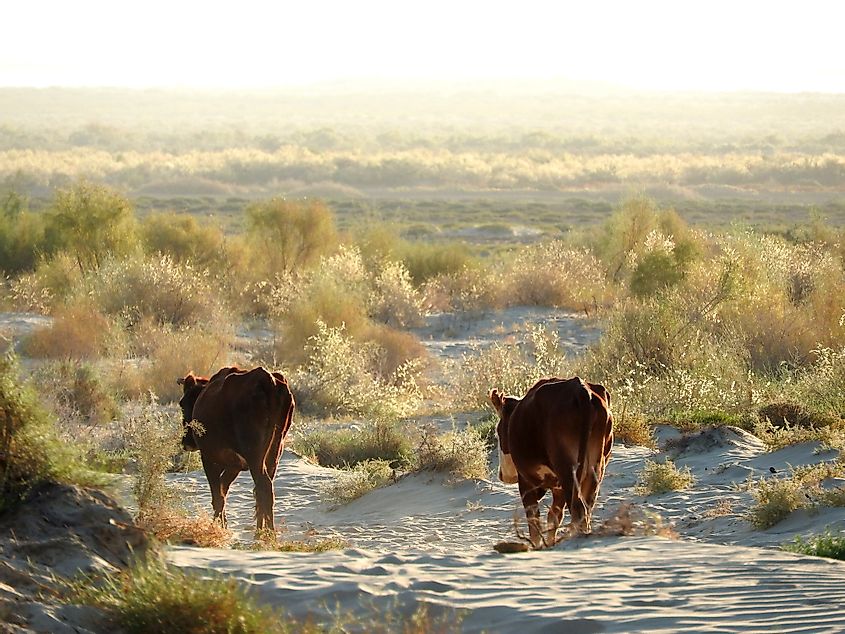
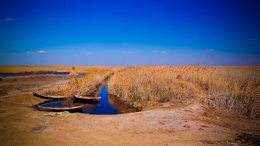
The disappearance of the Aral Sea did not surprise the Soviets since they expected it to happen at some point. However, not many people were prepared to deal with the environmental consequences that would follow. The lake’s rapid shrinkage has led to numerous problems in the region, chief of which is ecosystem collapse. The high mineral and salt content has made the water unfit for use by both wildlife and humans and killed off once-abundant marine species, such as a barbell, carps, sturgeon, and roach.
The fishing industry that once thrived in the region, employing over 40,000 people, was virtually destroyed. As soon as the water levels dropped, the health of the people living in the region began deteriorating. Dust blown from the sea bed contained toxic material, such as fertilizers, salt, and pesticides. The most affected populations are women and children. Some children are born with low birth weight and abnormalities resulting from toxic substances. Major complications among adults range from kidney diseases, anemia, and throat cancer.
Restoration Strategies
The Aral Sea's survival and future lie in the decisions made by five countries; Turkmenistan, Kazakhstan, Tajikistan, Uzbekistan, and Kyrgyzstan. The five countries adopted the Aral Sea Basin Program in 1994 as part of the restoration strategy. The program aimed to stabilize the basin’s environment, rehabilitate the areas around the sea, and improve the lake’s water management. The program has received overwhelming support from various international bodies, including the World Bank, UNDP, USAID, ADB, and other foreign governments. However, the restoration process has faced numerous challenges, including lack of co-operation by the member states and lack of public awareness of some initiatives.
