Four Corners, United States
The Four Corners is an area located in the southwestern region of the United States which serves as a meeting point of four different states. The region comprises the northeastern part of the state of Arizona, the southwestern edge of Colorado, the southeastern part of Utah, and the northwestern corner of New Mexico.
Geography
The Four Corners region forms a part of the larger Colorado Plateau desert area in the southwestern region of the United States and features a rural and rugged terrain. Some of the significant mountain ranges that are located in this area include Abajo Mountains, Sleeping Ute Mountains, and the Chuska Mountains.
According to the Köppen climate classification, the Four Corners region experiences a cold desert climate with hot and dry summers and cold and sunny winters.
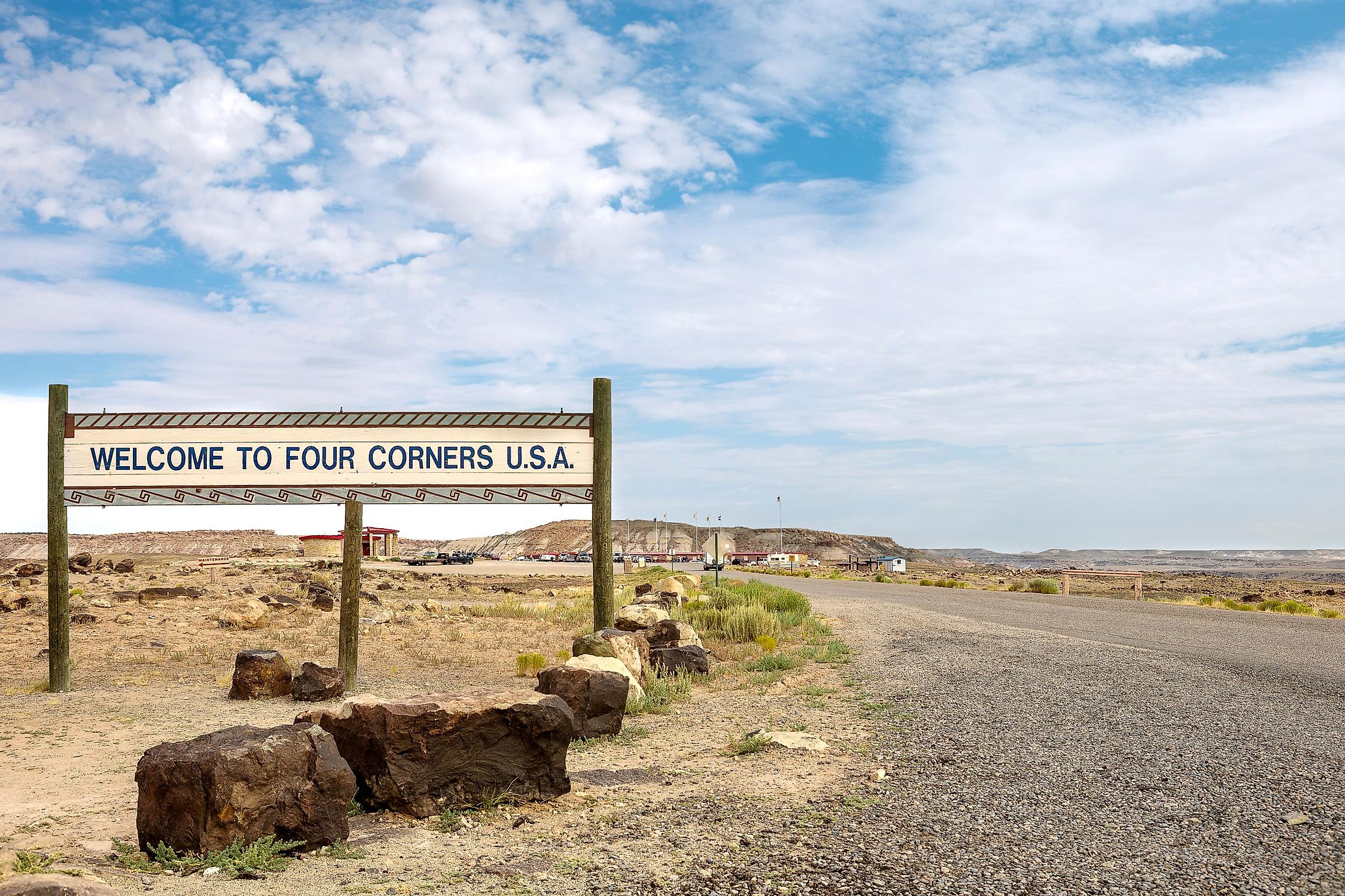
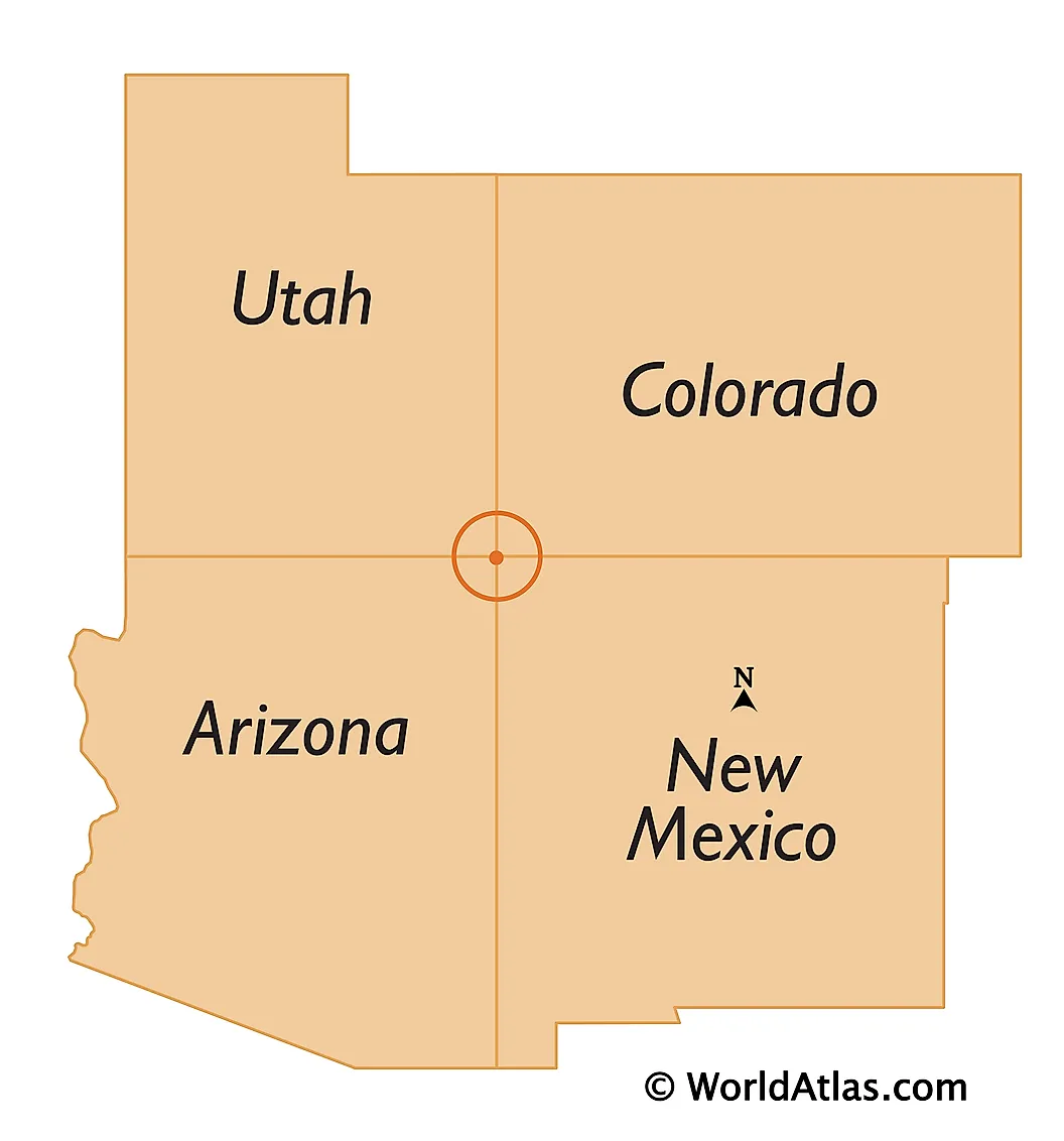
Located at 36°59'56.3"N 109°02'42.6"W is the Four Corners Monument, the only quadripoint in the United States where four different states converge. The Monument is positioned in the Colorado Plateau region, to the west of the US Highway 160 and about 64 km southwest of the city of Cortez in the US State of Colorado. The Four Corners Monument also serves as a political boundary between the two semi-autonomous Indigenous tribal governments of the Ute Mountain Ute Tribe Reservation and the Navajo Nation. The monument is preserved as a notable tourist attraction by the Department of Parks and Recreation of the Navajo Nation government.
The Four Corners Monument is surrounded by the Grand Circle, which includes the largest concentration of National Parks in the United States. The important protected areas that are located here are Canyons of the Ancients National Monument, Canyon de Chelly National Monument, Hovenweep National Monument, Mesa Verde National Park, Chaco Canyon, and the Monument Valley.
The New Mexican city of Farmington is the largest and the most populous in the Four Corners region. Some of the other important cities that are also located here include the cities of Aztec, Bloomfield, and Shiprock in New Mexico, the cities of Durango and Cortez in Colorado, Chinle and Kayenta in Arizona, and the cities of Blanding and Monticello in Utah.
Brief History

In 1848, Mexico ceded the Four Corners region to the United States after the end of the Mexican-American War. The Colorado Territory was created by Congress in 1861 and the Arizona Territory was carved out from the western portion of the New Mexico Territory in 1863. The line positioned to the south of the southwest corner of the Colorado territory served as a legally defined boundary between the two territories. In previous years, Congress had demarcated such territorial boundaries using physical features or latitudinal and longitudinal lines. But in this case, Congress decided to establish a point where four states would converge and which would be regardless of any survey errors that were most likely to occur during the boundary surveying process. In 1868, the US government started to survey the area, and eventually, Colorado became the first Four Corner State to be declared among the four territories. Subsequently, Utah became the second state, followed by New Mexico and then by Arizona.