
How Far Across Lake Michigan You Can Actually See
Stand on a beach in Michigan, look west, and you are seeing about three miles. That is it. Your eyes are roughly six feet above the water, the planet curves away beneath you at a fixed rate, and three miles out the surface drops below your line of sight whether the day is clear or not.
Lake Michigan is 118 miles across at its widest. So the honest answer to how far you can see across it is: not remotely far enough, by a factor of about forty.
The Three-Mile Problem

The maths is unglamorous. Horizon distance in miles is roughly 1.22 times the square root of your eye height in feet. At six feet, that is three miles. Climb a 120-foot dune and you get about fourteen. Get into a lighthouse gallery a hundred feet up and you are still looking at twelve or thirteen.
The reason the number grows so slowly is the square root. To double your horizon you have to quadruple your height, which is why the view from a tall building is less impressive than people expect and why no amount of standing on tiptoe has ever helped anyone.
The flip side is that tall objects can poke back over the curve at you. The curve hides a predictable amount of whatever is beyond it: about 900 feet at fifty miles, and more than 1,600 feet at fifty-six. Anything taller than that has its top sticking out.
How Wide It Actually Is
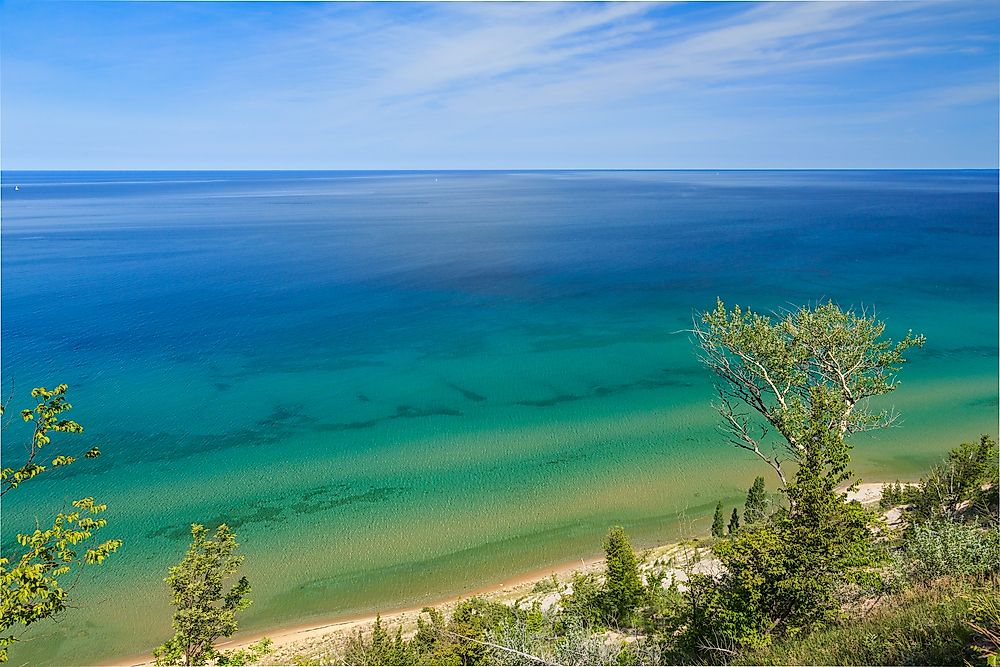
Lake Michigan runs 307 miles north to south and 118 miles east to west at the widest point, covering 22,404 square miles. It is the only one of the Great Lakes that sits entirely inside the United States, and the only one of the five where both shores belong to the same country.
Practically, that means standing anywhere on the open lake shore gives you a horizon of water and nothing else. People raised on the Great Lakes tend to find the ocean unremarkable for exactly this reason: they have been looking at an empty horizon their whole lives.
The narrows are a different story. Across the southern end the shore-to-shore distances drop considerably, and that is where the interesting thing happens.
Except People Photograph Chicago From Michigan

From the dunes near Stevensville and Bridgman on the Michigan shore, roughly 50 to 60 miles from the Loop, photographers regularly capture the Chicago skyline. Joshua Nowicki has built a following doing it from Grand Mere and Warren Dunes State Parks.
By the geometry above, this should be impossible. At that range the curve hides well over 1,600 feet of anything on the far shore, and the Willis Tower is 1,451 feet to the roof. The entire city should be hidden behind the bulge of the planet with room to spare.
It gets photographed anyway, several times most years, usually in spring and autumn.
The Lake Cheats

Water holds its temperature far longer than air does. In spring the lake stays cold while the air above it warms, which stacks a layer of dense chilled air underneath a layer of lighter warm air. Light crossing that boundary bends downward instead of travelling straight.
Bend it enough and the light follows the curve of the planet rather than shooting off into space. The atmosphere stops being empty and starts behaving like a fibre optic cable fifty miles long, piping an image of the city over the horizon and into a camera on a sand dune in another state.
Meteorologists call it a superior mirage, superior meaning the image appears above where the object actually sits. The more theatrical version, where the skyline stretches, floats, or flips upside down, is a Fata Morgana. Every atmosphere does this a little; the standard allowance already adds about eight percent to your horizon. Lake Michigan in April does it enormously.
The Detail That Settles The Argument

These photographs get passed around as evidence that the planet is flat, which is a bold use of them, because the pictures themselves show the opposite.
Look at any of them closely and the buildings are missing their lower floors. The towers rise straight out of the water with several hundred feet of base simply gone, which is precisely the amount the curvature formula says should be hidden at that distance. A flat lake would show you the whole city, streets included.
What the photos actually document is a planet curving away at the expected rate, with a layer of cold air doing a partial and imperfect job of bending the light back. The skyline is not defying the curve. It is being lifted just high enough to peer over the top of it, with its ankles still underwater.
Trying It Yourself

Height is the only part you control, so get up a dune. Warren Dunes and Grand Mere on the Michigan side put you over a hundred feet above the water, and Indiana Dunes State Park does something similar from closer in, around 35 to 50 miles out, where sightings are considerably more routine.
Timing matters more than weather. Look in spring, when the lake is still near freezing and the air has started to warm, and again in late autumn. Clear, cold, calm evenings are the ones that work. A hazy summer afternoon will give you nothing no matter how far you can see.
And if the skyline is not there, the three-mile horizon is still doing something worth looking at. A lake you cannot see across is a reasonable definition of large.


