Gila River
Frequently referred to as southern New Mexico’s lifeblood, the Gila River persists as the state’s last free-flowing river and one of the Western United States’ longest rivers. Despite the many continuous threats, this iconic natural feature of the American Southwest is highly biodiverse. The area where the Gila River’s three forks converge is known as the Gila Wilderness and is considered the US’ first federally designated Wilderness Area.
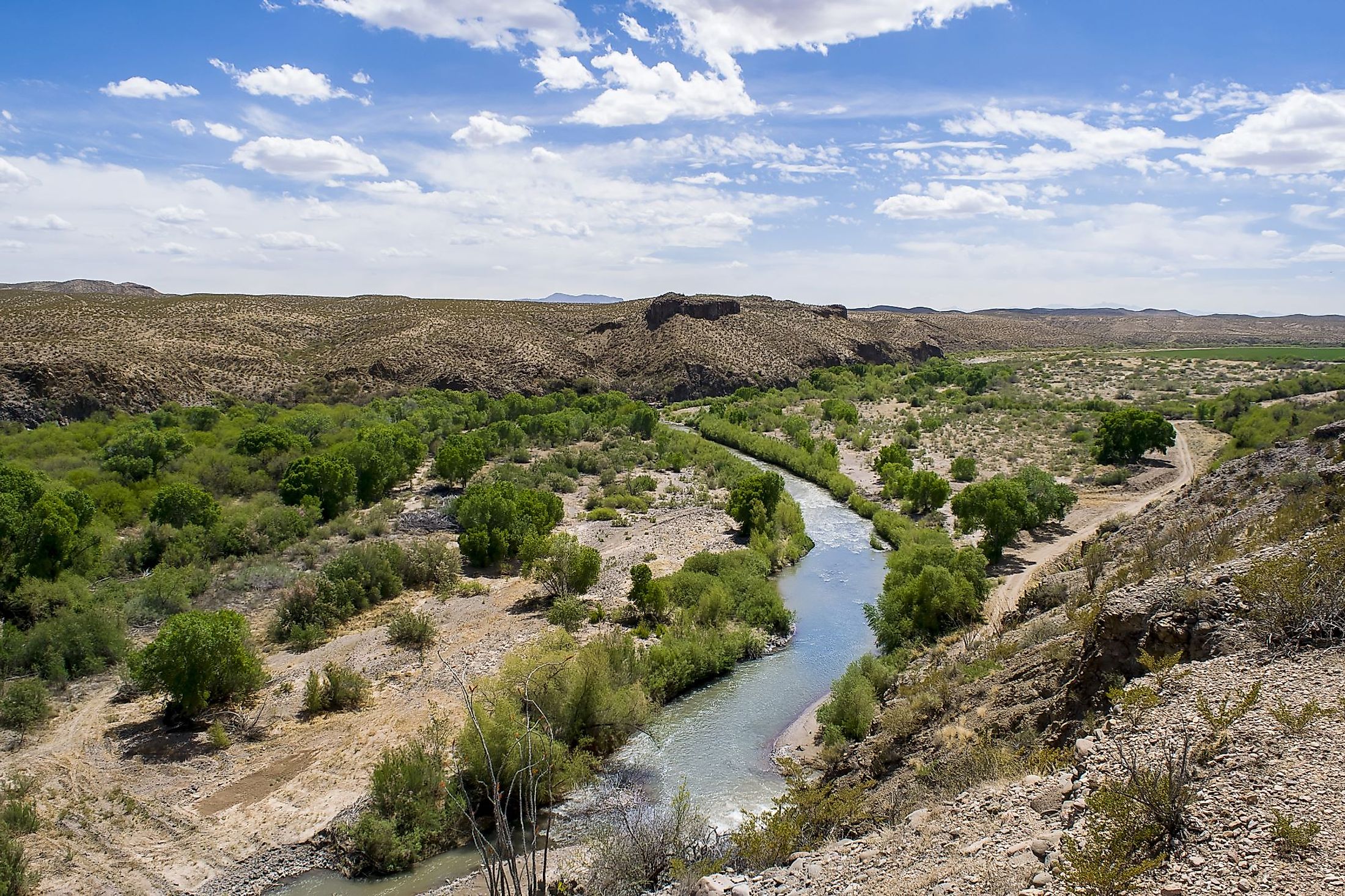
Course Of The Gila River

The Gila River, which stretches across the two US states of New Mexico and Arizona, flows more than 600 miles. As a tributary of the Colorado River, the Gila River is fed by six significant tributaries. The river’s three main forks, which are the West Fork, Middle Fork, and East Fork, lie within the Black Range on the Continental Divide. After originating in western New Mexico’s Sierra County, the Gila River flows along the Mogollon Mountains and southwest into the Gila National Forest and the Gila Cliff Dwellings National Monument. In turn, the river passes the town of Safford westward of Arizona before converging with the Colorado River in southwestern Arizona. Despite qualifying as one of the Western US’ longest rivers, the Gila River’s many irrigation diversions cause it to drain dry before reaching the first 500 miles of its voyage. Thus, what could once be traversed by large riverboats has been reduced to a mere intermittent trickle by the time it reaches the Gila River Indian Reservation. Moreover, the Gila River drains a watershed of approximately 60,000 square miles. Although this lies primarily within the US, the watershed extends into Mexico’s northern Sonora region. This watershed is so large that it covers an area larger than the entire Green River Basin. To add on, it is four times larger than Idaho’s Salmon River drainage.
The Climate Of The Gila River
The spring season sees the snow on the Sky Islands and the Mogollon Rim mountains melt. This leads to the gradual and predictable flow of the Gila River and its tributaries. By early summer, the vast majority, if not all, of the snow on these mountains melts. The river’s flow is heavily reduced down to a mere trickle, especially towards the end of its course. Nevertheless, the drying river is refilled with the coming of the southern monsoons by mid-to-late summer. This is even further bolstered by the periodic frontal storms of the fall and winter seasons. Furthermore, these rain events can cause flooding events as massive quantities of water are dumped into the river system in a brief period of time.
Brief History Of The Gila River

The Gila River has been exposed to many agriculture and human settlements throughout history. For instance, the indigenous Hohokam people succeeded in constructing complex civilizations along the banks of the Middle Gila River. This was achieved by creating hundreds of miles of irrigation canals that drew their water from the Gila River itself. The river was subsequently discovered and visited by several European explorers. The river actually marked the southern boundary of the US between 1848 and 1853. In the 19th century, the European settlers began to restructure the river’s course and flow. This was achieved by constructing diversions and small-scale dams to protect crops from harsh seasonal floods and droughts. The valley witnessed a substantial increase in population following 1928, as it was then that the Federal Government completed the Coolidge Dam on the Gila River itself. Rising agricultural demand led to farmers significantly increasing groundwater pumping methods. Despite this, continuing demand for water led to the establishment of the Central Arizona Project (CAP), a $4 billion aqueduct project meant to transport billions of gallons of water from the Colorado River. The CAP succeeded in providing the water and agricultural needs of major cities like Tucson and Phoenix. However, these monumental gains to the human population have been achieved by imperiling much of the ecosystems of the Gila River and its tributaries. Nevertheless, the area continues to be a critical region for wildlife, especially after Aldo Leopold convinced the US Forest Service in 1924 to establish the region as the US’ first congressionally designated Wilderness.
Ecology Of The Gila River

The Gila River passes through several iconic ecosystems, such as the massive cottonwood and willow forests as well as the arid Sonoran Desert. As such, the river’s waters provide vital habitats for a wide variety of organisms, many of which are found nowhere else. This includes over 300 species of migratory bird species, as well as several that are endemic to the area. Among these bird species that can only be found within the Gila Wilderness are the beardless Tyrannulet and the common Blackhawk. Other bird species that call this high-quality habitat home include the southwestern willow flycatcher, Montezuma quail, elf owl, and the threatened yellow-billed cuckoo. Given the river's highly varied landscape, featuring the Ponderosa Pine forests, the region is home to cougars, bighorn sheep, pronghorn, elk, and black bears. Moreover, the region also hosts the world’s largest population of rare Mexican spotted owls as well as several populations of reintroduced endangered Mexican wolves. Another endangered species that dwell in the river's ecosystems is the Mexican garter snake. The river also contains high levels of aquatic diversity, especially since many native fish species have become highly adapted to the region’s seasonal heavy rain events. For instance, the Gila topminnow has evolved several behavioral adaptations that enable it to avoid being washed downstream during flooding events. On the other hand, the watershed’s high-elevation portions tend to contain most fish populations. Thus, it is within such portions that the endangered Gila trout can be most commonly found.


