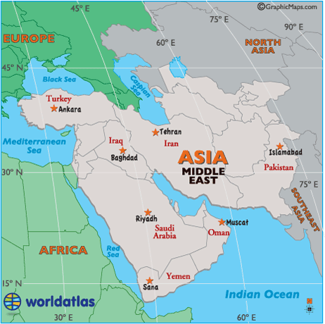
Location of Middle East

Latitude: (shown as a horizontal line) is the angular distance, in degrees, minutes, and seconds of a point north or south of the Equator. Lines of latitude are often referred to as parallels.
Longitude:(shown as a vertical line) is the angular distance, in degrees, minutes, and seconds, of a point east or west of the Prime (Greenwich) Meridian. Lines of longitude are often referred to as meridians.
Middle East Latitude and Longitude examples: (see map)
| Ankara, Turkey: | 39° | 55' | N | / 32° | 51' | E |
| Baghdad, Iraq: | 33° | 19' | N | / 44° | 25' | E |
| Islamabad, Pakistan: | 33° | 43' | N | / 73° | 3' | E |
| Muscat, Oman: | 23° | 36' | N | / 58° | 35' | E |
| Riyadh, Saudi Arabia: | 24° | 42' | N | / 46° | 43' | E |
| Sana, Yemen: | 15° | 21' | N | / 44° | 12' | E |
| Tehran, Iran: | 35° | 41' | N | / 51° | 25' | E |


