Countries With The Lowest Average Elevations
Many countries around the world, regardless of their size or geography, face challenges related to low elevation and climate vulnerability. Some nations, such as Tuvalu, the Maldives, and the Marshall Islands, consist entirely of low-lying atolls, making them particularly susceptible to rising sea levels and coastal erosion. Others, like the Netherlands and Bangladesh, have large portions of their population and infrastructure in flood-prone river deltas and coastal plains, requiring extensive flood management systems. Even countries with slightly higher average elevations, such as Latvia, Senegal, and The Gambia, must contend with coastal flooding, storm surges, and the long-term effects of climate change. As global temperatures rise and sea levels continue to increase, understanding the challenges faced by low-lying nations is critical for developing effective climate adaptation strategies and sustainable solutions to protect vulnerable communities worldwide.
Countries With The Lowest Average Elevations
- Maldives, 1.5 meters (5 feet)
- Tuvalu 1.8 meters (6 feet)
- Kiribati 2 meters (7 feet)
- Marshall Islands 2 meters (7 feet)
- Singapore 15 meters (49 feet)
- Qatar, 28 meters (92 feet)
- Netherlands, 30 meters (98 feet)
- Denmark, 34 meters (112 feet)
- Gambia, 34 meters (112 feet)
- Estonia, 61 meters (200 feet)
- Senegal, 69 meters (226 feet)
- Guinea-Bissau, 70 meters (230 feet)
- Trinidad and Tobago, 83 meters (272 feet)
- Bangladesh, 85 meters (279 feet)
- Latvia, 87 meters (285 feet)
15. Latvia, 87 meters (285 feet)
Latvia is a relatively low-lying country in Northern Europe, with an average elevation of about 87 meters (285 feet) above sea level. Although it is not as vulnerable as some coastal nations, Latvia's lengthy coastline along the Baltic Sea and its many rivers make certain areas susceptible to coastal erosion, flooding, and rising sea levels. The landscape includes flat plains, rolling hills, and extensive wetlands, with the highest point, Gaiziņkalns, reaching only 312 meters (1,024 feet).
Many of Latvia’s major cities and economic centers, including the capital, Riga, are situated in low-lying coastal or riverine areas, which increases their exposure to storm surges, heavy rainfall, and rising water levels in the Gulf of Riga. Climate change is anticipated to cause more extreme weather patterns, such as stronger storms, flooding, and warmer temperatures, potentially affecting Latvia’s forests, agriculture, and infrastructure.
To mitigate these risks, Latvia has been undertaking coastal protection projects, enhancing drainage systems, and developing climate adaptation strategies to safeguard its cities and agricultural land. The country is also concentrating on renewable energy initiatives and reforestation efforts to combat climate change and prepare for its long-term effects. While Latvia may not face environmental threats as immediate as those of some island or delta nations, it still encounters significant challenges that necessitate careful planning and adaptation..
14. Bangladesh, 85 meters (279 feet)
Bangladesh is one of the most low-lying and climate-vulnerable countries in the world, with an average elevation of just 85 meters (279 feet) above sea level. A significant portion of the country—especially along the coast and in river delta regions—lies less than 10 meters (33 feet) above sea level. It is situated in the Ganges-Brahmaputra-Meghna Delta, one of the largest and most densely populated river deltas on Earth. This geography makes Bangladesh highly susceptible to flooding, storm surges, and rising sea levels, particularly in coastal regions such as Khulna, Barisal, and Chittagong.
Climate change is exacerbating these risks, leading to stronger cyclones, increased river flooding, and saltwater intrusion that threaten millions of people. Seasonal monsoons regularly cause massive floods, displacing thousands and damaging crops, infrastructure, and drinking water supplies. Furthermore, the Sundarbans mangrove forest, a critical natural barrier against storms, is under threat from rising sea levels and human activities.
To address these challenges, Bangladesh has taken the lead in climate adaptation efforts. The country has been investing in flood-resistant infrastructure, early warning systems, mangrove restoration, and floating farms to help communities cope with extreme weather. The government is also implementing large-scale embankment projects and climate migration strategies to protect vulnerable populations. Despite these initiatives, Bangladesh remains one of the most at-risk nations in the world, with millions of people facing the long-term threat of displacement due to rising sea levels and worsening climate conditions.
13. Trinidad and Tobago, 83 meters (272 feet)
Trinidad and Tobago is a Caribbean nation characterized by relatively low-lying terrain, although its two islands exhibit distinct geographical features. Trinidad, the larger of the two, encompasses a mix of low-lying coastal plains, rolling hills, and mountain ranges. Its highest point, El Cerro del Aripo, reaches an elevation of 940 meters (3,084 feet). In contrast, Tobago is smaller and more mountainous, yet it still has vulnerable low-lying coastal areas. While much of the country is situated well above sea level, its coastal regions and flood-prone plains are at risk from rising sea levels, storm surges, and intense rainfall events.
The nation’s urban centers, infrastructure, and economic hubs—such as Port of Spain, San Fernando, and Scarborough—are concentrated in these coastal and low-lying areas, making them susceptible to flooding, coastal erosion, and the effects of hurricanes and tropical storms. Furthermore, climate change is leading to stronger storms and unpredictable weather patterns, which increases risks for vital sectors such as fishing communities, agriculture, and tourism.
To mitigate these threats, Trinidad and Tobago has been investing in climate adaptation measures, including coastal protection, flood management systems, and reforestation efforts aimed at reducing erosion. The country is also enhancing its renewable energy sector, especially in solar and wind power, as part of a broader strategy for climate resilience. While it may not be as immediately threatened as some lower-lying island nations, Trinidad and Tobago is proactively preparing for the long-term impacts of climate change.
12. Guinea-Bissau, 70 meters (230 feet)
Guinea-Bissau is a low-lying coastal country located in West Africa, with an average elevation of only 70 meters (230 feet) above sea level. Much of its territory is situated even lower. The extensive coastal plains, river deltas, and mangrove forests found in Guinea-Bissau make the country highly vulnerable to rising sea levels, flooding, and coastal erosion. In particular, areas such as the Bijagós Archipelago and the coastline are only a few meters above sea level, meaning that even a slight increase in sea levels could have devastating effects.
The country relies heavily on fishing, rice farming, and cashew cultivation, which makes it susceptible to saltwater intrusion from rising tides and storm surges, thereby threatening both livelihoods and food security. Additionally, seasonal flooding from major rivers, including the Geba River, heightens the risks of displacement and infrastructure damage. Climate change exacerbates these threats, bringing stronger storms and unpredictable weather patterns that impact Guinea-Bissau's already fragile economy.
To tackle these challenges, Guinea-Bissau has been working on initiatives like mangrove restoration, coastal defense projects, and sustainable land management. However, as one of the world’s poorest nations, it faces significant limitations in resources to adequately protect its people from the long-term effects of climate change. Consequently, Guinea-Bissau continues to seek international support and climate adaptation funding to help safeguard its vulnerable coastal communities.
11. Senegal, 69 meters (226 feet)
Senegal is a relatively low-lying country, with an average elevation of about 69 meters (226 feet) above sea level. Much of its coastal and riverine areas, however, are significantly lower, making them vulnerable to rising sea levels, coastal erosion, and flooding. The country has a long Atlantic coastline, with major cities like Dakar and Saint-Louis located near the ocean, where the land is only a few meters above sea level. Saint-Louis, in particular, is one of West Africa’s most climate-vulnerable cities, already experiencing severe coastal erosion and seasonal flooding. Additionally, the Senegal River Delta and other low-lying regions face increasing risks from storm surges and saltwater intrusion, threatening agriculture, fisheries, and freshwater supplies.
Climate change has intensified these challenges, resulting in stronger storms, rising temperatures, and desertification affecting both coastal and inland communities. To combat these threats, Senegal has been investing in coastal protection projects, mangrove restoration, and improvements to urban drainage systems to reduce flooding risks. The government is also developing sustainable strategies, including expanding renewable energy projects, to address both climate adaptation and mitigation in response to environmental changes.
10. Estonia, 61 meters (200 feet)
Estonia is a relatively low-lying country, with an average elevation of about 61 meters (200 feet) above sea level. Its highest point, Suur Munamägi, reaches only 318 meters (1,043 feet). The landscape primarily consists of flat plains, rolling hills, and a long, low-lying coastline along the Baltic Sea. This topography makes certain areas vulnerable to rising sea levels, coastal erosion, and flooding.
The country boasts over 2,000 islands, many of which are only a few meters above sea level, increasing their risk from climate change. Furthermore, Estonia’s capital, Tallinn, along with other major coastal cities, is experiencing rising sea levels that could impact infrastructure and ecosystems in the future. While Estonia may not face the same level of threat as some island nations, the gradual rise in sea levels and changing weather patterns could lead to more frequent coastal flooding and alterations in land use.
To address these challenges, Estonia has been implementing climate adaptation measures, such as improving coastal defenses, adopting sustainable land management practices, and investing in renewable energy sources, particularly wind and solar power. These efforts aim to reduce the country's carbon footprint and mitigate the long-term effects of climate change.
9. Gambia, 34 meters (112 feet)
The average elevation of The Gambia is approximately 34 meters (112 feet) above sea level. However, much of its coastal and riverbank areas are significantly lower, making the country highly vulnerable to flooding and rising sea levels. The geography of The Gambia is dominated by the Gambia River, which flows through the center of the country, creating low-lying floodplains that are particularly susceptible to water-related disasters.
Although the inland areas have slightly higher elevations, a large portion of the population and economic activities, including agriculture and fishing, are concentrated along the coast and riverbanks, where the land is closer to sea level. This concentration puts key areas, including Banjul, the capital, at risk of coastal erosion, tidal flooding, and saltwater intrusion—issues that are becoming more severe due to climate change.
To address these threats, The Gambia has been investing in mangrove restoration, flood control measures, and climate adaptation strategies to protect its coastal communities and agricultural lands. Despite having higher inland areas, the country's economic and environmental challenges are closely linked to the risks posed by its vulnerable low-lying regions.
8. Denmark, 34 meters (112 feet)
Denmark is a relatively low-lying country, with an average elevation of about 34 meters (112 feet) above sea level. Its lowest areas, especially along the coastline, are significantly lower. The country's geography includes coastal plains, rolling hills, and numerous islands, which make it particularly vulnerable to rising sea levels and coastal erosion. While Denmark does not face the same extreme risks as countries like the Netherlands or small island nations, some of its low-lying coastal regions—such as parts of Jutland and the islands of Lolland and Falster—are increasingly at risk of flooding due to climate change.
To address these challenges, Denmark has focused on climate adaptation strategies, which include coastal protection projects, reinforcement of dikes, and the implementation of sustainable urban drainage systems to mitigate the impact of extreme weather events. Additionally, Denmark is committed to reducing carbon emissions and investing in renewable energy, particularly wind power, to tackle the root causes of climate change while preparing for its long-term effects on the country’s landscape and communities.
7. Netherlands, 30 meters (98 feet)
As one of the lowest-lying countries in the world, about one-third of the Netherlands is situated below sea level, while much of the remaining land is only slightly above it. This low elevation results from a combination of natural geography and human intervention; historically, large portions of the country were wetlands, river deltas, and coastal plains. Over the centuries, the Dutch have reclaimed land from the sea using an extensive system of dikes, canals, and polders, allowing for the expansion of habitable and agricultural areas. However, this also makes the Netherlands highly vulnerable to flooding and rising sea levels, particularly in densely populated regions such as Amsterdam, Rotterdam, and The Hague.
To address these risks, the country has become a global leader in water management and climate adaptation. It has implemented advanced flood defenses, including storm surge barriers, floating architecture, and nature-based solutions like wetland restoration. The Netherlands continues to innovate in sustainable urban planning and climate resilience, serving as a model for other low-lying regions facing similar environmental challenges.
6. Qatar, 28 meters (92 feet)
Qatar is a low-lying country, with much of its land situated less than 100 meters (328 feet) above sea level, and many coastal areas even lower. This low elevation is primarily due to the country’s flat desert terrain and the absence of significant mountains or highlands. Located on the Qatar Peninsula, which extends into the Persian Gulf, Qatar's extensive coastline is particularly vulnerable to rising sea levels, coastal erosion, and flooding.
As a nation characterized by a hot, arid climate, Qatar also faces additional environmental challenges, including extreme temperatures, water scarcity, and desertification. These factors mean that any rise in sea level could endanger critical infrastructure, such as major cities like Doha, industrial zones, and desalination plants that are vital for the country’s freshwater supply.
To address these risks, Qatar has been investing in climate adaptation strategies, including coastal defenses, sustainable urban planning, and advanced water management systems. These efforts aim to safeguard its land and infrastructure against the long-term impacts of climate change.
5. Singapore 15 meters (49 feet)
Singapore, while being a highly developed city-state, has a relatively low elevation, with much of its land situated just 15 meters (49 feet) above sea level, and some coastal areas even lower. Unlike coral atoll nations, Singapore's low elevation results from its natural geography as a small island nation with limited high ground, along with extensive land reclamation projects that have expanded its coastline over the years. Large portions of the country, particularly its coastal and reclaimed areas, are highly vulnerable to rising sea levels and extreme weather events. Given its status as a densely populated urban center, flooding poses a significant risk to infrastructure, transportation, and housing.
To address these challenges, Singapore has invested heavily in climate resilience initiatives, including advanced drainage systems, tidal barriers, and large-scale reclamation projects aimed at elevating new developments. Additionally, the government is planning long-term solutions, such as floating structures and artificial islands, to protect the country from future sea-level rise. As a global leader in urban sustainability, Singapore continues to explore innovative engineering and nature-based solutions to ensure its long-term viability in a warming world..
4. Marshall Islands 2 meters (7 feet)
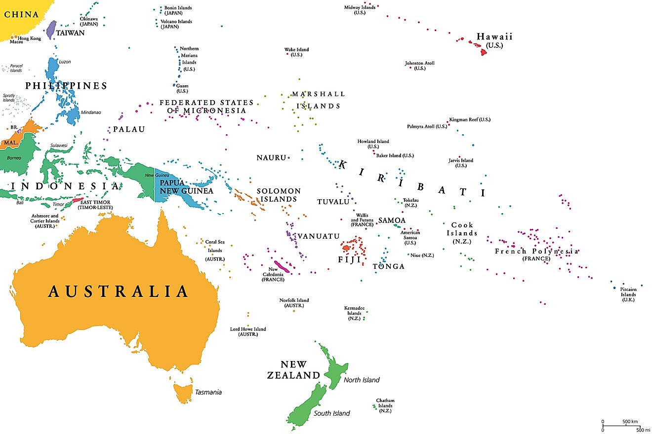
The Marshall Islands is one of the most vulnerable countries to rising sea levels, with its islands reaching a maximum height of only 2 meters (6.5 feet) above sea level. Unlike continental landmasses or volcanic islands, the Marshall Islands consists of coral atolls and low-lying islets formed by coral reefs growing on submerged volcanic remnants. This results in flat and fragile land that offers little protection against ocean surges and extreme weather.
The narrow strips of land that make up these islands are constantly shaped by wave action, and in many areas, coastal erosion and flooding have become part of daily life. Additionally, saltwater intrusion is a growing issue, contaminating freshwater supplies and making food production more challenging. As climate change accelerates, these risks are intensifying, and some communities may face displacement in the coming decades.
The Marshallese government is at the forefront of global climate action, advocating for stronger international commitments while also implementing local adaptation strategies. These strategies include building seawalls, improving infrastructure, and considering long-term solutions such as land reclamation or migration agreements with other countries.
3. Kiribati 2 meters (7 feet)
Kiribati is characterized by its extremely low elevation, with most of its islands rising only 1 to 3 meters (3 to 10 feet) above sea level. This unique geography, composed of coral atolls and reef island.
The islands are not only low but also narrow, with some measuring barely a few hundred meters in width. This narrowness makes them particularly susceptible to ocean surges and tidal fluctuations. Over time, natural erosion and rising sea levels have worsened land loss, affecting freshwater supplies, agriculture, and infrastructure.
Climate change has further amplified these risks, with stronger storms and coastal flooding increasingly threatening homes and livelihoods. Lacking significant elevation for natural protection, Kiribati faces an uncertain future. The government is compelled to seek local adaptation strategies and international support, including potential relocation plans for its people if parts of the country become uninhabitable.
2. Tuvalu 1.8 meters (6 feet)
Tuvalu's low elevation is primarily due to its geological formation, which consists of a series of coral atolls and reef islands. These naturally sit just a few meters above sea level. Unlike volcanic islands that feature mountains or highlands, Tuvalu's landmass is entirely made up of coral deposits that have built up over time, resulting in a flat and fragile landscape. Most of the country's land area is only about 2 meters above sea level, making it one of the lowest-lying nations in the world.
Additionally, natural processes such as erosion and land subsidence contribute to this minimal elevation, gradually wearing away the land. Climate change exacerbates the situation, with rising sea levels posing an existential threat to the islands. Coastal erosion, saltwater intrusion, and increased flooding are already affecting the lives of Tuvaluans, and some areas are at risk of becoming uninhabitable in the coming decades. Consequently, Tuvalu is often cited as one of the most vulnerable nations to climate change, with growing concerns about its long-term habitability each year.
1. Maldives, 1.5 meters (5 feet)
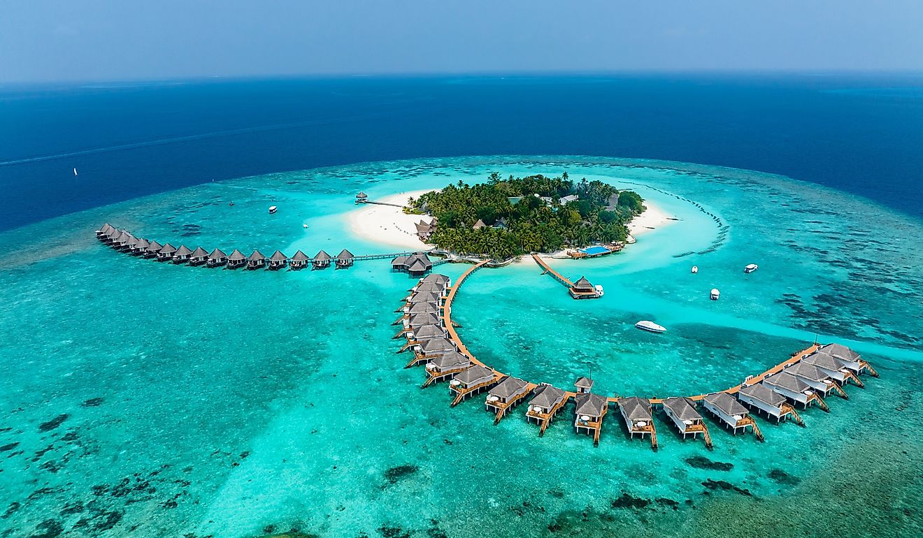
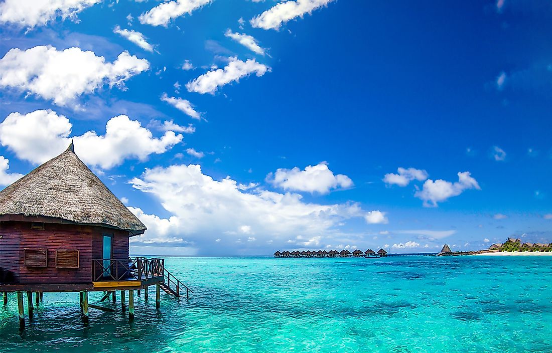
The Maldives is one of the lowest-lying nations on Earth, with an average elevation of just 1.5 meters (4.9 feet) above sea level. This is primarily due to its geological composition; the country consists of coral atolls rather than mountainous or volcanic islands. These atolls formed over thousands of years from coral reefs growing around submerged volcanic peaks, resulting in flat, sandy islands that barely rise above the ocean's surface. Unlike larger landmasses, the Maldives lacks significant natural barriers such as cliffs or hills to protect it from rising sea levels and coastal erosion.
The constant movement of waves and tides also reshapes its delicate shores, sometimes leading to land loss. As climate change accelerates sea level rise, the Maldives faces increasing risks of flooding, saltwater intrusion, and habitat loss, all of which threaten both the environment and the livelihoods of its people. Given these challenges, the Maldives is at the forefront of global discussions on climate resilience and sustainability, as the nation seeks innovative solutions to adapt and safeguard its future.
Countries With The Lowest Average Elevations
| Rank | Country | Meters | Feet |
|---|---|---|---|
| 1 | Maldives | 1.5 | 5 |
| 2 | Tuvalu | 1.8 | 6 |
| 3 | Kiribati | 2 | 7 |
| 4 | Marshall Islands | 2 | 7 |
| 5 | Singapore | 15 | 49 |
| 6 | Qatar | 28 | 92 |
| 7 | Netherlands | 30 | 98 |
| 8 | Denmark | 34 | 112 |
| 9 | Gambia | 34 | 112 |
| 10 | Estonia | 61 | 200 |
| 11 | Senegal | 69 | 226 |
| 12 | Guinea-Bissau | 70 | 230 |
| 13 | Trinidad and Tobago | 83 | 272 |
| 14 | Bangladesh | 85 | 279 |
| 15 | Latvia | 87 | 285 |
| 16 | Cyprus | 91 | 299 |
| 17 | Cuba | 108 | 354 |
| 18 | Kuwait | 108 | 354 |
| 19 | Uruguay | 109 | 358 |
| 20 | Lithuania | 110 | 361 |
| 21 | Ireland | 118 | 387 |
| 22 | Cambodia | 126 | 413 |
| 23 | Moldova | 139 | 456 |
| 24 | Hungary | 143 | 469 |
| 25 | United Arab Emirates | 149 | 489 |
| 26 | Belarus | 160 | 525 |
| 27 | United Kingdom | 162 | 531 |
| 28 | Finland | 164 | 538 |
| 29 | French Guiana | 168 | 551 |
| 30 | Belize | 173 | 568 |
