Rhine River
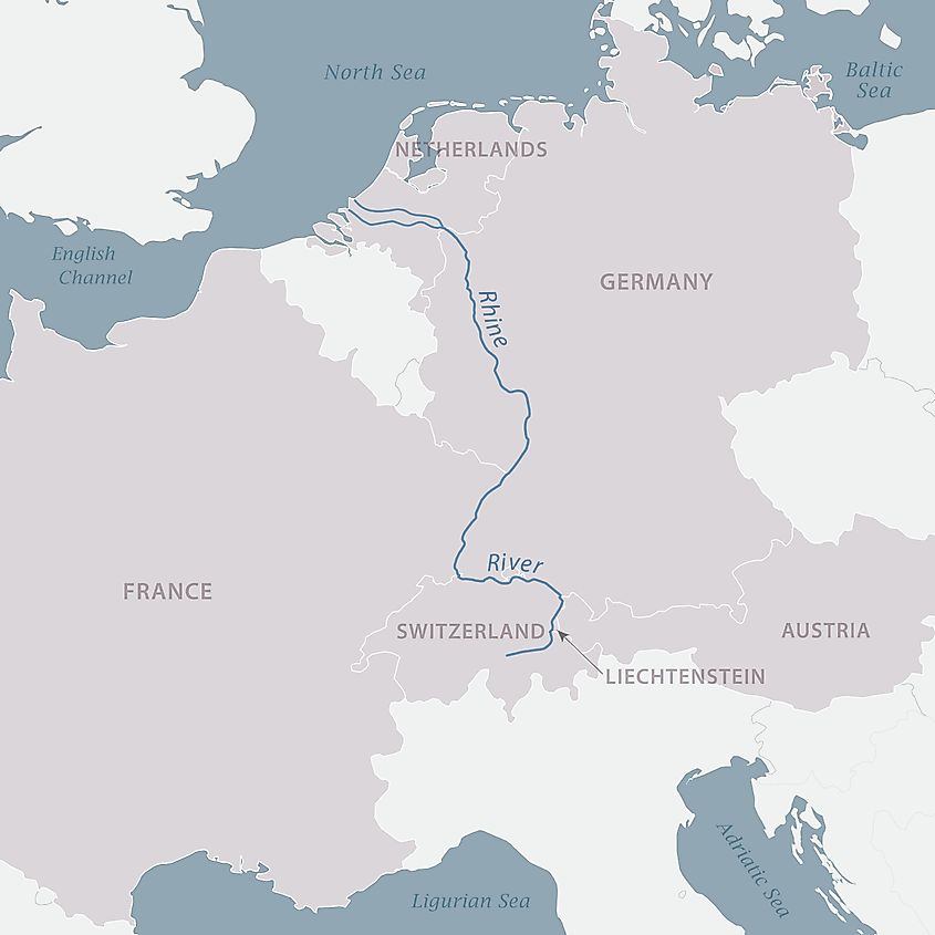
The Rhine River is the 11th longest river in Europe, stretching approximately 1,230 kilometers from its source in Switzerland to its mouth on the North Sea in the Netherlands. This transboundary river drains an area of about 185,000 square kilometers and flows through six countries; Switzerland, Germany, Austria, Liechtenstein, Germany, and the Netherlands. Additionally, the Rhine Basin drains Belgium and parts of Italy and France. The Rhine River is one of Europe’s most historically, culturally, and economically important rivers. It facilitates industrial transportation and supports industrial production, with about 20% of the world’s chemical industries manufacturing along the river. The Rhine, alongside the Danube, formed the Roman Empire’s northern inland frontier.
Naming
The Rhine River is known by different names depending on which country it flows through. Some of its names include Rhein (Germany), Rijn (Dutch), Rhin (French), Rhenus (Latin), and Renos (Celtic). However, these variant names were derived from the Gaulish word “Renos” used during the Greco-Roman period. The use of “Rh” in English, German, and French names resulted from the Greek influence. “Renos” is one of the class Gaulish river names derived from Proto-Indo European root “rei-“ meaning to flow, move, or run.
Overview

The Rhine River is Europe’s 12th longest river and the longest in Western and Central Europe, covering a distance of 1,230 kilometers from its source in Switzerland to its mouth in the Netherlands. It discharges an average of 2,900 cubic meters of water per second and a maximum of 13,000 cubic meters per second. The Rhine drains an area of about 185,000 square kilometers and flows through six countries. It has two primary sources; Anterior and Posterior Rhine, with both sources originating from Graubünden. The major cities along the Rhine include Basel (Switzerland), Cologne, Bonn, Duisburg, Mainz, Leverkusen, and Neuss (Germany), Strasbourg (France), and Rotterdam and Utrecht (Netherlands).
River Course

The Rhine River flows in a northward direction from its sources in Switzerland through the other five countries then turns west into the North Sea. It originates from two principal sources in Switzerland, including the Anterior Rhine in Tomasee and Posterior Rhine in Tamin, with both sources located in Graubünden. The 76-km long Anterior Rhine (Vorderrhein) originated from Lake Toma, located at an altitude of 2,344, and joins the 64 kilometers long Posterior Rhine (Hinterrhein) in Reichenau to form the Rhine River. Although the Hinterrhein is about 5% shorter than Vorderrhein, it has a much bigger volume.

Near Chur, the Rhine River turns north and flows through the Rhine Valley and later forming the boundary first between Switzerland and Liechtenstein then between Switzerland and Austria. In this section, the river flows for about 90 kilometers and the elevation from 600 meters to 400 meters. Shortly after, the Rhine River forms an inland delta and drains its waters into Lake Constance, Austria. This section is characterized by straight and reinforced banks to control flooding. The inland delta formed at the entrance of Lake Constance is an important bird sanctuary and nature reserve.
High Rhine
From Lake Constance, the Rhine exit through the Untersee arm and flow towards Basel, a section known as High Rhine (Hochrhein). The High Rhine is joined by Aare, Rhine’s major tributary, doubling the river’s discharge rate to about 1,000 cubic meters per second. The Rhine flows west from Lake Constance and descends to about 252 meters towards the Rhine Falls, then turns north in Basel, near the Rhine Knee. Some stretches of the High Rhine run on the border between Switzerland and Germany, while other stretches flow entirely within Switzerland.
Upper Rhine

The High Rhine ends at the Rhine Knee in Basel, where the river changes direction from west to north. The Central Bridge forms the boundary between the High and Upper Rhine. The Upper Rhine flows northwards for about 300 kilometers through the Upper Rhine plains and is joined by tributaries such as the Ill River, Neckar, and Main, which joins the Rhine near Mainz. From Mainz, Upper Rhine exits the Rhine Valley via the Mainz Basin and later forms the border between Germany (Baden-Württemberg) and France (Alsace). Before the straightening of the Upper Rhine in the 19th century, great meanders or loops characterized the river’s floodplains.
Middle Rhine And Lower Rhine

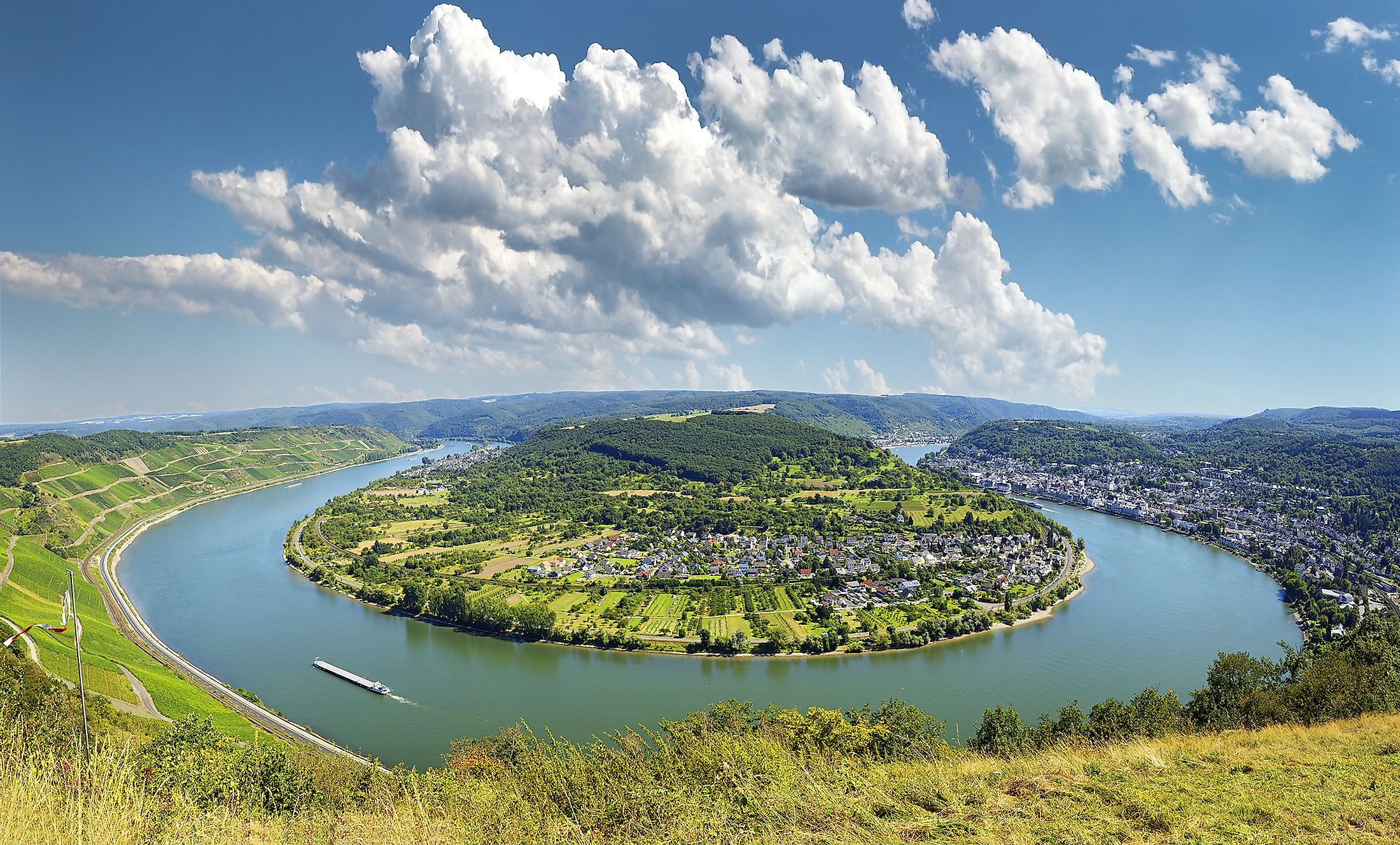
The Rhine River flows between Bingen an Rhein and Bonn in Germany as the Middle Rhine. The Middle Rhine is approximately 145 kilometers long and runs through the Rhine Gorge, formed through erosion. This section of the Rhine falls to about 50.4 meters above sea level and flows through the Rhenish Slate Mountains. The Eifel and Hunsruck ranges are located on the left and Westerwald and Taunus on the right. Mosella and Lahn Rivers are the Middle Rhine’s main tributaries, joining the river near Koblenz.
The Middle Rhine turns into the Lower Rhine as it enters the North German Plains, with the elevation falling to 12 meters. This river section is fed by Lippe and Ruhr and flows through North Rhine-Westphalia. Here, the river runs past the Rhine-Ruhr region, German’s most populated metropolitan region, crossing the Uerdingen line near Krefeld. The Rhine then turns west and enters the Dutch territory, where it breaks into several branches, including Waal and Lek. Together with Scheldt and Meuse Rivers, the Rhine forms the Rhine-Meuse-Scheldt delta, Europe’s largest river delta, covering 25,347 square kilometers.


