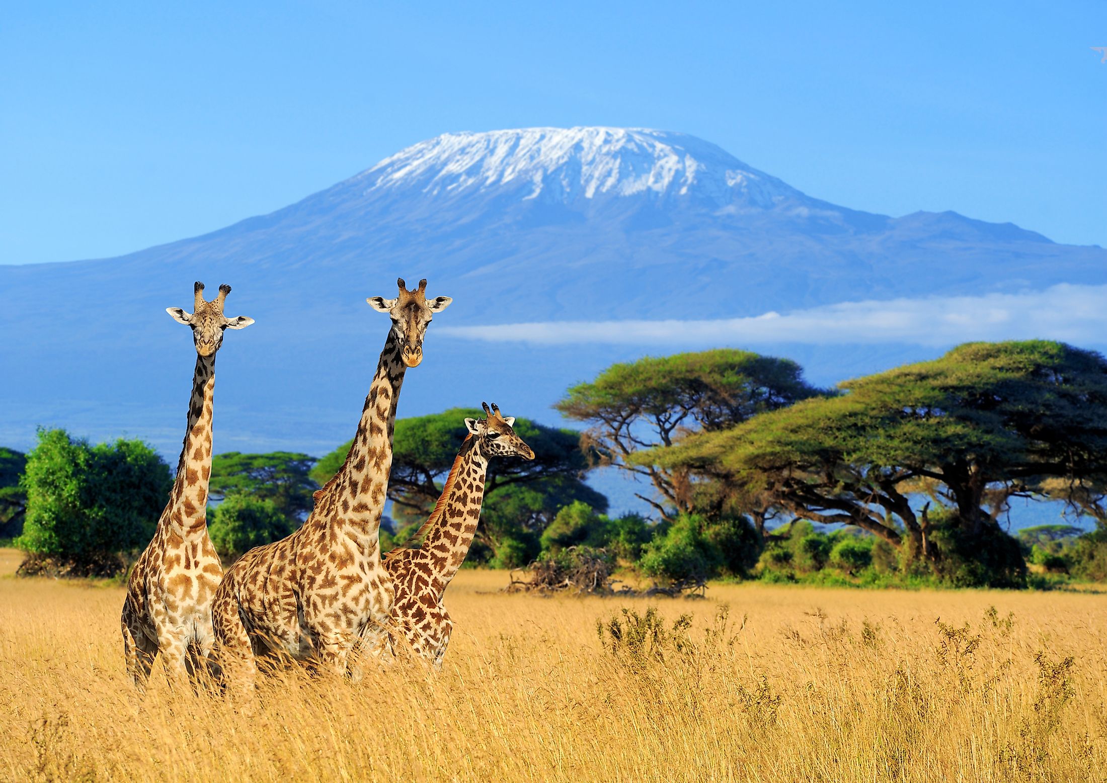
Mount Kilimanjaro
Occupying a total area of about 30,370,000 sq. km, Africa is the 2nd largest and the 2nd most populous continent in the world. The Continent of Africa is characterized by many unique geographical features including mountains, valleys, plains, and deserts. The Great Rift Valley of East Africa hosts some of the tallest mountains on the African Continent.
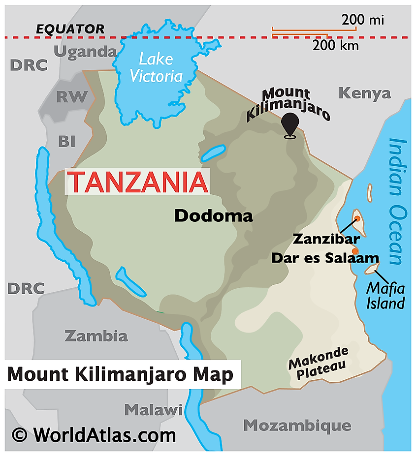
Located in the northeastern part of the East African nation of Tanzania, close to its northern boundary with Kenya is Mount Kilimanjaro. The mountain forms a part of Tanzania’s Kilimanjaro National Park and is situated approximately 300km south of the Equator, 160km east of the East African Rift System, 225km south of Nairobi - the Kenyan Capital city, and 280km from the Indian Ocean. Rising to an elevation of 5,895m above sea level, Mount Kilimanjaro is an inactive stratovolcano, that is considered the tallest mountain in the African continent as well as the highest free-standing mountain in the world. It is also the 4th most isolated mountain peak on Earth and the 4th most prominent peak among the Seven Summits of the World after Mount Everest, Mount Aconcagua, and Mount Denali.
Geography
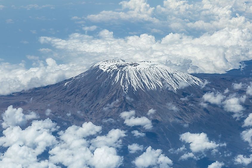
Mount Kilimanjaro rises to an elevation of 5,895m above sea level and about 4,900m above its plateau base. The topographical prominence of Mount Kilimanjaro is 5,885m and the topographical isolation of the mountain is 5,510km. Mount Kilimanjaro is often referred to as the “Roof of Africa”.
The majestic Mount Kilimanjaro is an inactive snow-capped stratovolcano that extends for about 80km from east-west and is made up of three principal volcanic cones namely Mawenzi, Kibo, and Shira. Kibo forms the central cone and is the highest followed by Mawenzi at 5,149m and Shira at 4,005m. Both the Mawenzi and Shira cones are extinct, whereas Kibo is considered as a dormant volcano, that has a high chance of erupting again. The highest summit of Kilimanjaro is located on the crater rim of Kibo volcano and has been named the Uhuru Peak, where the word ‘Uhuru’ means ‘freedom’ in the native Swahili language.
It is believed that Mount Kilimanjaro was formed due to the active continental rifting about 3 million years ago during the formation of the Great Rift Valley. Intense volcanic activities began about 1 million year ago when the molten lava began to burst through the fractures. Initially, this molten lava was of low viscosity but over time continuous volcanic activity led to the ejection of more viscous lava which eventually formed the Shira volcanic cone. Shira was the first to become extinct and collapsed into a huge caldera that currently forms the Shira Ridge. Subsequent volcanic eruptions led to the formation of the other two volcanic cones – Mawenzi and Kibo. The volcanic cone of Mawenzi is highly eroded and jagged and is separated by gorges on the east and west. Mawenzi and Kibo are connected by an 11km saddle at about 4,500m. Kibo is the youngest and the highest cone on the mountain and scientists have estimated that the last volcanic eruptions from this cone happened sometime around 150,000 and 200,000 years ago. These eruptions helped in the formation of the Kibo summit crater. The snow-clad dome of Kibo features a caldera on its southern side that is about 300m deep and has an inner cone that displays residual volcanic activities. It has been estimated that there are over 250 parasitic cones on the northwestern and southeastern flanks of Kibo that has been formed approximately 150,000 and 200,000 years ago.
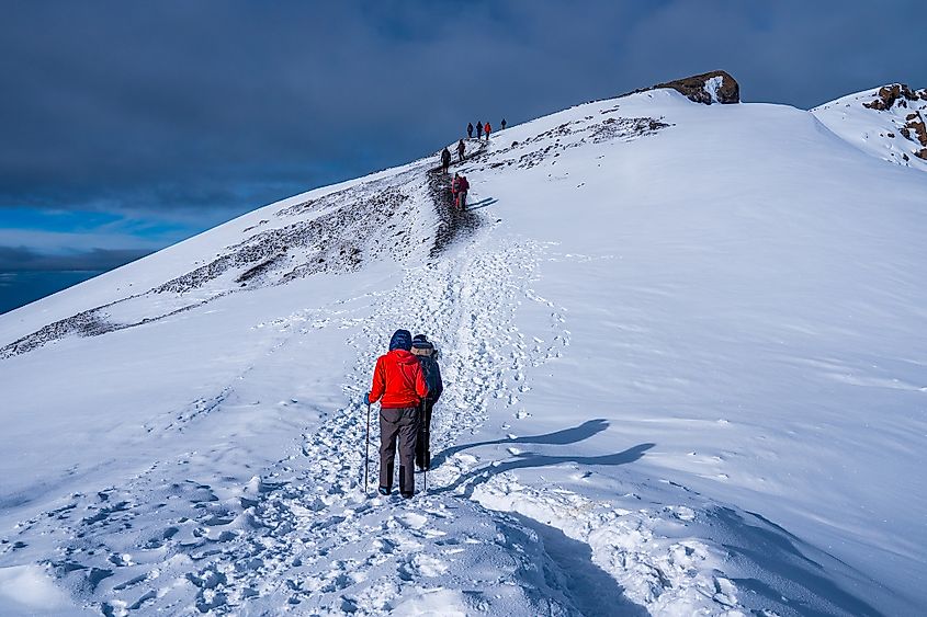
Mount Kilimanjaro is drained by many rivers and streams mainly on its eastern and southern sides. The rivers which drain Mount Kilimanjaro include Lumi and Pangani rivers. There are two distinct rainy seasons in Mount Kilimanjaro – one rainy season is from March to May and another rainy season is during November. The southern slopes of the mountain receive comparatively high rainfall than the northern slopes. The average temperature in the summit area of the mountain is about -7°C, while at the mountain base it is around 21° to 27°C. Snowfall can occur during any time of the year, but it usually occurs during the two rainy seasons. However, the snowcaps of the mountain are diminishing quite fast and scientists have estimated that the mountain may become completely ice-free in the next 20 years.
Ecology
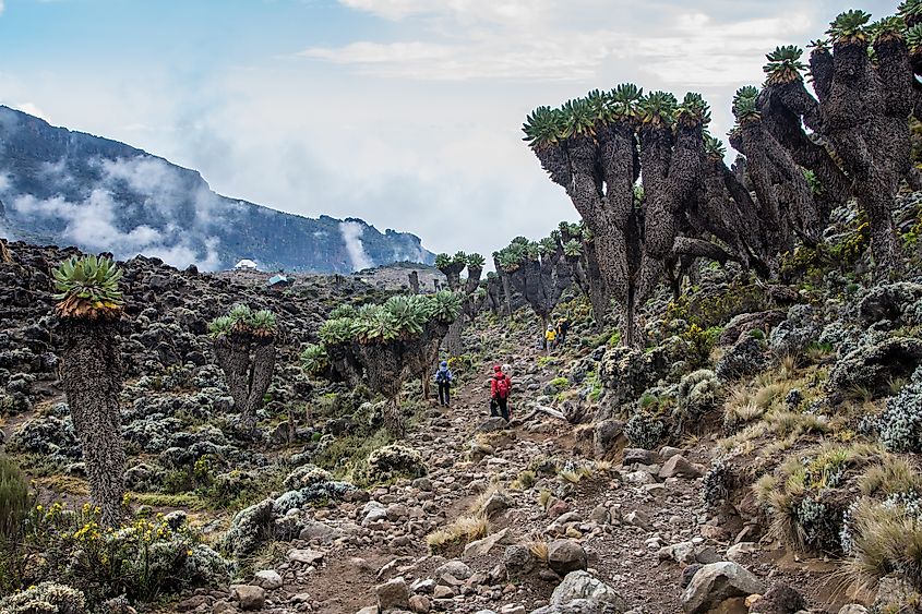
Mount Kilimanjaro contains many vegetation zones that vary greatly from its base to its summit. The base of the massif is covered by semi-arid scrublands. The lower southern slopes of the mountain are well-watered and rich in fertile volcanic soil, which allows for the successful practice of crop cultivation and animal grazing in the region. Further up the slopes, dense montane forests dominate the landscape. As one moves up the mountain, these dense montane forests are gradually replaced by the sub-alpine moorlands and alpine bogs. Two significant plant species are grown in the moorlands. These include the giant groundsel and the giant lobelia. Above the moorlands, an alpine desert type of vegetation is found that is characterized by mosses and lichens.
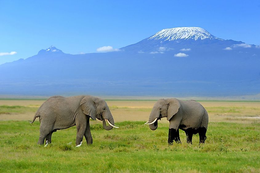
About 140 species of mammals have been reported from the dense montane forests. These include African Elephants, Elands, Cape buffaloes, Bushbucks, dik-diks, Black and White Colobus monkeys, chameleons, mongooses, duikers, warthogs, blue monkeys, Kilimanjaro shrew, etc. Over 179 avian species have been recorded from the Mt. Kilimanjaro habitat. Some of the rare birds that are found here include Abbot’s starling, Hunter’s cisticola, Hill chat, etc.
Brief History
The exact origin of the mountain’s name is not known. In 1860, the German missionary Johann Ludwig Krapf reported that the native Swahilis people who lived along the coasts referred to the mountain as “Kilimanjaro”. According to the Nuttall Encyclopedia, the mountain’s name was “Kilima-Njaro” which is made up of the Swahili word “Kilima” which means “mountain” and the Chagga word “Njaro” which means “whiteness”. Another theory suggested that the Europeans who attempted to summit the peak but had failed in their attempts adopted the name from a kiChagga phrase which referred to their failure to climb the mountain.
The southern and eastern slopes of the mountain were originally inhabited by the indigenous Chagga People. Several fables and historical reports have indicated the presence of this mountain that was also referred to as the “Mountain of the Moon” in ancient times. In 1848, the German missionaries Johann Ludwig Krapf and Johannes Rebmann became the first Europeans to visit the mountain. In 1889, the Kibo summit was first reached by the German geographer Hans Meyer and Ludwig Purtscheller, the Austrian mountaineer.
In the early 20th century, Kilimanjaro Mountain and its surrounding forests were designated as a game reserve. The Mount Kilimanjaro National Park was established in 1973 to protect Mount Kilimanjaro along with its six surrounding forest corridors that stretch downwards through the montane forests. The Mount Kilimanjaro National Park was also designated as a UNESCO World Heritage Site in 1987.
Economy
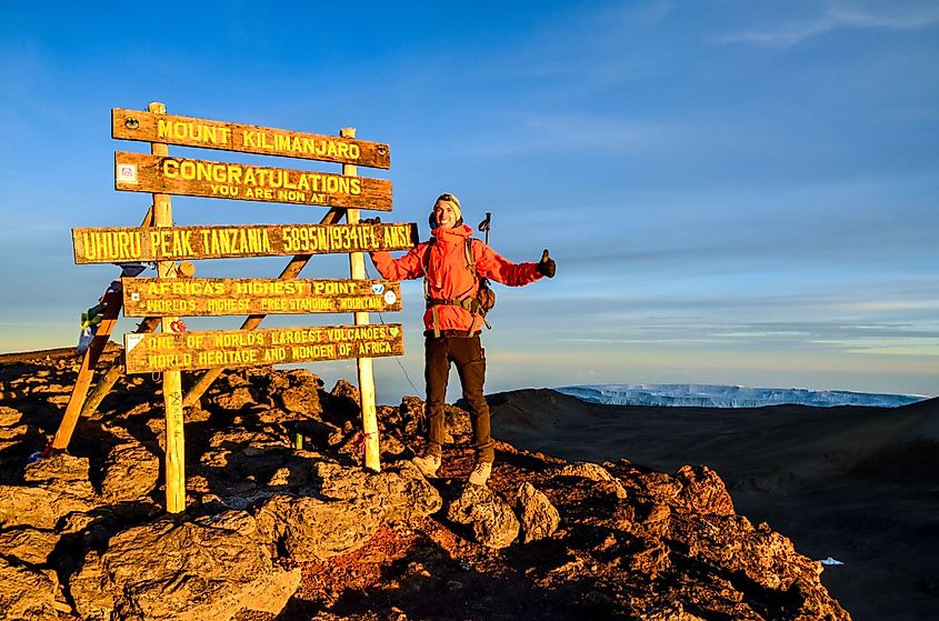
The Kilimanjaro region serves as one of Tanzania’s leading producers of barley, wheat, sugar, coffee, etc. Other crops like corn, bananas, cotton, sisal, wattle bark, potatoes, and pyrethrum are also cultivated. Over 18 villages are located in the Forest Reserve outside the boundaries of the National Park and are inhabited by the native Chaga, Kahe, and Mbugu people. The town of Moshi serves as a base for the ascent as well as the principal trading center. Mt. Kilimanjaro has become a global tourist hotspot and attracts tourists all year round. The thriving tourism industry has greatly benefitted the economy of the entire region as well the indigenous people who live in the region. Since Kibo’s peak can be climbed without the aid of mountaineering equipment, several climbers attempt to ascent the high summit every year.
