Indian Ocean
The Indian Ocean is a large saline water body covering about 20% of the world’s ocean total area. The ocean is the youngest geologically and the smallest of the three major oceans (Pacific, Atlantic, and Indian Oceans), but larger than the Arctic and Southern Oceans. It is located between Africa on the west, Asia on the north, Australia on the east, and south by the Southern Ocean. The Ocean has four important waterways, including the Strait of Hormuz, Suez Canal, Strait of Malacca, and Bab el Mandeb. The Indian Ocean was known previously by several other names, including the Eastern Ocean, Indic Ocean, or Hindu Ocean.
Contents:
Location And Geography
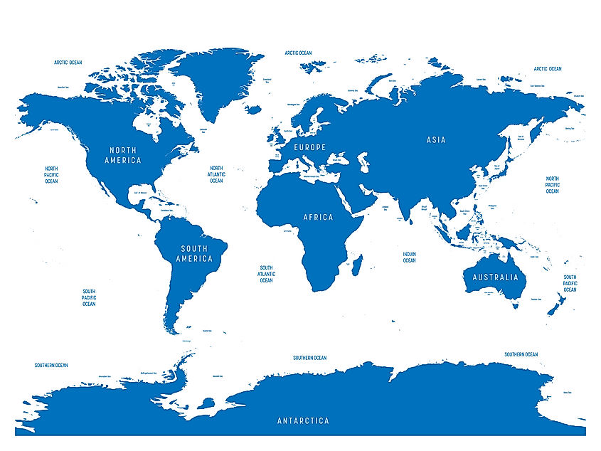
The Indian Ocean covers about 70.56 million square miles or 19.8% of the Earth’s total water surface. It has a maximum length of 10,000 kilometers, between Antarctica and the Bay of Bengal, and is 7,600 kilometers wide between Australia and Africa’s southern tip. Its average depth is 3,741 meters below the sea surface, with a maximum depth of 7,258 meters at the Sunda Deep in Java Trench, off Indonesia’s southern coast. The Ocean’s volume is 264 million cubic kilometers, while the coastline is approximately 66,526 kilometers.
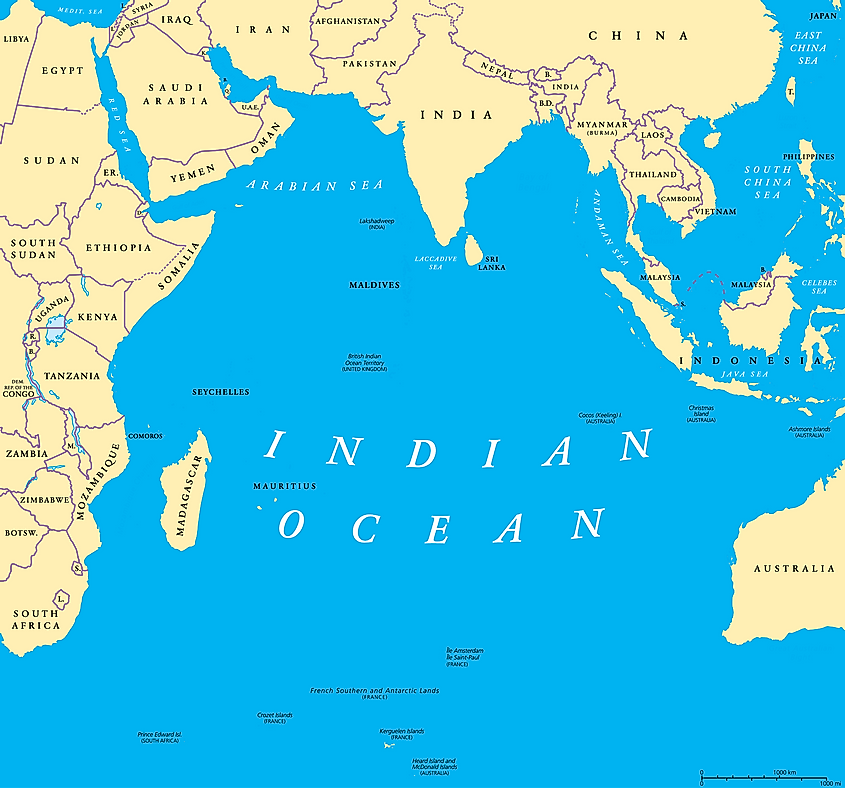
Until 2000, the Southern Ocean (except the marginal seas on the northern rim) was part of the Indian Ocean. However, the IHO, in 2000, created the Southern Ocean, by including the northern marginal seas as part of the Indian Ocean and removing the portion south of the 600 south latitude.
The Indian Ocean’s northern coast is shared by Pakistan, Iran, Bangladesh, and India, while Sunda Island (Indonesia), Malay Peninsula, and Australia share the eastern coast. It is bounded to the west by Africa and the Arabian Peninsula and south by Antarctica. The Indian Ocean is linked to the Atlantic Ocean in the southwest as Africa’s southern tip. India, Australia, and Indonesia have the longest exclusive economic zones and shorelines.
Rivers And Marginal Seas
The Indian Ocean drains approximately 21.1 million square kilometers or about 30% of its total surface area. The drainage basin is divided into over 800 smaller basins. Roughly 50% of the Indian Ocean’s drainage basin is in Asia, while the rest is shared by Africa (30%) and Australasia (20%). The rivers draining into the Indian Ocean are relatively shorter than those of the Pacific and Atlantic Oceans. The five largest rivers emptying into the ocean are Zambezi, Jubba, Indus, Murray, and Ganges-Brahmaputra.
The Indian Ocean has fewer marginal sea seas than the Pacific or Indian Oceans, with most of its seas covering less than 500,000 square kilometers. The Arabian Sea, located in the northern Indian Ocean, is the largest, covering about 3.86 million square kilometers. It is connected to the Red Sea by the Bab el Mandeb strait and the Gulf of Eden. The Red Sea spans 438,000 square kilometers, while the Gulf of Eden covers about 410,000 square kilometers. The Bay of Bengal is the Indian Ocean’s second-largest extension at 2.6 million square kilometers. It is separated from the Arabian Sea by mainland India. Other seas, bays, and gulfs of the Indian Ocean are the Andaman Sea, Mozambique Channel, Laccadive Sea, Timor Sea, and the Persian Gulf.
Climate And Hydrology
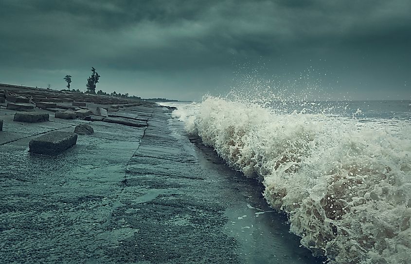
The Indian Ocean region is divided into four main climatic zones: Monsoon, trade-wind, subtropical and temperate, and sub-Antarctic and Antarctic zones. The monsoon zone extends northwards from 10 degrees south latitude, experiencing monsoon climate. During summer, the high atmospheric pressure over Australia and low pressure over Asia combine to form the southwest monsoon, with a wind speed of up to 45 km/h. During winters, the low pressure over northern Australia combines with high atmospheric pressure over Asia to form the northeast monsoon.
The trade winds prevail almost throughout the year, but particularly strongest between June and September. The Indian Ocean is the world’s warmest ocean and continuously warmed at about 34.2 degrees Fahrenheit between 1901 and 2012. Human activities in and around the ocean region have induced greenhouse warming, leading to frequent El Nino.
The Indian Ocean’s hydrological characteristics are influenced by interactions between the weather elements, such as wind, rain, and solar energy, and the ocean’s currents. The two main currents in the ocean are the Agulhas Return Current and Agulhas Current, controlled by the monsoon. In the Monsoon zone, the ocean’s surface circulates in reverses at least twice a year, featuring the two large opposing gyres, which develop in the Arabian Sea and the Bay of Bengal.
Below the ocean’s surface, the deepwater circulation is irregular and sluggish. Highly saline water from the Red Sea and the Persian Gulf enters the ocean and sinks below the freshwater surface (between 600 m and 1,000 m), forming the North Indian High Salinity Intermediate Water. The ocean’s salinity varies between 3.2% and 3.7%, with the Arabian Sea having the highest salinity level to about 120 meters because of the high evaporation rate.
Brief History
Unlike the Pacific and Atlantic Oceans, the Indian Ocean islands were uninhabited until the colonial period. However, the coastal areas, especially Africa and Asia, were already inhabited. The Arabs began spreading Islam along the ocean’s western shores from around the 8th century. Trade across the ocean connected Eastern Africa to the Arab World, with the Muslim merchants trading over 1,000 African slaves annually.
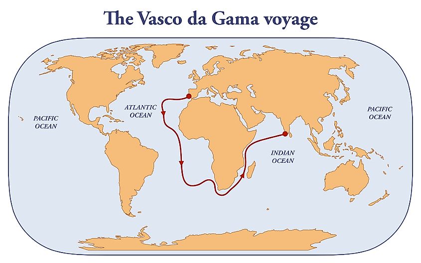
In 1497, Vasco da Gama became the first European to reach India through the Cape of Good Hope. In the 16th century, the Portuguese became the first Europeans to begin slave trade in the Indian Ocean by establishing the “State of India.” In 1517, the Ottoman Empire started expanding into the Indian Ocean by conquering Egypt. The Dutch East India Company, established in the early 17th century, lead to a sharp increase in slave trade over the Indian Ocean. Overall, up to 733,000 African slaves were traded by the Europeans between 16th and the mid-19th century within the Indian Ocean.
Biodiversity
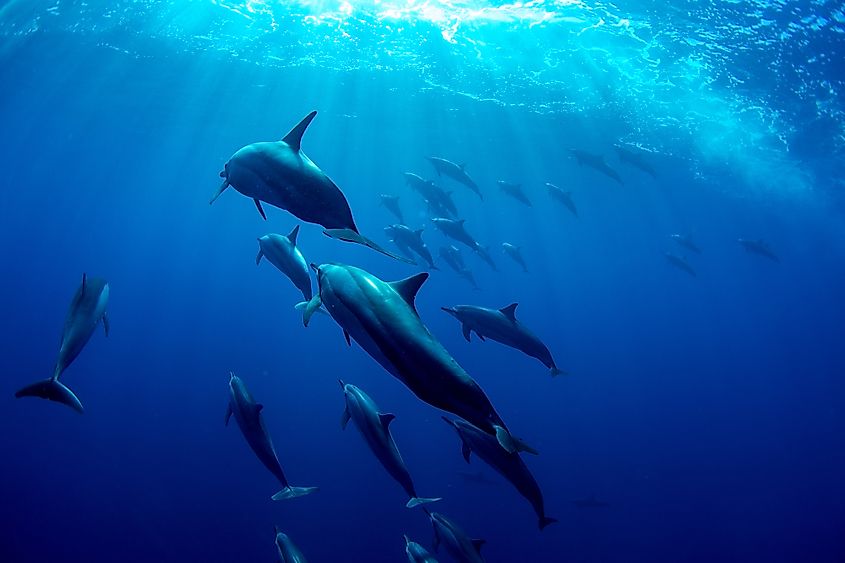
Nine of the 36 world’s biodiversity hotspots are in the Indian Ocean. Madagascar and neighboring islands host 13,000 plants, 381 reptiles, 313 birds, 160 fish, and 200 mammals, of which the majority are endemic species. The Maputaland-Pondoland-Albany hotspot contains over 8,000 plants, 197 mammals, 200 reptiles, and 70 freshwater fishes. The Eastern Africa coastal forests are home to over 4,000 plants (1,750 endemics) and 235 mammals. The Horn of Africa, including the East Africa Rift Valley and Ethiopian Highlands, hosts over 5,000 plants, 100 freshwater fishes, and close to 190 mammals. The other biodiversity hotspots around the Indian Ocean region are Western Ghats-Sri Lanka, Indo-Burma, Sundaland, Wallacea, and Southwest Australia. Sundaland hosts over 25,000 plant species, including 15,000 endemic species.
