10 Largest Islands Countries In The World
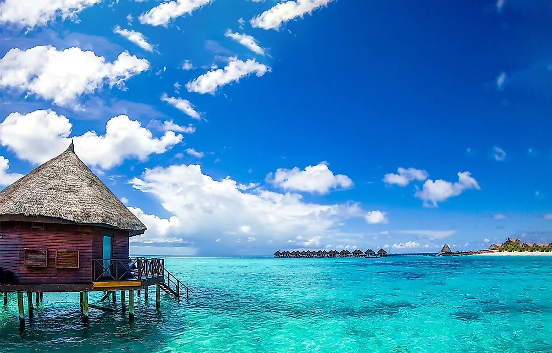
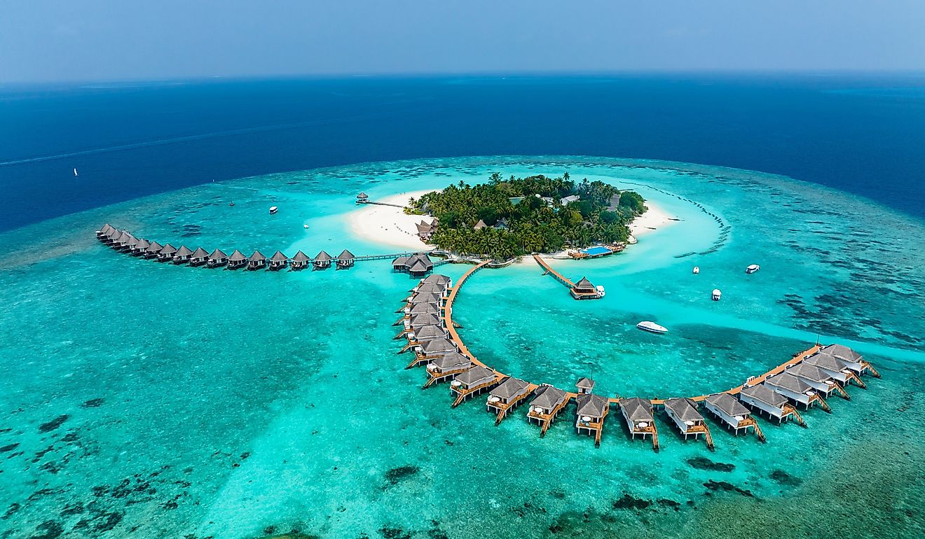
The vast World Ocean is dotted with numerous island countries, some of which span thousands of square kilometers. Besides island countries, several dependent territories are scattered throughout the oceans. Some mainland countries like Italy, Spain, the United States, and Canada also extend into the waters. For instance, the US state of Hawaii is located in the Pacific Ocean. Most island countries cover more than one island, some of which may be uninhabited. Other countries like Indonesia and Papua New Guinea also share an island. Below are the ten largest island countries.
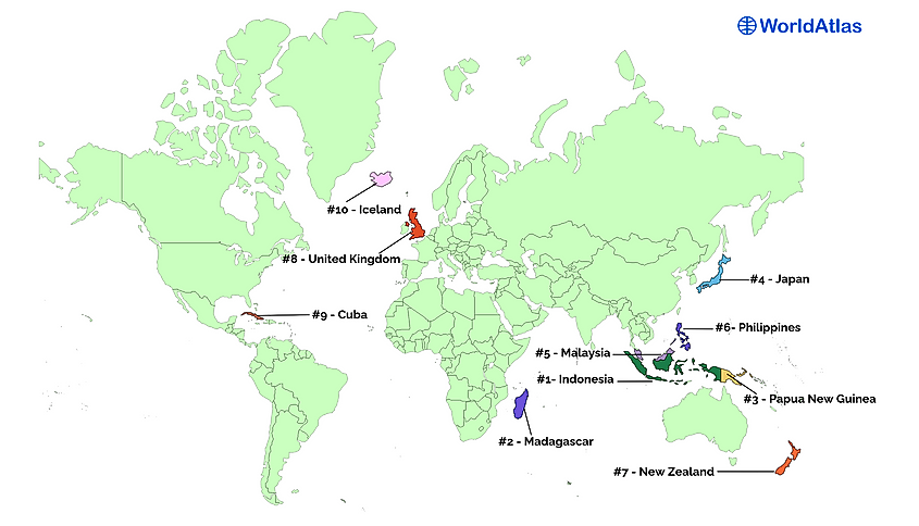
10 Largest Island Countries In The World
- Indonesia
- Madagascar
- Papua New Guinea
- Japan
- Malaysia
- Philippines
- New Zealand
- United Kingdom
- Cuba
- Iceland
1. Indonesia - 1,904,569 km2 (735,358 miles2)
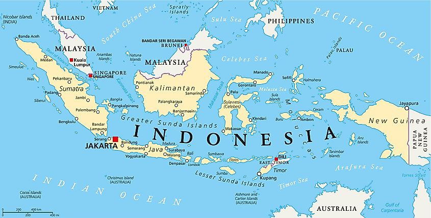
Indonesia is the world’s 14th largest country by land area, covering about 1.9 million km2. It is the largest island country by land area and straddles Southeastern Asia and Oceania. Indonesia comprises over 17,000 islands, of which the United Nations recognizes 16,056. However, only about 6,000 islands are inhabited. These islands extend for about 1,760 km north-south and 5,120 km from west to east. Sumatra is the largest Indonesian island and the world’s sixth-largest island, spanning 443,066 km2. Other major islands of the country are Java, Kalimantan (Indonesia’s part of the Borneo), Sulawesi, and Western New Guinea (Indonesia’s portion of the New Guinea Island).
2. Madagascar - 587,041 km2 (226,658 miles2)

Madagascar is an island country off the East African coast. It consists of Madagascar, the main island and the world’s fourth-largest island and other small islands. It is the world's second-largest island country, occupying 587,041 km2, with the main island taking up 587,040 km2. The island country is about 400 km off mainland Africa. It is bordered by other islands in the Indian Ocean, including Comoros, Mayotte, Reunion, and Mauritius. The island of Madagascar was part of the Indian Subcontinent up to 88 million years ago. Its split from India allowed its flora and fauna to evolve independently, making the country a biodiversity hotspot.
3. Papua New Guinea - 462,840 km2 (178,704 miles2)

Papua New Guinea is an island country in Oceania occupying New Guinea’s eastern half. It also has numerous small islands in the Southwestern Pacific region known as Melanesia. New Guinea is the world’s second-largest island, occupying 785,753 km2. Indonesia claims the island’s western half, leaving Papua New Guinea with just about 365,213 km2. Including the other smaller islands, Papua New Guinea covers about 462,840 km2. Other major islands include New Britain, Bougainville, New Ireland, and Admiralty Islands.
4. Japan - 377,915 km2 (145,913 miles2)

Japan is an island country in the Pacific country and forms part of East Asia. It is one of the world’s most urbanized and densely populated countries. Japan is separated from China and Russia by the Sea of Japan and sandwiched by the East China Sea and Sea of Okhotsk in the south and north. It has 6,852 islands, spanning 377,915 km2. Honshu is the largest Japanese Island and the world’s seventh-largest island, occupying 225,800 km2, about 60% of the country’s total land area. Hokkaido is the second-largest island, at 78,511 km2. The other three main islands are Kyushu, Shikoku, and Okinawa Islands. Tokyo, Japan’s capital, is located on the island of Honshu.
5. Malaysia - 329,847 km2 (127,355 miles2)

Malaysia comprises over 20,000 islands including rocks, sandbanks, and islets, occupying about 329,847 km2 total. It shares the island of Borneo (the world’s third-largest island) with Brunei and Indonesia, claiming about 26% of the island’s western portion. Malaysia also occupies the Malay Peninsula’s southern half and shares the peninsula with Thailand. Peninsular Malaysia is about 132,265 km2, while East Malaysia (Labuan, Sarawak, and Sabah), located on Borneo, is about 198,447 km2. Thus, Malaysia shares a land border with Brunei and Indonesia (on the island of Borneo) and Thailand on the Malay Peninsula.
6. Philippines - 300,000 km2 (115,831 miles2)

The Philippines is an archipelagic country in the western Pacific Ocean, consisting of over 7,600 islands. These islands are broadly divided into three regions: Mindanao, Visayas, and Luzon, and occupy a total area of 300,000 km2. Luzon occupies the archipelago’s northern portion and comprises the main island (Luzon), which occupies about 109,965 km2 (the world’s 15th largest island). Luzon region hosts over 55% of the country’s population. The Visayas comprises central islands which occupy about 71,503 km2. Mindanao is the northern island group and the second-largest island after Luzon, occupying 97,530 km2.
7. New Zealand - 268,838 km2 (103,798 miles2)

New Zealand is an island country comprising over 700 islands scattered in the Southwestern Pacific Ocean and occupies about 268,838 km2. Its main landmasses are the North and South Islands. South Island is New Zealand’s largest island and the world’s 12th largest island, spanning 150,437 km2. It hosts some of the country’s largest regions like Canterbury, Tasman, Marlborough, Southland, and West Coast. North Island is the world’s 14th largest island, occupying 113, 729 km2. It hosts regions such as Auckland, Taranaki, and Wellington.
8. United Kingdom - 243,610 km2 (94,058 miles2)

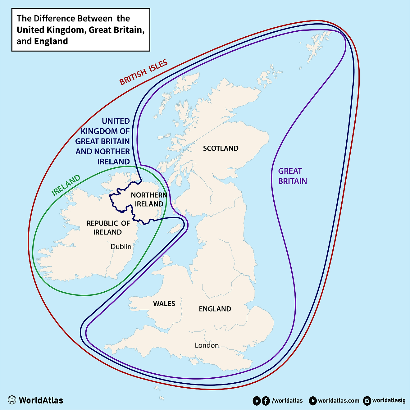
The United Kingdom, located in the North Atlantic Ocean, is the world’s ninth-largest island and Europe’s largest island, occupying about 243,610 km2. Great Britain is the largest of the British Isles and occupies about 66.4% of the island group’s total land area. The island is separated from mainland Europe by the English Channel and the North Sea. Three constituent countries share the island of Great Britain: England (130,279 km2), Wales (20,779 km2), and Scotland (77,933 km2). Great Britain is bordered to the west by Ireland, Europe’s third-largest island. Ireland is shared by the Republic of Ireland and Northern Ireland. Northern Ireland and Great Britain (Scotland, Wales, and England) form the United Kingdom.
9. Cuba - 110,860 km2 (42,804 miles2)

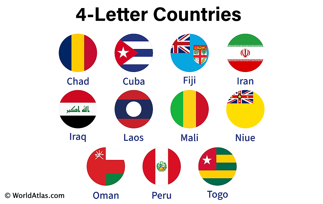
Cuba is a Caribbean island country located where the Caribbean Sea meets the Atlantic Ocean and the Gulf of Mexico. It is separated from the Yucatan Peninsula in the west by the Yucatan Channel, and Florida (US) in the north by the Florida Strait. The country comprises two main islands, Cuba and Isla de la Juventud, and several other smaller islands. It occupies about 110,861 km2, of which 104,556 km2 are occupied by the island of Cuba (the world’s 17th largest island).
10. Iceland - 103,000 km2 (39,769 miles2)

Iceland is an island country in the North Atlantic Ocean, occupying 103,000 km2. The main island is located to the south of the Arctic Circle, which touches the small island of Grimsey. Iceland is Europe’s second-largest island and comprises the main island and at least 30 smaller islands. Iceland (main island) is the world’s 18th largest island, occupying 101,826 km2. Iceland is closer to Greenland than mainland Europe, but closer to continental Europe than North America. The Scandinavian Peninsula (Norway) is located 970 km to the east. Iceland is one of the world’s most sparsely populated countries, at four people per km2. Reykjavík, the country’s capital, is home to about 70% of the country’s population.
10 Largest Island Countries In The World
| Rank | Country | Area (km2) | Area (miles2) |
|---|---|---|---|
| 1 | Indonesia | 1,904,569 | 735,358 |
| 2 | Madagascar | 587,041 | 226,658 |
| 3 | Papua New Guinea | 462,840 | 178,704 |
| 4 | Japan | 377,915 | 145,913 |
| 5 | Malaysia | 329,847 | 127,355 |
| 6 | Philippines | 300,000 | 115,831 |
| 7 | New Zealand | 268,838 | 103,798 |
| 8 | United Kingdom | 243,610 | 94,058 |
| 9 | Cuba | 110,860 | 42,804 |
| 10 | Iceland | 103,000 | 39,769 |
