Great Dismal Swamp, Virginia
The Great Dismal Swamp is a geological marvel. It was beneath the sea for millions of years before the Swamp developed. Naturalists and other scientists regard it as one of the most outstanding outdoor laboratories in the world. When the Continental Shelf's last substantial change occurred, this natural gem emerged as a landform.
Geography And Climate Of Great Dismal Swamp
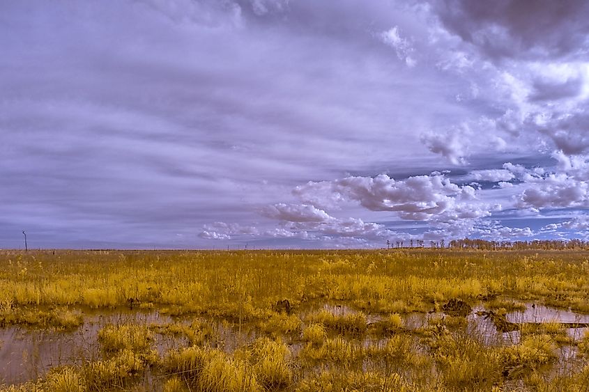
Often referred to as the Dismal Swamp, the Great Dismal Swamp is a big swamp that is situated in the Coastal Plain region between the cities of Norfolk and Elizabeth City, in the southeastern part of Virginia and the northeastern part of North Carolina. It is highly wooded and has natural elevations ranging from 10 to 20 feet above sea level. The Pamlico Formation (also known as the Great Dismal Swamp Terrace) rises to 25 feet or more along the western edge, establishing a natural border. According to some estimates, the original swamp covered over one million acres. At present, the Great Dismal Swamp covers an area of about 1,940 sq. km.
The Great Dismal Swamp's climate is influenced by the Atlantic Ocean, Chesapeake Bay, and Albemarle Sound. It experiences a humid subtropical climate, with long humid summers and mild winters. The average temperature of Virginia is 60 °F, and rainfall occurs all year, with 45.74 inches of precipitation and 8.8 inches of snowfall. During the winter, northwesterly winds impact the Great Dismal Swamp, whereas southwesterly winds influence it during the summer.
History Of Great Dismal Swamp

It is uncertain who found the Great Dismal and when. Colonel William Byrd II examined and described the North Carolina/Virginia state border across the Swamp in 1728. Colonel Byrd proposed draining the marsh and creating a north-south channel across it to link the waters of Virginia's Chesapeake Bay and North Carolina's Albemarle Sound. George Washington visited the Swamp and formed both the Dismal Swamp Land Company and the Adventurers for Draining the Great Dismal Swamp with numerous other famous Virginians and North Carolinians. This group intended to drain the Swamp cut the trees, and farm the area. In 1763, the company paid $20,000 for 40,000 acres of Swamp property. Washington oversaw the mapping and excavation of Washington Ditch, which runs from the western tip of the Swamp to Lake Drummond, and Riddick Ditch was finished in the late 1700s. These ditches worked together to move logs out of the Swamp while also draining it. The adventurers quickly learned that the process of emptying the Swamp was huge and abandoned that portion of their strategy to focus on lumbering. They harvested several cypress trees for shipbuilding and cedar trees for shingles and other items. The Dismal Swamp was a well-known path and location for freedom seekers. This was the most complex and dangerous route, full of insects, snakes, and wild creatures. Many runaways ended up in this desolate location. Many freedom seekers decided to seek sanctuary in the Great Dismal Swamp amid a colony of runaways known as maroons. Because of the Swamp's unique characteristics, vast colonies were able to establish a permanent shelter. It was difficult to apprehend a fugitive after they entered the Swamp. However, special-trained dogs were used on occasion to catch runaways. Colonies were formed on high ground in the Swamp, with primitive cottages built.
Preservation Of The Great Dismal Swamp

Conservation groups across the United States began demanding the preservation of the remaining Great Dismal Swamp and the restoration of its wetlands in the mid-20th century, which was recognized as vital habitat for a broad range of birds, animals, plants, and other living things. The Union Camp Corporation, a paper company located in Franklin, Virginia, with substantial land holdings in the region, granted over 49,000 acres of land to the Nature Conservancy in 1973. The property was transferred to the US Fish and Wildlife Service the following year. During this period, the National Park Service designated a 45,611-acre section of the swamp as a National Natural Landmark in 1973, owing to its unique combination of geological and ecological features. The Dismal Swamp Act of 1974 authorized the establishment of the Great Dismal Swamp National Wildlife Refuge. The refuge has about 107,000 acres of wooded wetlands, with the 3,100-acre Lake Drummond at its heart. The refuge's resource management initiatives strive to recover and sustain the swamp's natural ecological variety, including its water supplies, native plant types, and animal species.
Lake Drummond

Lake Drummond is a freshwater lake situated at the heart of the Great Dismal Swamp. The lake's origins are unknown. Several hypotheses have suggested the lake's origin, including that the lake was formed by a meteor/comet strike, a fire that burnt a deep hole in the peat soil, or sustained winds during the last ice age that built an artificial barrier of sand that impeded normal drainage. Lake Drummond and part of the Great Dismal Swamp are protected by the Great Dismal Swamp National Wildlife Refuge, which was established by the Dismal Swamp Act of 1974. The lake has a low nutrient content due to the leaching of acidic elements from nearby peat soils. A few fish species are there, including crappie, bowfin, and longnose gar.
Great Dismal Swamp Today
Today, the swamp is a vibrant ecosystem and one of Virginia's most attractive sites to explore. The swamp has a lot to offer, from nature paths to exhilarating activities in and around Lake Drummond. Unfortunately, the swamp has been plagued by fires during droughts and drier seasons in recent years. It is not uncommon for the marsh to catch fire, and smoke may be seen from Richmond. Today, Lake Drummond is the hub of activity in the swamp, drawing fishermen, tourists, and boaters, but the refuge does not permit camping.
