Geography Of The World
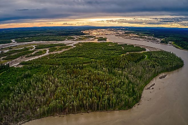
Tanana River
The Tanana River flows for approximately 570 miles after rising from the Nabesna and Chisana rivers. It obtains its name from the Athabascan term "tenene.
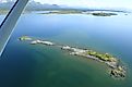
Iliamna Lake
Located in the southwest corner of Alaska, Iliamna Lake, named by the local indigenous tribe, Tanaina, covers an astonishing 1,000 square miles.
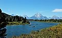
Snake River
Snake River serves as the Columbia River's largest tributary. With a length of over 1,000 miles, the river drains Wyoming, Washington, and Idaho.
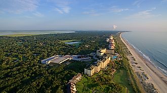
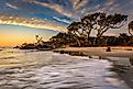
Amelia Island
Amelia Island, Florida, is a one-of-a-kind gem within the network of barrier islands that spans from South Carolina to Florida along the east coast.
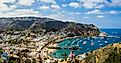
Santa Catalina Island, California
Its actual name is Santa Catalina Island, but locals refer to it as Catalina. It's exciting to see why those escaping the city tend to land precisely there.
Mount Desert Island, Maine
Mount Desert Island, situated just off the shore of Maine's eastern coast, was founded by European explorers in 1604, and it was first settled in 1762.
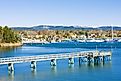
Orcas Island
Orcas Island is the biggest island in the San Juan archipelago, situated in the far northwestern portion of the San Juan County in the US State of Washington.
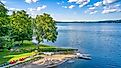
Cayuga Lake
Cayuga Lake is a large lake situated in the Finger Lakes region of the Cayuga, Seneca, and Tompkins counties in the US State of New York.
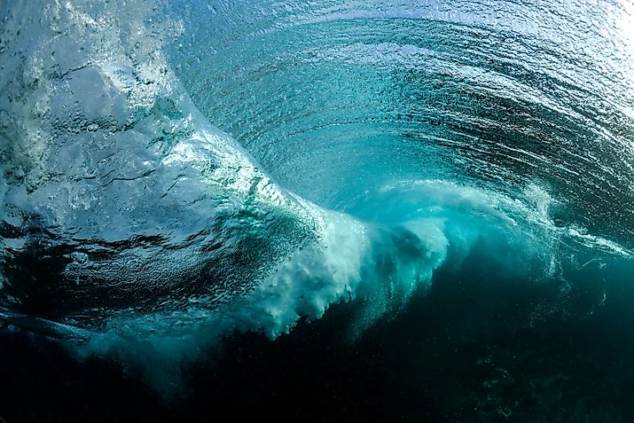
Ocean Gyre
An ocean gyre is a term given to any large-scale system of cyclical ocean currents, especially those associated with significant wind systems.
Kodiak Island
Kodiak Island is a vast island off Alaska's southern coast that is separated from the rest of the mainland by the Shelikof Strait.
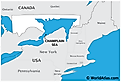
Champlain Sea
Created by retreating ice sheets during the end of the last Ice Age, the Champlain Sea was an inlet of the Atlantic Ocean into North America.
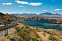
Mohave Valley
Mohave Valley is a small geographical region that spans portions of Arizona, California, and Nevada. This area generally hugs the eastern shore of the Colorado River.
Canandaigua Lake
Canandaigua Lake is situated in the Finger Lakes region of Ontario County in the US State of New York. The name of the lake and its adjacent city has been derived from the native Seneca word "Ganandogan."
Owasco Lake
The name of the Owasco Lake is believed to have been derived from the native Iroquois word "dwas-co," which means "bridge on the water."
Kootenay River
The Kootenay River is a 781km long river that flows in the Pacific Northwest region in the western part of North America. The river is referred to as “Kootenay”.
Lake Seminole
Named after the Seminole Native American tribe, Lake Seminole is a human-made lake created at the convergence of Spring Creek, the Chattahoochee River.
Monterey Bay
Monterey Bay is an arm of the Pacific Ocean situated on the coast of California, the United States of America. The bay is located south of the San Francisco Bay Area.
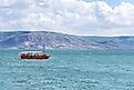
Sea Of Galilee
Also referred to as Lake Tiberias, the Sea of Galilee is a large freshwater lake situated in the northeastern part of Israel.
Jekyll Island, Georgia
Jekyll Island is located in Glynn County, off Georgia. It is one of the Sea Islands and also one of the barrier islands of the Golden Isles of Georgia.
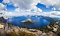
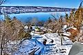
Crater Lake
The Crater Lake is a clear, deep-blue color lake situated within a vast volcanic caldera in the Klamath County in south-central Oregon.
Keuka Lake
Keuka Lake is located 27 km southwest of the City of Geneva and one of the major Finger Lakes in New York state, United States of America.
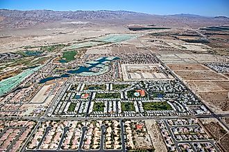
Coachella Valley
Coachella Valley is a part of the Colorado Desert and extends northwest 70 km from the Salton Sea through Riverside County to the San Gorgonio Pass, southern California.
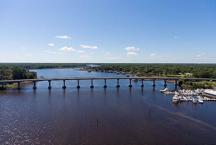
Apalachicola Bay
Apalachicola Bay is a large estuary situated along the northwestern coast of the US State of Florida. The bay forms a part of the National Estuarine Research Reserve System.
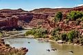
San Juan River
The San Juan River was named by San Juan Bautista. The river threads its way through Colorado, New Mexico, and Utah to the border of northern Arizona.
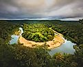
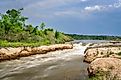
Buffalo National River
The Buffalo River is a 246km long river that flows through the forested Ozark Mountains in the northwestern part of the US State of Arkansas.
Ouachita River
Ouachita River is a 974km long river that flows in a southeasterly direction through the two US States of Arkansas and Louisiana.
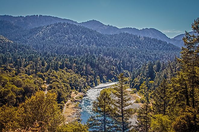
Trinity River, California
The Trinity River is a major river in the northwest of California in the United States of America and is the principal tributary of the Klamath River.
Santa Rosa Mountains, California
Santa Rosa Mountains is a mountain range located mainly in Riverside County and along the edges of Imperial and San Diego County in California.
Proposed States That Do Not Exist In The United States
It is generally known that the United States of America is composed of 50 different states. Here are ten proposed states that do not exist in the United States today.
Mississippi Sound
Mississippi Sound is a 145km long arm of the Gulf of Mexico that extends from the city of Waveland in the US State of Mississippi to the Dauphin Island Bridge.
San Juan Islands
The San Juan Islands are an archipelago situated in the Pacific Northwest between the US State of Washington and Canada’s Vancouver Island.
Klamath River
The Klamath River originates from the Upper Klamath Lake, east of the Cascade Range. It then flows for 414km passing through the US State of Oregon.
Niobrara River
The Niobrara River rises near the town of Lusk in Niobrara County in the eastern part of the US State of Wyoming.
9 Unique Ways To Experience Winter In The Finger Lakes
The ideas of engaging oneself in the Finger Lakes region during wintertime listed below are the best activities unique to this region.
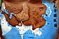
Yuan Dynasty
The Yuan Dynasty, also known as the Mongol Dynasty, ruled China between 1271 CE and 1368 CE. It was created when the Mongols invaded and conquered China.
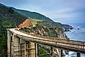
Big Sur, California
Big Sur is a scenic region situated in the western portion of the US State of California that features a 160km long, rugged stretch of seacoast.
Osage River
The Osage River is a tributary of the Missouri River and runs through Missouri in the United States of America. It is the eighth largest river in the state.