Geography Of The World
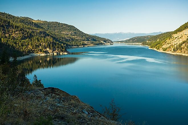
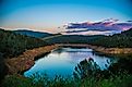
Lake Koocanusa
Lake Koocanusa is a reservoir constructed by the damming of the Kootenay River by the Libby Dam between British Columbia, Canada, and Montana, United States.
Winooski River
The Winooski River is a 145km long river that flows in the north-central portion of the US State of Vermont. It springs near Cabot in Washington County.
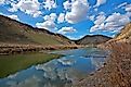
Humboldt River
The Humboldt River Basin is a large river drainage system in north-central Nevada that runs east-to-west from its headwaters to the Humboldt Sink.
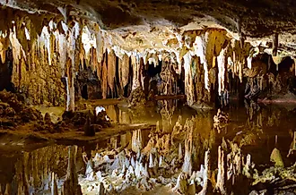
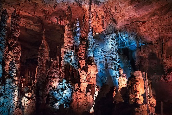
Luray Caverns, Virginia
The Luray Caverns in the US State of Virginia is a landform with rich history and an exciting founding story that acts as the state's ultimate attraction.
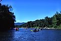
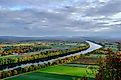
Connecticut River
For several millenniums, the plentiful resources of the Connecticut River drew humans who transformed and remade the surrounding landscape.
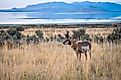
Antelope Island
Antelope Island is the largest and most fascinating of the Great Salt Lake's islands. It is worth visiting merely for the landscape and views.
Madeline Island
Hiking, bicycling, kayaking, swimming, canoeing, golfing, napping, reading, shopping, and dining are just a few of the many activities available. Madeline Island has it all.
Wind Cave, South Dakota
Among one of the largest mapped caves in the world, Wind Cave is a multi-faceted National Park in South Dakota, U.S.A.
Cathedral Caverns, Alabama
The Cathedral Cavern is located in Alabama and has been recognized as a state park since 2000. Previously, the cavern was owned as a private attraction.
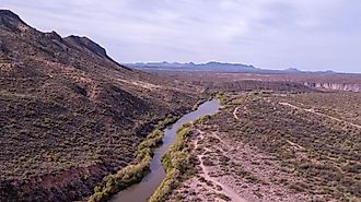
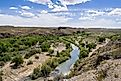
Verde Valley, Arizona
The Verde Valley is a valley that is situated in the central part of Arizona. Located in Yavapai County, Verde Valley is around 90 miles north of Phoenix.
Lake Oroville
Lake Oroville is a reservoir situated in Butte County in the northern portion of the US State of California. The lake is located 8km northeast of Oroville.
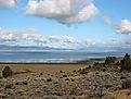
Goose Lake Valley
Goose Lake Valley is situated in the northwestern corner of the Great Basin in the United States. The Goose Lake valley surrounds the isolated Goose Lake on the Oregon-California border.
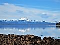
Shasta Lake
Shasta Lake is a large reservoir situated in the US state of California. This artificial lake has an area of 30,000 acres and a volume of 5.615 cubic kilometers.
Yellowstone River
Noted for its scenic beauty, the Yellowstone River flows a course of 692 miles through the US states of Wyoming, Montana, and North Dakota.
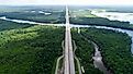
Detroit River
As one of the world’s busiest waterways, the Detroit River has had a profound impact on the region and Detroit’s overall development.
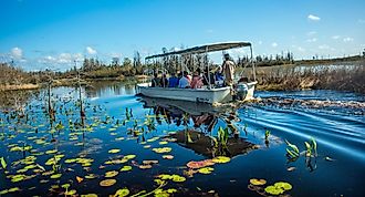
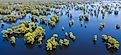
Okefenokee Swamp
Spanning across Southern Georgia and Northern Florida is the Okefenokee Swamp. With an area of 1,770 sq. km, the swamp is one of the largest in North America.
Lake Norman
The freshwater of Lake Norman originates from the Catawba River, confiscated by the Cowans Ford Dam, and outflows into Mountain Island Lake.
Des Moines River
The Des Moines River is the biggest river flowing across the state of Iowa and is a branch of the Mississippi River.
Great Dismal Swamp, Virginia
The Great Dismal Swamp is a geological marvel. It was beneath the sea for millions of years before the Swamp developed.
Atchafalaya Swamp
Atchafalaya Swamp is a large swamp located in the south-central portion of Louisiana and is considered to be the largest swamp in the United States.
Sabine River
Sabine River is a long river that flows in the southern part of the United States. The river serves as a border between Texas and Louisiana.
Gila River
Frequently referred to as southern New Mexico’s lifeblood, the Gila River persists as the state’s last free-flowing river and one of the Western United States’ longest rivers.
Kenai Peninsula, Alaska
The Kenai Peninsula, located off the coast of Southcentral Alaska, is a vast peninsula. The name Kenai is derived from the term "Kenaitze."
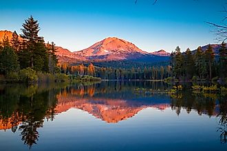
Lassen Peak
In Lassen Volcanic National Park stands Lassen Peak, which is one of seven active volcanoes in California. The volcano last erupted more than 100 years ago.
9 Most Spectacular Valleys In The United States
The following are nine such places within the United States that will present all kinds of lovely dilemmas.
Wabash River
The Wabash River is an 810km long river streaming southwest from northwest Ohio and flowing across northern Indiana until southern Illinois.
Door Peninsula, Wisconsin
With a population of 708 people, Door Peninsula is an eastern Wisconsin peninsula that separates the southern half of Green Bay from Lake Michigan.
Kalalau Valley
The Kalalau Valley is located in the Napali Coast State Park and houses the Kalalau Beach, set on the northwestern side of the Kauai Island.
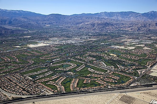
Coachella Valley
Wrapped around nine cities, Coachella Valley is on the edge of the Colorado Desert in Southern California.
Shenandoah Valley
Shenandoah Valley is a part of the Great Appalachian Valley, located in the US State of Virginia and the Eastern Panhandle of the state of West Virginia.
Monument Valley
Monument Valley is a valley located in Navajo Tribal Park, across the border of the U.S. states of Arizona and Utah.
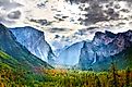
Yosemite Valley
Yosemite Valley is a natural U-shaped valley in Yosemite National Park, located on the western hill of the Sierra Nevada Mountains in California, U.S.
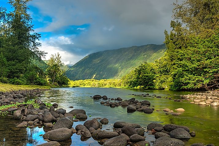
Maui Island, Hawaii
Maui Island is considered to be the second-largest among all the Hawaiian Islands and is situated in Maui County, Hawaii, United States.
Lanai, Hawaii
Lanai Island is the largest privately-owned Island in the Hawaiian islands chain located in Maui County, in the US state of Hawaii.
America's 11 Most Magical Island Vacation Destinations
With thousands of large and small islands in the continental United States, the magical ones are not necessarily the typical tropical heaven that one pictures, but paradises nevertheless
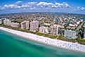
Marco Island, Florida
Marco Island is a small city located in the Collier County of Florida. It is considered a principal city of Naples–Marco Island Metropolitan Area.
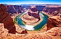
Horseshoe Bend, Arizona
The 270-degree horseshoe-shaped curve, carved into the Arizona bedrock by the Colorado River, is one of the state's most photogenic landforms
Prince of Wales Island, Alaska
Prince of Wales Island is the fourth-largest island in the United States and one of the islands of the Alexander Archipelago in the Alaska Panhandle.